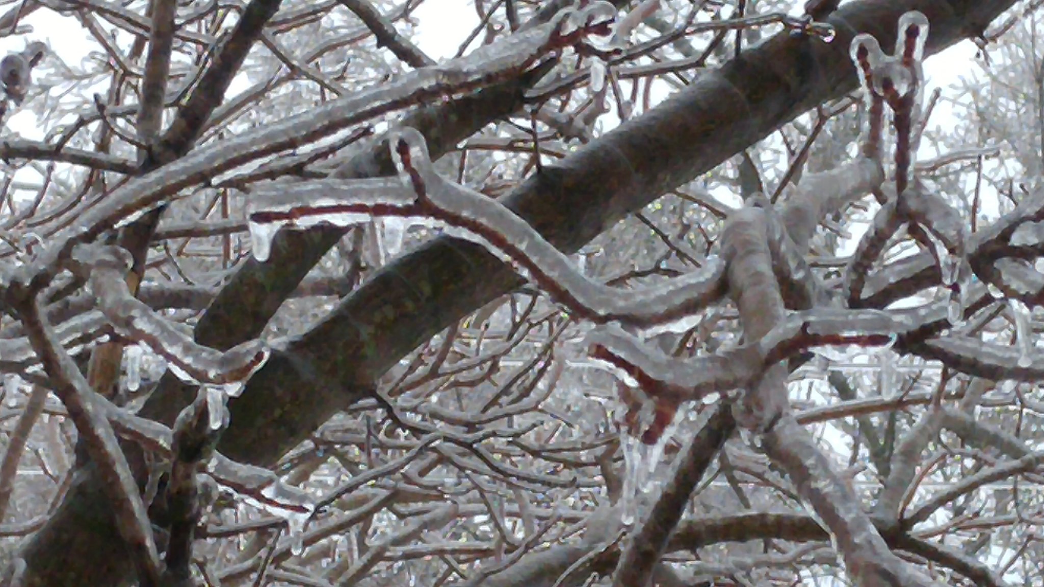
| On the afternoon and night of Monday, February 11, a mix of wintry precipitation produced two tenths to one half inch of ice accumulation in portions of northern Illinois, including the Chicago metro area, and far northwest Indiana. In addition, there were 2 to 4 inches of snow accumulation in far northern Illinois. After the icing event, strong winds picked up on the afternoon of Tuesday, February 12 and continued into that night. This resulted in scattered power outages as the winds blew ice-covered tree branches and wires. In addition, the combination of the wind and falling and blowing snow resulting in hazardous travel. | 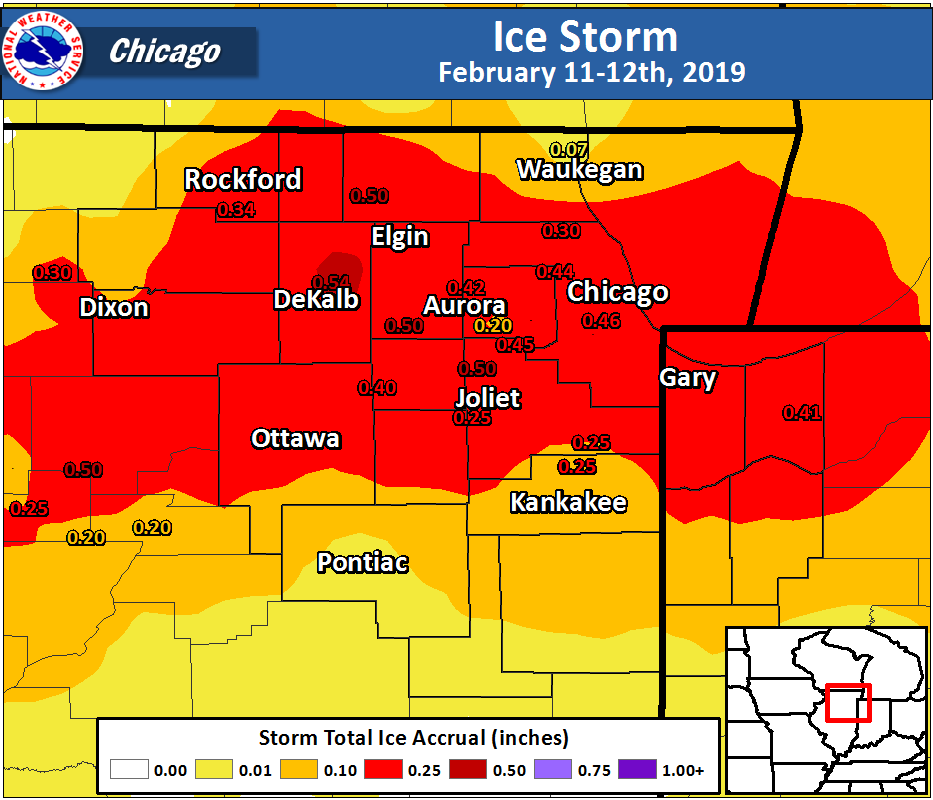 |
Fast Facts
Other ice amounts include:
Science
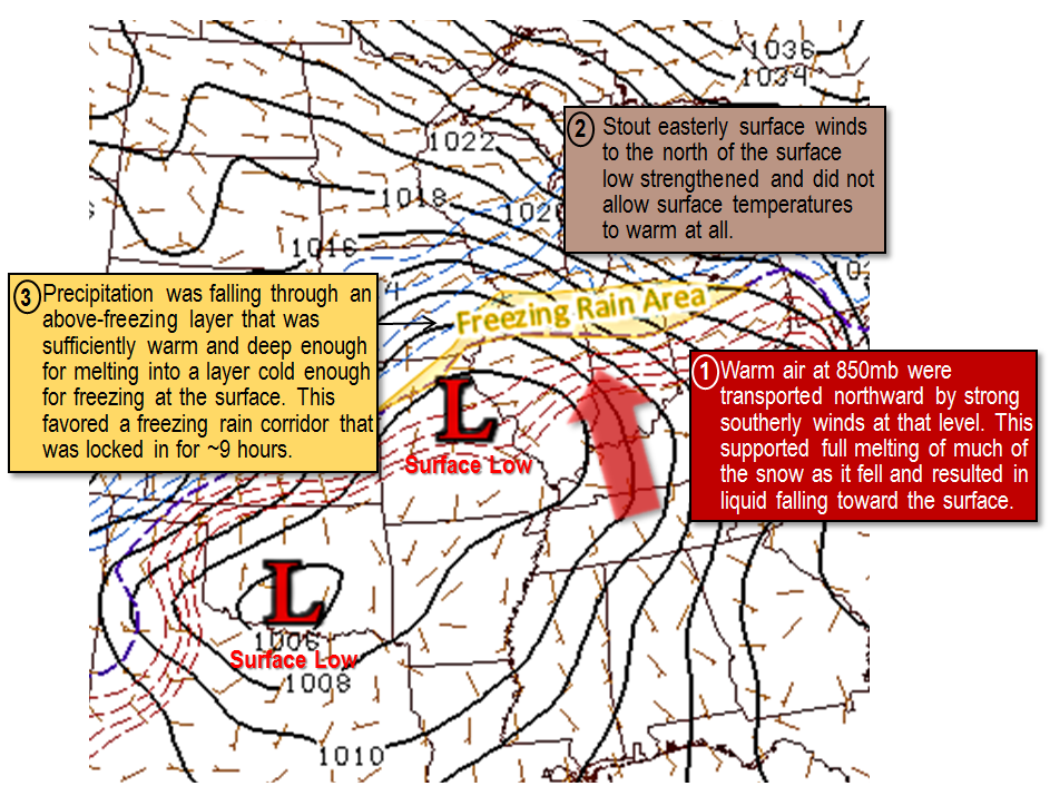
Early on Monday afternoon, February 11, a center of low pressure was developing across the central United States. Ahead of this low pressure system, a broad area of precipitation stretched from Texas into the central Atlantic coast along a frontal boundary. During the afternoon this boundary, along with the precipitation, began lifting north as a warm front across Illinois and Indiana. In the cold air well head of the advancing boundary, subfreezing temperatures at all levels of the atmosphere were supporting areas of moderate snowfall across Iowa, Wisconsin, and far northern Illinois. In warmer locations well south of the boundary toward central Illinois, above-freezing temperatures from the surface up to around 5000 feet were supporting widespread rainfall. In between these two locations, roughly from northern Indiana along the I-80 corridor of Illinois, the situation was more complicated.
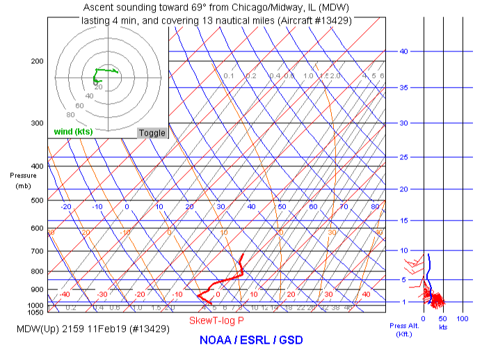
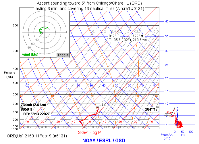
Around 5:00 PM on Monday, weather instruments on a plane taking off from Midway Airport recorded a subfreezing layer of air from near the surface up to around 5000 feet. This was similar to the cold air being seen to the north of this location. In fact, this vertical temperature profile looked very similar to that measured at the exact same time by a plane departing from O’Hare Airport north of Midway. However, at Midway, around the 5000 ft level, the vertical temperature profile showed a layer of warmer above-freezing air. It is common to see milder air like this along a warm front riding up and over colder and denser air in the surface layer.
In terms of precipitation type, this elevated warm layer makes a big difference. When all levels of the atmosphere are below freezing, snow is the expected outcome. However, with an elevated warm layer above a subfreezing layer, sleet and freezing rain start to become a concern. If the elevated warm layer is shallow enough and the surface refreezing layer is deep enough, falling snowflakes melt slightly and then refreeze into ice pellets (sleet). Sleet was in fact observed for a time Monday afternoon. As the warm front continued to advance north, the elevated warm layer got deeper and the surface cold layer became milder (though still subfreezing). Eventually the falling snow flakes melted completely into raindrops and did not refreeze until hitting something on the ground. By the time the freezing rain tapered to freezing drizzle during the overnight hours, some locations had received almost a half inch of freezing rain.
By Tuesday morning, temperatures at locations that had received the most freezing rain had nudged up to or just above the freezing mark. This is fortunate because strong winds expected Tuesday afternoon would produce considerable problems for heavily weighted trees and power lines.
Snow Totals
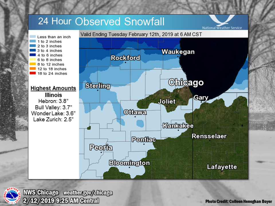 |
| Snow map updates between 8 and 10 a.m. |
Public Information Statement National Weather Service Chicago IL 1007 AM CST Tue Feb 12 2019 ...Morning Snowfall Roundup... The following are snow amounts for the previous 24 hours as measured in the morning by NWS Cooperative Observers and CoCoRaHS observers. Observations are usually taken at 7 AM. 24-hour Snowfall Amounts for Tuesday(02/12/19)... Northern Illinois Snow Location (County): fall(inches) Hebron (McHenry)..............................3.8 Bull Valley 2WNW (McHenry)....................3.7 Wonder Lake 1WNW (McHenry)....................3.6 Waukegan 2N (Lake)............................2.5 Lake Zurich (Lake)............................2.5 Rockford (Winnebago)..........................2.2 Highwood 1S (Lake)............................2.1 Capron (Boone)................................2.0 Rockford 2ENE (Winnebago).....................2.0 Rockford 1NW (Winnebago)......................1.9 Roscoe 2ESE (Winnebago).......................1.8 Roscoe 2se (Winnebago)........................1.8 Crystal Lake (McHenry)........................1.6 Mundelein (Lake)..............................1.6 Dixon (Lee)...................................1.5 Rockford 3NE (Winnebago)......................1.5 Genoa (De Kalb)...............................1.4 Lincolnshire 1N (Lake)........................1.4 Buffalo Grove 2N (Lake).......................1.3 Woodstock 4SW (McHenry).......................1.2 Rochelle (Ogle)...............................1.2 Botanic Gardens (Cook)........................1.0 Palatine 1NNE (Cook)..........................1.0 Roselle 1ESE (Du Page)........................1.0 De Kalb (De Kalb).............................0.8 Elgin (Kane)..................................0.8 Elk Grove Village 1ESE (Cook).................0.8 Schaumburg 2E (Cook)..........................0.7 Ashton (Lee)..................................0.7 Riverwoods (Lake).............................0.6 Barrington (Lake).............................0.5 Hoffman Estates 2SE (Cook)....................0.5 De Kalb (De Kalb).............................0.5 Geneva 1SSW (Kane)............................0.5 Elgin 2W (Kane)...............................0.5 Algonquin 1N (McHenry)........................0.5 Crystal Lake 1WSW (McHenry)...................0.5 Paw Paw (Lee).................................0.5 Hoffman Estates 5W (Cook).....................0.4 Batavia 1WSW (Kane)...........................0.4 Plainfield 2SSE (Will)........................0.4 Lisle Morton Arb (Du Page)....................0.4 Park Ridge (Cook).............................0.3 Harwood Heights (Cook)........................0.3 Elk Grove Village 2WSW (Cook).................0.3 Lincolnwood 2E (Cook).........................0.3 Elmhurst 2SE (Du Page)........................0.3 Batavia 1WNW (Kane)...........................0.3 St. Charles 6NW (Kane)........................0.3 Ohare Airport (Cook)..........................0.3 Batavia (Kane)................................0.2 Chicago 6ESE (Cook)...........................0.2 Palos Park 1SW (Cook).........................0.2 Oak Park 1NNE (Cook)..........................0.2 Downers Grove 0.4NNE (Du Page)................0.2 La Grange Park 1SSW (Cook)....................0.1 Burr Ridge 2SW (Du Page)......................0.1 Sugar Grove 1NE (Kane)........................0.1 Manhattan (Will)..............................0.1 Midway Coop (Cook)............................0.1 Westmont (Du Page)............................0.1 Elburn (Kane)...............................TRACE Earlville 3S (La Salle).....................TRACE Bridgeview 1NNW (Cook)......................TRACE Oak Park 2S (Cook)..........................TRACE Oak Lawn (Cook).............................TRACE Park Forest 1SW (Cook)......................TRACE Wheaton 2NNE (Du Page)......................TRACE Aurora 4SE (Du Page)........................TRACE Batavia 2WNW (Kane).........................TRACE Elburn (Kane)...............................TRACE North Aurora 2NE (Kane).....................TRACE Manhattan 1ESE (Will).......................TRACE Peotone (Will)..............................TRACE Kankakee (Kankakee).........................TRACE Romeoville (Will)...........................TRACE Peotone (Will)..............................TRACE Watseka (Iroquois)..........................TRACE Northwest Indiana Snow Location (County): fall(inches) Munster 2NNW (Lake)...........................0.2 Dyer 1WNW (Lake)............................TRACE St. John (Lake).............................TRACE |
Rain Totals
Public Information Statement
National Weather Service Chicago IL
1006 AM CST Tue Feb 12 2019

...Morning Rainfall Roundup...

   The following are rain amounts for the previous 24-hours
   as measured in the morning by NWS Cooperative Observers
   and CoCoRaHS observers.
   Observations are usually taken between 6 AND 8 AM.

   24-hour rainfall amounts
       for Tuesday(02/12/19)...


Illinois                                       Rain
  Location (County):                           fall (inches)

  Woodstock 4SW (McHenry)......................0.92
  Streator (Livingston)........................0.90
  Ashton (Lee).................................0.89
  Rockford 3NE (Winnebago).....................0.81
  Ottawa 2N (La Salle).........................0.80
  La Salle (La Salle)..........................0.79
  Earlville 3S (La Salle)......................0.77
  Ottawa 1NW (La Salle)........................0.77
  Morris (Grundy)..............................0.76
  Park Forest 1SW (Cook).......................0.75
  Ottawa (La Salle)............................0.75
  Pontiac 1SE (Livingston).....................0.74
  Fairbury (Livingston)........................0.72
  Minooka (Grundy).............................0.72
  Peru 1ENE (La Salle).........................0.72
  Mendota (La Salle)...........................0.72
  Ashkum 5.6E (Iroquois).......................0.71
  Rockford 1NW (Winnebago).....................0.71
  Kankakee (Kankakee)..........................0.71
  Mazon 0.5ENE (Grundy)........................0.70
  Amboy (Lee)..................................0.69
  Paxton (Ford)................................0.69
  Lincolnwood 2E (Cook)........................0.68
  Earlville 5NNE (De Kalb).....................0.68
  Crete 3E (Will)..............................0.68
  Rockford 2ENE (Winnebago)....................0.68
  Monee (Will).................................0.68
  Chicago Ridge (Cook).........................0.67
  Park Forest (Cook)...........................0.67
  Palos Park 1SW (Cook)........................0.66
  Morris 6ESE (Grundy).........................0.66
  Coal City 3N (Grundy)........................0.66
  Herscher 3E (Kankakee).......................0.66
  Wonder Lake 1WNW (McHenry)...................0.66
  Paxton (Ford)................................0.66
  Aurora (Kane)................................0.65
  Dixon (Lee)..................................0.65
  Chicago 6ESE (Cook)..........................0.65
  Downers Grove 0.4NNE (Du Page)...............0.65
  Burr Ridge 2SW (Du Page).....................0.65
  Gibson 6NE (Ford)............................0.65
  Mundelein (Lake).............................0.65
  Watseka (Iroquois)...........................0.65
  Botanic Gardens (Cook).......................0.64
  Hoffman Estates 5W (Cook)....................0.64
  Watseka 6.9WNW (Iroquois)....................0.64
  Sugar Grove 1NE (Kane).......................0.64
  Geneva 1SSW (Kane)...........................0.64
  Waukegan 2N (Lake)...........................0.64
  Channahon 2SSE (Will)........................0.64
  Joliet 2n (Will).............................0.64
  Manhattan (Will).............................0.64
  Rochelle (Ogle)..............................0.64
  Bourbonnais (Kankakee).......................0.63
  Coal City 4NNW (Grundy)......................0.63
  Park Ridge (Cook)............................0.63
  Harwood Heights (Cook).......................0.63
  Gibson 3WNW (Ford)...........................0.63
  Carbon Hill 3.1N (Grundy)....................0.63
  Batavia 2WNW (Kane)..........................0.63
  North Aurora 2NE (Kane)......................0.63
  St. Charles 6NW (Kane).......................0.63
  Highwood 1S (Lake)...........................0.63
  Waukegan (Lake)..............................0.63
  Dwight (Livingston)..........................0.62
  Oak Park 2S (Cook)...........................0.62
  Homewood (Cook)..............................0.62
  Elmhurst (Du Page)...........................0.62
  Bull Valley 2WNW (McHenry)...................0.62
  Lake Zurich (Lake)...........................0.62
  Elburn (Kane)................................0.61
  De Kalb (De Kalb)............................0.61
  Batavia 1WSW (Kane)..........................0.61
  Elburn (Kane)................................0.61
  Elgin 2W (Kane)..............................0.61
  Plainfield 2SSE (Will).......................0.61
  Romeoville (Will)............................0.61
  La Grange Park 1SSW (Cook)...................0.60
  Wheaton 2NNE (Du Page).......................0.60
  Batavia 1WNW (Kane)..........................0.60
  Algonquin 1N (McHenry).......................0.60
  Naperville 4SSW (Will).......................0.60
  Midlothian (Cook)............................0.59
  Oak Park 1NNE (Cook).........................0.59
  Elmhurst 2SE (Du Page).......................0.59
  Rockford (Winnebago).........................0.59
  Elk Grove Village 1ESE (Cook)................0.58
  Riverwoods (Lake)............................0.58
  Westmont (Du Page)...........................0.57
  Palatine 1NNE (Cook).........................0.56
  Beecher 3SSE (Will)..........................0.56
  New Lenox 3E (Will)..........................0.56
  Chatsworth (Livingston)......................0.55
  Bridgeview 1NNW (Cook).......................0.55
  Oak Lawn (Cook)..............................0.55
  Elk Grove Village 2WSW (Cook)................0.55
  Chatsworth (Livingston)......................0.55
  Barrington (Lake)............................0.54
  Batavia (Kane)...............................0.54
  Elgin (Kane).................................0.54
  Hebron (McHenry).............................0.54
  Lisle Morton Arb (Du Page)...................0.54
  Oak Lawn 1N (Cook)...........................0.53
  Manhattan 1ESE (Will)........................0.53
  Peotone (Will)...............................0.53
  Steward (Lee)................................0.53
  Capron (Boone)...............................0.51
  Schaumburg 2E (Cook).........................0.51
  Roscoe 2ESE (Winnebago)......................0.51
  Ohare Airport (Cook).........................0.51
  Roscoe 2se (Winnebago).......................0.51
  Lincolnshire 1N (Lake).......................0.50
  Brandon Road Lock & Dam (Will)...............0.50
  Pontiac (Livingston).........................0.50
  St Anne (Kankakee)...........................0.50
  Buffalo Grove 2N (Lake)......................0.49
  Morris (Grundy)..............................0.48
  Huntley (McHenry)............................0.48
  Aurora 4SE (Du Page).........................0.46
  Crystal Lake 1WSW (McHenry)..................0.44
  Midway (Cook)................................0.44
  Midway Coop (Cook)...........................0.44
  Morris 2SSE (Grundy).........................0.43
  New Lenox 2SE (Will).........................0.43
  West Chicago (Du Page).......................0.42
  Lansing (Cook)...............................0.42
  Kankakee (Kankakee)..........................0.38
  Worth (Cook).................................0.34
  Hoffman Estates 2SE (Cook)...................0.34
  Chicago 5NE (Cook)...........................0.33
  Paw Paw (Lee)................................0.30
  Aurora (Kane)................................0.29
  Crystal Lake (McHenry).......................0.28
  Joliet (Will)................................0.26
  Somonauk 2NE (De Kalb).......................0.25
  De Kalb (De Kalb)............................0.22
  Wheeling (Cook)..............................0.19
  Genoa (De Kalb)..............................0.17
  Marseilles Lock & Dam (La Salle).............0.15
  Peru (La Salle)..............................0.03

Indiana                                        Rain
  Location (County):                           fall (inches)

  Brook 4W (Newton)............................0.84
  Rensselaer 2N (Jasper).......................0.74
  De Motte 1SSW (Jasper).......................0.68
  Dyer 1WNW (Lake).............................0.68
  De Motte 6S (Jasper).........................0.66
  Morocco (Newton).............................0.66
  Rensselaer 2SSW (Jasper).....................0.65
  De Motte 4SW (Jasper)........................0.62
  Rensselaer (Jasper)..........................0.60
  Wheatfield 4WSW (Jasper).....................0.57
  Valparaiso 4SW (Porter)......................0.56
  Gary 5ENE (Lake).............................0.55
  Wheatfield 3S (Jasper).......................0.48
  Crown Point (Lake)...........................0.47
  Crown Point 1N (Lake)........................0.47
  Valparaiso 2WSW (Porter).....................0.47
  Valparaiso 6SSW (Porter).....................0.47
  Munster 2NNW (Lake)..........................0.44
  Crown Point 2WSW (Lake)......................0.43
  Remington (Jasper)...........................0.41
  Valparaiso (Porter)..........................0.34
  St. John (Lake)..............................0.31

$$
|
Storm Reports
PRELIMINARY LOCAL STORM REPORT...SUMMARY
NATIONAL WEATHER SERVICE CHICAGO IL
1150 AM CST TUE FEB 12 2019

..TIME...   ...EVENT...      ...CITY LOCATION...     ...LAT.LON...
..DATE...   ....MAG....      ..COUNTY LOCATION..ST.. ...SOURCE....
            ..REMARKS..

1141 AM     ICE STORM        CHANNAHON               41.43N 88.23W
02/12/2019                   WILL               IL   PUBLIC

            STORM TOTAL 0.25 INCHES.

1140 AM     ICE STORM        MANTENO                 41.25N 87.84W
02/12/2019                   KANKAKEE           IL   PUBLIC

            STORM TOTAL 0.25 INCHES.

1138 AM     ICE STORM        NAPERVILLE              41.77N 88.15W
02/12/2019                   DUPAGE             IL   PUBLIC

            STORM TOTAL 0.2 INCHES.

1137 AM     ICE STORM        NEWARK                  41.54N 88.58W
02/12/2019                   KENDALL            IL   PUBLIC

            STORM TOTAL APPROXIMATELY 0. 4 INCHES.

1136 AM     ICE STORM        DOWNERS GROVE           41.79N 88.01W
02/12/2019                   DUPAGE             IL   PUBLIC

            STORM TOTAL 0.25 INCHES.

1134 AM     ICE STORM        MARENGO                 42.25N 88.61W
02/12/2019                   MCHENRY            IL   PUBLIC

            STORM TOTAL OF 0.50 INCHES.

1132 AM     ICE STORM        OSWEGO                  41.61N 88.21W
02/12/2019                   WILL               IL   PUBLIC

            STORM TOTAL OF 0.50 INCHES.

1129 AM     ICE STORM        PLAINFIELD              41.61N 88.21W
02/12/2019                   WILL               IL   PUBLIC

            STORM TOTAL OF 0.50 INCHES OF ICE.

1000 AM     FREEZING RAIN    BOLINGBROOK             41.70N 88.07W
02/12/2019  E0.50 INCH       WILL               IL   TRAINED SPOTTER

            ICE AMOUNT 0.45 TO 0.50. TAKEN NEAR BOUGHTON
            ROAD AND WEBER ROAD.

0935 AM     FREEZING RAIN    CHICAGO                 41.88N 87.63W
02/12/2019  M0.00 INCH       COOK               IL   NWS EMPLOYEE

            LARGE BRANCHES AND POWER LINES DOWN.

0800 AM     FREEZING RAIN    DEKALB                  41.93N 88.75W
02/12/2019  M0.54 INCH       DE KALB            IL   TRAINED SPOTTER

            REPORT FROM GURLER ROAD.

0556 AM     ICE STORM        3 ESE VALPARAISO        41.45N 87.01W
02/12/2019                   PORTER             IN   ASOS

            STORM TOTAL OF 0.41 INCHES OF ICE MEASURED
            AT THE VPZ ASOS.

0553 AM     ICE STORM        MIDWAY AIRPORT          41.79N 87.75W
02/12/2019                   COOK               IL   ASOS

            STORM TOTAL OF 0.46 INCHES OF ICE MEASURED
            AT THE MDW ASOS.

0552 AM     ICE STORM        ROCKFORD AIRPORT        42.20N 89.10W
02/12/2019                   WINNEBAGO          IL   ASOS

            STORM TOTAL OF 0.34 INCHES OF ICE MEASURED
            AT THE RFD ASOS. TOTAL SNOW AMOUNTS OF 2.2
            INCHES OF SNOW ALSO REPORTED THUS FAR.

0552 AM     ICE STORM        DUPAGE AIRPORT          41.91N 88.25W
02/12/2019                   DUPAGE             IL   ASOS

            STORM TOTAL OF 0.42 INCHES OF ICE MEASURED
            AT THE DPA ASOS.

0552 AM     ICE STORM        1 WSW BEACH PARK        42.42N 87.87W
02/12/2019                   LAKE               IL   ASOS

            STORM TOTAL OF 0.07 INCHES OF ICE MEASURED
            AT THE UGN ASOS.

0552 AM     ICE STORM        2 WNW SUGAR GROVE       41.77N 88.48W
02/12/2019                   KANE               IL   ASOS

            STORM TOTAL OF 0.5 INCHES OF ICE MEASURED AT
            THE ARR ASOS.

0552 AM     ICE STORM        1 NE PROSPECT HEIGHTS   42.12N 87.90W
02/12/2019                   COOK               IL   ASOS

            STORM TOTAL OF 0.3 INCHES OF ICE MEASURED AT
            THE PWK ASOS.

0551 AM     ICE STORM        OHARE AIRPORT           41.97N 87.92W
02/12/2019                   COOK               IL   ASOS

            STROM TOTAL OF 0.44 INCHES OF ICE
            ACCUMULATION REPORTED FROM THE ORD ASOS. 0.3
            INCHES OF SNOW ALSO REPORTED.

0530 AM     SNOW             5 NW WOODSTOCK          42.36N 88.53W
02/12/2019  M3.0 INCH        MCHENRY            IL   CO-OP OBSERVER

            3 INCHES OF SNOW AND ICE COMBINED, MELTED
            DOWN TO 0.56 INCHES.

0530 AM     FREEZING RAIN    PEOTONE                 41.34N 87.79W
02/12/2019  E0.25 INCH       WILL               IL   CO-OP OBSERVER

            MELTED DOWN TO 0.52.

0500 AM     FREEZING RAIN    BURBANK                 41.74N 87.78W
02/12/2019  M0.44 INCH       COOK               IL   CO-OP OBSERVER
Storm Reports
Public Information Statement
National Weather Service Chicago IL
901 PM CST Tue Feb 12 2019 /1001 PM EST Tue Feb 12 2019/

...Maximum Wind Gusts Through 9 pm Tuesday Evening...

Location                     Speed     Time/Date
----------------------------------------------------
Gary Airport                 45 MPH    0445 PM 02/12
Pontiac Airport              45 MPH    0835 PM 02/12
Sugar Grove - Aurora Arpt.   44 MPH    0706 PM 02/12
Kankakee Airport             44 MPH    0815 PM 02/12
Valparaiso Airport           41 MPH    0356 PM 02/12
Chicago Crib                 40 MPH    0650 PM 02/12
West Chicago - DuPage Arpt.  40 MPH    0709 PM 02/12
Lansing Airport              40 MPH    0435 PM 02/12
Chicago Midway               40 MPH    0637 PM 02/12
Chicago O`Hare               40 MPH    0418 PM 02/12
Rockford Airport             40 MPH    0448 PM 02/12
Rensselaer Airport           40 MPH    0335 PM 02/12
Wheeling - Chicago Exec. Arp 37 MPH    0511 PM 02/12
Waukegan Airport             36 MPH    0802 PM 02/12

Observations are collected from a variety of sources with varying
equipment and exposures. We thank all volunteer weather observers
for their dedication. Not all data listed are considered official.
Additional
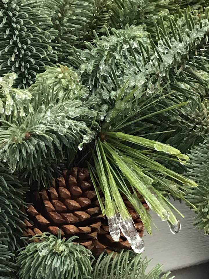
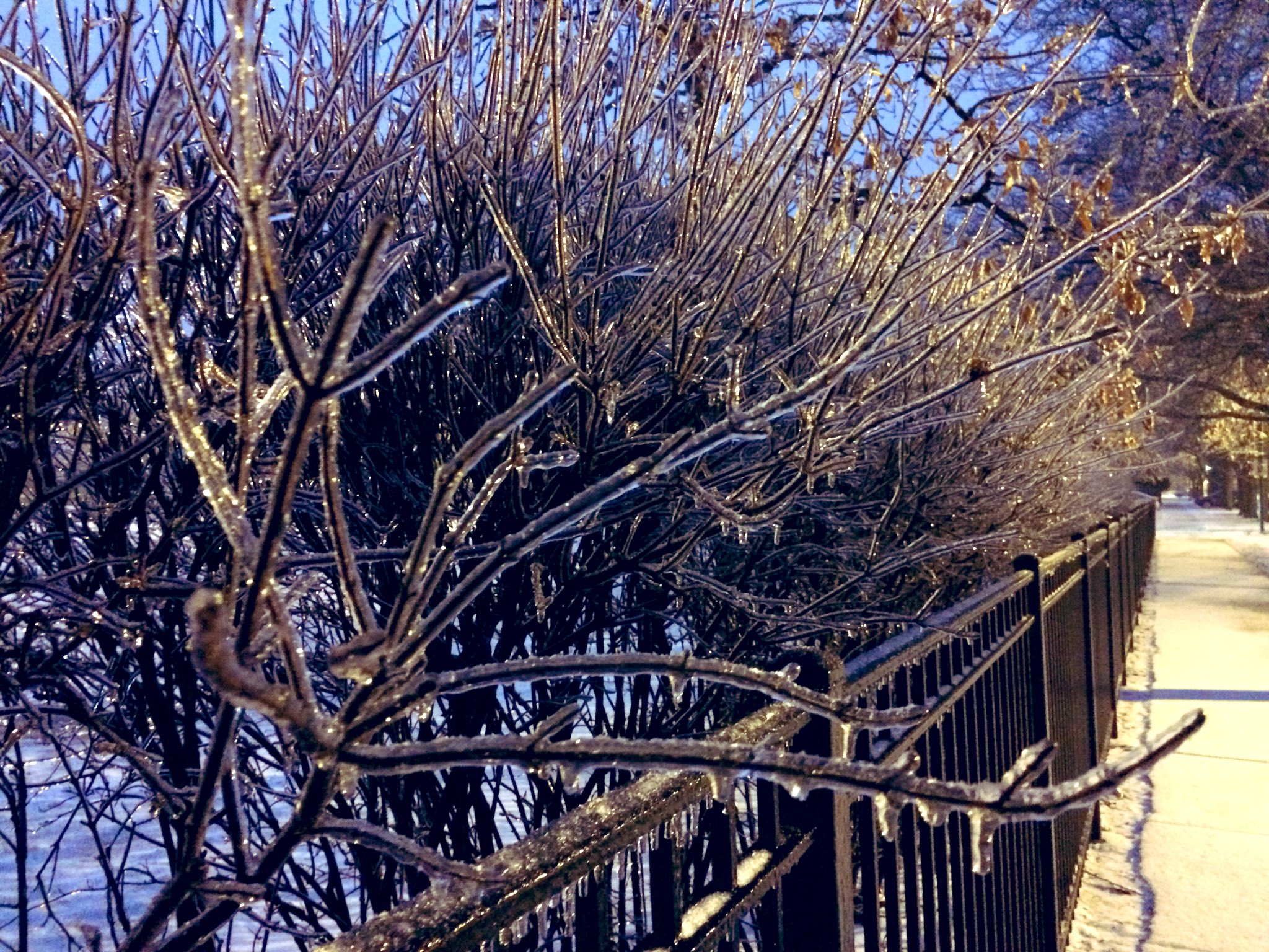
Photos
 |
 |
 |
| Photo courtesy of Cheli Mateja Paw Paw, IL |
Photo courtesy of Terrie Sheetz Plainfield, IL |
Photo courtesy of Danielle Nellie Beverly IL |
 |
 |
 |
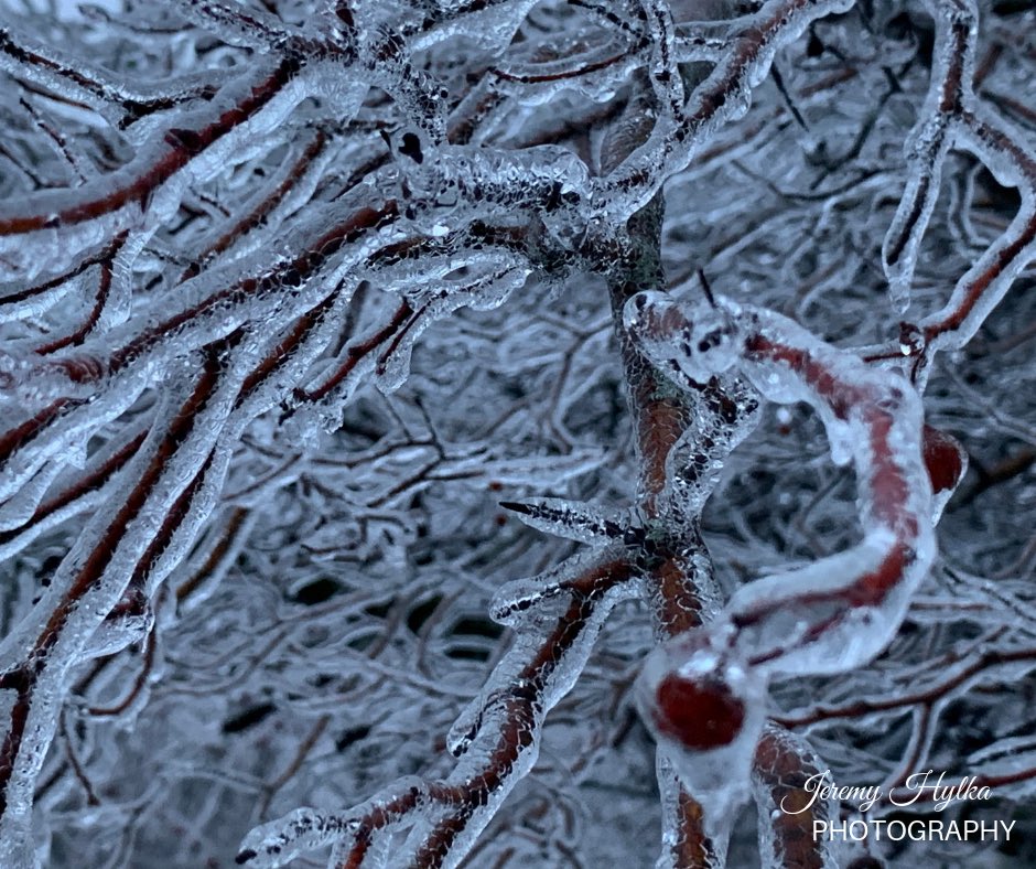
| Photo courtesy of Jeremy Hylka Joliet, IL |
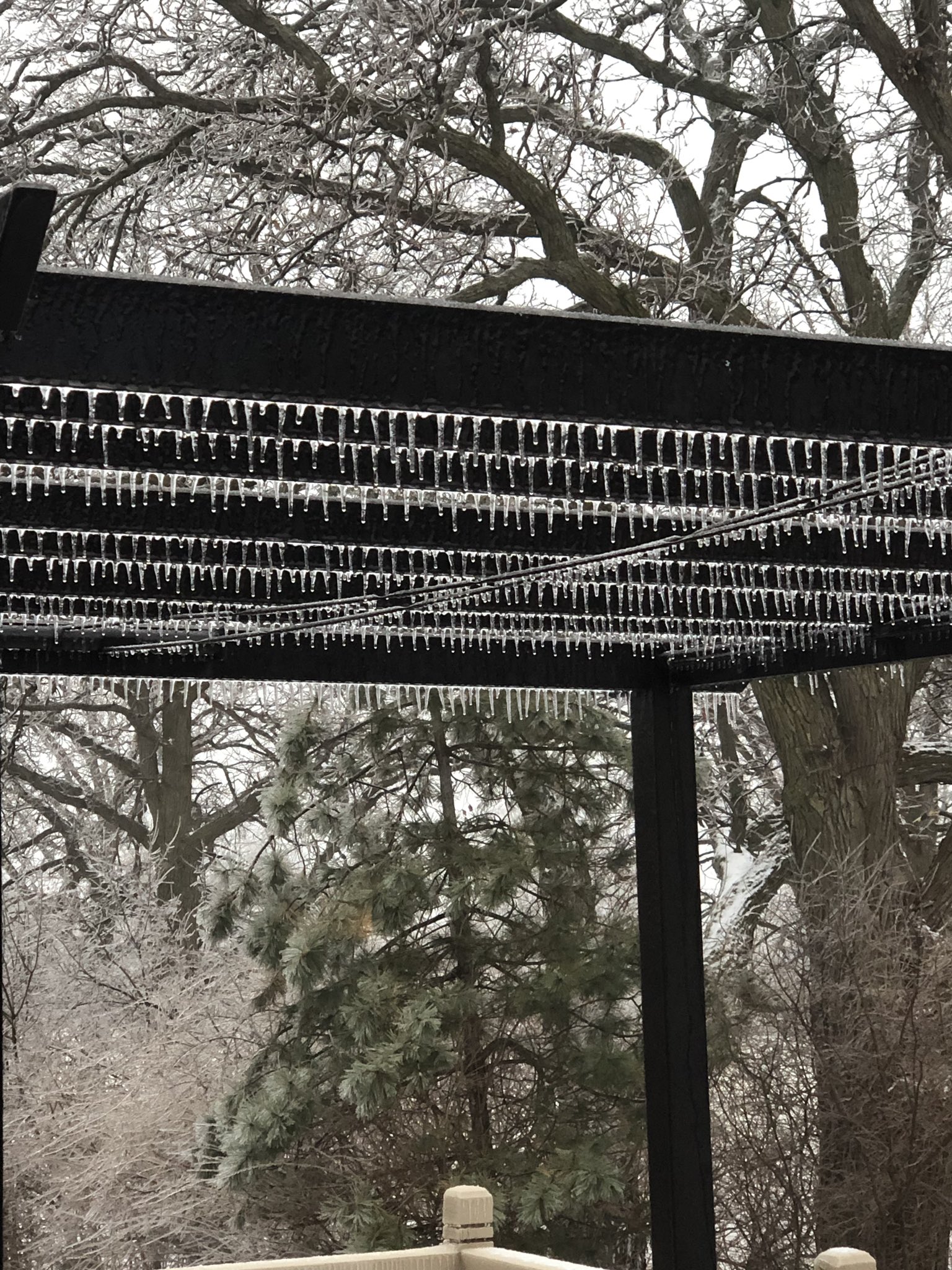
Photo courtesy of Alex Pipkalejs Lemont, IL |
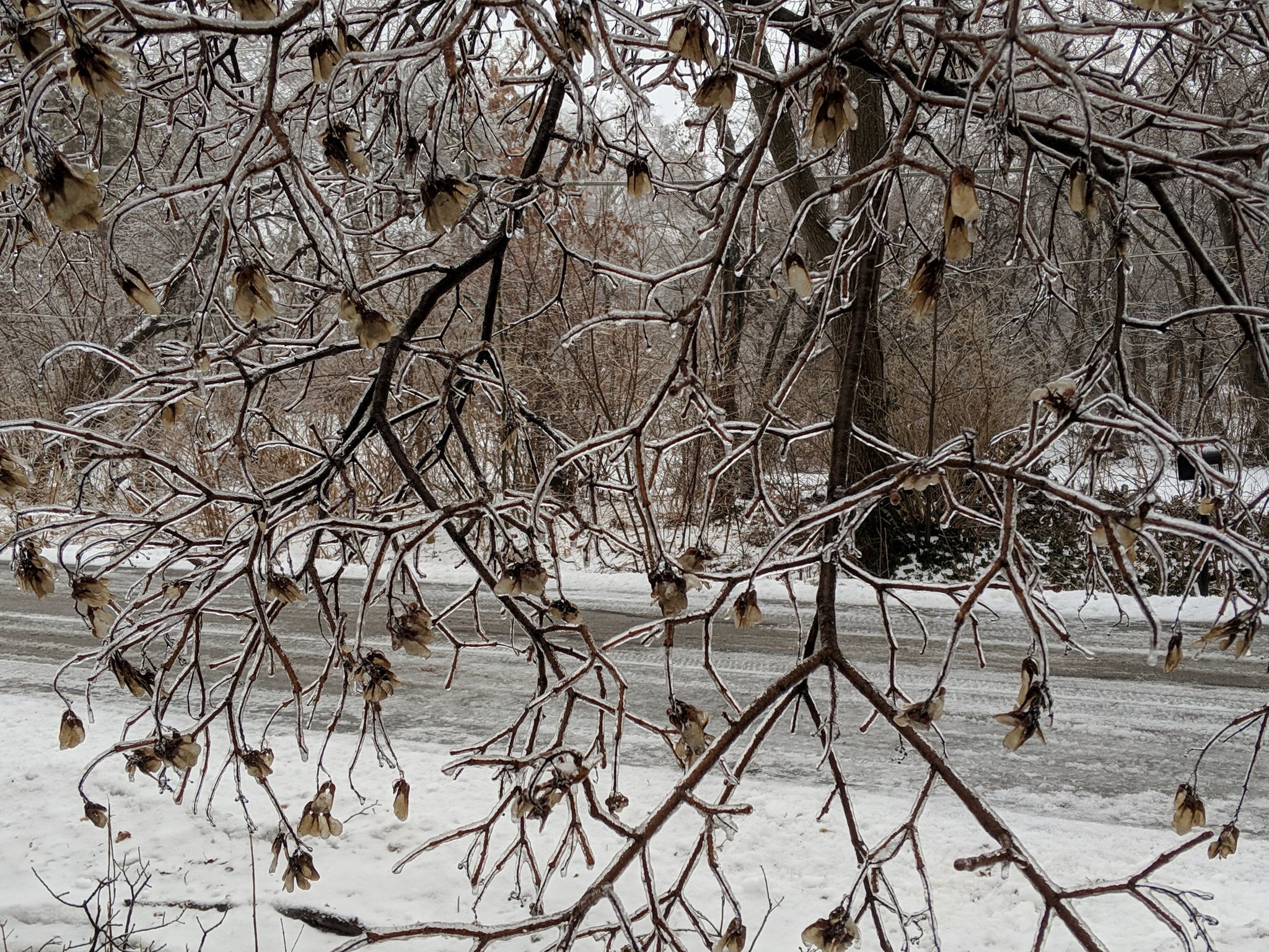
Photo courtesy of Mark Gottlieb West Chicago, IL |
Links
 |
Media use of NWS Web News Stories is encouraged! Additional recaps can be found on the NWS Chicago Science & Past Events Page. |
|

