Chicago, IL
Weather Forecast Office
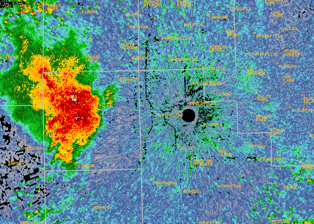
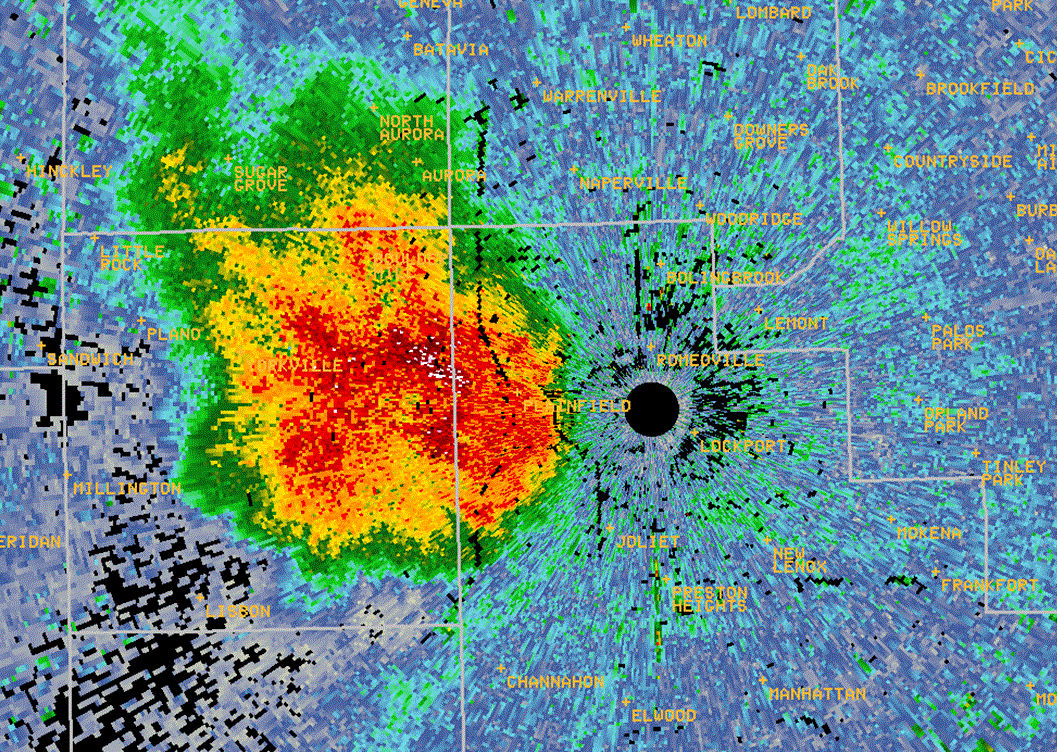
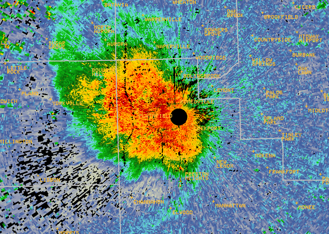
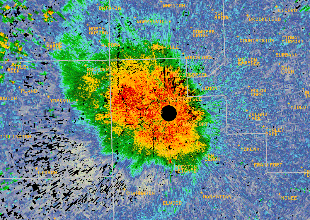
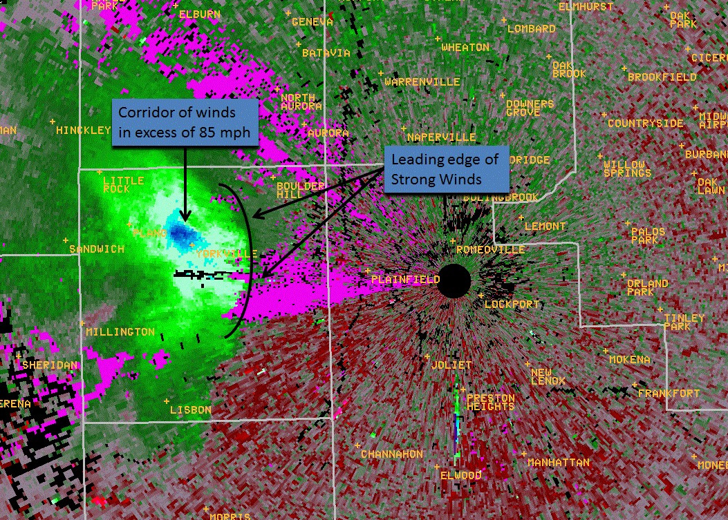
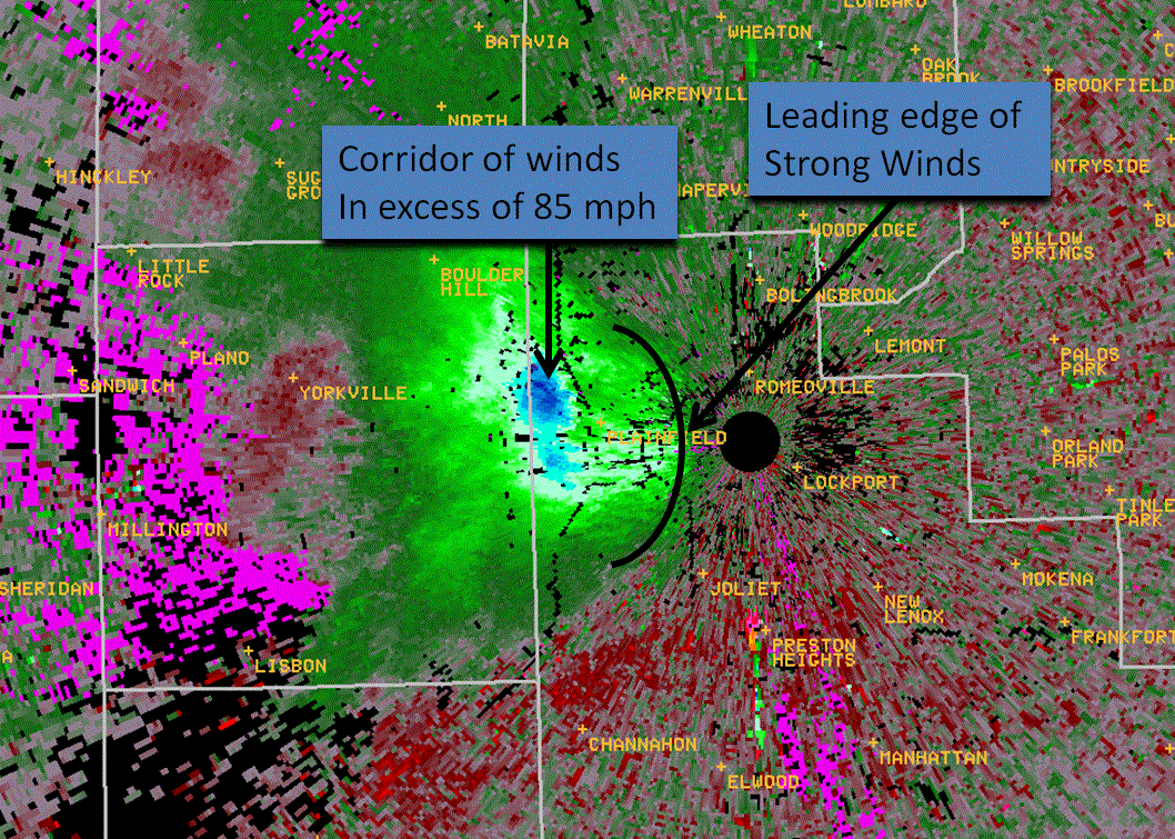
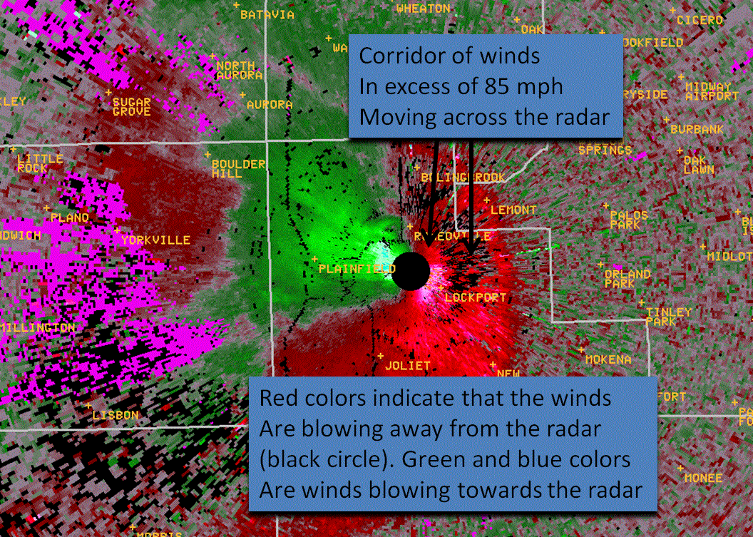
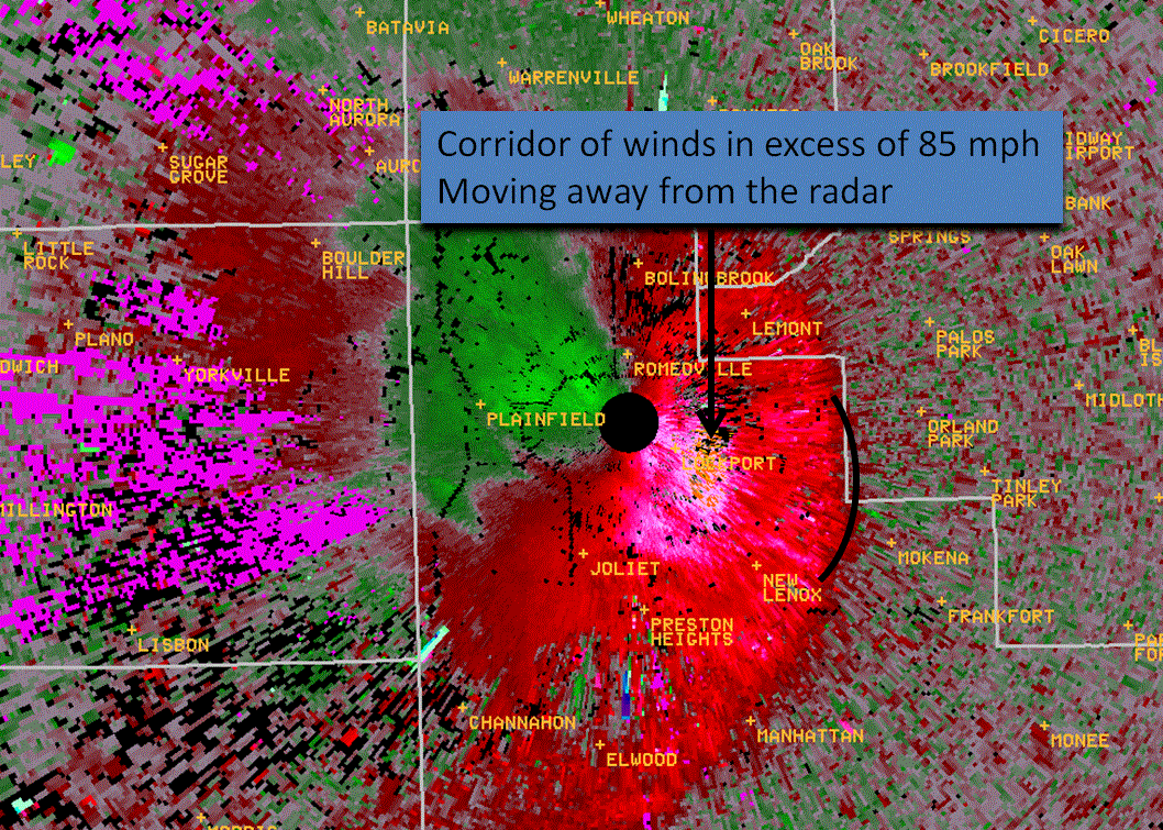
On the evening of June 29, 2012, a severe thunderstorm spawned a downburst which resulted in a swath of 75 to 95 mph winds across portions of central and eastern Kendall and northern Will Counties. Numerous damage reports were received which included downed power lines, uprooted trees, broken tree limbs, as well as some structural damage. The storm passed right over the KLOT Doppler Radar which resulted in an optimal Doppler Radar measurement of the wind speeds. The images below show the progression of the storm as it approached and crossed over the radar. The green and blue colors on the velocity images show wind blowing toward the radar, while the red and orange colors show winds blowing away from the radar. As the storm approaches the radar, the radar beam samples winds closer to the ground. Click on the images to see a larger version.
|
925 PM: Reflectivity (left) and Velocity (right) - approximate wind speeds ~ 1170 ft AGL |
|
|
|
 |
|
939 PM: Reflectivity (left) and Velocity (right) - approximate wind speeds ~ 440 ft AGL |
|
|
|
 |
|
949 PM: Reflectivity (left) and Velocity (right) - approximate wind speeds ~ 110 ft AGL |
|
|
|
 |
|
951 PM: Reflectivity (left) and Velocity (right) - approximate wind speeds ~ 150 ft AGL |
|
|
|
 |
A sample of the highest reported wind speeds.
|
Location |
Wind Speed (mph) |
| 5 miles south of Oswego |
92 |
| NWS office in Romeoville |
87 |
| Plainfield |
70 |
| 2 miles NW of Lockport |
80-90 |
MDB/KJB 6/30/2012
Hazards
Enhanced Hazardous Weather Outlook
Hazardous Weather Outlook
National Briefing
Storm Spotter Training and Seminars
Outlooks
Watch/Warning/Advisory Criteria
Snow Squall Warnings
Local Forecasts
Marine
Aviation
Fire
Text Products
Great Lakes Marine Portal
Lake Michigan Beach Forecast
El Nino
Snow and Ice Probabilities
US Dept of Commerce
National Oceanic and Atmospheric Administration
National Weather Service
Chicago, IL
250 George J Michas Dr.
Romeoville, IL 60446
815-834-1435 8am-8pm
Comments? Questions? Please Contact Us.