Chicago, IL
Weather Forecast Office
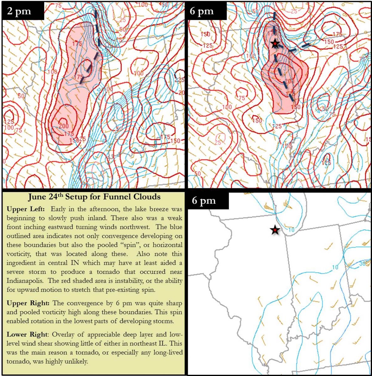
 |
|
|
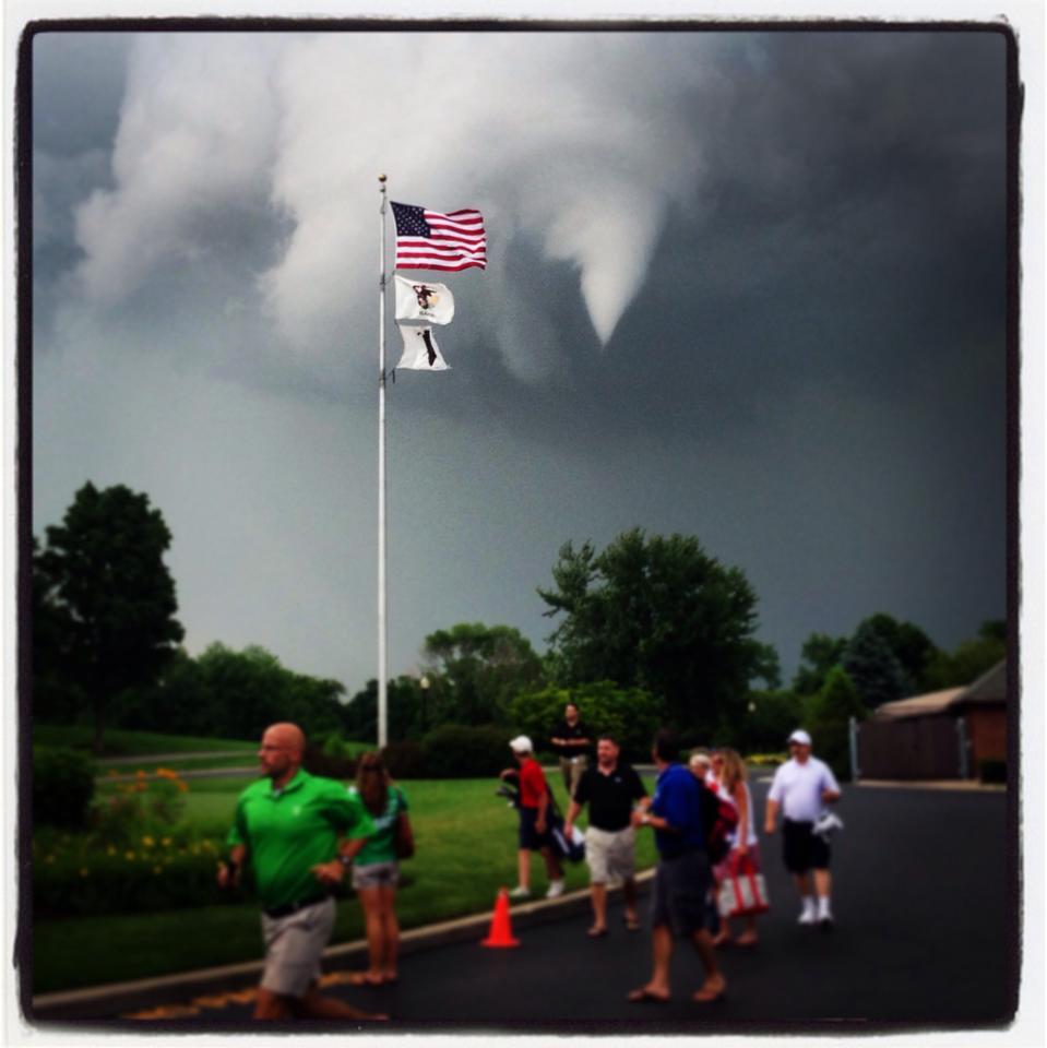
Glen Ellyn around 6 pm. Photo courtesy of Norm Ramil. |
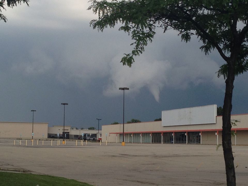
Oak Brook around 6:15. Photo courtesy of Annie Marie. |
|
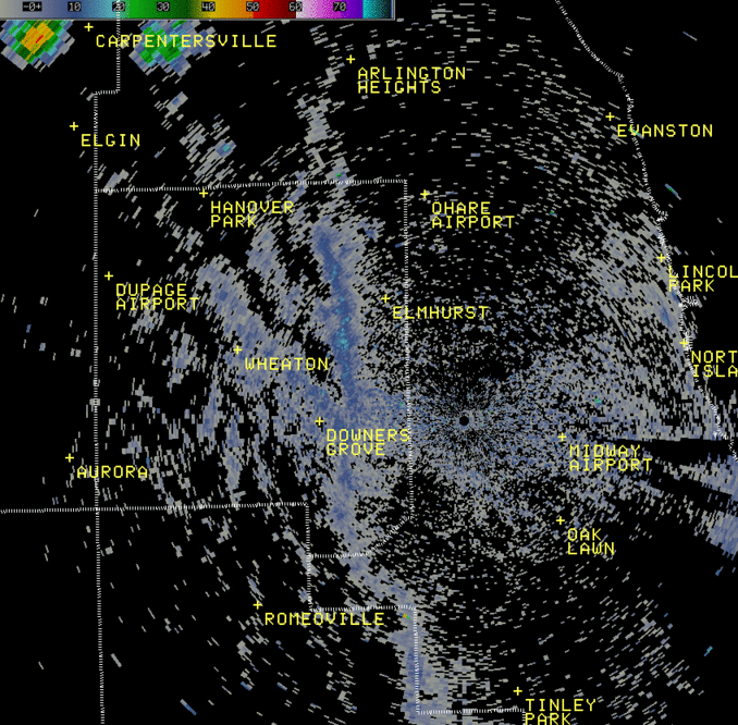
ORD Terminal Doppler Weather Radar 1.8° Loop from ~5:30 pm - 6:45 pm |
|
|
|
Note multiple elongated boundaries that intersect and storms that develop on these. The updrafts of these developing storms stretched pre-existing low-level "spin" and helped produce the funnel clouds. |
|
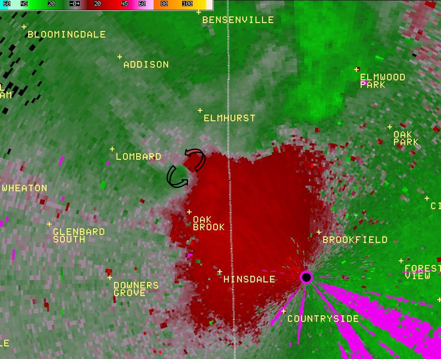
ORD Terminal Doppler Weather Radar 1.8° Storm-Relative Motion indicating rotation near the cloud base level |
|
|
|
Note multiple elongated boundaries that intersect and storms that develop on these. The updrafts of these developing storms stretched pre-existing low-level "spin" and helped produce the funnel clouds. |
Hazards
Enhanced Hazardous Weather Outlook
Hazardous Weather Outlook
National Briefing
Storm Spotter Training and Seminars
Outlooks
Watch/Warning/Advisory Criteria
Snow Squall Warnings
Local Forecasts
Marine
Aviation
Fire
Text Products
Great Lakes Marine Portal
Lake Michigan Beach Forecast
El Nino
Snow and Ice Probabilities
US Dept of Commerce
National Oceanic and Atmospheric Administration
National Weather Service
Chicago, IL
250 George J Michas Dr.
Romeoville, IL 60446
815-834-1435 8am-8pm
Comments? Questions? Please Contact Us.