Overview | Fast Facts | Snowfall Map | Amounts and Highest Wind Gusts | Other Stories
An Alberta Clipper type system tracked north of the Canadian border on Thursday. An upper disturbance out ahead of an Arctic front trailing from the low pressure area resulted in accumulating snow spreading across the area from late Thursday morning through the early afternoon. Periods of snow continued into the mid evening as the Arctic front approached and crossed the area before diminishing to scattered overnight snow showers and flurries. The strong pressure gradient between the low pressure to the north, high pressure over the Southeast US and expansive Arctic high pressure spreading into the northern High Plains resulted in strong gusty south-southwest winds shifting to the west-northwest behind the Arctic front. The newly fallen snow and gusty winds caused areas of blowing and widespread drifting snow and very hazardous travel conditions, with near zero visibility at times in open areas.
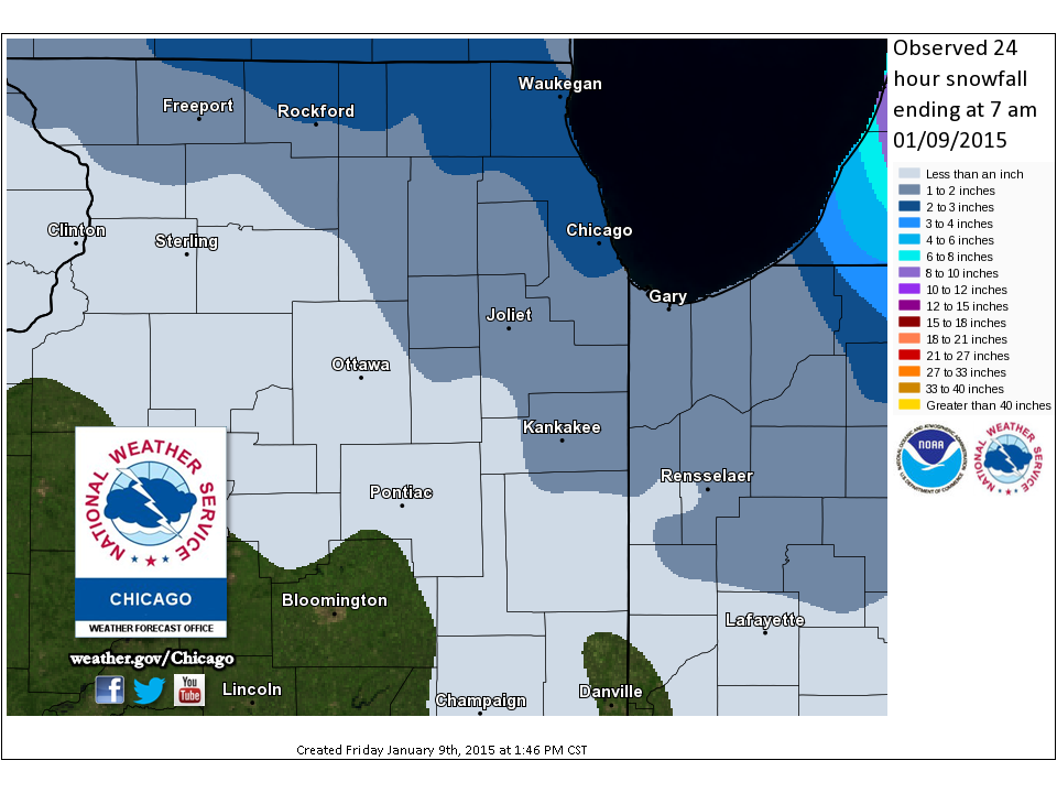
Snowfall Map (through 7am January 9th)
 |
Snowfall Amounts, Highest Wind Gusts, & Other Numbers
|
Chicago O'Hare |
3.0" |
|
Rockford |
1.5" |
|
Chicago Midway 3SW |
2.0" |
|
Romeoville (NWS Office) |
2.5" |
PDF of the Above Listings & Morning Minimum Temperatures

