A significant heat wave continues for the Rockies, Northern Plains, and Great Lakes into the Mid-Atlantic, peaking in intensity through midweek and lingering across parts of the Northern Plains and Midwest until this weekend. Excessive rainfall my bring life-threatening and locally catastrophic flash and urban flooding across portions of southwestern Texas through early Friday. Read More >
| A powerful low pressure system over the northern Great Lakes brought periods of light snow and snow showers, resulting in light accumulations from a coating to as high as 2.3". Falling temperatures during the snow caused icy roads in some areas, with multiple accidents on the evening of December 30th. Peak wind gusts during the PM hours of December 30th ranged from 35 to 55 mph. |
|
Fast Facts
Snow Totals
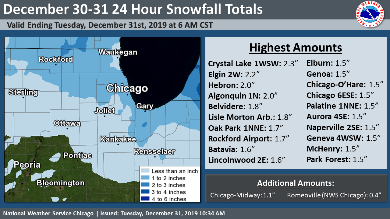 |
| Snowfall Map and Highest Observed Amounts |
Text Listing of Snowfall Reports from Volunteer Observers
Peak Winds
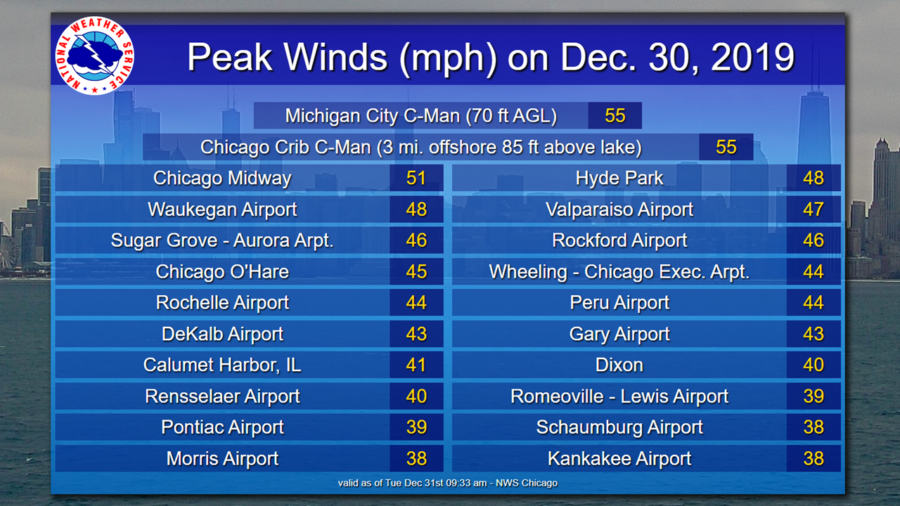 |
| Highest Observed Wind Gusts on December 30th |
 |
Media use of NWS Web News Stories is encouraged! Additional recaps can be found on the NWS Chicago Science & Past Events Page. |
|