Widespread, life-threatening considerable flash flooding is expected in south-central Texas through at least Friday. Catastrophic river flooding and rapid rises on small streams, arroyos, and typically dry washes are expected in the Texas Hill Country. Wildfire smoke is impacting air quality across much of the Great Lakes region into the Northeast U.S. with Air Quality Alerts in effect. Read More >
Overview
Storm Reports
|
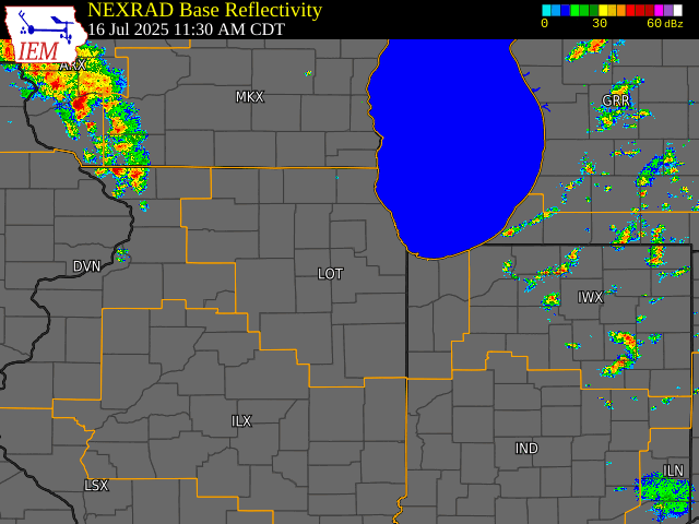
Preliminary Storm Report Map |
Preliminary Local Storm Report...Summary
National Weather Service Chicago IL
539 AM CDT Thu Jul 17 2025

..TIME...   ...EVENT...      ...CITY LOCATION...     ...LAT.LON...
..DATE...   ....MAG....      ..COUNTY LOCATION..ST.. ...SOURCE....
            ..REMARKS..

0128 PM     Tstm Wnd Dmg     3 N Ashton              41.91N 89.22W
07/16/2025                   Ogle               IL   Law Enforcement

            Report of a down power line by the road.

0154 PM     Tstm Wnd Gst     Peru                    41.33N 89.13W
07/16/2025  E60 MPH          La Salle           IL   Trained Spotter

            Estimated 60-70 mph winds.

0158 PM     Funnel Cloud     1 NE Rockton            42.46N 89.06W
07/16/2025                   Winnebago          IL   Public

            Moving Northeast.

0215 PM     Tstm Wnd Gst     3 NNE Pontiac           40.92N 88.62W
07/16/2025  M67 MPH          Livingston         IL   AWOS

            PK58 kt wind gust - AWOS station KPNT
            Pontiac Airport.

0219 PM     Tstm Wnd Dmg     4 WNW Hampshire         42.11N 88.60W
07/16/2025                   De Kalb            IL   Emergency Mngr

            Trees and Powerlines down.

0220 PM     Tstm Wnd Dmg     Leland                  41.62N 88.80W
07/16/2025                   La Salle           IL   911 Call Center

            Power poles snapped around Leland. Relayed
            via La Salle County SO. Time estimated based
            on radar.

0243 PM     Tstm Wnd Dmg     2 WNW Yorkville         41.66N 88.49W
07/16/2025                   Kendall            IL   Public

            Received picture showing portion of a 4 to 5
            inch diameter tree snapped along with a
            large limb down. Time estimated via radar.

0243 PM     Tstm Wnd Dmg     2 NNW Yorkville         41.67N 88.45W
07/16/2025                   Kendall            IL   Law Enforcement

            Trees fell on powerlines along Meadowview
            Lane.

0247 PM     Tstm Wnd Dmg     3 W Oswego              41.68N 88.41W
07/16/2025                   Kendall            IL   Public

            Photo showed on social media showed a 6 to 8
            inch diameter hardwood tree snapped in half.
            Time estimated by radar.

0249 PM     Tstm Wnd Dmg     Oswego                  41.67N 88.36W
07/16/2025                   Kendall            IL   Public

            Photo of a large branch, 15 inches in
            diameter, snapped.

0252 PM     Tstm Wnd Dmg     Oswego                  41.68N 88.35W
07/16/2025                   Kendall            IL   Law Enforcement

            Corrects previous tstm wnd dmg report from
            Oswego. Trees down blocking portions of the
            roadway.

0252 PM     Tstm Wnd Dmg     1 E Boulder Hill        41.71N 88.32W
07/16/2025                   Kendall            IL   Law Enforcement

            Trees down and blocking Long Beach Drive.

0254 PM     Tstm Wnd Dmg     Island Lake             42.28N 88.19W
07/16/2025                   Lake               IL   Public

            Photos shared of large tree limbs snapped on
            at least two trees in Island Lake. Time
            estimated from radar.

0254 PM     Tstm Wnd Dmg     Boulder Hill            41.71N 88.34W
07/16/2025                   Kendall            IL   Amateur Radio

            Tree branches down on cars.

0302 PM     Tstm Wnd Dmg     2 NW Aurora             41.78N 88.34W
07/16/2025                   Kane               IL   Public

            Large tree branch down blocking roadway.

0304 PM     Tstm Wnd Dmg     1 NNE Plainfield        41.62N 88.20W
07/16/2025                   Will               IL   Public

            Powerlines down.

0304 PM     Tstm Wnd Gst     3 SE Batavia            41.82N 88.27W
07/16/2025  M67 MPH          Kane               IL   Public

            Personal Weather Station.

0305 PM     Tstm Wnd Dmg     1 SSW Warrenville       41.80N 88.19W
07/16/2025                   DuPage             IL   Public

            Received picture of part of a 6 to 8 inch
            diameter tree snapped. Time estimated from
            radar.

0305 PM     Tstm Wnd Dmg     1 S Naperville          41.75N 88.15W
07/16/2025                   DuPage             IL   Public

            Corrects previous tstm wnd dmg report from 1
            S Naperville. Received picture of a large 8
            to 10 inch diameter tree limb down. Time
            estimated from radar.

0305 PM     Tstm Wnd Dmg     1 ESE Naperville        41.76N 88.13W
07/16/2025                   DuPage             IL   NWS Employee

            NWS Employee reports large 6 to 12 inch
            diameter tree limb down. Time estimated from
            radar.

0307 PM     Tstm Wnd Gst     2 SSE Naperville        41.75N 88.13W
07/16/2025  M62 MPH          DuPage             IL   Trained Spotter


0308 PM     Tstm Wnd Dmg     1 ESE Bolingbrook       41.70N 88.05W
07/16/2025                   Will               IL   Public

            Powerlines down.

0309 PM     Tstm Wnd Gst     2 SSE Naperville        41.75N 88.13W
07/16/2025  M68 MPH          DuPage             IL   Trained Spotter

            6 inch tree limb down.

0312 PM     Tstm Wnd Dmg     1 SSE Aurora            41.74N 88.31W
07/16/2025                   Kane               IL   Emergency Mngr

            Powerlines down.

0312 PM     Tstm Wnd Dmg     1 NNW Aurora            41.77N 88.33W
07/16/2025                   Kane               IL   Emergency Mngr

            Trees and powerlines down.
0313 PM     Tstm Wnd Dmg     1 N Wheaton             41.88N 88.11W
07/16/2025                   DuPage             IL   Fire Dept/Rescue

            *** 1 INJ ***
            A tree fell across a road on the north side
            of Wheaton and one of its limbs went through
            the windshield of a car driving by. The
            occupant was transported to the hospital
            with minor injuries. Time estimated from
            radar.
0319 PM     Tstm Wnd Dmg     1 S Glen Ellyn          41.86N 88.07W
07/16/2025                   DuPage             IL   Public

            Tree branches down with the largest at 6
            inches in diameter.

0321 PM     Tstm Wnd Gst     Minooka                 41.46N 88.26W
07/16/2025  M57 MPH          Grundy             IL   Mesonet


0321 PM     Tstm Wnd Dmg     2 NW Lombard            41.90N 88.03W
07/16/2025                   DuPage             IL   Public

            Received pictures of a roughly 4 to 5 inch
            diameter tree limb down. Time estimated from
            radar.

0322 PM     Tstm Wnd Dmg     1 SSE Bloomingdale      41.94N 88.08W
07/16/2025                   DuPage             IL   Public

            Picture shows a large tree limb snapped from
            trunk. Limb appears to be about 7 to 8
            inches in diameter. Time estimated from
            radar.

0324 PM     Tstm Wnd Dmg     1 S Glendale Heights    41.90N 88.07W
07/16/2025                   DuPage             IL   Public

            Two areas of concentrated tree damage
            occurred surrounding North Avenue in
            Glendale Heights and Glen Ellyn. Photos
            depicted numerous hardwood and softwood
            trees snapped, including several that were
            at least 1 foot in diameter. Wind gusts
            likely exceeded 70 mph. Time estimated by
            radar.

0324 PM     Tstm Wnd Gst     2 SW Orland Park        41.60N 87.88W
07/16/2025  M70 MPH          Cook               IL   Trained Spotter

            Corrects previous tstm wnd gst report from 2
            SW Orland Park.

0325 PM     Tstm Wnd Dmg     3 W Addison             41.92N 88.04W
07/16/2025                   DuPage             IL   Public

            Multiple public reports of downed trees and
            large tree limbs from a downburst on the
            west side of Addison. Time estimated from
            radar.

0327 PM     Tstm Wnd Gst     1 W Addison             41.92N 88.01W
07/16/2025  E60 MPH          DuPage             IL   Public

            Estimated 60 mph winds.

0328 PM     Tstm Wnd Dmg     Wood Dale               41.96N 87.98W
07/16/2025                   DuPage             IL   Trained Spotter

            Multiple downed tree branches up to 6 inch
            in diameter. Relayed through social media
            and the time estimated through radar.

0330 PM     Marine Tstm Wind 3 E Waukegan            42.37N 87.80W
07/16/2025  M40 MPH          LMZ740             IL   Buoy

            Peak gust of 35 kt at Waukegon Buoy.

0333 PM     Tstm Wnd Dmg     1 WNW Midway Airport    41.79N 87.77W
07/16/2025                   Cook               IL   Public

            Photo shared on social media depicting
            several 6 inch diameter tree limbs downed in
            Garfield Ridge. Time estimated by radar.

0334 PM     Tstm Wnd Gst     Midway Airport          41.78N 87.76W
07/16/2025  M53 MPH          Cook               IL   ASOS

            Corrects previous non-tstm wnd gst report
            from Midway Airport. Peak gust of 46 kt.
            ASOS station KMDW Chicago Midway.

0336 PM     Tstm Wnd Dmg     1 SW Berwyn             41.84N 87.80W
07/16/2025                   Cook               IL   Public

            Photo shared on social media showing a
            roughly 8 inch in diameter tree branch
            snapped in Proska Park. Time estimated by
            radar.

0338 PM     Tstm Wnd Gst     Ohare Airport           41.98N 87.90W
07/16/2025  M67 MPH          Cook               IL   ASOS

            Corrects previous non-tstm wnd gst report
            from Ohare Airport. Peak gust of 58 kt at
            ITWS runway sensor.

0338 PM     Tstm Wnd Dmg     2 S Des Plaines         42.02N 87.88W
07/16/2025                   Cook               IL   Public

            Photo relayed on social media of a 1 foot in
            diameter tree uprooted near Linden and
            Prospect in Des Plaines. A portion of
            sidewalk was damaged by the uprooted tree,
            as well. Time estimated by radar.
0340 PM     Tstm Wnd Dmg     1 ENE Brighton Park - C 41.82N 87.68W
07/16/2025                   Cook               IL   Public

            Multiple reports of downed trees and tree
            limbs across the Brighton Park, Gage Park,
            McKinley Park, and Bridgeport neighborhoods
            of Chicago. Data collected from 311
            requests. Time estimated by radar.
0341 PM     Tstm Wnd Dmg     Park Ridge              42.01N 87.84W
07/16/2025                   Cook               IL   Public

            Photo relayed via social media of a 4 to 6
            inch diameter tree branch downed. Time
            estimated by radar.

0343 PM     Tstm Wnd Dmg     1 SSE Jefferson Park -  41.97N 87.76W
07/16/2025                   Cook               IL   Public

            Multiple reports of downed trees and tree
            limbs across the Jefferson Park neighborhood
            of Chicago. Data collected from 311
            requests. Time estimated by radar.

0343 PM     Tstm Wnd Dmg     Bridgeport - Chicago    41.84N 87.64W
07/16/2025                   Cook               IL   Public

            Report of a 6 inch diameter tree branch down
            on a street sign. Time estimated from radar.

0343 PM     Tstm Wnd Dmg     1 W Montrose Harbor     41.96N 87.65W
07/16/2025                   Cook               IL   Public

            Received picture of a large tree limb
            approximately 10 to 12 inches in diameter
            downed onto a bus bench awning. Time
            estimated from radar.

0346 PM     Tstm Wnd Dmg     1 SE Aurora             41.75N 88.31W
07/16/2025                   Kane               IL   Emergency Mngr

            Tree and powerlines down.
0348 PM     Tstm Wnd Dmg     1 ESE North Center - Ch 41.94N 87.67W
07/16/2025                   Cook               IL   Public

            Multiple reports of downed trees and tree
            limbs across the Bricktown and Buena Park
            neighborhoods of Chicago. Data collected
            from 311 requests. Time estimated by radar.
0350 PM     Marine Tstm Wind 2 E Navy Pier           41.89N 87.56W
07/16/2025  M52 MPH          LMZ741             IL   Public

            Peak gust of 45 kt measured at the Chicago
            Buoy.
0351 PM     Tstm Wnd Dmg     1 SSE Calumet Hts. - Ch 41.72N 87.57W
07/16/2025                   Cook               IL   Public

            Numerous reports of downed trees and tree
            limbs across the Marionette Manor
            neighborhood of Chicago. Data collected from
            311 requests. Time estimated by radar.
0352 PM     Tstm Wnd Dmg     1 W Montrose Harbor     41.96N 87.65W
07/16/2025                   Cook               IL   Public

            A piece of a roof blew into the gangway
            between two buildings.

0353 PM     Tstm Wnd Gst     1 NE Montrose Harbor    41.97N 87.63W
07/16/2025  M63 MPH          LMZ741             IL   Mesonet

            Mesonet station XMTB Montrose Beach Light.

0358 PM     Marine Tstm Wind 3 NE Navy Pier          41.92N 87.57W
07/16/2025  M74 MPH          LMZ741             IL   Mesonet

            Five minutes of gusts in excess of 60 kt
            with peak gust of 64 kt.

0358 PM     Tstm Wnd Dmg     1 SE Blue Island        41.64N 87.67W
07/16/2025                   Cook               IL   Public

            Photo showing approximately 1 foot diameter
            tree limb downed onto a mobile home/trailer
            in Blue Island, causing damage to its roof.
            Time estimated from radar.

0406 PM     Tstm Wnd Dmg     1 SSE Piper City        40.74N 88.18W
07/16/2025                   Ford               IL   Emergency Mngr

            6 inch limb snapped one half mile south of
            US 24 on IL 115.

0411 PM     Tstm Wnd Dmg     2 WSW Schererville      41.48N 87.48W
07/16/2025                   Lake               IN   Public

            Received picture of approximately 8 inch
            diameter tree snapped. Time estimated from
            radar.

0421 PM     Tstm Wnd Dmg     Ashkum                  40.88N 87.95W
07/16/2025                   Iroquois           IL   Public

            Photo shared of a large, rotted tree snapped
            a few feet up from its base, partially
            landing on the roof of a house and an
            adjacent garage building in Ashkum. Time
            estimated from radar.

0440 PM     Tstm Wnd Gst     1 S Hobart              41.52N 87.26W
07/16/2025  M65 MPH          Lake               IN   Public


0500 PM     Marine Tstm Wind 3 NE Beverly Shores     41.72N 86.93W
07/16/2025  M40 MPH          LMZ745             IN   C-Man Station

            Measured at the Michigan City GLERL site.


&&

$$
|
 |
Media use of NWS Web News Stories is encouraged! Please acknowledge the NWS as the source of any news information accessed from this site. Additional event recaps can be found on the NWS Chicago Past Events Page |
|