Severe Thunderstorm Hits Childress on June 15th with Severe Winds and Wind-driven Hail
*LATEST* Press release about the damaging thunderstorm that impacted Childress on Sunday, June 15, 2008. The document was released on Monday, August 11, 2008, in PDF format. To obtain a PDF reader CLICK HERE.
 |
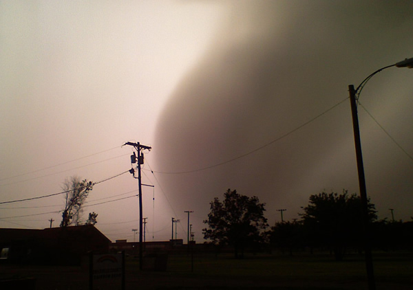 |
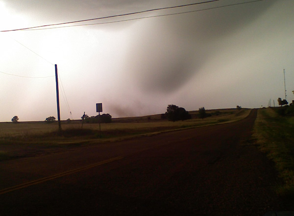
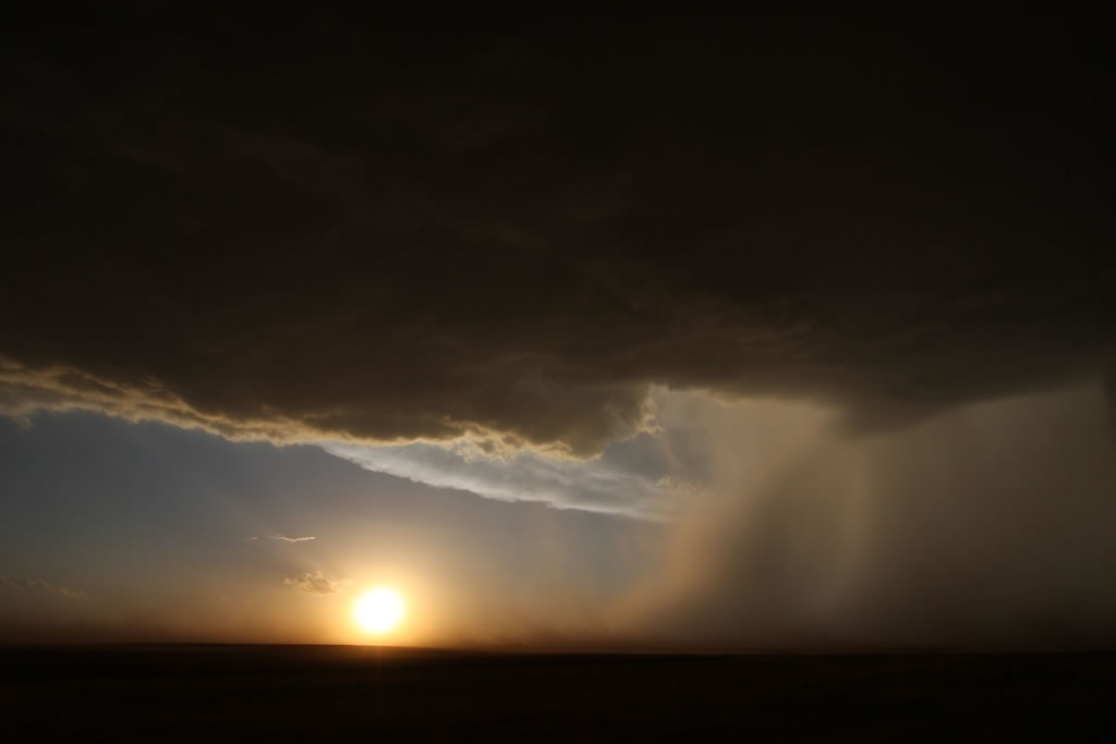
Images of the Severe "Macroburst" that hit Childress. A macroburst is a large downburst with an outflow diameter of 2.5 miles or larger and damaging winds. The Images show a descending core of heavy rain and hail from the thunderstorm. The strong outflow winds are also generating blowing dust visible in the first image. Please click on the images to view larger versions. Images courtesy Brian James, KVII-TV Amarillo.
Sunday evening the 15th, an intense thunderstorm moved out of the southeast Texas Panhandle and across Childress county, bringing a wide swatch of damage from strong winds and wind-driven hail. The storm also was responsible for six minor injuries. The thunderstorm formed in an environment with strong wind shear and instability. This caused the storm to develop into a supercell, meaning that it showed deep and persistent storm-scale rotation (on the order of 2-10 miles in diameter) above cloud base. The image below is an accumulated precipitation image from the Lubbock radar and is useful to show the path of the thunderstorm. The actual precipitation values are overestimated in the core of the storm due to the presence of hail.
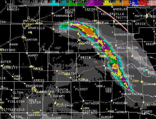 |
| A 24-hour accumulated precipitation image estimated from the Lubbock radar (located just below the image below the town of Abernathy) showing the track of the storm across the region. |
The storm moved across Childress County from approximately 7:30 pm to 9:15 pm - bringing severe weather to the city of Childress from about 8:30 pm to 9:00 pm. The following two images show the storm as it appeared on radar over Childress. The first image is the vantage point of the radar at Lubbock and the second one is from Frederick, Oklahoma (the radar at Amarillo also showed a similar perspective). Both images show the core of very strong reflectivity values over Childress indicative of large hail. The second image also shows a large hail signature commonly called a "hail spike" on the west side of the storm (extending into Hall County).
 |
 |
| National Weather Service Doppler Radar images of the Childress thunderstorm. The one on the left is from Lubbock and the one on the right is from Frederick, OK. Both images are from 0133 UTC or 833 pm CDT. The radar beam height over Childress from the Lubbock radar is about 11,000 feet and from the Frederick radar it is about 5,000 feet. Please click on the images to view larger versions. | |
On Monday the 16th, a team from the National Weather Service Office in Lubbock and Texas Tech University went to Childress to conduct a damage survey. They found that a large number of homes and other structures suffered extensive wind and hail damage - almost all the homes in Childress had their east-facing windows destroyed by hail. The hail was not exceptionally large, ranging from around quarter to ping-pong ball size. But the strong winds in excess of 80 mph caused the hail to be extremely destructive. Below are a few photographs taken during the damage survey. Please click on each image to view a larger version.
 |
|
This home experienced extensive carport and roof damage. For a larger view click on the image.
|
 |
|
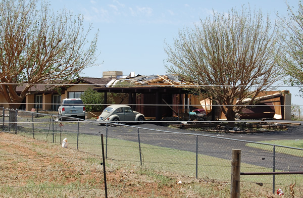
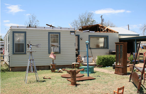
This home suffered some of the worst damage found by the survey team. It lost almost its entire roof and then most of the possessions inside were ruined by rain/wind/hail. For a larger view click on the image.
|
 |
|
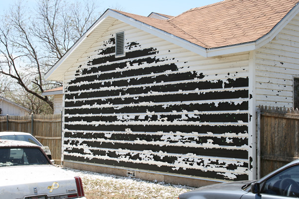
This home in southeast Childress had it's vinyl siding shredded by wind-driven hail. For a larger view click on the image.
|
After reviewing the damage survey photographs, radar data, and other information, the survey team determined that the damage was not caused by a tornado, but rather a combination of the strong straight-line winds (in the 75 to 95 mph range) and the large hail driven by the wind. Please click HERE to view the Public Information Statement (PNS) released by the National Weather Service Office in Lubbock. Below are some additional pictures taken of the storm near Childress just before sunset.
 |
 |
 |
 |
|
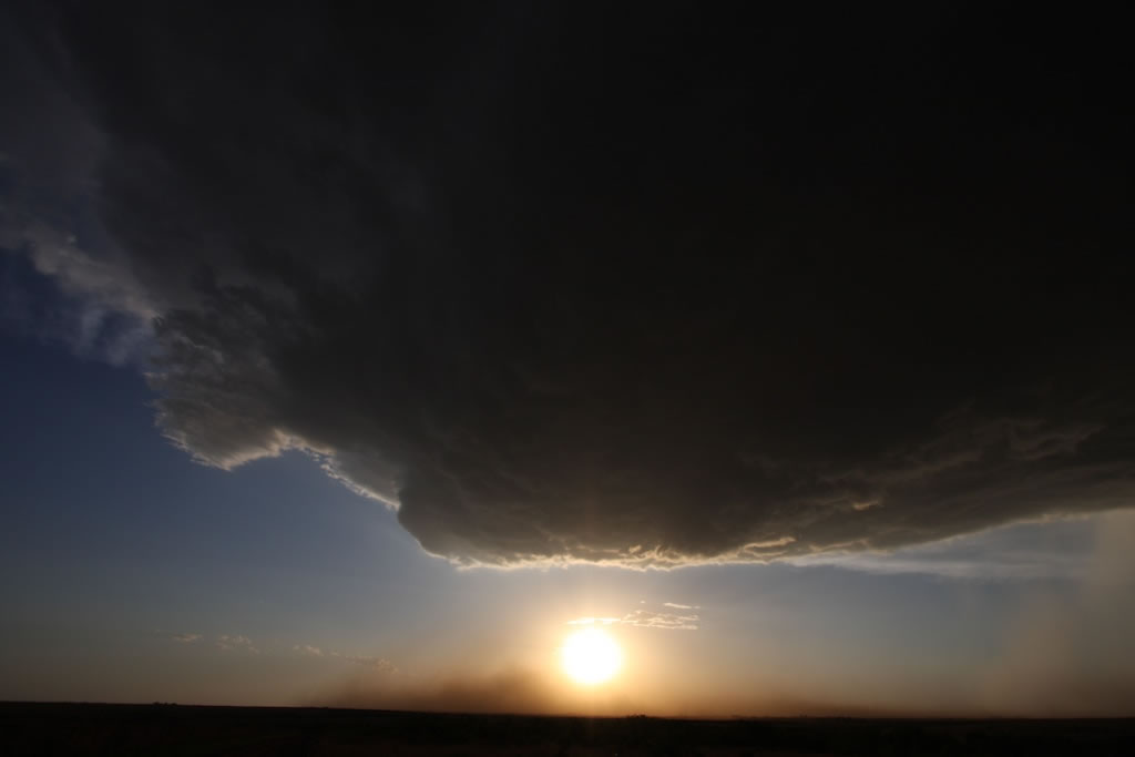
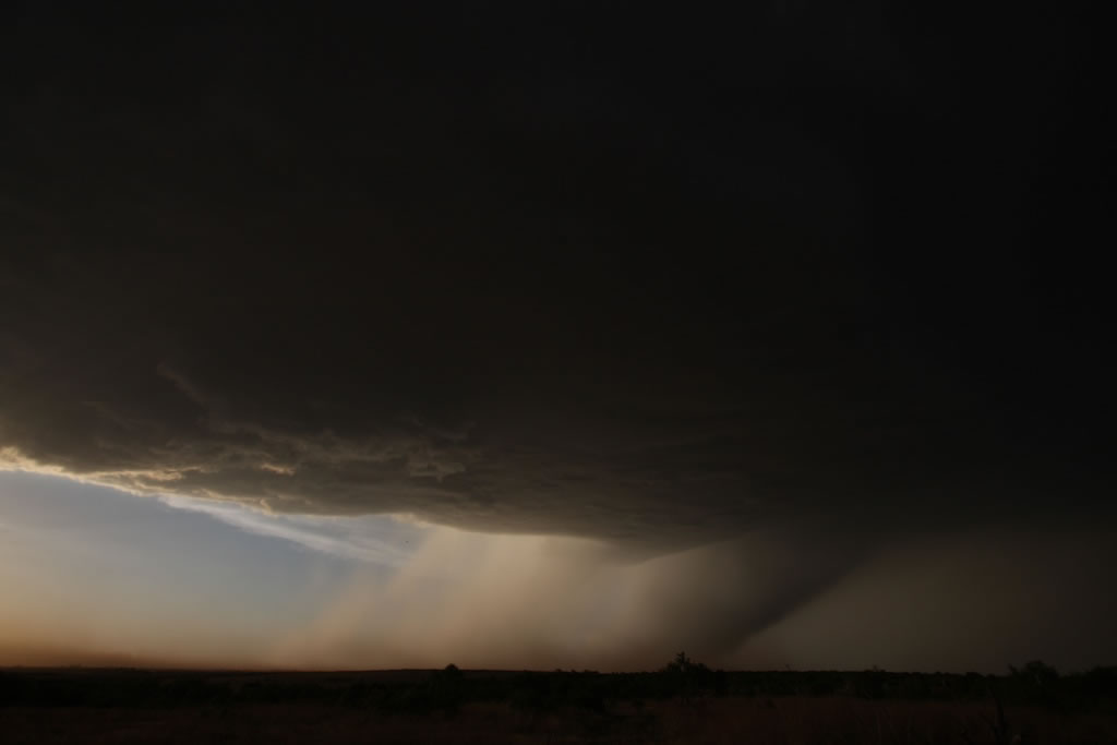
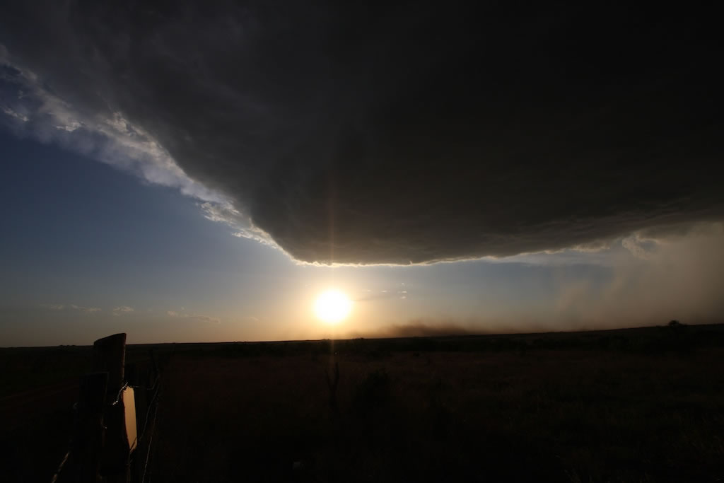
Above are pictures taken of the storm that impacted Childress on the evening of 15 June 2006. The pictures were taken from about 6 miles south of Childress look north-northwest. The images depict areas of heavy rain and hail below the storm cloud base (on the right side), with strong outflow winds (dust) seen near ground level.The strong winds/dust appear to be emanating from the location where the rain and hail reach the ground, as is typical for a wet macroburst/downburst. The pictures are courtesy of Russell Graves. Click on the images for a larger view.
|
|
More information can be found for this event at the Texas Tech Mesonet web site. Follow this LINK.

