
Scattered thunderstorms with severe gusts, hail and a tornado risk are possible near a cold front from the Ohio Valley to the Mid-Atlantic tonight. Tropical Storm Bertha is expected to bring tropical storm conditions to portions of the Gulf Coast from the panhandle of Florida into Louisiana through Wednesday. Read More >
|
A Cold and Snowy Christmas 2012 |
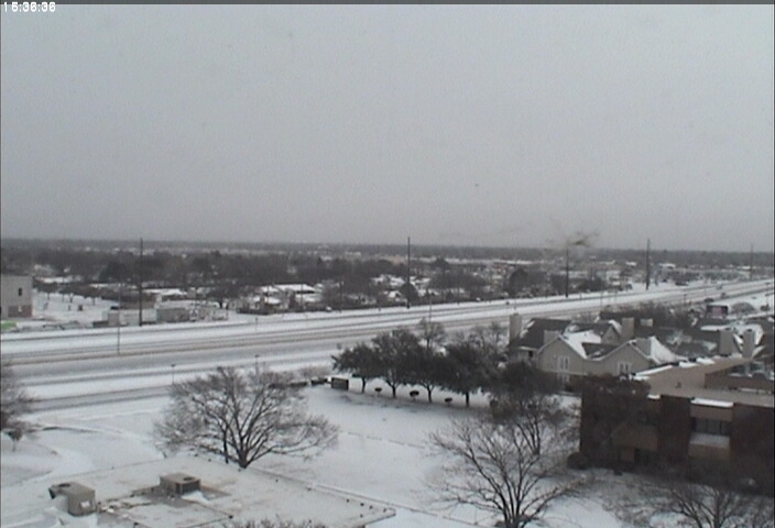 |
| A view looking northeast from the NWS Lubbock webcam around 9:30 am Christmas morning. |
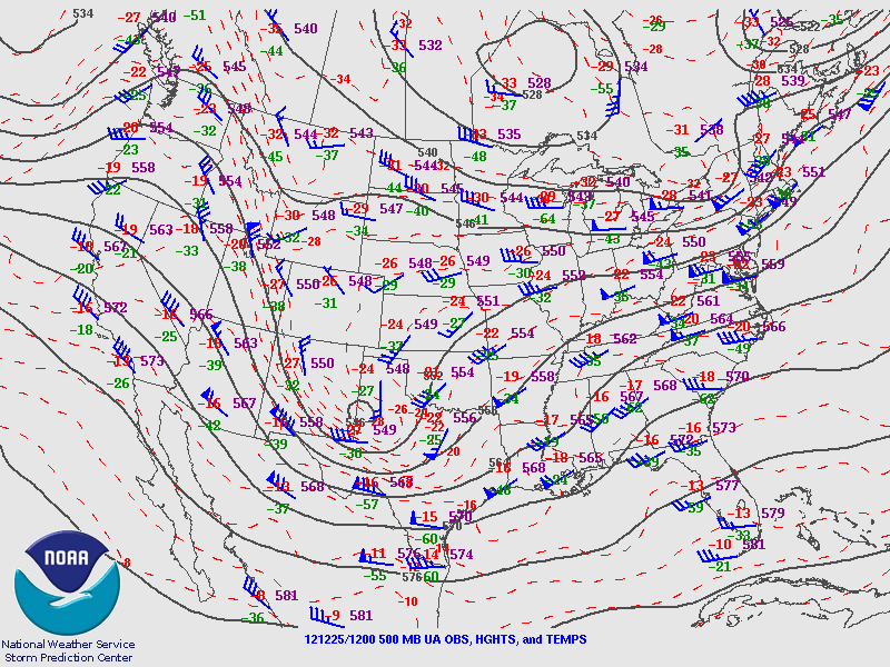
| A strong upper-level trough (shown below) moved across New Mexico and into West Texas during the evening hours on Christmas Eve and into Christmas morning. At the surface, an intensifying low pressure system developed across eastern New Mexico and pushed into central Texas during the morning hours. This brought a strong cold front through the extreme southern Texas panhandle, South Plains, and Rolling Plains by mid to late morning on Christmas day. |
|
|
| Upper-level low pressure system moving into the South Plains at 6:00 am Christmas morning. |
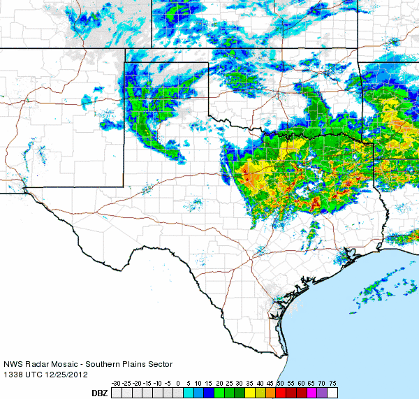
| Ahead of the front, a light to moderate band of snow developed and impacted much of the extreme southern panhandle, South Plains, and Rolling Plains as seen below. The snow lasted through the early afternoon before coming to an end across the extreme southeastern panhandle. |
|
|
| Southern Plains radar loop from about 7:30 am to 8:45 am Christmas morning. |
|
|
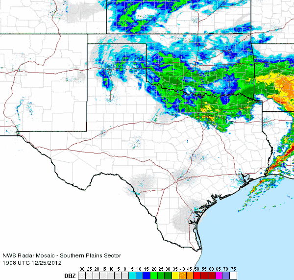
| Southern Plains radar loop from about 1:00 pm to 2:15 pm Christmas afternoon. |
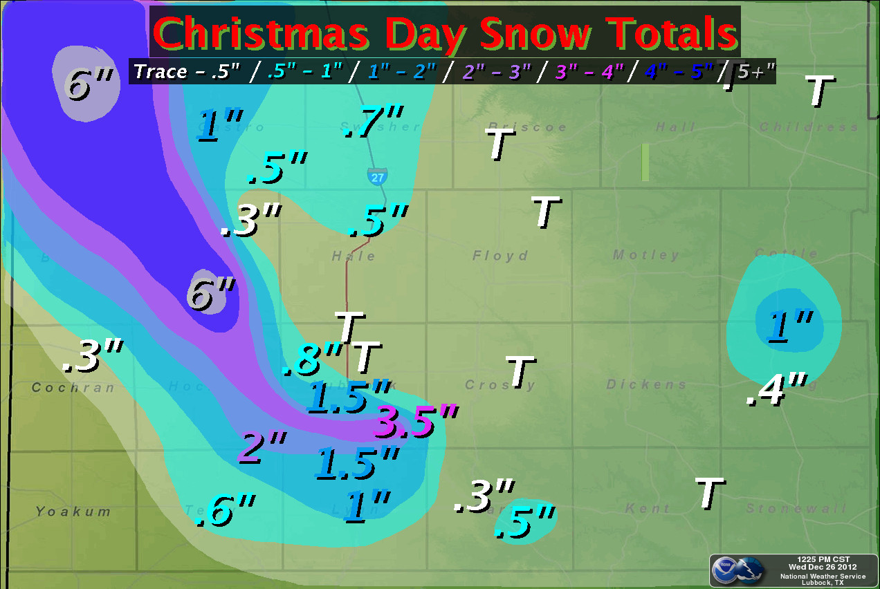
| The below image shows preliminary snowfall totals. The heaviest band of snow produced 3-5 inches on a line from about Friona to south and west of Lubbock. Accumulations tapered off quickly outside of this range as Morton and northeast sections of Lubbock recorded less than half an inch. The extreme southern panhandle saw more widely distributed higher amounts with areas through northwestern Swisher County receiving about 1 inch of snowfall. |
|
|
| Snowfall totals across the extreme southern Texas Panhandle, South Plains, and Rolling Plains. Click on the image for a larger view. |
| The coldest air of the season filtered into the region behind the cold front by way of brisk 20-30 mph northerly winds. Afternoon temperatures remained below freezing, including areas across the extreme southwestern Texas Panhandle and northwestern South Plains hovering in the upper teens. Wind chills became dangerous after sunset Christmas evening, as 10-20 mph winds combined with falling temperatures to produce wind chills around 0 degrees Fahrenheit. The figure below shows wind chill values at 10:00 pm Christmas night. |
|
|
| Wind chill readings as of 10:00 pm Christmas night. Courtesy of the West Texas Mesonet. |
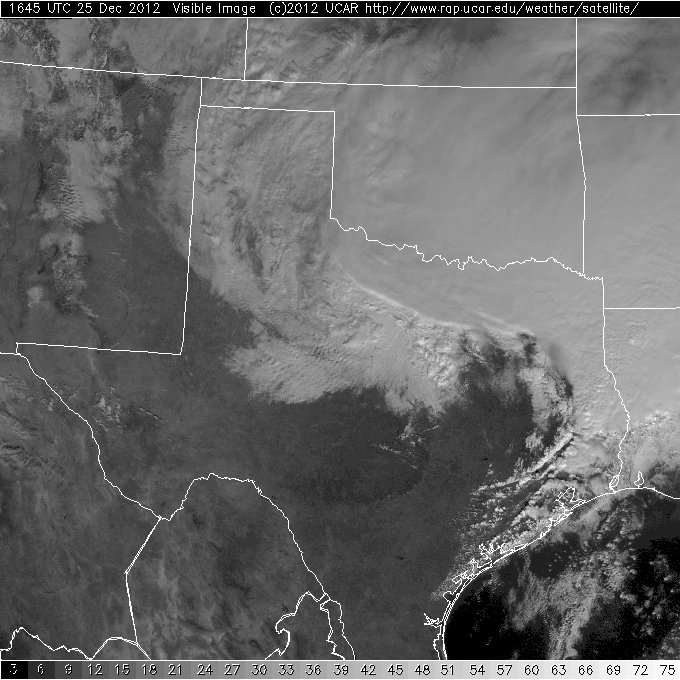
| The following is an interesting image captured from this event. Meteorologists look at visible satellite imagery during the daylight hours to see clouds in the atmosphere. In the image below, clouds are thinning and beginning to clear out of the South Plains and extreme southwestern portions of the Texas Panhandle. This is allowing the satellite to see the fresh snowfall on the ground behind the thicker blanket of cloud cover to the east. |
|
|
| Visible satellite imagery from 10:45 am Christmas morning. |

