
Scattered thunderstorms with severe gusts, hail and a tornado risk are possible near a cold front from the Ohio Valley to the Mid-Atlantic tonight. Tropical Storm Bertha is expected to bring tropical storm conditions to portions of the Gulf Coast from the panhandle of Florida into Louisiana through Wednesday. Read More >
|
Severe Thunderstorms Slam the Rolling Plains |
||||
 |
||||
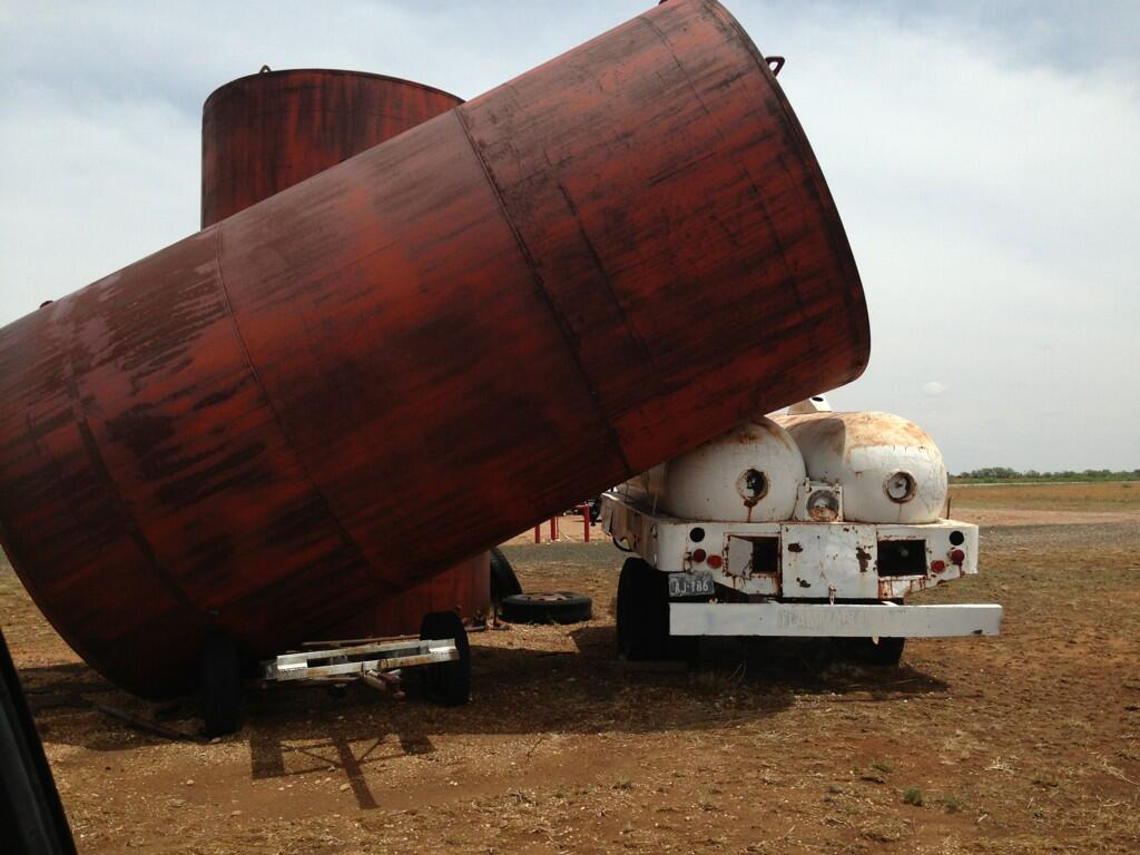
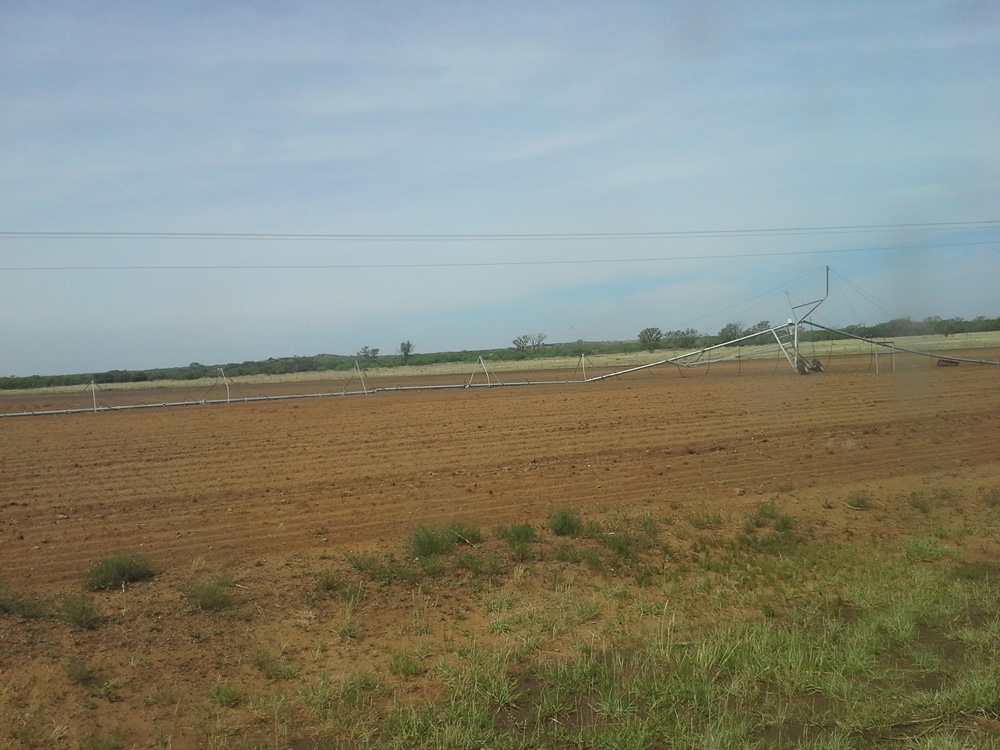
| Wind damage observed north of Jayton. Click on the image for a larger view. | ||||
|
A large, isolated supercell thunderstorm developed across the central South Plains on Thursday, May 23rd. This storm formed on an outflow boundary which was moving west from earlier storms in Oklahoma. Very moist and unstable air was in place across the South Plains area, and the outflow boundary, in combination with the Caprock escarpment, provided enough upward push for this storm to break through a lid of warmer air aloft. Once the storm developed, it grew quickly, and landspout-type tornadoes were observed in eastern Floyd County within minutes under the base of the building updrafts. The storm moved very slowly to the southeast, and produced a strong outflow boundary which moved west and south across Crosby, Lubbock, and Hale Counties, and eventually into Garza and Lynn Counties. These outflow winds were severe at times, clocked at around 60-70 mph across portions of Floyd and Crosby Counties. Unfortunately, these winds easily lofted dirt from many of the freshly-plowed fields in the area, and as a result, portions of the central South Plains were on the receiving end of another haboob. Farther to the south and east though, a second storm developed and strengthened on the outflow boundary and brought locally heavy rain and large hail along with strong wind. Golf ball-sized hail was reported near Spur around 5:15 pm. The supercell began to strengthen and its rotation increased as it moved into Kent and Stonewall Counties. This resulted in wind gusts in excess of 90 mph recorded at the Jayton airport. A subsequent damage survey by the NWS determined that a tornado struck about 7 miles northeast of the town of Girard, with a track length of approximately two miles, and estimated winds of 100 mph, or an EF-1 rating. Another severe storm cell produced baseball-sized hail southwest of Aspermont around 5:30 pm. Rainfall on the order of two to four inches was measured along the storm's path with some locally higher amounts likely. The cooperative observer in Jayton measured an impressive 4.3 inches in town. To view the preliminary local storm reports from this event please click here. Several pictures of damage from the severe storms can be found below. |
||||
|
||||
|
||||
| The following image depicts a classic illustration of straight line wind damage. The residence in the upper right of the image lost nearly all of its metal roof. Note how the metal sheets are scattered in one direction in a divergent pattern. This clearly reinforces the recommendation that during strong thunderstorms, one should seek shelter in a sturdy shelter as it offers some degree of protection from flying debris. Vehicles and mobile homes are certainly not safe during high wind events. | ||||
.png) |
||||
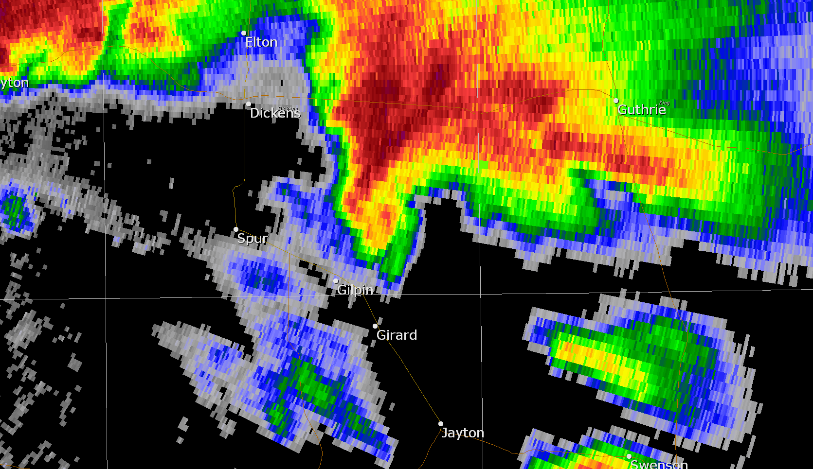
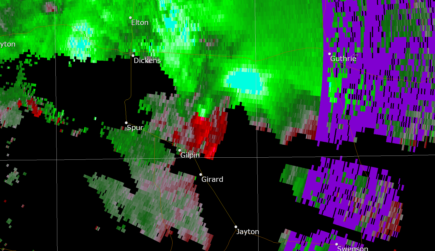
| Below are two radar images showing reflectivity (left) and storm relative velocity (right) of the storm depicting a tight circulation in southeastern Dickens County. The hook echo in the left image is clearly visible north-northeast of Girard corresponding to the radar-indicated circulation center with the right image. An aerial survey was conducted, thanks to the Texas Department of Public Safety, which located evidence of damage supportive of an EF1 tornado. No structures appear to have been damaged by the tornado though a number of trees were toppled in a pattern suggestive of cyclonic rotation. | ||||
  |
||||
| The below image gives a regional perspective on how the relatively small but intense complex of storms evolved through the late afternoon hours on the 23th of May. | ||||
 |
||||
| Regional radar loop captured from 3:48 to 4:58 pm on 23 May 2013. | ||||
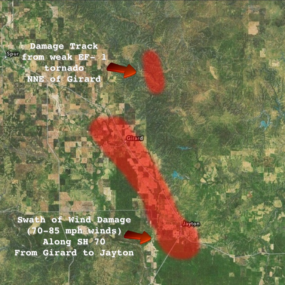
| The most intense storm produced significant wind damage from Girard to Jayton, and one brief tornado north-northeast of Girard. See the below map for details. | ||||
 |
||||
| Map displaying the approximate swath of wind damage from near Girard through Jayton from strong straight-line winds on 23 May 2013. Also displayed is the approximate path of a brief tornado north-northeast of Girard. Click on the map for a larger view. | ||||
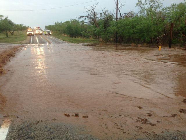
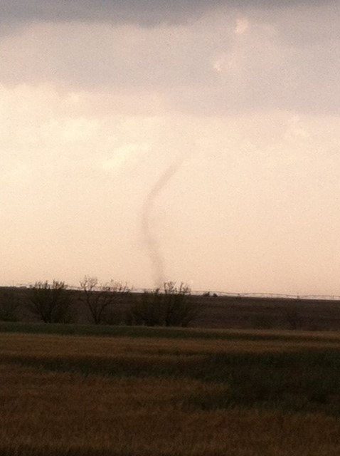
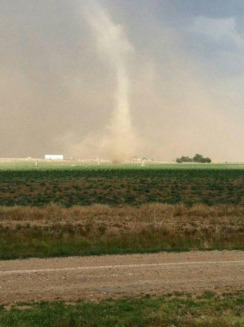
| The severe storms not only produced very large hail and damaging winds, they also dropped torrential rains and produced a few landspout-type tornadoes as the below images demonstrate. | ||||
|
||||
|
||||
| The West Texas Mesonet also produced a case study for this day that can be accessed HERE. In addition, below is a graphical plot of the preliminary storm reports and rainfall totals for May 23rd. Also plotted are radar derived maximum hail sizes and rotation tracks. | ||||
|
|
|||
|
Preliminary Storm Reports
|
Toggle 24 Hour Rainfall Totals
|
Toggle Maximum Radar Estimated Hail Size
|
Toggle Radar Derived Rotation Tracks
|


