
Dangerous heat will expand from the Gulf Coast into the Southern Plains and Desert Southwest through week's end. Additional extreme heat impacting the Pacific Northwest will shift to the northern Plains by the weekend. Tropical Storm Bertha is expected to continue to impact portions of the northern Gulf Coast from the western Florida Panhandle to southeastern Louisiana through tonight. Read More >
|
Another Day of Wind and Dust |
|
 |
|
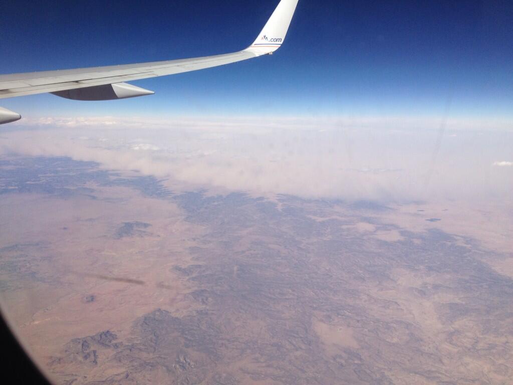
| Picture of the advancing wall of dust (haboob) over the Texas Panhandle, as viewed from a plane, on 18 March 2014. The image is courtesy of Katie Western. | |
| It may have seemed like déjà vu as a week to the day another couple of rounds of wind and blowing dust struck West Texas. This second bout of wind and dust was courtesy of a strong upper level storm system that emerged from the Rockies into the Great Plains. On the north side of the system, parts of the upper Midwest saw 6-10 inches of heavy, wet snow. Unfortunately, no moisture fell south of the system, though plenty of blowing dust did cloud the sky. | |
 |
|
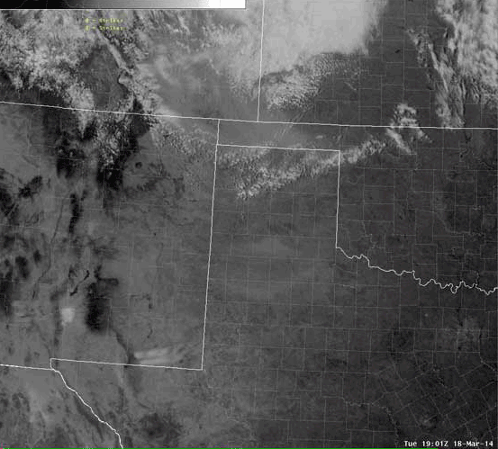
| Visible satellite loop captured during the afternoon and early evening of 18 March 2014. Two distinct areas of dust are seen, one moving eastward over the South and Rolling Plains, and another moving southward out of the Texas Panhandle. | |
| As the above satellite animation shows, initially strong westerly winds lofted copious amount of blowing dust, carrying it from west to east over the South and Rolling Plains from late Tuesday morning through the afternoon hours. Visibilities of 1/2 to 2 miles were fairly common in this dust plume, though in localized spots it did drop to near zero in brownout conditions. Conditions temporarily improved as the westerly winds eased a bit into the early evening. However, a strong cold front then blasted southward out of the Texas Panhandle, bringing with it a wall of dust otherwise known as a haboob. Visibilities quickly fell to and below 1 mile in most spots, with the dusty skies lingering for several hours well into the night. | |
 |
|
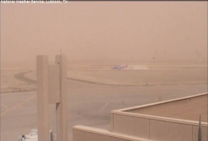
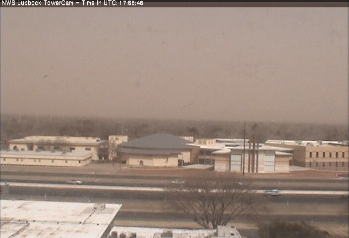
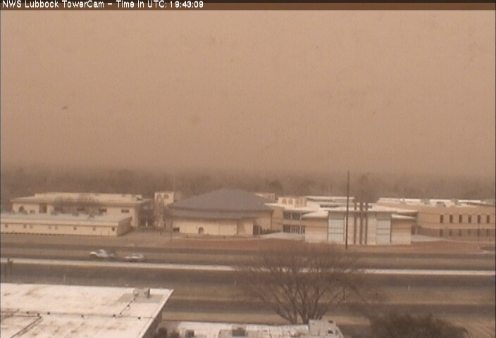
| This is what it looked like at ground level in the early afternoon at the Lubbock International Airport on 18 March 2014. | |
|
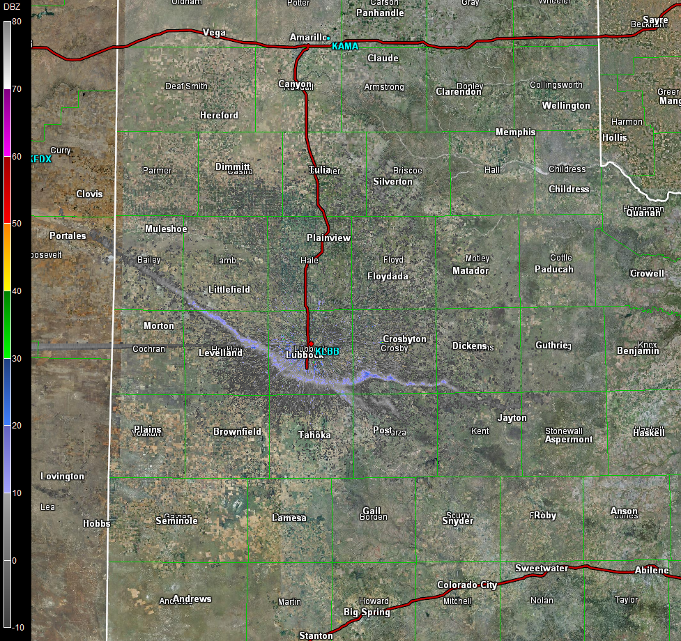
The dust was not only sampled visually, but could also be seen on radar. A particularly well defined plume of dust developed in eastern New Mexico, near Clovis, then spread quickly eastward on the strong westerly winds Tuesday afternoon, as the below radar animation illustrates. |
|
 |
|
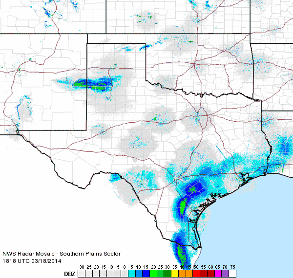
| Regional radar loop valid from 1:18 to 2:28 pm on 18 March 2014. The large plume stretching from eastern New Mexico into the South Plains is not rain or snow, but a thick plume of dust. | |
|
The winds during the afternoon peaked at 30 to 40 mph at most locations, with gusts of 45 to 55 mph quite common. The highest wind gust recorded across the area occurred at the Lubbock Airport when a gust topped out at 58 mph around 3 pm. Winds behind the cold front during the evening were not quite as strong as during the afternoon, but still reached sustained levels of 25 to 35 mph, with gusts to 45 mph. The combination of the strong winds and warm and very dry air also created a very high fire danger during the afternoon. Thankfully, though, the South Plains and Rolling Plains escaped the day without any major wildfires. One large wildfire did ignite and burn thousands of acres west of Higgins, in Lipscomb County, in the eastern Texas Panhandle. Additional pictures taken from around the South Plains region during this wind and dust event can be found below: |
|
 |
 |
| A couple of images captured on the south side of Lubbock at 12:56 pm (left) and 2:43 pm (right) on 18 March 2014. A noticeable thickening of the dust can be seen. | |
 |
|
|
Another enhanced satellite view (from the Aqua satellite) of the unfolding dust storm during the afternoon of 18 March 2014.
|
|
 |
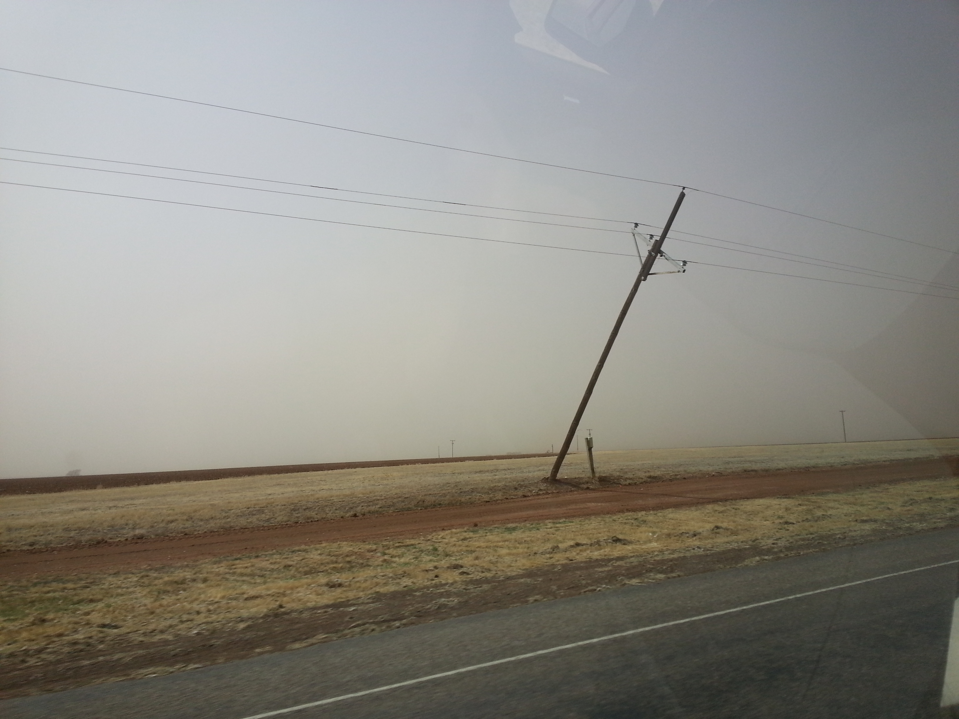 |
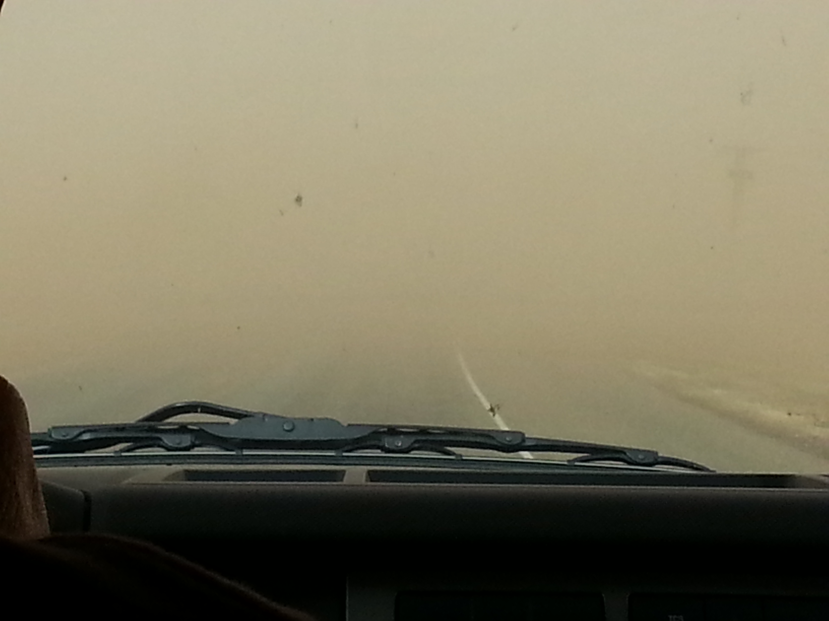
| The strong winds and blowing dust made travel difficult in spots. The left image was taken near Ralls, where the visibility briefly dropped to near zero downwind of an open field. In addition, the strong winds caused some damage, taking down a couple of power poles between Ralls and Cone (right). | |
 |
 |
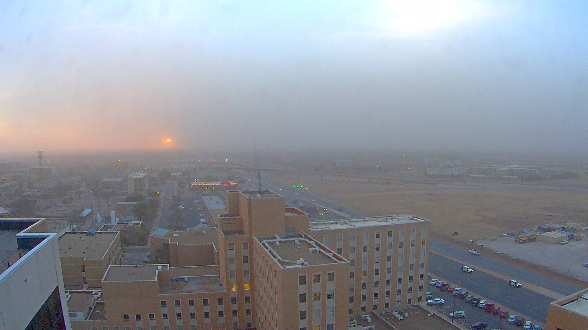
| View of what it looked like in Lubbock, visually and on radar, as what remained of the Texas Panhandle haboob rolled through Lubbock just before sunset. The picture on the left is courtesy of the KAMC Covenant skycam. | |
| The West Texas Mesonet also put together a page for the recent dust storms that can be VIEWED HERE. | |

