
Scattered thunderstorms with severe gusts, hail and a tornado risk are possible near a cold front from the Ohio Valley to the Mid-Atlantic tonight. Tropical Storm Bertha is expected to bring tropical storm conditions to portions of the Gulf Coast from the panhandle of Florida into Louisiana through Wednesday. Read More >
 |
||
 |
||
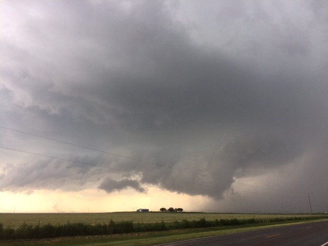
| Wall cloud on a storm southwest of Muleshoe around 3:30 pm on Friday, 12 June 2015. The image is courtesy of Bruce Haynie. | ||
| Mid-June of 2015 brought another stretch of unsettled weather as a slow moving upper level storm system approaching from the west interacted with abundant moisture and instability. This resulted in several rounds of thunderstorms moving across the South Plains region from Friday afternoon through Monday (12-15 June). The strongest storms dropped large hail, produced damaging winds, and dumped heavy rain. | ||
 |
||
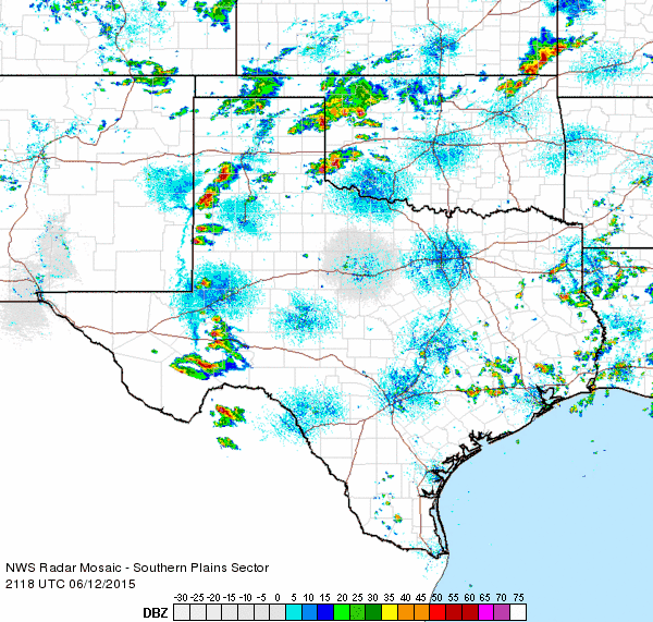
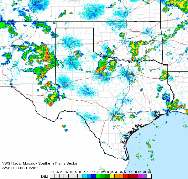
| Regional radar animation valid from 4:18 to 5:28 pm on Friday, 12 June 2015. | ||
| The active weather really kicked off in earnest Friday afternoon, June 12th, as scattered thunderstorms erupted across the southwest Texas Panhandle into the western South Plains, while additional activity developed around Childress (see the above radar animation). Strong instability and sufficient wind shear were in place to allow some of the storms to organize and rotate as they tracked eastward. Many locations did receive hail between quarter and ping pong ball size during the late afternoon and evening hours, with tennis ball sized hail reported 8 miles west of Plains and baseball sized hail observed 2 miles north-northeast of Ropesville. | ||
|
||
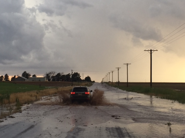
| (left) View of a wall cloud and rain shaft over western Lubbock Friday evening (12 June 2015). The right image was captured by Bruce Haynie around 8:30 pm Friday evening and shows flooding on FM 211 about two miles west of New Home. | ||
| The thunderstorms also produced severe wind gusts measured as high as 73 mph just south of Plainview. These strong winds downed power lines on I-27 between Hale Center and Plainview and damaged homes and trees in and around the Plainview area. The intense winds even knocked over semi-trucks traversing I-27 south of Plainview. Several wall clouds and funnel clouds were also reported, though no known tornadoes touched down. | ||
 |
||
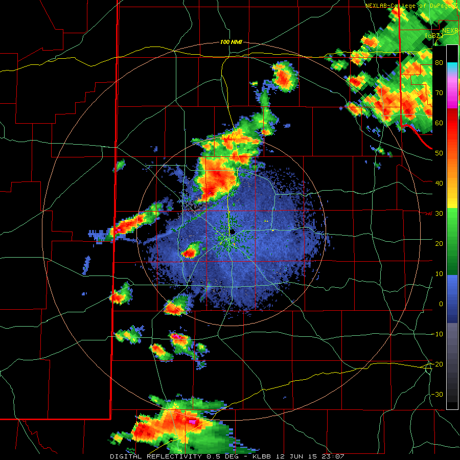
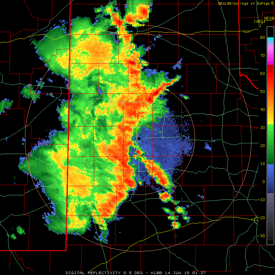
| Lubbock WSR-88D animation valid from 6:07 to 8:01 pm on Friday, 12 June 2015. | ||
| The storm intensity gradually waned through the late evening hours, but widespread rain did continue in the Rolling Plains through late Friday night. Additional scattered showers even persisted over portions of the southern Texas Panhandle much of Saturday morning. | ||
 |
||
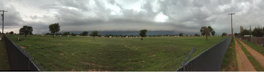
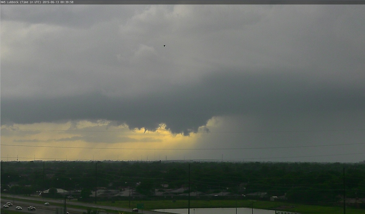
| Panoramic view of a shelf cloud as it approached Lubbock around 8:15 pm on Saturday, 13 June 2015. The picture is courtesy of Aaron Hill. | ||
| Another round of more intense thunderstorms then developed in eastern New Mexico and moved and expanded into the South Plains Saturday evening. This activity quickly formed into a line that moved all the way across the area through the evening and overnight hours. A few of the storms did drop some hail (generally small), but strong winds and heavy downpours were the more widespread impacts with this activity. | ||
 |
||
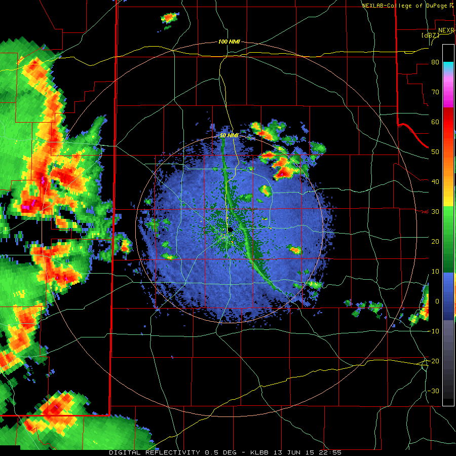
| Regional radar animation valid from 5:58 to 7:08 pm on Saturday, 13 June 2015. | ||
| The strongest winds moved across the southern South Plains, from Denver City and Plains through Tahoka and O'Donnell, where a bowing segment in the line moved across. Wind gusts of 65 mph and higher were reported, and these strong winds did knock down trees and power poles in spots, including in and around Denver City. The storms gradually weakened as they moved off the Caprock, but they still dropped moderate to heavy rain as they continued through early Sunday morning. | ||
 |
||
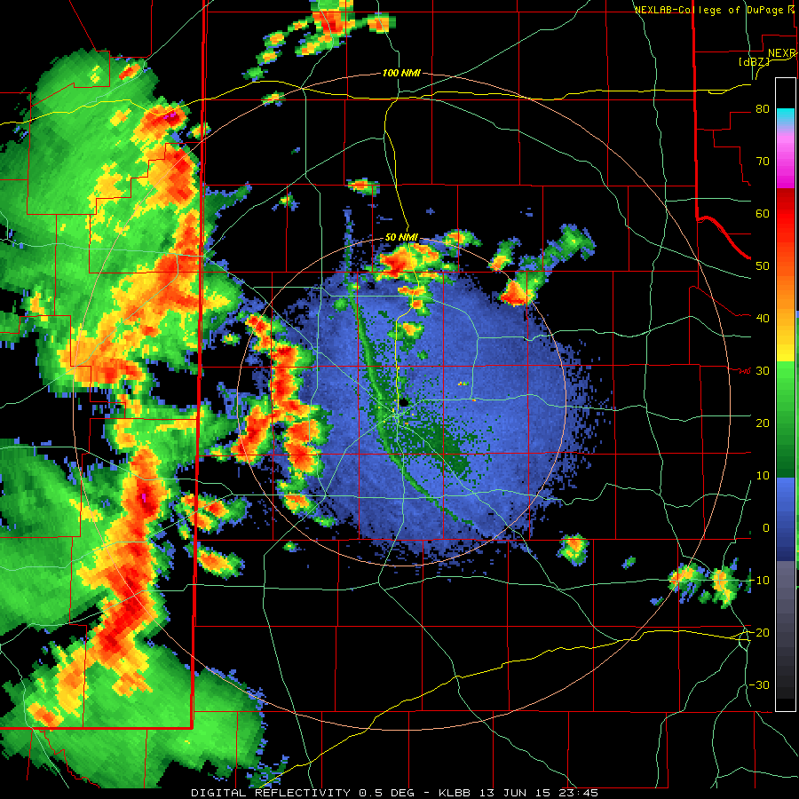
| Lubbock WSR-88D animation valid from 8:37 to 9:04 pm on Saturday, 13 June 2015. Additional radar animations can be viewed at the following links: 5:55 to 6:47 pm on 13 June 2015; 6:45 to 7:41 pm on 13 June 2015; and 10:00 to 10:26 pm on 13 June 2015. | ||
|
Much of the day on Sunday (14 June) was relatively quiet, but things became more active again by late afternoon as slow moving storms developed west of Muleshoe and dropped very heavy rain. One storm split off of the Bailey County activity and raced northeastward dropping golf ball sized hail in Friona around 5:15 pm. Later in the evening, a squall line then formed and tracked eastward across the central and southern South Plains, while additional slow moving activity trained over the Childress area. A few showers lingered over the Rolling Plains through early Monday (15 June), but quiet weather returned through much of the day. This respite was interrupted by additional showers and thunderstorms during the late afternoon and evening hours, with the greatest coverage across the southern Rolling Plains. This activity wasn't as intense as the previous few days, with no severe reports received, though it did drop heavy rain in spots before diminishing late Monday night. |
||
 |
||
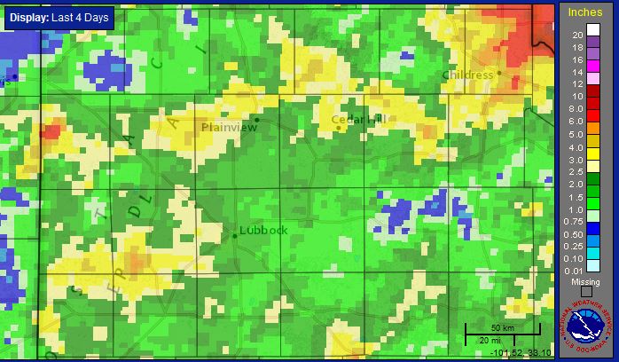
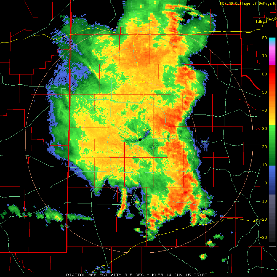
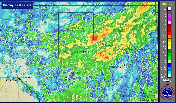
| Radar-estimated and bias-adjusted four-day rainfall totals for the South Plains region, ending at 8 am on Tuesday, 16 June 2015. A regional view of the equivalent map can be VIEWED HERE. | ||
| In addition to the severe weather, the rounds of thunderstorms brought more heavy rain to the region, as the above plot shows. Many locations received 1-2 inches, with a number of spots recording 2.5-3+ inches over the wet mid-June 4-day stretch. Particularly hard hit were portions of western Bailey County and much of Childress County. Childress (at the airport west of town) officially recorded 3.42 inches from June 12-16th, with eastern portions of the county likely seeing 6 or more inches. One automated gauge located 10 miles north of Childress reported 6.32 inches over the 4-day event, with 3.88 inches of that falling Sunday into early Monday. Lubbock officially recorded 1.83 inches over the long weekend, with over half of that falling on the 13th. | ||
| A view of the preliminary storm reports can be found below and in a list at the following links: 12 June 2015 and 13 June 2015. Also displayed below are the radar-estimated maximum hail size and rotation tracks for June 12th. The four day rainfall totals, courtesy of the West Texas Mesonet, is also available below. | ||
|
|
||||
|
Toggle Maximum Radar-Estimated Hail Size on June 12th, 2015
|
Toggle Radar-Estimated Rotation on June 12th
|
Toggle Preliminary Storm Reports for June 12th
|
Toggle Preliminary Storm Reports for June 13th
|
Toggle 4-day Rainfall ending at 8 am June 16th
|

