 |
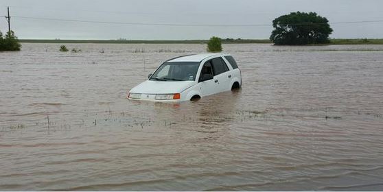 |
| A car that flooded out east of Idalou on Highway 82. The picture is courtesy of Brandon Sullivan. |
| |
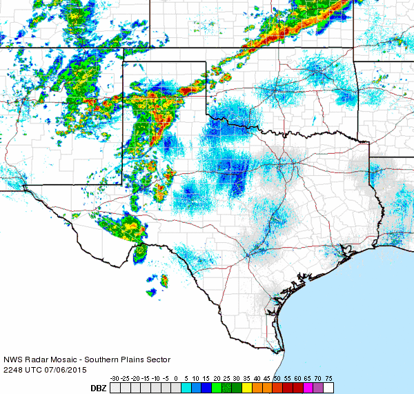
| An unusually strong summer cold front took advantage of very warm and moist air to generate widespread showers and thunderstorms over West Texas beginning Monday afternoon, July 6th. Storms initially erupted along the cold front draped across the Texas Panhandle, while additional thunderstorms developed over the western South Plains Monday afternoon. This activity spread slowly eastward, dropping heavy rain as it did. |
| |
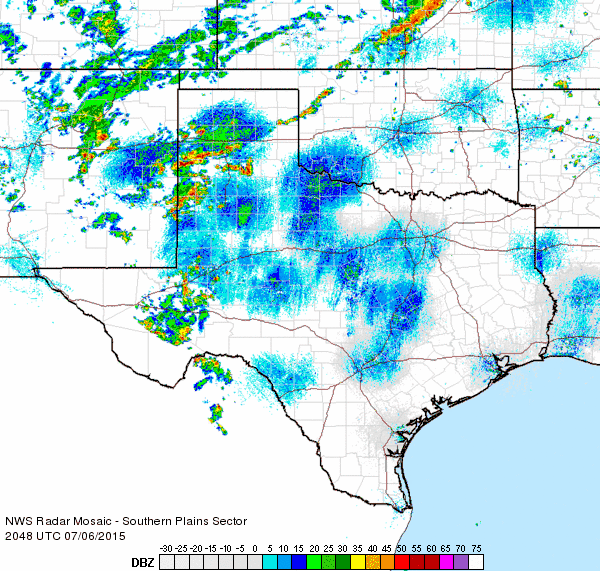 |
| Regional radar animation valid from 3:48 to 4:58 pm on 6 July 2015. |
| |
| Early on, the storms had plenty of heat and instability to utilize as temperatures peaked in the middle and upper 90s at most locations. In addition to dropping torrential rains, a few of the storms became severe and produced strong downburst winds and localized small hail. The winds, estimated in excess of 60 mph over portions of southern Lubbock County, did tree damage and knock down power poles near 130th Street and Frankford Avenue as well as along FM 1585. This caused scattered power outages in and around Lubbock Tuesday evening. You can view a more complete listing of the preliminary storm reports for July 6th HERE. |
| |
 |
 |
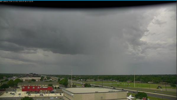
| (right) Developing thunderstorm on the west side of Lubbock shortly after 4 pm on 6 July 2015. (right) TXDOT webcam image near Loop 289 and University Avenue in Lubbock shortly before 6 pm on 6 July 2015. |
| |
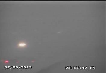
| In addition to the strong winds, very heavy rain briefly resulted in near zero visibility in spots, making travel difficult to impossible. The strong storms gradually decreased in intensity during the mid-evening hours as temperatures cooled and instability waned. |
| |
 |
| Regional radar animation valid from 5:48 to 6:58 pm on 6 July 2015. |
| |
| Even as the rain briefly subsided, residual flooding from all the runoff did create travel troubles, as the below image illustrates. |
| |
 |
| Flooding problems near 98th and Quaker in Lubbock around 6:45 pm on 6 July 2015. |
| |
| The shower and thunderstorm coverage then increased again late in the evening as strengthening southerly winds over the Permian Basin carried even richer moisture northward into the frontal zone that was now sagging into the southern South Plains and Rolling Plains. Slow-moving heavy rain producing showers and thunderstorms continued much of the night into early Tuesday morning as they gradually shifted south and eastward. |
| |
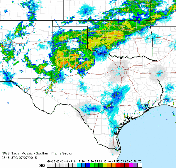 |
| Regional radar animation valid from 12:48 to 1:58 am on 7 July 2015. |
| |
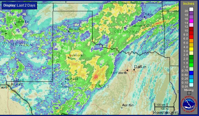
| By the time all was said and done Tuesday evening, most locations collected an inch or more of rain, with many spots seeing much more than that. A good chunk of the area recorded 3 inches or more, including near Friona, near Silverton, around Childress, and over a large area of the eastern South Plains into the western and southern Rolling Plains. The heaviest rain fell just northeast of Lubbock as well as from eastern Lynn County through much of Garza County. A few of the heaviest totals included 5.13" in Justiceburg, 4.96" in Post, and 4.08 inches near Lake Alan Henry. Lubbock officially record 3.40", 2.43" of which fell on the 6th. This broke the daily record for the date by almost an inch (the previous record was 1.53", set in 1960). |
| |
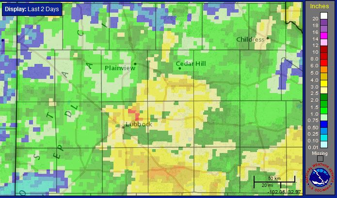 |
| Radar-estimated and bias-adjusted 2-day rain totals for the South Plains region, ending at 8 pm on Tuesday, 7 July 2015. A regional view of the equivalent map can be FOUND HERE. |
| |
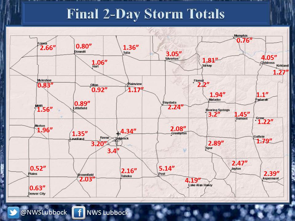 |
| 2 day rainfall totals from the National Weather Service Cooperative Observer Network. Click on the image for a larger view. |
| |
| In addition to all the rain, the cold front brought much cooler weather to the region. After highs in the middle and upper 90s on Monday, cloudy skies and northerly breezes only allowed highs to reach the upper 60s to lower and middle 70s. Lubbock's official high was a meager 71 degrees, which set a new record for the coolest high for the date (the previous record was 78 degrees, set back in 1958). |
| |

