| Thunderstorms bring welcome widespread rain to West Texas 3-4 June 2018 |
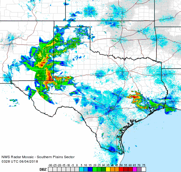 |
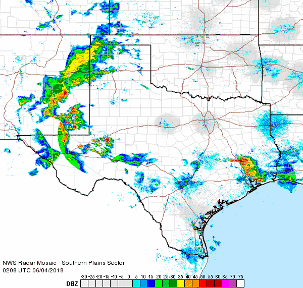
| Regional radar animation valid from 10:28 pm to 11:38 pm on Sunday, 3 June 2018. Additional radar animations are available at: 9:08 pm to 10:18 pm on Sunday, 3 June 2018 and 6:48 am to 7:58 am on Monday, 4 June 2018. |
| A weak upper level disturbance, stout easterly upslope flow behind the previous day's cold front, and gradually increasing moisture and instability was enough to support widespread showers and thunderstorms across the South Plains region Saturday night into early Monday. The thunderstorms initially develop across New Mexico during the day on Sunday before spreading across the state line in the evening. In addition to dropping widespread rain, this complex of storms did bring gusty winds. Most wind gusts were sub-severe, though strong winds did down three power poles east of New Home in Lynn County. |
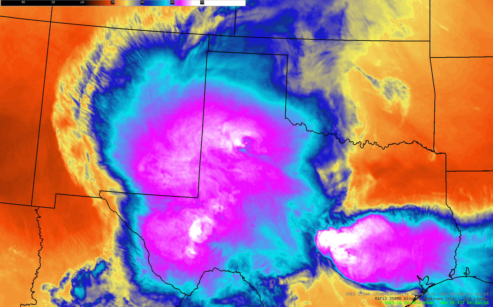 |
| Water vapor imagery captured at 12:42 am on 4 June 2018. |
| The above satellite image shows how expansive the thunderstorms were, stretching across much of western Texas and southeastern New Mexico, while another complex of storms impacted southeastern parts of Texas. |
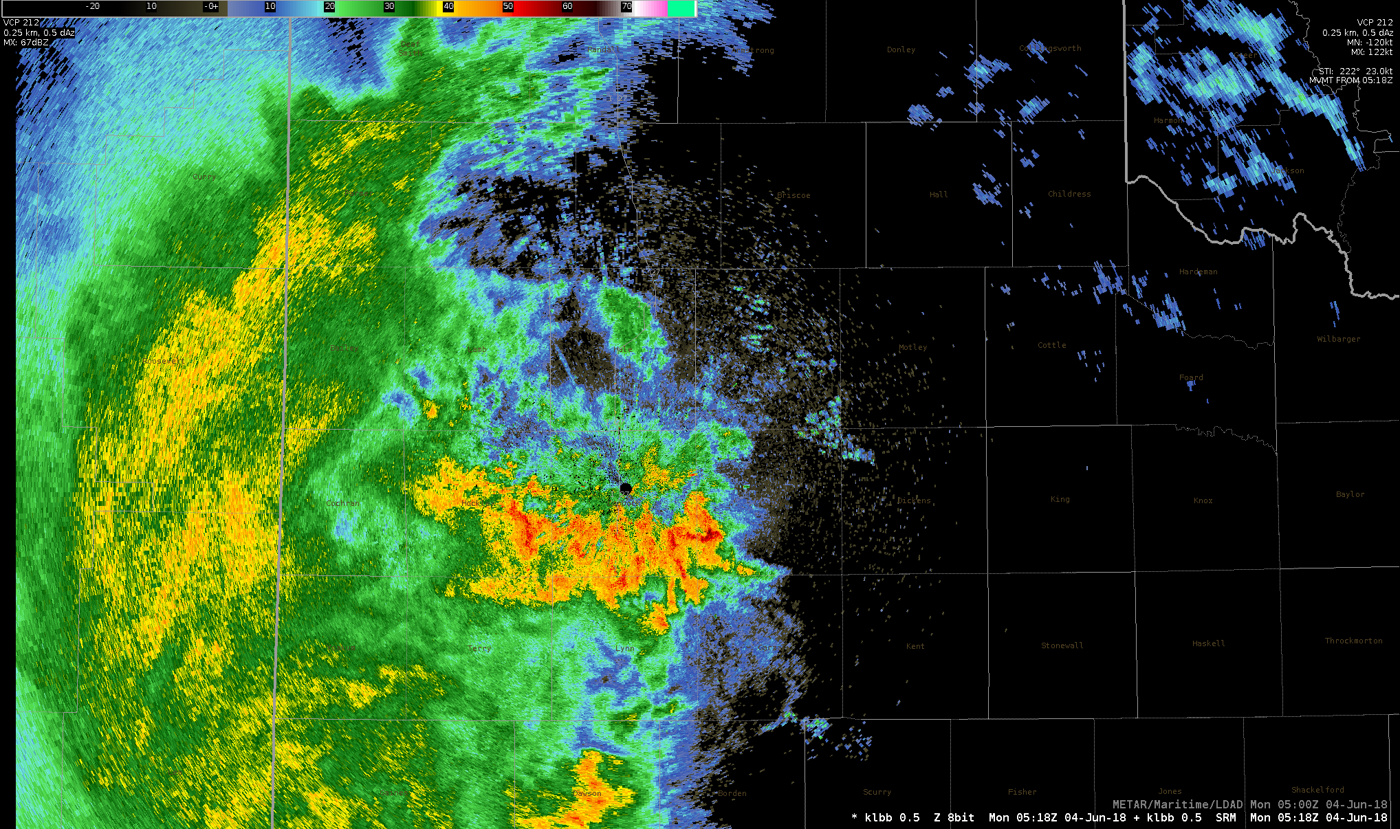 |
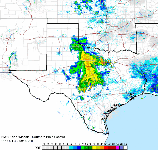
| Lubbock WSR-88D image observed at 12:18 am on 4 June 2018. |
| The most intense rainfall affected the central South Plains where a batch of strong thunderstorms developed ahead of the main complex during the late evening hours of the 3rd and early into the 4th. The rain then continued much of the night while gradually shifting eastward before coming to an end in the Rolling Plains Monday morning. |
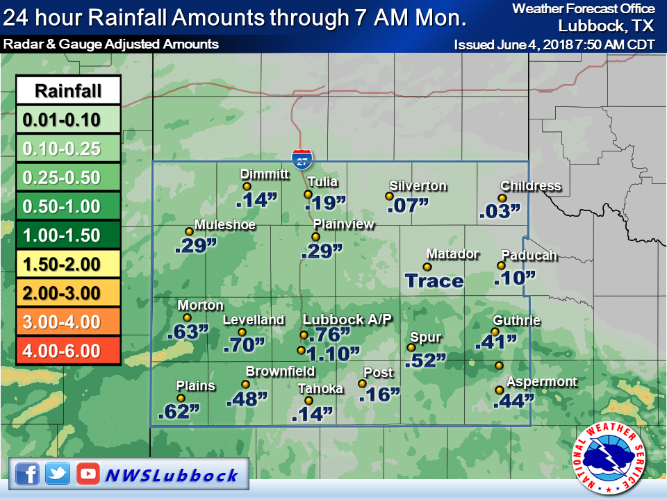 |
| 24 hour rainfall totals ending at 7 am on 4 June 2018. |
| Outside of the southeast Texas Panhandle, all of the South Plains region recorded rainfall with this overnight round of showers and thunderstorms. Rain totals of a quarter to half inch were common, with localized heavier amounts of 1/2 to 1+ inches over the central South Plains. Officially the Lubbock Airport recorded 0.76" of rain with this event, bringing the yearly total to 3.12 inches. |

