On Sunday, May 19th, with an upper level low approaching off the Colorado Front Range through the Panhandles, a fairly stout dry line began to surge eastward off the Texas Caprock and Panhandle reaching as far east as El Reno, OK. With deep layer moisture and favorable wind fields across central Oklahoma, supercell thunderstorms quickly developed along the dry line, primarily along the U.S. Interstate Highway 44 (I-44) corridor, and moved quickly to the east/northeast. As these storms gained intensity, many produced tornadoes, with tornadoes impacting Edmond, Arcadia, Luther and Carney, Norman and Lake Thunderbird, and Shawnee, and two near the town of Prague. The most intense tornado occurred within the city of Shawnee, where EF-4 damage was found as the tornado traveled north of the city before crossing U.S. Interstate Highway 40 (I-40).
Below is a map with the preliminary damage path of the Lake Thunderbird-Bethel Acres-Shawnee tornado. Contours delineate the extent of EF-0 (light blue), EF-1 (green), EF-2 (yellow), EF-3 (orange), and EF-4 (red) damage from the survey.
| Year | Total |
| 2010 | 15 |
| 1960 | 12 |
| 2015 | 10 |
| 2017 | 8 |
| 2013 | 8 |
PUBLIC INFORMATION STATEMENT
NATIONAL WEATHER SERVICE NORMAN OK
406 PM CDT WED MAY 22 2013

...LATEST ON TORNADO INFORMATION FOR MAY 19 AND MAY 20...

A NUMBER OF TORNADOES AFFECTED PORTIONS OF CENTRAL AND WESTERN
OKLAHOMA ON MAY 19 AND 20. INFORMATION ON MOST OF THESE TORNADOES IS
STILL VERY PRELIMINARY.

...MAY 19 EDMOND TORNADO /OKLAHOMA COUNTY/...
RATING:                  EF1
PATH LENGTH:             7 MILES
PATH WIDTH /MAXIMUM/:    TO BE DETERMINED
TIME:                    4:22-4:30 PM CDT
LOCATION:                NEAR 33RD STREET AND SOUTH BOULEVARD STREET
                           IN EDMOND TO NEAR HIGHWAY 66 AND POST ROAD

...MAY 19 ARCADIA TORNADO /OKLAHOMA COUNTY/...
RATING:                  EF0
PATH LENGTH:             SHORT
PATH WIDTH /MAXIMUM/:    NARROW
TIME:                    4:33 PM CDT
LOCATION:                APPROX. 1 SW ARCADIA

...MAY 19 LUTHER-CARNEY TORNADO
  /OKLAHOMA.. LOGAN AND LINCOLN COUNTIES/...
RATING:                  EF3
PATH LENGTH:             20 MILES
PATH WIDTH /MAXIMUM/:    TO BE DETERMINED
TIME:                    4:41 PM - 5:24 PM CDT
LOCATION:                3 NORTHWEST OF LUTHER TO CARNEY TO
                           2 MILES SOUTHEAST OF TRYON

...MAY 19 LAKE THUNDERBIRD-SHAWNEE TORNADO
  /CLEVELAND AND POTTAWATOMIE COUNTIES/...
RATING:                  EF4
PATH LENGTH:             20 MILES
PATH WIDTH /MAXIMUM/:    TO BE DETERMINED
TIME:                    6:00 PM - 6:50 PM CDT
LOCATION:                LAKE THUNDERBIRD /8 MILES EAST OF DOWNTOWN
                           NORMAN TO 6.5 MILES EAST-SOUTHEAST OF MCLOUD

...MAY 19 WEST OF PRAGUE TORNADO
  /POTTAWATOMIE AND LINCOLN COUNTIES/...
RATING:                  EF2
PATH LENGTH:             7 MILES
PATH WIDTH /MAXIMUM/:    400 YARDS
TIME:                    6:59 PM - 7:12 PM CDT
LOCATION:                6 MILES WEST-SOUTHWEST OF PRAGUE TO
                           3 MILES NORTH-NORTHWEST OF PRAGUE

...MAY 19 NORTHEAST OF PRAGUE TORNADO
  /LINCOLN AND OKFUSKEE COUNTIES/...
RATING:                  EF1
PATH LENGTH:             10 MILES
PATH WIDTH /MAXIMUM/:    700 YARDS
TIME:                    7:17 PM - 7:33 PM CDT
LOCATION:                3.5 MILES NORTHEAST OF PRAGUE TO
                           5.5 MILES WEST OF WELTY

...MAY 20 NEWCASTLE/MOORE TORNADO
  /GRADY..MCCLAIN AND CLEVELAND COUNTIES/...

RATING:                  EF5
PATH LENGTH:             17 MILES
PATH WIDTH /MAXIMUM/:    1.3 MILES
TIME:                    2:45 PM - 3:35 PM CDT
LOCATION:                4.4 MILES WEST NEWCASTLE TO 4.8 MILES EAST
                           OF MOORE

...MAY 20 STEPHENS COUNTY TORNADO...

RATING:                  TO BE DETERMINED
PATH LENGTH:             APPROXIMATELY 6 MILES
PATH WIDTH /MAXIMUM/:    TO BE DETERMINED
TIME:                    7:58 PM - 8:20 PM CDT
LOCATION:                APPROXIMATELY 7 MILES SOUTH-SOUTHEAST OF
                           MARLOW TO 3 MILES WEST OF BRAY.

OTHER TORNADO REPORTS ARE ALSO STILL BEING INVESTIGATED FROM MAY 20.

$$
|
A long track tornado began at 6:00 PM CDT (5:00 PM CST) in Cleveland County in the eastern sections of Norman just to the north of Lake Thunderbird along 96th Avenue and to the south of Tecumseh Road. The tornado moved northeast, crossing the eastern arm of Lake Thunderbird. A number of homes were significantly damaged as the tornado moved east-northeast through neighborhoods from near Indian Hills Road and 168th Avenue SE to the Pottawatomie County line.
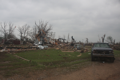
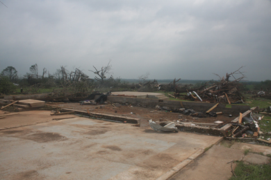
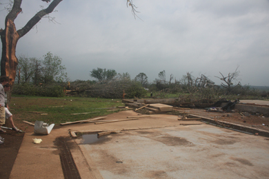
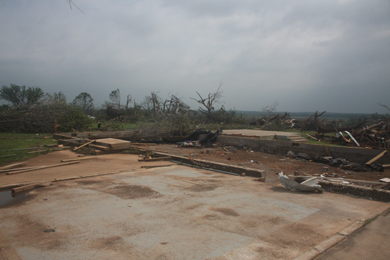
The large tornado moved east-northeast into Pottawatomie County at 6:20 PM CDT and began curving northeast as it approached OK State Highway 102. The tornado moved through the Steelman Estates Mobile Home Park north of Independence Road after crossing OK State Highway 102. Just northeast of the mobile home park, a permanent home was destroyed with much of the debris blown well to the northeast. It continued northeast crossing U.S. Interstate Highway 40 (I-40) near the intersection of US-177, then curved north-northeast finally dissipating near Wolverine Road and Coker Road at 6:50 PM CDT. One fatality occurred in the mobile home park, and another man was killed in his vehicle.
Below is an image with the preliminary damage path of the Lake Thunderbird-Bethel Acres-Shawnee tornado. Contours delineate the extent of EF-0 (light blue), EF-1 (green), EF-2 (yellow), EF-3 (orange), and EF-4 (red) damage from the survey.
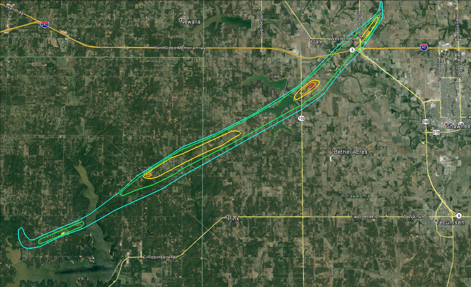
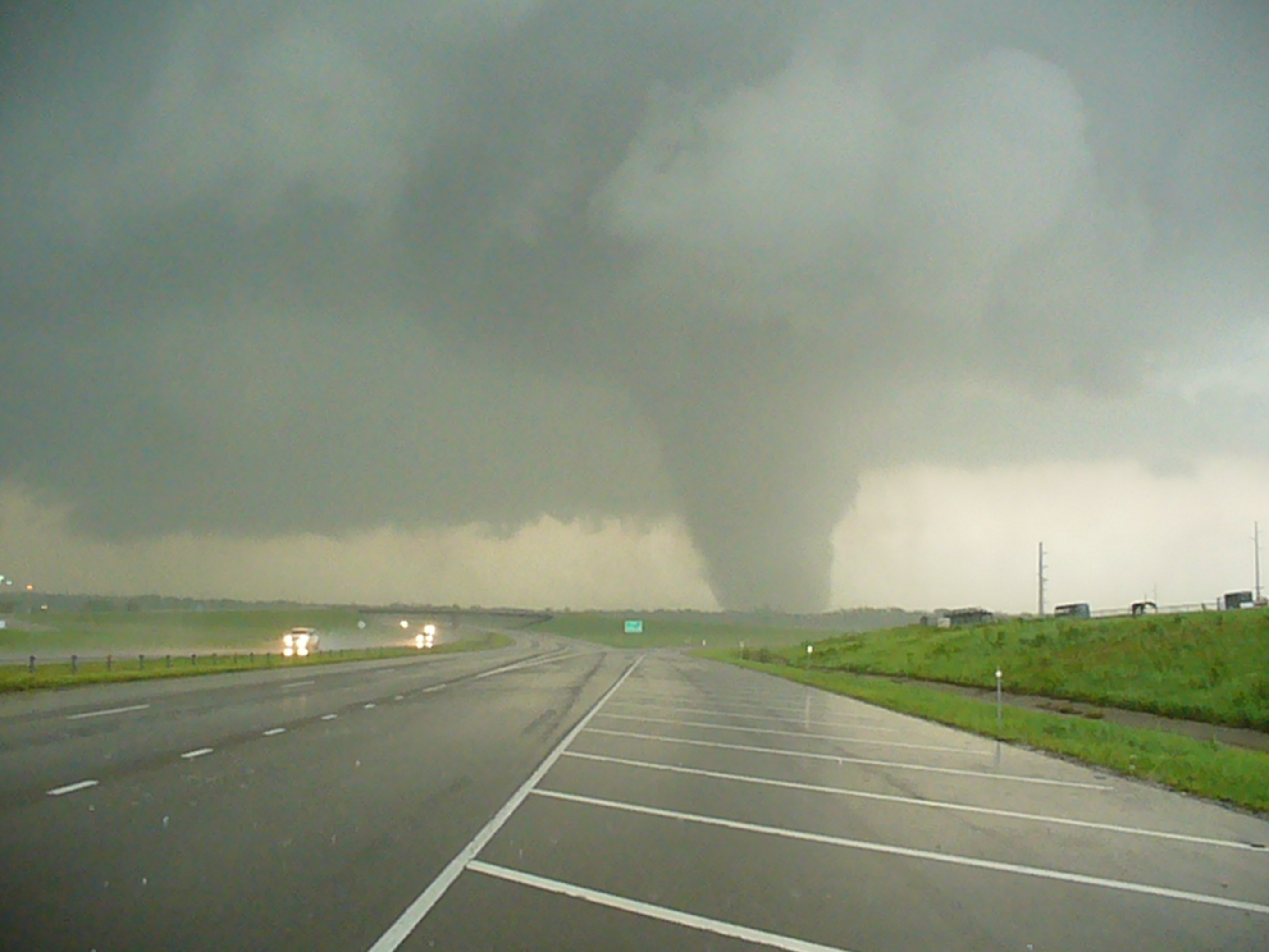 Photo courtesy Chris Calvert |
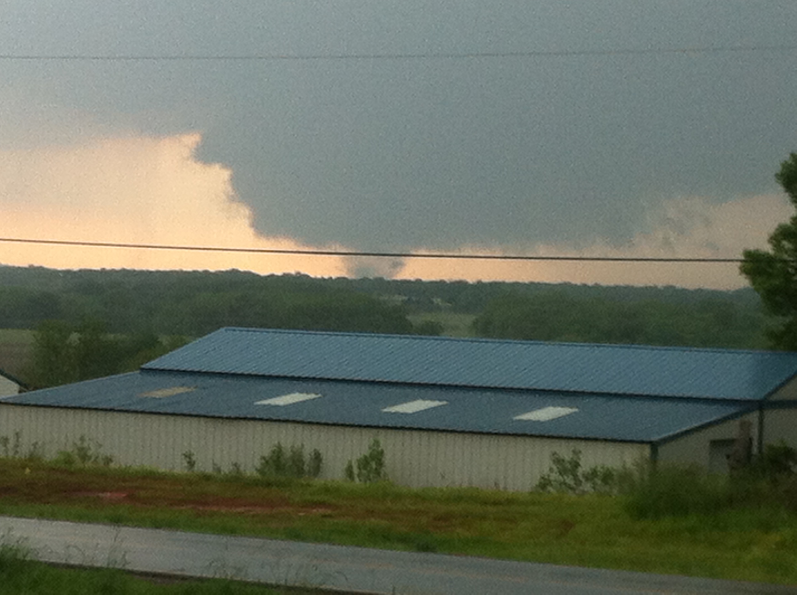 Photo courtesy Cliff Harden |
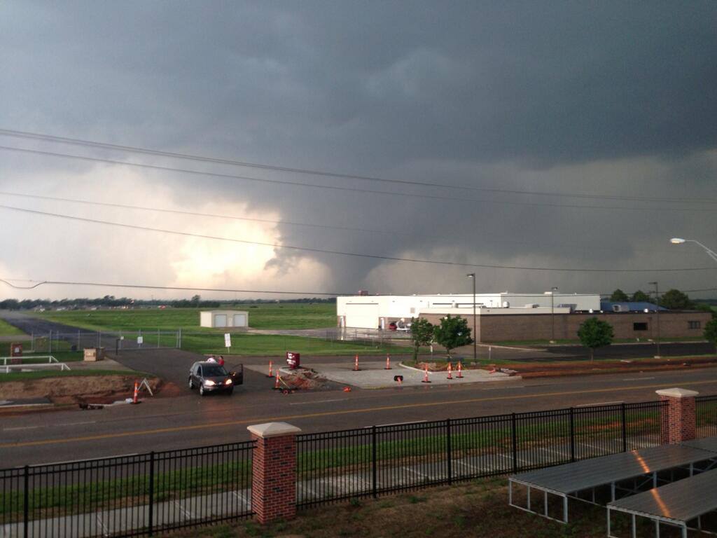 Photo courtesy Matt Kenndey |
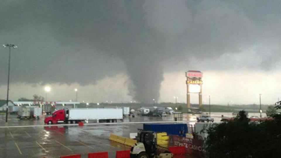 Photo courtesy Sara Wederski |
 Photo courtesy Bill Hark |
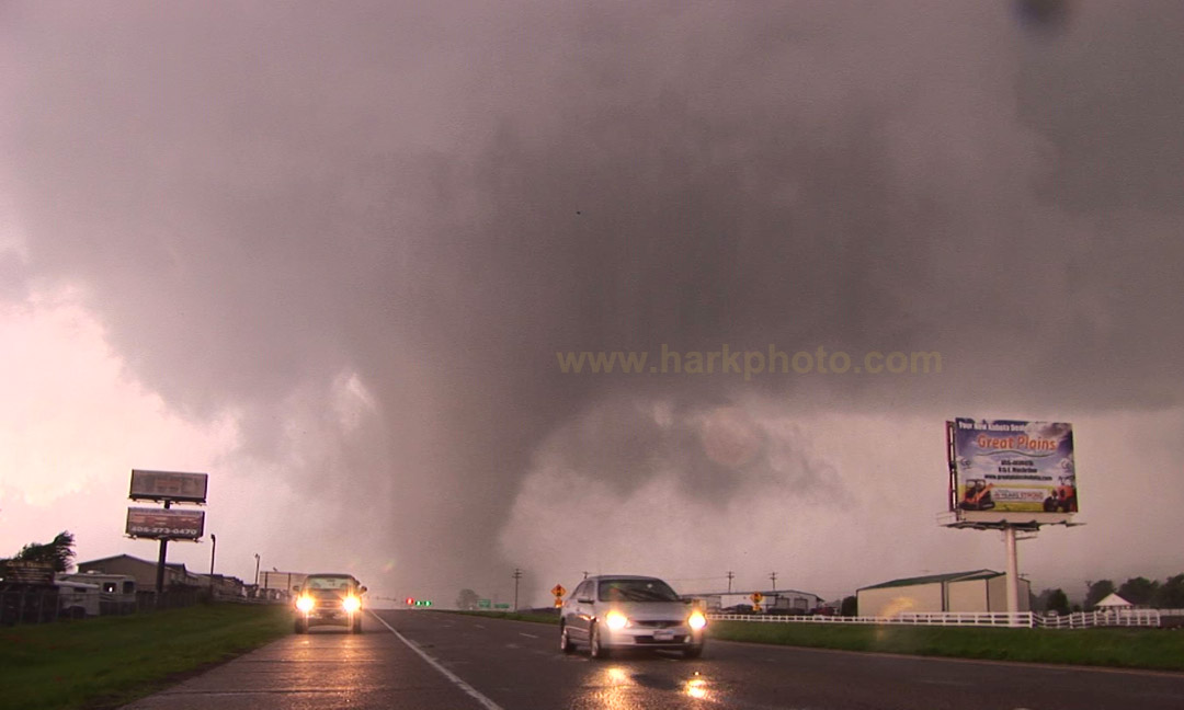 Photo courtesy Bill Hark |
The above video includes footage from the three main tornadoes that occured on May 19th. The first portion of the video (0:00 to 2:33) is of the east Lake Thunderbird-Shawnee, OK Tornado. The second segment (2:33 to 3:20) is of the Carney, OK Tornado, and the final few seconds (3:20 to 3:38) is of the Edmond, OK Tornado. Video courtesy Brandon Sullivan
Surveys conducted by crews in the NWS Norman and NWS Tulsa forecast areas revealed that 8 tornadoes occurred during the afternoon and evening of May 19, 2013. A total of 7* tornadoes occurred in the NWS Norman forecast area in Oklahoma, Logan, Cleveland, Pottawatomie, and Lincoln Counties in central Oklahoma. A total of 2* tornadoes occurred in the NWS Tulsa forecast area in Okfuskee and Creek Counties in central Oklahoma. *The last tornado of the small tornado outbreak began in the NWS Norman forecast area in Lincoln County, and then crossed over into NWS Tulsa forecast area and traveled through Okfuskee and Creek Counties.
| # | Date | Time (CST) |
Path Length (miles) |
Path Width (yards) |
F-Scale | Killed | Injured | County | Path |
|---|---|---|---|---|---|---|---|---|---|
| 1 | 05/19/2013 | 1522-1530 | 4.5 | 900 | EF1 | 0 | 0 | Oklahoma | Edmond (Near 33rd/S Boulevard - 0.3 NW E 15th/Air Depot) |
| 2 | 05/19/2013 | 1533-1534 | 0.5 | 200 | EF1 | 0 | 0 | Oklahoma | 1 SW Arcadia (just N of SH-66 near Post Road) |
| 3 | 05/19/2013 | 1541-1624 | 21 | 1200 | EF3 | 0 | 4 | Oklahoma/ Logan/ Lincoln | 3 NW Luther - Carney (SE) - 3 SE Tryon |
| 4 | 05/19/2013 | 1700-1750 | 23 | 1500 | EF4 | 2 | 10 | Cleveland/ Pottawatomie | East Norman (8 E downtown) - 6.5 ESE McLoud |
| 5 | 05/19/2013 | 1740-1743 | 2 | 30 | EF0 | 0 | 0 | Pottawatomie | 4 SSE - 2.5 SE Dale |
| 6 | 05/19/2013 | 1747-1748 | 0.2 | 50 | EF0 | 0 | 0 | Creek | 2 WNW Shamrock |
| 7 | 05/19/2013 | 1759-1812 | 7 | 450 | EF2 | 0 | 0 | Pottawatomie/ Lincoln | 6 WSW Prague - 2.5 N Prague |
| 8 | 05/19/2013 | 1817-1840 | 14 | 700 | EF1 | 0 | 0 | Lincoln/ Okfuskee/ Creek | 3.5 NE Prague - 5.3 SSW Iron Post |
PRELIMINARY LOCAL STORM REPORT
NATIONAL WEATHER SERVICE NORMAN OK
756 PM CDT SUN MAY 19 2013

..TIME...   ...EVENT...      ...CITY LOCATION...     ...LAT.LON...
..DATE...   ....MAG....      ..COUNTY LOCATION..ST.. ...SOURCE....
            ..REMARKS..

0345 PM     HAIL             CHEROKEE                36.75N 98.35W
05/19/2013  E1.00 INCH       ALFALFA            OK   LAW ENFORCEMENT

0347 PM     HAIL             7 WNW EDMOND            35.69N 97.59W
05/19/2013  E1.00 INCH       OKLAHOMA           OK   TRAINED SPOTTER

            MCARTHUR AND COFFEE CREEK RD

0401 PM     HAIL             7 ENE PIEDMONT          35.68N 97.63W
05/19/2013  E1.50 INCH       OKLAHOMA           OK   TRAINED SPOTTER

0405 PM     HAIL             13 W MEDFORD            36.81N 97.97W
05/19/2013  E1.75 INCH       GRANT              OK   LAW ENFORCEMENT

            NESCATUNGA NR HWY 11

0415 PM     TSTM WND GST     3 SSW FREEDOM           36.73N 99.13W
05/19/2013  M61.00 MPH       WOODWARD           OK   MESONET

0415 PM     HAIL             5 W EDMOND              35.65N 97.57W
05/19/2013  E1.25 INCH       OKLAHOMA           OK   PUBLIC

0415 PM     TSTM WND GST     3 SSW FREEDOM           36.73N 99.13W
05/19/2013  M61.00 MPH       WOODWARD           OK   MESONET

0417 PM     HAIL             6 NE EDMOND             35.71N 97.40W
05/19/2013  M1.00 INCH       OKLAHOMA           OK   EMERGENCY MNGR

            I-35 AND SEWARD

0418 PM     HAIL             W EDMOND                35.65N 97.48W
05/19/2013  M1.50 INCH       OKLAHOMA           OK   AMATEUR RADIO

            178TH AND WESTERN

0421 PM     TORNADO          EDMOND                  35.65N 97.48W
05/19/2013                   OKLAHOMA           OK   BROADCAST MEDIA

            15TH AND COLTRAIN RD, FROM KWTV

0433 PM     TORNADO          1 SW ARCADIA            35.66N 97.34W
05/19/2013                   OKLAHOMA           OK   BROADCAST MEDIA

            AT E HWY 66 AND POST RD. FROM VARIOUS MEDIA SOURCES.

0437 PM     HAIL             5 WNW ARCADIA           35.69N 97.41W
05/19/2013  M2.60 INCH       OKLAHOMA           OK   PUBLIC

0451 PM     HAIL             3 N LUTHER              35.71N 97.18W
05/19/2013  E2.75 INCH       OKLAHOMA           OK   PUBLIC

0453 PM     TORNADO          3 N LUTHER              35.71N 97.18W
05/19/2013                   OKLAHOMA           OK   BROADCAST MEDIA

            FROM KWTV

0455 PM     HAIL             2 WSW BLANCHARD         35.13N 97.69W
05/19/2013  E2.00 INCH       GRADY              OK   PUBLIC

0502 PM     HAIL             3 WNW NORMAN            35.24N 97.49W
05/19/2013  E1.25 INCH       CLEVELAND          OK   PUBLIC

            36TH NW AND ROCK CREEK RD

0505 PM     HAIL             2 S NEWCASTLE           35.22N 97.60W
05/19/2013  E1.00 INCH       MCCLAIN            OK   TRAINED SPOTTER

0510 PM     HAIL             BLANCHARD               35.15N 97.66W
05/19/2013  E1.25 INCH       MCCLAIN            OK   CO-OP OBSERVER

            COUNTY LINE RD AND HWY 62

0513 PM     TORNADO          SE CARNEY               35.81N 97.02W
05/19/2013                   LINCOLN            OK   BROADCAST MEDIA

            VARIOUS MEDIA SOURCES

0526 PM     HAIL             2 N NORMAN              35.25N 97.44W
05/19/2013  E1.50 INCH       CLEVELAND          OK   BROADCAST MEDIA

            NEAR MAX WESTHEIMER AIRPORT. FROM KFOR

0527 PM     HAIL             2 NW NORMAN             35.24N 97.47W
05/19/2013  E1.75 INCH       CLEVELAND          OK   NWS EMPLOYEE

            36TH AND TECUSEMAH

0530 PM     HAIL             N NORMAN                35.22N 97.44W
05/19/2013  E3.00 INCH       CLEVELAND          OK   PUBLIC

            E 12TH AND TECUMSEH

0539 PM     HAIL             1 W NEWCASTLE           35.25N 97.62W
05/19/2013  E1.75 INCH       MCCLAIN            OK   NWS EMPLOYEE

0540 PM     HAIL             NEWCASTLE               35.25N 97.60W
05/19/2013  E1.75 INCH       MCCLAIN            OK   PUBLIC

0542 PM     HAIL             2 W NORMAN              35.22N 97.48W
05/19/2013  E1.50 INCH       CLEVELAND          OK   PUBLIC

0545 PM     HAIL             2 SE WILL ROGERS AIRPOR 35.37N 97.57W
05/19/2013  E1.00 INCH       CLEVELAND          OK   PUBLIC

0547 PM     HAIL             NW NORMAN               35.22N 97.44W
05/19/2013  E2.50 INCH       CLEVELAND          OK   PUBLIC

            36TH AVE NW AND TECUMSEH RD

0601 PM     TORNADO          NW LAKE THUNDERBIRD     35.23N 97.23W
05/19/2013                   CLEVELAND          OK   BROADCAST MEDIA

            FROM KWTV

0602 PM     HAIL             MOORE                   35.34N 97.49W
05/19/2013  E1.00 INCH       CLEVELAND          OK   PUBLIC

0611 PM     TORNADO          E LAKE THUNDERBIRD      35.23N 97.23W
05/19/2013                   CLEVELAND          OK   BROADCAST MEDIA

            FROM KWTV

0612 PM     HAIL             2 SSE VALLEY BROOK      35.38N 97.47W
05/19/2013  E1.50 INCH       CLEVELAND          OK   PUBLIC

0621 PM     HAIL             TINKER AIR FORCE BASE   35.42N 97.39W
05/19/2013  E1.00 INCH       OKLAHOMA           OK   AWOS

0621 PM     HAIL             TINKER AIR FORCE BASE   35.42N 97.39W
05/19/2013  E1.00 INCH       OKLAHOMA           OK   OTHER FEDERAL

0628 PM     HAIL             MIDWEST CITY            35.46N 97.37W
05/19/2013  E1.00 INCH       OKLAHOMA           OK   PUBLIC

            29TH AND DOUGLAS

0708 PM     TORNADO          2 NW PRAGUE             35.51N 96.72W
05/19/2013                   LINCOLN            OK   BROADCAST MEDIA

0710 PM     TSTM WND GST     3 NNW SHAWNEE           35.38N 96.94W
05/19/2013  M61.00 MPH       POTTAWATOMIE       OK   MESONET

0724 PM     HAIL             6 N PRAGUE              35.58N 96.69W
05/19/2013  E1.00 INCH       LINCOLN            OK   PUBLIC


&&

$$

JPIKE
|
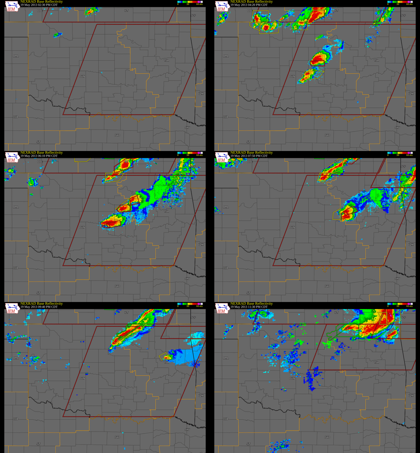
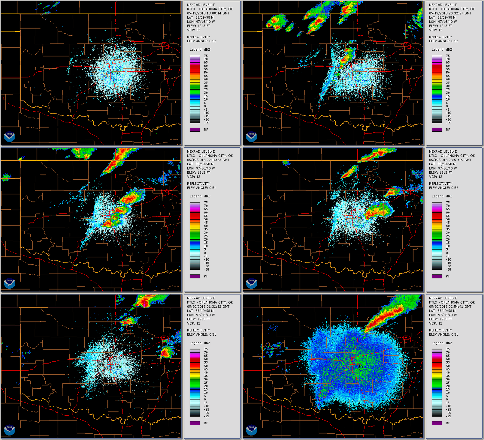
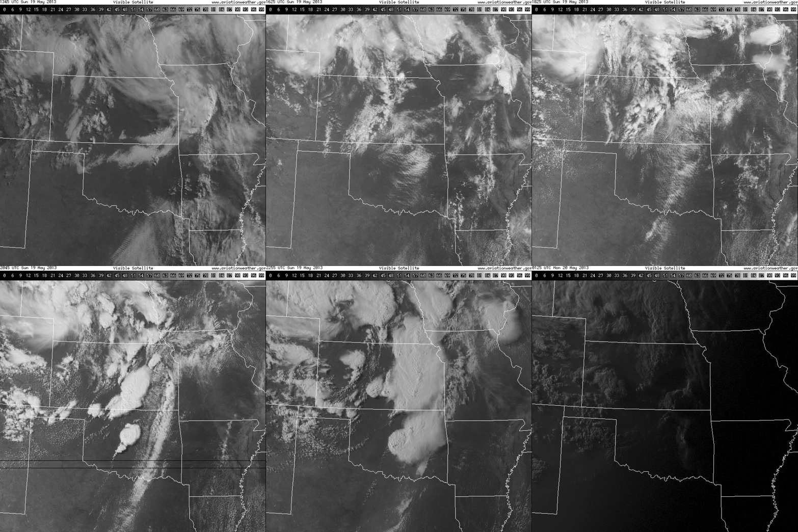
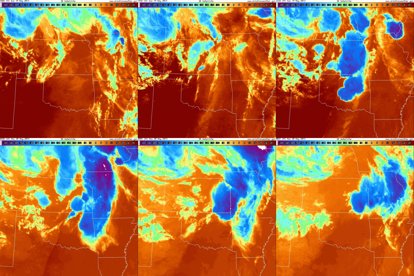
 Photo courtesy Chris Calvert |
 Photo courtesy Cliff Harden |
 Photo courtesy Matt Kenndey |
 Photo courtesy Sara Wederski |
 Photo courtesy Bill Hark |
 Photo courtesy Bill Hark |
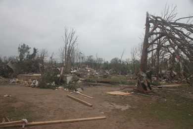
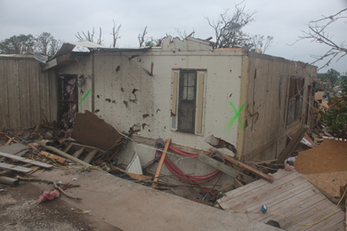
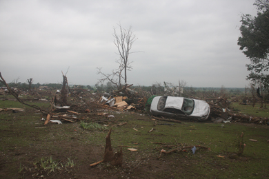
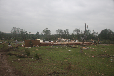
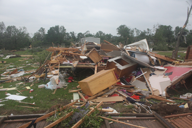
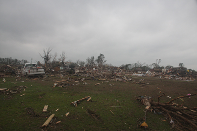
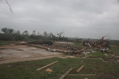
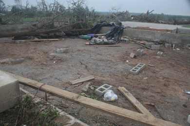
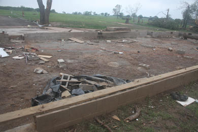
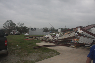
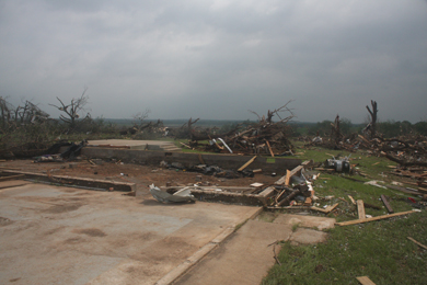
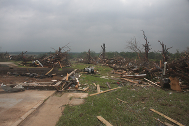
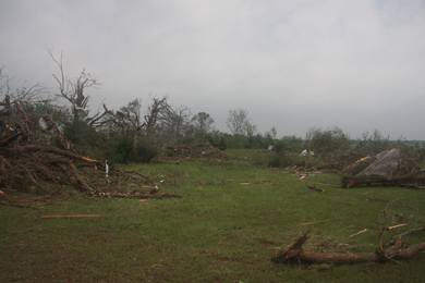
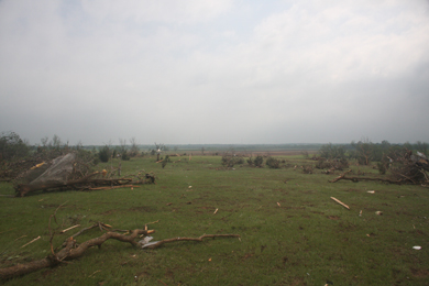
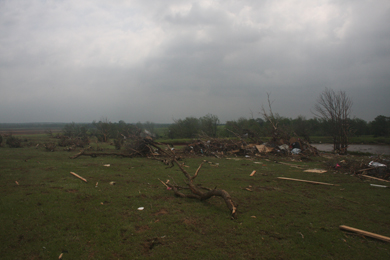
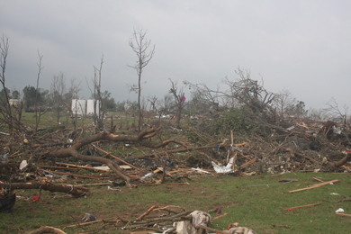
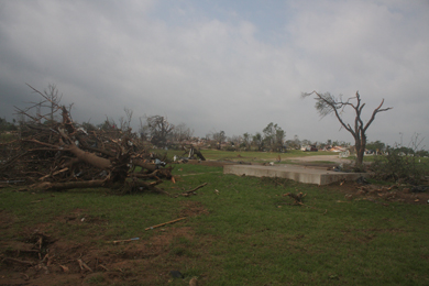
The following photos were taken by a NWS storm survey team during the morning of May 20, 2013. These are photos of damage that occurred in the Steelman Estates Mobile Home Park, which is located 2.5 miles south of Dale, OK, or about 7 miles west-northwest of the center of Shawnee, OK and just northeast of the Shawnee Twin Lakes. The damage was produced by the violent Lake Thunderbird-Shawnee Tornado, and some of the damage at this location was rated EF-3 or EF-4.
 |
 |
 |
 |
 |
 |
 |
 |
 |
 |
 |
 |
 |
 |
 |
 |
 |
 |
 |
 |
 |
 |
 |
 |
 |
 |
 |
 |
 |