
Numerous severe thunderstorms with a potential for 60-80 mph winds, along with tornadoes (some strong), and large to very large hail are expected across the northern and central Plains through tonight. Heavy to excessive rainfall may bring a flooding threat to parts of North Dakota and Minnesota, and from the Ohio Valley to the Southeast through tonight. Read More >
 |
NWS Mt Holly Weather Briefing Page |
 |
.MARINE...
No marine hazards expected through Wednesday. Southerly winds
increasing to 10-15 kts with gusts up to 20 kts and seas 2-3
feet. May try to touch SCA gusts on the waters late Wednesday,
but confidence is low at this time.

Outlook...

Wednesday night...SCA conditions possible due to wind gusts up to 25
kt and seas around 3-5 feet.

Thursday through Sunday...No marine headlines anticipated. Winds
will generally remain between 5-15 kt through Saturday, with gusts
up to 20 kt possible on Sunday. Seas generally around 2-3 feet.
Isolated to scattered showers and thunderstorms possible on Thursday
and Friday. Fair weather expected for Saturday and Sunday.

Rip Currents...

For Wednesday, southerly winds increase to 10 to 20 mph with
gusts up to 25 mph, especially in the afternoon. Breaking waves
will vary between 2 to 3 feet. While there will be a light
easterly swell in the morning, a more dominant southerly swell
around 7 to 8 seconds should propagate northward in the
afternoon. Given these conditions, have opted to go with a
MODERATE risk for the development of dangerous rip currents for
all beaches.

For Thursday, southwesterly winds diminish to around 10 to 15
mph. Breaking waves around 1 to 2 feet with a southerly swell
around 6 to 7 seconds. Given the lighter conditions, have opted
to go with a LOW risk for the development of dangerous rip
currents for all beaches.

Ocean water temperatures are gradually increasing, but remain
mostly in the 60s.

For specific beach forecasts, visit weather.gov/beach/phi

&&
Special Marine Warnings NWS PHI
Special Marine Warning 0042
Special Marine Warning 0041
Special Marine Warning 0040
Special Marine Warning 0039
Special Marine Warning 0038
Special Marine Warning 0037
Special Marine Warning 0036
Special Marine Warning 0035
Special Marine Warning 0034
Special Marine Warning 0033
Special Marine Warning 0032
Special Marine Warning 0031
Special Marine Warning 0030
Special Marine Warning 0029
Special Marine Warning 0028
Special Marine Warning 0027
Special Marine Warning 0026
Special Marine Warning 0025
Special Marine Warning 0024
Special Marine Warning 0023
Special Marine Warning 0022
Special Marine Warning 0021
Special Marine Warning 0020
Special Marine Warning 0019
Special Marine Warning 0018
Special Marine Warning 0017
Special Marine Warning 0016
Special Marine Warning 0015
Special Marine Warning 0014
Special Marine Warning 0013
Special Marine Warning 0012
Special Marine Warning 0011
Special Marine Warning 0010
Special Marine Warning 0009
Special Marine Warning 0008
Special Marine Warning 0007
Special Marine Warning 0006
Special Marine Warning 0005
Special Marine Warning 0004
Special Marine Warning 0003
Special Marine Warning 0002
Special Marine Warning 0001
Special Marine Warnings NWS OKX
Special Marine Warning 0025
Special Marine Warning 0024
Special Marine Warning 0023
Special Marine Warning 0022
Special Marine Warning 0021
Special Marine Warning 0020
Special Marine Warning 0019
Special Marine Warning 0018
Special Marine Warning 0017
Special Marine Warning 0016
Special Marine Warning 0015
Special Marine Warning 0014
Special Marine Warning 0013
Special Marine Warning 0012
Special Marine Warning 0011
Special Marine Warning 0010
Special Marine Warning 0009
Special Marine Warning 0008
Special Marine Warning 0007
Special Marine Warning 0006
Special Marine Warning 0005
Special Marine Warning 0004
Special Marine Warning 0003
Special Marine Warning 0002
Special Marine Warning 0001
Special Marine Warnings NWS LWX
Special Marine Warning 0067
Special Marine Warning 0066
Special Marine Warning 0065
Special Marine Warning 0064
Special Marine Warning 0063
Special Marine Warning 0062
Special Marine Warning 0061
Special Marine Warning 0060
Special Marine Warning 0059
Special Marine Warning 0058
Special Marine Warning 0057
Special Marine Warning 0056
Special Marine Warning 0055
Special Marine Warning 0054
Special Marine Warning 0053
Special Marine Warning 0052
Special Marine Warning 0051
Special Marine Warning 0050
Special Marine Warning 0049
Special Marine Warning 0048
Special Marine Warning 0047
Special Marine Warning 0046
Special Marine Warning 0045
Special Marine Warning 0044
Special Marine Warning 0043
Special Marine Warning 0042
Special Marine Warning 0041
Special Marine Warning 0040
Special Marine Warning 0039
Special Marine Warning 0038
Special Marine Warning 0037
Special Marine Warning 0036
Special Marine Warning 0035
Special Marine Warning 0034
Special Marine Warning 0033
Special Marine Warning 0032
Special Marine Warning 0031
Special Marine Warning 0030
Special Marine Warning 0029
Special Marine Warning 0028
Special Marine Warning 0027
Special Marine Warning 0026
Special Marine Warning 0025
Special Marine Warning 0024
Special Marine Warning 0023
Special Marine Warning 0022
Special Marine Warning 0021
Special Marine Warning 0020
Special Marine Warning 0019
Special Marine Warning 0018
Special Marine Warning 0017
Special Marine Warning 0016
Special Marine Warning 0015
Special Marine Warning 0014
Special Marine Warning 0013
Special Marine Warning 0012
Special Marine Warning 0011
Special Marine Warning 0010
Special Marine Warning 0009
Special Marine Warning 0008
Special Marine Warning 0007
Special Marine Warning 0006
Special Marine Warning 0005
Special Marine Warning 0004
Special Marine Warning 0003
Special Marine Warning 0002
Special Marine Warning 0001
Special Marine Warnings NWS AKQ
Special Marine Warning 0046
Special Marine Warning 0045
Special Marine Warning 0044
Special Marine Warning 0043
Special Marine Warning 0042
Special Marine Warning 0041
Special Marine Warning 0040
Special Marine Warning 0039
Special Marine Warning 0038
Special Marine Warning 0037
Special Marine Warning 0036
Special Marine Warning 0035
Special Marine Warning 0034
Special Marine Warning 0033
Special Marine Warning 0032
Special Marine Warning 0031
Special Marine Warning 0030
Special Marine Warning 0029
Special Marine Warning 0028
Special Marine Warning 0027
Special Marine Warning 0026
Special Marine Warning 0025
Special Marine Warning 0024
Special Marine Warning 0023
Special Marine Warning 0022
Special Marine Warning 0021
Special Marine Warning 0020
Special Marine Warning 0019
Special Marine Warning 0018
Special Marine Warning 0017
Special Marine Warning 0016
Special Marine Warning 0015
Special Marine Warning 0014
Special Marine Warning 0013
Special Marine Warning 0012
Special Marine Warning 0011
Special Marine Warning 0010
Special Marine Warning 0009
Special Marine Warning 0008
Special Marine Warning 0007
Special Marine Warning 0006
Special Marine Warning 0005
Special Marine Warning 0004
Special Marine Warning 0003
Special Marine Warning 0002
Special Marine Warning 0001
Marine Weather Statements NWS PHI
FZUS71 KPHI 080910
MWSPHI

Marine Weather Statement
National Weather Service Mount Holly NJ
510 AM EDT Mon Jun 8 2026

ANZ430-431-453>455-485-081015-
510 AM EDT Mon Jun 8 2026

...A FRONT APPROACHING THE WATERS...

The areas affected include...
  Coastal waters from Cape Henlopen to Fenwick Island DE out 20
  NM...
  Coastal waters from Cape May NJ to Cape Henlopen DE out 20 NM...
  Coastal waters from Great Egg Inlet to Cape May NJ out 20 NM...
  Delaware Bay waters north of East Point NJ to Slaughter Beach
  DE...
  Delaware Bay waters south of East Point NJ to Slaughter Beach
  DE...
  Waters from Cape May NJ to Fenwick Island DE from 20 to 60 NM...

At 509 AM EDT, a buoy reported a front, producing winds to around 30
knots. This front was located along a line extending from 13 nm
northeast of Pea Patch Island to 9 nm north of Chicken Bone, moving
south at 10 knots.

Locations impacted include...
Brown Shoal Light, Fourteen Foot Bank Light, Slaughter Beach, Cape
Henlopen, East Point, Bowers Beach, Rehoboth Beach, Woodland Beach,
Stony Point, Cape May Point, Miah Maull Light, Ship John Shoal Light,
Brandywine Shoal Light, Indian River Inlet Bridge, Wildwood,
Overfalls Shoal, Fortesque Beach, Sea Breeze, Bethany Beach, and
Delaware Lightship Buoy 44009.

PRECAUTIONARY/PREPAREDNESS ACTIONS...

Mariners can expect gusty winds to around 30 knots and locally
higher waves. Boaters should seek safe harbor immediately until
these storms pass.

&&

LAT...LON 3974 7546 3961 7534 3951 7539 3943 7534
      3946 7520 3935 7518 3926 7507 3944 7506
      3943 7505 3839 7434 3828 7448 3853 7514
      3852 7525 3863 7531 3864 7523 3875 7520
      3876 7530 3883 7528 3904 7546 3940 7560

$$

SFJ
Marine Weather Statements NWS OKX
FZUS71 KOKX 071958
MWSOKX

Marine Weather Statement
National Weather Service New York NY
358 PM EDT Sun Jun 7 2026

ANZ331-340-072045-
358 PM EDT Sun Jun 7 2026

...A STRONG THUNDERSTORM OVER THE WATERS...

The areas affected include...

  Long Island Sound East of New Haven CT / Port Jefferson NY to the
Mouth of the Connecticut River...
  Peconic and Gardiners Bays...

At 357 PM EDT, Doppler radar indicated a strong thunderstorm, capable
of producing winds to around 30 knots and small hail. This
thunderstorm was located near Central Long Island Sound, moving
southeast at 20 knots.

PRECAUTIONARY/PREPAREDNESS ACTIONS...

Mariners can expect gusty winds to around 30 knots, locally higher
waves, and lightning strikes. Boaters should seek safe harbor
immediately until this storm passes.

&&

LAT...LON 4105 7246 4102 7253 4100 7252 4100 7249
      4104 7246 4096 7239 4095 7243 4088 7247
      4090 7262 4094 7264 4095 7263 4095 7258
      4100 7257 4097 7265 4112 7273 4118 7256

$$

JT
Marine Weather Statements NWS LWX
FZUS71 KLWX 090130
MWSLWX

Marine Weather Statement
National Weather Service Baltimore MD/Washington DC
930 PM EDT Mon Jun 8 2026

ANZ531>533-538>541-090330-
Chesapeake Bay from Pooles Island to Sandy Point MD-
Chesapeake Bay from Sandy Point to North Beach MD-
Chesapeake Bay from North Beach to Drum Point MD-
Patapsco River including Baltimore Harbor-
Chester River to Queenstown MD-Eastern Bay-
Choptank River to Cambridge MD and the Little Choptank River-
930 PM EDT Mon Jun 8 2026

...A FEW SPORADIC GUSTS...

Easterly winds may occasionally gust 15 to 20 knots this evening.
Mariners in small craft should exercise caution and be prepared
for locally higher winds and waves.

$$
Marine Weather Statements NWS AKQ
FZUS71 KAKQ 140236
MWSAKQ

Marine Weather Statement
National Weather Service Wakefield VA
1036 PM EDT Wed May 13 2026

ANZ630>632-635>637-639-140330-
1036 PM EDT Wed May 13 2026

A Marine Weather Statement has been issued for the following areas...
  Chesapeake Bay from New Point Comfort to Little Creek VA...
  Chesapeake Bay from Smith Point to Windmill Point VA...
  Chesapeake Bay from Windmill Point to New Point Comfort VA...
  James River from JRB to HRBT, Including the Elizabeth River...
  James River from Jamestown to the James River Bridge...
  Rappahannock River from Urbanna to Windmill Point...
  York River...

At 1036 PM EDT, Doppler radar indicated showers, capable of producing
winds to around 30 knots. These showers were located along a line
extending from 8 nm north of Irvington to 17 nm north of Cobham Bay
to 25 nm west of Burwell Bay, moving east at 20 knots.

PRECAUTIONARY/PREPAREDNESS ACTIONS...

Mariners can expect gusty winds to around 30 knots, locally higher
waves, and lightning strikes. Boaters should seek safe harbor
immediately until these storms pass.

&&

LAT...LON 3722 7678 3725 7663 3702 7641 3709 7632
      3735 7670 3736 7670 3741 7662 3729 7647
      3742 7630 3762 7664 3779 7655 3776 7639
      3792 7642 3790 7591 3799 7561 3798 7561
      3685 7635 3697 7667 3713 7679

$$

HET
Marine Weather Message NWS PHI
WHUS71 KPHI 070559
MWWPHI

URGENT - MARINE WEATHER MESSAGE
National Weather Service Mount Holly NJ
159 AM EDT Sun Jun 7 2026

ANZ450>452-070700-
/O.CAN.KPHI.SC.Y.0059.000000T0000Z-260607T1000Z/
Coastal waters from Sandy Hook to Manasquan Inlet NJ out 20 NM-
Coastal waters from Manasquan Inlet to Little Egg Inlet NJ out
20 NM-
Coastal waters from Little Egg Inlet to Great Egg Inlet NJ out
20 NM-
159 AM EDT Sun Jun 7 2026

...SMALL CRAFT ADVISORY IS CANCELLED...

Winds and seas have fallen below SCA criteria. Thus, the Small
Craft Advisory has been cancelled.

$$

Hoeflich
Marine Weather Message NWS OKX
WHUS71 KOKX 070744
MWWOKX

URGENT - MARINE WEATHER MESSAGE
National Weather Service New York NY
344 AM EDT Sun Jun 7 2026

ANZ350-353-355-070845-
/O.CAN.KOKX.SC.Y.0067.000000T0000Z-260607T1000Z/
Moriches Inlet NY to Montauk Point NY out 20 NM-
Fire Island Inlet NY to Moriches Inlet NY out 20 NM-
Sandy Hook NJ to Fire Island Inlet NY out 20 NM-
344 AM EDT Sun Jun 7 2026

...SMALL CRAFT ADVISORY IS CANCELLED...

Seas have lowered below 5 ft and the advisory is cancelled.

$$

For more details, see the Coastal Waters Forecast from
National Weather Service New York NY, or visit
https://www.weather.gov/okx/marine
Marine Weather Message NWS LWX
WHUS71 KLWX 091507
MWWLWX

URGENT - MARINE WEATHER MESSAGE
National Weather Service Baltimore MD/Washington DC
1107 AM EDT Tue Jun 9 2026

ANZ530-535-536-538-542-092315-
/O.CON.KLWX.SC.Y.0102.260609T2000Z-260610T0200Z/
Chesapeake Bay north of Pooles Island MD-
Tidal Potomac from Key Bridge to Indian Head MD-
Tidal Potomac from Indian Head to Cobb Island MD-
Patapsco River including Baltimore Harbor-
Patuxent River to Broomes Island MD-
1107 AM EDT Tue Jun 9 2026

...SMALL CRAFT ADVISORY REMAINS IN EFFECT FROM 4 PM THIS
AFTERNOON TO 10 PM EDT THIS EVENING...

* WHAT...South winds around 10 kt with gusts up to 20 kt
  expected.

* WHERE...Tidal Potomac River from Key Bridge to Cobb Island MD,
  Chesapeake Bay north of Pooles Island MD, Patapsco River
  including Baltimore Harbor, and Patuxent River to Broomes
  Island MD.

* WHEN...From 4 PM this afternoon to 10 PM EDT this evening.

* IMPACTS...Conditions will be hazardous to small craft.

PRECAUTIONARY/PREPAREDNESS ACTIONS...

Inexperienced mariners, especially those operating smaller
vessels, should avoid navigating in hazardous conditions.

&&

$$

ANZ531>533-537-539>541-092315-
/O.CON.KLWX.SC.Y.0102.260609T2000Z-260610T1600Z/
Chesapeake Bay from Pooles Island to Sandy Point MD-
Chesapeake Bay from Sandy Point to North Beach MD-
Chesapeake Bay from North Beach to Drum Point MD-
Tidal Potomac from Cobb Island MD to Smith Point VA-
Chester River to Queenstown MD-Eastern Bay-
Choptank River to Cambridge MD and the Little Choptank River-
1107 AM EDT Tue Jun 9 2026

...SMALL CRAFT ADVISORY REMAINS IN EFFECT FROM 4 PM THIS
AFTERNOON TO NOON EDT WEDNESDAY...

* WHAT...South winds 10 to 15 kt with gusts up to 20 kt expected.

* WHERE...Chesapeake Bay from Pooles Island MD to Drum Point MD,
  Tidal Potomac from Cobb Island MD to Smith Point VA, Chester
  River to Queenstown MD, Eastern Bay, and Choptank River to
  Cambridge MD and the Little Choptank River.

* WHEN...From 4 PM this afternoon to noon EDT Wednesday.

* IMPACTS...Conditions will be hazardous to small craft.

PRECAUTIONARY/PREPAREDNESS ACTIONS...

Inexperienced mariners, especially those operating smaller
vessels, should avoid navigating in hazardous conditions.

&&

$$

ANZ534-543-092315-
/O.CON.KLWX.SC.Y.0102.260609T2000Z-260610T2200Z/
Chesapeake Bay from Drum Point MD to Smith Point VA-
Tangier Sound and the inland waters surrounding Bloodsworth
Island-
1107 AM EDT Tue Jun 9 2026

...SMALL CRAFT ADVISORY REMAINS IN EFFECT FROM 4 PM THIS
AFTERNOON TO 6 PM EDT WEDNESDAY...

* WHAT...South winds 10 to 15 kt with gusts up to 20 kt expected.

* WHERE...Chesapeake Bay from Drum Point MD to Smith Point VA
  and Tangier Sound and the inland waters surrounding
  Bloodsworth Island.

* WHEN...From 4 PM this afternoon to 6 PM EDT Wednesday.

* IMPACTS...Conditions will be hazardous to small craft.

PRECAUTIONARY/PREPAREDNESS ACTIONS...

Inexperienced mariners, especially those operating smaller
vessels, should avoid navigating in hazardous conditions.

&&

$$
Marine Weather Message NWS AKQ
WHUS71 KAKQ 092022
MWWAKQ

URGENT - MARINE WEATHER MESSAGE
National Weather Service Wakefield VA
422 PM EDT Tue Jun 9 2026

ANZ650-652-654-101100-
/O.NEW.KAKQ.SC.Y.0073.260610T2300Z-260611T0800Z/
Coastal waters from Fenwick Island DE to Chincoteague VA out
20 NM-
Coastal waters from Chincoteague to Parramore Island VA out 20 NM-
Coastal waters from Parramore Island to Cape Charles Light VA out
20 NM-
422 PM EDT Tue Jun 9 2026

...SMALL CRAFT ADVISORY IN EFFECT FROM 7 PM WEDNESDAY TO 4 AM EDT
THURSDAY...

* WHAT...South winds 15 to 20 kt with gusts up to 25 kt and seas
  4 to 5 ft expected.

* WHERE...Coastal waters from Fenwick Island DE to Chincoteague
  VA out 20 NM, Coastal waters from Chincoteague to Parramore
  Island VA out 20 NM and Coastal waters from Parramore Island
  to Cape Charles Light VA out 20 NM.

* WHEN...From 7 PM Wednesday to 4 AM EDT Thursday.

* IMPACTS...Conditions will be hazardous to small craft.

PRECAUTIONARY/PREPAREDNESS ACTIONS...

Inexperienced mariners, especially those operating smaller
vessels, should avoid navigating in hazardous conditions.

&&

$$
Latest Coastal Waters Forecast Issued for the NJ/DE coasts and Delaware Bay
FZUS51 KPHI 092003
CWFPHI

Coastal Waters Forecast for New Jersey and Delaware
National Weather Service Mount Holly NJ
401 PM EDT Tue Jun 9 2026

Sandy Hook NJ to Fenwick Island DE to 60 NM offshore and Delaware
Bay

ANZ400-100900-
401 PM EDT Tue Jun 9 2026

.SYNOPSIS FOR THE COASTAL WATERS FROM SANDY HOOK NJ TO FENWICK
ISLAND DE AND FOR DELAWARE BAY...
A warm front will lift north tonight,  giving way to hotter and more
humid conditions, as well as daily chances for showers and storms
through the end of the week. A cold front will pass through the area
late Friday, resulting in somewhat cooler and drier conditions for
the weekend.

$$

ANZ450-100900-
Coastal waters from Sandy Hook to Manasquan Inlet NJ out 20 NM-
401 PM EDT Tue Jun 9 2026

.TONIGHT...SW winds 15 to 20 kt with gusts up to 25 kt,
diminishing to 10 to 15 kt with gusts up to 20 kt after midnight.
Seas 2 to 3 ft. Wave Detail: S 3 ft at 4 seconds and E 2 ft at
7 seconds.
.WED...S winds 10 to 15 kt with gusts up to 20 kt. Seas 2 to
4 ft. Wave Detail: S 3 ft at 6 seconds. A chance of showers.
.WED NIGHT...S winds 15 to 20 kt, becoming SW 10 to 15 kt after
midnight. Seas 3 to 5 ft. Wave Detail: S 4 ft at 6 seconds. A
chance of tstms in the evening. A chance of showers.
.THU...SW winds 5 to 10 kt. Seas 3 to 4 ft. Wave Detail: S 3 ft
at 6 seconds. A chance of showers.
.THU NIGHT...SW winds 5 to 10 kt. Seas 2 to 3 ft. Wave Detail: S
3 ft at 7 seconds. A chance of tstms in the evening. Showers
likely.
.FRI...W winds 5 to 10 kt, becoming S in the afternoon. Seas 2 to
3 ft. Wave Detail: S 2 ft at 6 seconds.
.FRI NIGHT...S winds 5 to 10 kt, becoming W after midnight. Seas
2 to 3 ft. A chance of showers and tstms.
.SAT...NW winds 5 to 10 kt. Seas around 2 ft.
.SAT NIGHT...W winds 5 to 10 kt. Seas around 2 ft.
.SUN...W winds around 5 kt, becoming S 10 to 15 kt in the
afternoon. Seas 2 to 3 ft.
.SUN NIGHT...S winds 10 to 15 kt, diminishing to 5 to 10 kt after
midnight. Seas 2 to 3 ft.

Winds and seas higher in and near tstms.

$$

ANZ451-100900-
Coastal waters from Manasquan Inlet to Little Egg Inlet NJ out
20 NM-
401 PM EDT Tue Jun 9 2026

.TONIGHT...SW winds 15 to 20 kt, diminishing to 10 to 15 kt late.
Seas 2 to 3 ft. Wave Detail: S 3 ft at 4 seconds and E 2 ft at
7 seconds.
.WED...S winds 10 to 15 kt, increasing to 15 to 20 kt in the
afternoon. Seas 2 to 4 ft. Wave Detail: SE 4 ft at 6 seconds. A
chance of showers.
.WED NIGHT...SW winds 15 to 20 kt with gusts up to 25 kt. Seas
3 to 5 ft. Wave Detail: S 4 ft at 6 seconds. A chance of showers
and tstms.
.THU...SW winds 10 to 15 kt. Seas 3 to 4 ft. Wave Detail: S 4 ft
at 6 seconds. A chance of showers in the afternoon.
.THU NIGHT...SW winds 10 to 15 kt, becoming W 5 to 10 kt after
midnight. Seas 2 to 4 ft. Wave Detail: S 3 ft at 7 seconds. A
chance of tstms in the evening. Showers likely.
.FRI...W winds 5 to 10 kt, becoming S 10 to 15 kt in the
afternoon. Seas 2 to 3 ft. Wave Detail: S 2 ft at 6 seconds.
.FRI NIGHT...S winds 10 to 15 kt, becoming W 5 to 10 kt after
midnight. Seas 2 to 3 ft. A chance of showers and tstms.
.SAT...NW winds 5 to 10 kt, becoming NE in the afternoon. Seas
around 2 ft.
.SAT NIGHT...W winds 5 to 10 kt. Seas around 2 ft.
.SUN...W winds around 5 kt, becoming S 10 to 15 kt in the
afternoon. Seas 2 to 3 ft.
.SUN NIGHT...S winds 10 to 15 kt, becoming SW 5 to 10 kt after
midnight. Seas 2 to 4 ft.

Winds and seas higher in and near tstms.

$$

ANZ452-100900-
Coastal waters from Little Egg Inlet to Great Egg Inlet NJ out
20 NM-
401 PM EDT Tue Jun 9 2026

.TONIGHT...S winds 10 to 15 kt with gusts up to 20 kt. Seas 2 to
3 ft. Wave Detail: S 2 ft at 4 seconds and E 2 ft at 7 seconds.
.WED...S winds 10 to 15 kt, increasing to 15 to 20 kt in the
afternoon. Seas 3 to 4 ft. Wave Detail: SE 4 ft at 6 seconds. A
chance of showers and tstms in the afternoon.
.WED NIGHT...SW winds 15 to 20 kt with gusts up to 25 kt. Seas
3 to 5 ft. Wave Detail: S 4 ft at 5 seconds. A chance of showers
and tstms.
.THU...SW winds 10 to 15 kt. Seas 3 to 4 ft. Wave Detail: S 3 ft
at 6 seconds. A chance of showers in the afternoon.
.THU NIGHT...SW winds 10 to 15 kt, becoming W 5 to 10 kt after
midnight. Seas 2 to 4 ft. Wave Detail: S 3 ft at 6 seconds. A
chance of tstms in the evening. Showers likely.
.FRI...W winds 5 to 10 kt, becoming S 10 to 15 kt in the
afternoon. Seas 2 to 3 ft. Wave Detail: S 2 ft at 6 seconds.
.FRI NIGHT...S winds 10 to 15 kt, becoming W 5 to 10 kt after
midnight. Seas 2 to 3 ft. A chance of showers and tstms.
.SAT...N winds 5 to 10 kt. Seas around 2 ft.
.SAT NIGHT...W winds 5 to 10 kt. Seas around 2 ft.
.SUN...W winds around 5 kt, becoming S 10 to 15 kt in the
afternoon. Seas around 2 ft.
.SUN NIGHT...S winds 10 to 15 kt, becoming SW 5 to 10 kt after
midnight. Seas 2 to 3 ft.

Winds and seas higher in and near tstms.

$$

ANZ453-100900-
Coastal waters from Great Egg Inlet to Cape May NJ out 20 NM-
401 PM EDT Tue Jun 9 2026

.TONIGHT...S winds 10 to 15 kt with gusts up to 20 kt. Seas 2 to
3 ft. Wave Detail: S 2 ft at 4 seconds and E 2 ft at 7 seconds.
.WED...S winds 10 to 15 kt with gusts up to 25 kt. Seas 2 to
4 ft. Wave Detail: SE 4 ft at 7 seconds and S 3 ft at 4 seconds.
A chance of showers and tstms in the afternoon.
.WED NIGHT...S winds 15 to 20 kt, becoming SW 10 to 15 kt after
midnight. Seas 3 to 5 ft. Wave Detail: S 4 ft at 5 seconds. A
chance of showers and tstms.
.THU...SW winds around 10 kt. Seas 3 to 4 ft. Wave Detail: S 3 ft
at 6 seconds. A chance of showers in the morning.
.THU NIGHT...SW winds 5 to 10 kt. Seas 2 to 4 ft. Wave Detail: S
3 ft at 6 seconds. A chance of tstms in the evening. Showers
likely.
.FRI...W winds 5 to 10 kt, becoming SW in the afternoon. Seas
around 2 ft. Wave Detail: S 2 ft at 6 seconds.
.FRI NIGHT...SW winds 5 to 10 kt, becoming W after midnight. Seas
around 2 ft. A chance of showers and tstms.
.SAT...NW winds 5 to 10 kt. Seas around 2 ft.
.SAT NIGHT...W winds 5 to 10 kt. Seas around 2 ft.
.SUN...W winds around 5 kt, becoming S 10 to 15 kt in the
afternoon. Seas around 2 ft.
.SUN NIGHT...S winds 10 to 15 kt, becoming SW 5 to 10 kt after
midnight. Seas 2 to 3 ft.

Winds and seas higher in and near tstms.

$$

ANZ454-100900-
Coastal waters from Cape May NJ to Cape Henlopen DE out 20 NM-
401 PM EDT Tue Jun 9 2026

.TONIGHT...S winds 10 to 15 kt with gusts up to 20 kt. Seas 2 to
3 ft. Wave Detail: S 2 ft at 4 seconds and E 2 ft at 7 seconds.
.WED...S winds 10 to 15 kt with gusts up to 20 kt. Seas 2 to
4 ft. Wave Detail: S 3 ft at 4 seconds and SE 3 ft at 7 seconds.
A chance of showers and tstms in the afternoon.
.WED NIGHT...S winds 15 to 20 kt, becoming SW 10 to 15 kt after
midnight. Seas 3 to 4 ft. Wave Detail: S 4 ft at 5 seconds. A
chance of showers and tstms.
.THU...SW winds around 10 kt. Seas 2 to 4 ft. Wave Detail: S 3 ft
at 6 seconds. A chance of showers.
.THU NIGHT...SW winds 5 to 10 kt. Seas 2 to 3 ft. Wave Detail: S
3 ft at 6 seconds. A chance of tstms in the evening. A chance of
showers.
.FRI...W winds around 5 kt, becoming S in the afternoon. Seas
around 2 ft. Wave Detail: S 2 ft at 6 seconds and SW 1 foot at
2 seconds.
.FRI NIGHT...S winds around 10 kt, becoming W after midnight.
Seas around 2 ft. A chance of showers and tstms.
.SAT...NW winds 5 to 10 kt. Seas around 2 ft.
.SAT NIGHT...W winds 5 to 10 kt. Seas around 2 ft.
.SUN...W winds around 5 kt, becoming S 10 to 15 kt in the
afternoon. Seas around 2 ft.
.SUN NIGHT...S winds 10 to 15 kt. Seas 2 to 3 ft. A chance of
showers.

Winds and seas higher in and near tstms.

$$

ANZ455-100900-
Coastal waters from Cape Henlopen to Fenwick Island DE out 20 NM-
401 PM EDT Tue Jun 9 2026

.TONIGHT...S winds 10 to 15 kt with gusts up to 20 kt. Seas
around 3 ft. Wave Detail: E 3 ft at 7 seconds and S 2 ft at
3 seconds.
.WED...S winds 10 to 15 kt with gusts up to 20 kt. Seas 3 to
4 ft. Wave Detail: S 3 ft at 6 seconds. A chance of showers and
tstms in the afternoon.
.WED NIGHT...S winds 15 to 20 kt, becoming SW 10 to 15 kt after
midnight. Seas 3 to 5 ft. Wave Detail: S 4 ft at 5 seconds. A
chance of showers and tstms.
.THU...SW winds around 10 kt. Seas 2 to 4 ft. Wave Detail: S 3 ft
at 6 seconds. A chance of showers.
.THU NIGHT...SW winds 5 to 10 kt. Seas 2 to 3 ft. Wave Detail: S
3 ft at 6 seconds. A chance of tstms in the evening. A chance of
showers.
.FRI...W winds around 5 kt, becoming S in the afternoon. Seas
around 2 ft. Wave Detail: SE 2 ft at 6 seconds.
.FRI NIGHT...S winds 5 to 10 kt, becoming W after midnight. Seas
around 2 ft. A chance of showers and tstms.
.SAT...NW winds 5 to 10 kt. Seas around 2 ft.
.SAT NIGHT...W winds around 5 kt. Seas around 2 ft.
.SUN...W winds around 5 kt, becoming S 10 to 15 kt in the
afternoon. Seas around 2 ft.
.SUN NIGHT...S winds 10 to 15 kt, diminishing to 5 to 10 kt after
midnight. Seas 2 to 3 ft.

Winds and seas higher in and near tstms.

$$

ANZ431-100900-
Delaware Bay waters south of East Point NJ to Slaughter Beach DE-
401 PM EDT Tue Jun 9 2026

.TONIGHT...S winds 10 to 15 kt. Seas around 2 ft. Wave Detail: S
2 ft at 3 seconds.
.WED...S winds 10 to 15 kt. Seas around 2 ft. Wave Detail: S 2 ft
at 4 seconds. A chance of showers and tstms in the afternoon.
.WED NIGHT...S winds 10 to 15 kt, becoming SW 5 to 10 kt after
midnight. Seas around 2 ft. Wave Detail: S 2 ft at 4 seconds. A
chance of showers and tstms.
.THU...W winds 5 to 10 kt. Seas around 2 ft. Wave Detail: SE 2 ft
at 6 seconds and SW 1 foot at 2 seconds. A chance of showers in
the afternoon.
.THU NIGHT...W winds 5 to 10 kt. Seas around 2 ft. Wave Detail:
SE 2 ft at 6 seconds and W 1 foot at 2 seconds. A chance of tstms
in the evening. A chance of showers.
.FRI...W winds around 5 kt, becoming S in the afternoon. Seas
1 foot or less. Wave Detail: W 1 foot at 2 seconds and SE 1 foot
at 6 seconds.
.FRI NIGHT...SW winds 5 to 10 kt, becoming W after midnight. Seas
around 2 ft. A chance of showers and tstms.
.SAT...NW winds 5 to 10 kt. Seas 1 foot or less.
.SAT NIGHT...NW winds 5 to 10 kt. Seas 1 foot or less.
.SUN...SW winds around 5 kt, becoming S 10 to 15 kt in the
afternoon. Seas 1 foot or less, then around 2 ft in the
afternoon.
.SUN NIGHT...S winds 10 to 15 kt, diminishing to 5 to 10 kt after
midnight. Seas around 2 ft. A chance of showers.

Winds and seas higher in and near tstms.

$$

ANZ430-100900-
Delaware Bay waters north of East Point NJ to Slaughter Beach DE-
401 PM EDT Tue Jun 9 2026

.TONIGHT...S winds around 10 kt. Seas around 2 ft this evening,
then 1 foot or less. Wave Detail: SE 1 foot at 3 seconds,
becoming S 1 foot at 4 seconds.
.WED...S winds 5 to 10 kt. Seas 1 foot or less, then around 2 ft
in the afternoon. Wave Detail: S 1 foot at 4 seconds, becoming S
1 foot at 3 seconds. A chance of showers and tstms in the
afternoon.
.WED NIGHT...SW winds 5 to 10 kt. Seas around 2 ft in the
evening, then 1 foot or less. Wave Detail: S 1 foot at 3 seconds,
becoming SE 1 foot at 5 seconds. A chance of tstms in the
evening. A chance of showers.
.THU...W winds 5 to 10 kt. Seas 1 foot or less. Wave Detail: W
1 foot at 2 seconds and SE 1 foot at 6 seconds. A chance of
showers in the afternoon.
.THU NIGHT...W winds 5 to 10 kt. Seas 1 foot or less. Wave
Detail: W 1 foot at 2 seconds and SE 1 foot at 6 seconds. A
chance of tstms in the evening. A chance of showers.
.FRI...W winds around 5 kt, becoming SW around 5 kt in the
afternoon. Seas 1 foot or less. Wave Detail: SE 1 foot at
6 seconds.
.FRI NIGHT...SW winds 5 to 10 kt, becoming NW after midnight.
Seas 1 foot or less. A chance of showers and tstms.
.SAT...NW winds 5 to 10 kt. Seas 1 foot or less.
.SAT NIGHT...NW winds 5 to 10 kt, diminishing to around 5 kt
after midnight. Seas 1 foot or less.
.SUN...W winds around 5 kt, becoming S in the afternoon. Seas
1 foot or less.
.SUN NIGHT...S winds 10 to 15 kt, diminishing to 5 to 10 kt after
midnight. Seas 1 foot or less. A chance of showers.

Winds and seas higher in and near tstms.

$$

ANZ485-100900-
Waters from Cape May NJ to Fenwick Island DE from 20 to 60 NM-
401 PM EDT Tue Jun 9 2026

.TONIGHT...S winds 10 to 15 kt. Seas around 3 ft. Wave Detail: E
3 ft at 7 seconds and S 2 ft at 3 seconds.
.WED...S winds around 15 kt with gusts up to 25 kt. Seas 3 to
4 ft. Wave Detail: S 4 ft at 5 seconds and E 2 ft at 7 seconds. A
chance of showers in the afternoon.
.WED NIGHT...S winds 15 to 20 kt with gusts up to 25 kt. Seas
4 to 6 ft. Wave Detail: S 5 ft at 6 seconds. Showers likely with
a chance of tstms.
.THU...SW winds 10 to 15 kt. Seas 4 to 5 ft. Wave Detail: S 5 ft
at 6 seconds. Showers likely in the morning.
.THU NIGHT...SW winds 10 to 15 kt. Seas 3 to 4 ft. Wave Detail: S
4 ft at 6 seconds. A chance of showers.
.FRI...SW winds 5 to 10 kt. Seas 2 to 3 ft. Wave Detail: S 2 ft
at 6 seconds. A chance of showers in the morning.
.FRI NIGHT...SW winds around 10 kt. Seas 2 to 3 ft. A chance of
showers and tstms.
.SAT...NW winds 5 to 10 kt. Seas around 2 ft.
.SAT NIGHT...W winds around 5 kt. Seas around 2 ft.
.SUN...W winds around 5 kt, becoming S in the afternoon. Seas
around 2 ft.
.SUN NIGHT...S winds around 10 kt. Seas 2 to 3 ft.

Winds and seas higher in and near tstms.

$$

ANZ483-100900-
Waters from Great Egg Inlet NJ to Cape May NJ from 20 to 60 NM-
401 PM EDT Tue Jun 9 2026

.TONIGHT...S winds 10 to 15 kt with gusts up to 20 kt. Seas 2 to
3 ft. Wave Detail: S 2 ft at 3 seconds and E 2 ft at 7 seconds.
.WED...S winds 15 to 20 kt with gusts up to 25 kt. Seas 3 to
4 ft. Wave Detail: S 4 ft at 5 seconds and E 2 ft at 7 seconds. A
chance of showers in the afternoon.
.WED NIGHT...SW winds 15 to 20 kt with gusts up to 25 kt. Seas
4 to 6 ft. Wave Detail: S 5 ft at 8 seconds and S 4 ft at
5 seconds. Showers likely with a chance of tstms.
.THU...SW winds 15 to 20 kt, diminishing to 10 to 15 kt in the
afternoon. Seas 4 to 5 ft. Wave Detail: S 4 ft at 6 seconds. A
chance of showers in the morning.
.THU NIGHT...SW winds 10 to 15 kt. Seas 3 to 4 ft. Wave Detail: S
4 ft at 6 seconds. A chance of tstms in the evening. Showers
likely.
.FRI...SW winds 5 to 10 kt. Seas 2 to 3 ft. Wave Detail: S 2 ft
at 6 seconds. A chance of showers in the morning.
.FRI NIGHT...SW winds around 10 kt, becoming W after midnight.
Seas 2 to 3 ft. A chance of showers and tstms.
.SAT...NW winds 5 to 10 kt. Seas around 2 ft.
.SAT NIGHT...W winds 5 to 10 kt. Seas around 2 ft.
.SUN...W winds around 5 kt, becoming SW in the afternoon. Seas
around 2 ft.
.SUN NIGHT...S winds 10 to 15 kt. Seas 2 to 4 ft.

Winds and seas higher in and near tstms.

$$

ANZ482-100900-
Waters from Little Egg Inlet NJ to Great Egg Inlet NJ from 20 to
60 NM-
401 PM EDT Tue Jun 9 2026

.TONIGHT...SW winds 10 to 15 kt with gusts up to 20 kt. Seas 2 to
3 ft. Wave Detail: S 2 ft at 3 seconds and E 2 ft at 7 seconds.
.WED...S winds 15 to 20 kt with gusts up to 25 kt. Seas 3 to
4 ft. Wave Detail: S 4 ft at 5 seconds and E 2 ft at 7 seconds. A
chance of showers in the afternoon.
.WED NIGHT...SW winds 15 to 20 kt with gusts up to 25 kt. Seas
4 to 6 ft. Wave Detail: S 5 ft at 6 seconds. Showers likely with
a chance of tstms.
.THU...SW winds 10 to 15 kt with gusts up to 25 kt. Seas 4 to
6 ft. Wave Detail: S 4 ft at 6 seconds. Showers likely in the
morning.
.THU NIGHT...SW winds 10 to 15 kt. Seas 3 to 4 ft. Wave Detail: S
4 ft at 7 seconds. A chance of tstms in the evening. Showers
likely.
.FRI...SW winds 10 to 15 kt. Seas 2 to 3 ft. Wave Detail: S 3 ft
at 6 seconds. A chance of showers in the morning.
.FRI NIGHT...SW winds 10 to 15 kt, becoming W after midnight.
Seas 2 to 3 ft. A chance of showers and tstms.
.SAT...NW winds 5 to 10 kt. Seas around 2 ft.
.SAT NIGHT...W winds 5 to 10 kt. Seas around 2 ft.
.SUN...W winds around 5 kt, becoming SW in the afternoon. Seas
2 to 3 ft.
.SUN NIGHT...SW winds 10 to 15 kt. Seas 2 to 3 ft.

Winds and seas higher in and near tstms.

$$

ANZ481-100900-
Waters from Manasquan Inlet NJ to Little Egg Inlet NJ from 20 to
60 NM-
401 PM EDT Tue Jun 9 2026

.TONIGHT...SW winds around 15 kt with gusts up to 20 kt. Seas
around 3 ft.
.WED...S winds 15 to 20 kt with gusts up to 25 kt. Seas 3 to
4 ft.
.WED NIGHT...SW winds 15 to 20 kt with gusts up to 25 kt. Seas
4 to 6 ft. Showers likely with a chance of tstms.
.THU...SW winds 10 to 15 kt with gusts up to 25 kt. Seas 4 to
5 ft. A chance of showers.
.THU NIGHT...SW winds 10 to 15 kt. Seas 3 to 5 ft. A chance of
tstms in the evening. Showers likely.
.FRI...W winds 5 to 10 kt, becoming SW 10 to 15 kt in the
afternoon. Seas 2 to 3 ft. A chance of showers in the morning.
.FRI NIGHT...S winds 10 to 15 kt, becoming W after midnight. Seas
2 to 3 ft. A chance of showers and tstms.
.SAT...NW winds 5 to 10 kt. Seas around 2 ft.
.SAT NIGHT...W winds 5 to 10 kt, becoming NW after midnight. Seas
around 2 ft.
.SUN...W winds around 5 kt, becoming SW 10 to 15 kt in the
afternoon. Seas 2 to 3 ft.
.SUN NIGHT...SW winds 10 to 15 kt. Seas 3 to 4 ft.

Winds and seas higher in and near tstms.

$$

ANZ480-100900-
Waters from Sandy Hook NJ to Manasquan Inlet NJ from 20 to 40 NM-
401 PM EDT Tue Jun 9 2026

.TONIGHT...SW winds 15 to 20 kt, diminishing to 10 to 15 kt late.
Seas around 3 ft. Wave Detail: S 3 ft at 4 seconds and E 1 foot
at 7 seconds.
.WED...S winds 10 to 15 kt with gusts up to 25 kt. Seas 3 to
4 ft. Wave Detail: S 4 ft at 5 seconds and SE 4 ft at 8 seconds.
A chance of showers.
.WED NIGHT...S winds 15 to 20 kt, becoming SW 10 to 15 kt after
midnight. Seas 4 to 5 ft. Wave Detail: S 4 ft at 6 seconds.
Showers likely with a chance of tstms.
.THU...SW winds 10 to 15 kt. Seas 4 to 5 ft. Wave Detail: S 4 ft
at 6 seconds. A chance of showers.
.THU NIGHT...SW winds 10 to 15 kt with gusts up to 20 kt,
becoming W 5 to 10 kt after midnight. Seas 3 to 4 ft. Wave
Detail: S 3 ft at 7 seconds. Showers likely.
.FRI...W winds 5 to 10 kt, becoming S in the afternoon. Seas 2 to
3 ft. Wave Detail: S 3 ft at 6 seconds. A chance of showers in
the morning.
.FRI NIGHT...S winds 5 to 10 kt, becoming W after midnight. Seas
2 to 3 ft. A chance of showers and tstms.
.SAT...NW winds 5 to 10 kt. Seas around 2 ft.
.SAT NIGHT...W winds 5 to 10 kt, becoming NW after midnight. Seas
around 2 ft.
.SUN...W winds around 5 kt, becoming S 10 to 15 kt in the
afternoon. Seas 2 to 3 ft.
.SUN NIGHT...SW winds 10 to 15 kt. Seas 3 to 4 ft.

Winds and seas higher in and near tstms.

$$
Latest Coastal Waters Forecast Issued for Long Island waters and New York Harbor
FZUS51 KOKX 092325
CWFOKX

Coastal Waters Forecast
National Weather Service New York NY
725 PM EDT Tue Jun 9 2026

Montauk Point NY to Sandy Hook NJ out 60 nm offshore, including
Long Island Sound, the Long Island Bays, and New York Harbor

ANZ300-101215-
725 PM EDT Tue Jun 9 2026

.Synopsis for the Long Island and Connecticut coastal waters...
An area of weak low pressure over the Great Lakes lifts north
through Wednesday, sending a warm front through the area Wednesday
evening. A cold front will then move through late Friday into
early Saturday, followed by high pressure to start the weekend.
Another cold front will pass through late Sunday.

$$

ANZ350-101215-
Moriches Inlet NY to Montauk Point NY out 20 NM-
725 PM EDT Tue Jun 9 2026

.TONIGHT...SW winds 10 to 15 kt with gusts up to 20 kt. Seas 2 to
3 ft. Wave Detail: SW 3 ft at 4 seconds and SE 1 ft at 7 seconds.
.WED...SW winds 10 to 15 kt with gusts up to 20 kt. Seas around
3 ft. Wave Detail: S 3 ft at 6 seconds. Slight chance of showers
in the afternoon.
.WED NIGHT...SW winds 15 to 20 kt with gusts up to 25 kt. Seas
3 to 5 ft, occasionally to 6 ft. Wave Detail: S 5 ft at
7 seconds. Chance of showers and tstms.
.THU...SW winds 10 to 15 kt with gusts up to 20 kt. Seas 3 to
4 ft, occasionally to 5 ft. Wave Detail: S 4 ft at 6 seconds.
Slight chance of showers in the morning, then chance of showers
in the afternoon.
.THU NIGHT...W winds 5 to 10 kt. Seas 3 to 4 ft, occasionally to
5 ft. Wave Detail: S 4 ft at 7 seconds. Chance of showers and
slight chance of tstms.
.FRI...W winds 5 to 10 kt, becoming S in the afternoon. Seas
around 3 ft. Wave Detail: S 3 ft at 7 seconds. Chance of showers
in the morning.
.FRI NIGHT...SW winds 5 to 10 kt. Seas 2 to 3 ft. Chance of
showers.
.SAT...NW winds 5 to 10 kt. Seas around 2 ft.
.SAT NIGHT...NW winds 5 to 10 kt. Seas around 2 ft.
.SUN...W winds 5 to 10 kt. Seas 2 to 3 ft.
.SUN NIGHT...SW winds 5 to 10 kt with gusts up to 20 kt. Seas
2 to 3 ft.

Winds and seas may be higher in and near tstms.

$$

ANZ353-101215-
Fire Island Inlet NY to Moriches Inlet NY out 20 NM-
725 PM EDT Tue Jun 9 2026

.TONIGHT...SW winds 10 to 15 kt with gusts up to 20 kt. Seas 3 to
4 ft, occasionally to 5 ft. Wave Detail: SW 3 ft at 4 seconds and
E 1 ft at 5 seconds.
.WED...SW winds 10 to 15 kt, becoming S 15 to 20 kt in the
afternoon. Seas 2 to 4 ft, occasionally to 5 ft. Wave Detail: S
4 ft at 6 seconds. Chance of showers in the afternoon.
.WED NIGHT...SW winds 15 to 20 kt with gusts up to 25 kt. Seas
3 to 5 ft, occasionally to 6 ft. Wave Detail: S 4 ft at
6 seconds. Chance of showers and tstms.
.THU...SW winds 10 to 15 kt. Seas 3 to 4 ft, occasionally to
5 ft. Wave Detail: S 4 ft at 6 seconds. Chance of showers and
slight chance of tstms in the afternoon.
.THU NIGHT...SW winds 10 to 15 kt, becoming W 5 to 10 kt after
midnight. Seas 3 to 4 ft, occasionally to 5 ft. Wave Detail: S
4 ft at 7 seconds. Showers likely with slight chance of tstms.
.FRI...W winds 5 to 10 kt, becoming SW in the afternoon. Seas
2 to 3 ft. Wave Detail: S 3 ft at 7 seconds. Chance of showers in
the morning.
.FRI NIGHT...S winds 5 to 10 kt, becoming W after midnight. Seas
2 to 3 ft. Chance of showers.
.SAT...NW winds 5 to 10 kt. Seas around 2 ft.
.SAT NIGHT...W winds 5 to 10 kt. Seas around 2 ft.
.SUN...SW winds 10 to 15 kt with gusts up to 20 kt. Seas 2 to
3 ft.
.SUN NIGHT...SW winds 10 to 15 kt with gusts up to 20 kt. Seas
around 3 ft.

Winds and seas may be higher in and near tstms.

$$

ANZ355-101215-
Sandy Hook NJ to Fire Island Inlet NY out 20 NM-
725 PM EDT Tue Jun 9 2026

.TONIGHT...S winds 15 to 20 kt with gusts up to 25 kt, becoming
SW 10 to 15 kt with gusts up to 20 kt after midnight. Seas 2 to
4 ft, occasionally to 5 ft. Wave Detail: S 3 ft at 4 seconds and
E 1 ft at 5 seconds.
.WED...S winds 10 to 15 kt, increasing to 15 to 20 kt in the
afternoon. Seas 2 to 4 ft, occasionally to 5 ft. Wave Detail: SE
4 ft at 5 seconds and SE 1 ft at 8 seconds. Slight chance of
showers in the morning, then chance of showers in the afternoon.
.WED NIGHT...S winds 15 to 20 kt, becoming SW 10 to 15 kt after
midnight. Seas 3 to 4 ft, occasionally to 5 ft. Wave Detail: S
4 ft at 6 seconds. Chance of showers and tstms.
.THU...SW winds 10 to 15 kt. Seas around 3 ft. Wave Detail: S
3 ft at 6 seconds. Chance of showers and slight chance of tstms
in the afternoon.
.THU NIGHT...W winds 5 to 10 kt. Seas 2 to 4 ft, occasionally to
5 ft. Wave Detail: S 3 ft at 7 seconds. Showers likely. Chance of
tstms, mainly in the evening.
.FRI...W winds 5 to 10 kt, becoming S in the afternoon. Seas 2 to
3 ft. Wave Detail: S 3 ft at 7 seconds. Chance of showers in the
morning.
.FRI NIGHT...S winds 5 to 10 kt, becoming W after midnight. Seas
around 2 ft. Chance of showers and tstms.
.SAT...NW winds 5 to 10 kt. Seas around 2 ft.
.SAT NIGHT...W winds 5 to 10 kt. Seas around 2 ft.
.SUN...SW winds 10 to 15 kt with gusts up to 20 kt. Seas 2 to
3 ft.
.SUN NIGHT...S winds 10 to 15 kt with gusts up to 20 kt. Seas
2 to 3 ft.

Winds and seas may be higher in and near tstms.

$$

ANZ332-101215-
Long Island Sound East of the Mouth of the Connecticut River-
725 PM EDT Tue Jun 9 2026

.TONIGHT...SW winds 10 to 15 kt with gusts up to 20 kt,
diminishing to 5 to 10 kt after midnight. Seas around 2 ft. Wave
Detail: SW 1 ft at 3 seconds.
.WED...SW winds around 10 kt. Seas 1 ft or less, then around 2 ft
in the afternoon. Wave Detail: SW 1 ft at 2 seconds. Slight
chance of showers in the afternoon.
.WED NIGHT...SW winds 10 to 15 kt, diminishing to 5 to 10 kt
after midnight. Seas around 2 ft. Wave Detail: SW 1 ft at
3 seconds. Chance of showers and tstms.
.THU...SW winds 5 to 10 kt. Seas around 2 ft. Wave Detail: SW
1 ft at 2 seconds. Chance of showers and slight chance of tstms
in the afternoon.
.THU NIGHT...W winds 5 to 10 kt. Seas 1 to 2 ft. Wave Detail: W
1 ft at 2 seconds. Chance of showers and slight chance of tstms.
.FRI...W winds around 5 kt, becoming S in the afternoon. Seas
1 ft or less. Wave Detail: S 1 ft at 2 seconds. Chance of showers
in the morning.
.FRI NIGHT...S winds 5 to 10 kt, becoming E after midnight. Seas
1 ft or less. Chance of showers.
.SAT...W winds 5 to 10 kt. Seas 1 ft or less.
.SAT NIGHT...NW winds 5 to 10 kt. Seas 1 ft or less.
.SUN...W winds 5 to 10 kt. Seas 1 to 2 ft.
.SUN NIGHT...SW winds 5 to 10 kt. Seas around 2 ft.

Winds and seas may be higher in and near tstms.

$$

ANZ331-101215-
Long Island Sound East of New Haven CT/Port Jefferson NY to the
Mouth of the Connecticut River-
725 PM EDT Tue Jun 9 2026

.TONIGHT...SW winds 10 to 15 kt, diminishing to 5 to 10 kt late
this evening and overnight. Seas around 2 ft this evening, then
1 ft or less. Wave Detail: SW 1 ft at 3 seconds.
.WED...SW winds 5 to 10 kt. Seas 1 ft or less. Wave Detail: SW
1 ft at 3 seconds. Chance of showers in the afternoon.
.WED NIGHT...S winds 5 to 10 kt. Seas 1 ft or less. Wave Detail:
S 1 ft at 3 seconds. Chance of showers and tstms.
.THU...SW winds 5 to 10 kt. Seas 1 ft or less. Wave Detail: SW
1 ft at 2 seconds. Chance of showers and slight chance of tstms
in the afternoon.
.THU NIGHT...W winds around 5 kt. Seas 1 ft or less. Chance of
showers and slight chance of tstms.
.FRI...W winds around 5 kt, becoming S in the afternoon. Seas
1 ft or less. Chance of showers in the morning.
.FRI NIGHT...SE winds 5 to 10 kt, becoming E after midnight. Seas
1 ft or less. Chance of showers.
.SAT...NW winds around 5 kt. Seas 1 ft or less.
.SAT NIGHT...NW winds around 5 kt. Seas 1 ft or less.
.SUN...W winds 5 to 10 kt. Seas 1 ft or less.
.SUN NIGHT...SW winds 5 to 10 kt. Seas 1 ft or less.

Winds and seas may be higher in and near tstms.

$$

ANZ335-101215-
Long Island Sound West of New Haven CT/Port Jefferson NY-
725 PM EDT Tue Jun 9 2026

.TONIGHT...SW winds 10 to 15 kt with gusts up to 20 kt,
diminishing to 5 to 10 kt late. Seas around 2 ft this evening,
then 1 ft or less. Wave Detail: SW 1 ft at 3 seconds, becoming SW
1 ft at 2 seconds.
.WED...S winds 5 to 10 kt. Seas 1 ft or less. Wave Detail: SW
1 ft at 2 seconds. Slight chance of showers in the morning, then
chance of showers in the afternoon.
.WED NIGHT...S winds 5 to 10 kt. Seas 1 ft or less. Wave Detail:
S 1 ft at 2 seconds. Chance of showers and tstms.
.THU...W winds 5 to 10 kt. Seas 1 ft or less. Wave Detail: W 1 ft
at 2 seconds. Chance of showers and slight chance of tstms in the
afternoon.
.THU NIGHT...W winds 5 to 10 kt. Seas 1 ft or less. Wave Detail:
W 1 ft at 2 seconds. Chance of showers. Chance of tstms, mainly
in the evening.
.FRI...W winds around 5 kt, becoming S in the afternoon. Seas
1 ft or less.
.FRI NIGHT...S winds 5 to 10 kt, becoming NW after midnight. Seas
1 ft or less. Chance of showers.
.SAT...NW winds 5 to 10 kt. Seas 1 ft or less.
.SAT NIGHT...NW winds 5 to 10 kt. Seas 1 ft or less.
.SUN...W winds 10 to 15 kt with gusts up to 20 kt. Seas 1 ft or
less.
.SUN NIGHT...SW winds 10 to 15 kt with gusts up to 20 kt. Seas
1 ft or less.

Winds and seas may be higher in and near tstms.

$$

ANZ338-101215-
New York Harbor-
725 PM EDT Tue Jun 9 2026

.TONIGHT...S winds 10 to 15 kt with gusts up to 20 kt, becoming
SW 5 to 10 kt late. Waves 1 to 2 ft.
.WED...S winds 5 to 10 kt. Waves 1 ft or less, then 1 to 2 ft in
the afternoon. Slight chance of showers in the morning, then
chance of showers and slight chance of tstms in the afternoon.
.WED NIGHT...SW winds 5 to 10 kt. Waves 1 to 2 ft. Chance of
showers. Chance of tstms, mainly in the evening.
.THU...W winds 5 to 10 kt. Waves 1 to 2 ft in the morning, then
1 ft or less. Chance of showers and slight chance of tstms in the
afternoon.
.THU NIGHT...W winds 5 to 10 kt. Waves 1 ft or less. Chance of
showers. Chance of tstms, mainly in the evening.
.FRI...W winds around 5 kt, becoming S in the afternoon. Waves
1 ft or less.
.FRI NIGHT...SW winds 5 to 10 kt, becoming NW after midnight.
Waves 1 ft or less. Chance of showers in the evening. Chance of
tstms.
.SAT...NW winds 5 to 10 kt. Waves 1 ft or less.
.SAT NIGHT...NW winds 5 to 10 kt. Waves 1 ft or less.
.SUN...SW winds 10 to 15 kt with gusts up to 20 kt. Waves 1 to
2 ft.
.SUN NIGHT...SW winds 10 to 15 kt with gusts up to 20 kt. Waves
1 to 2 ft.

Winds and waves may be higher in and near tstms.

$$

ANZ340-101215-
Peconic and Gardiners Bays-
725 PM EDT Tue Jun 9 2026

.TONIGHT...SW winds 5 to 10 kt. Waves 1 ft or less.
.WED...SW winds 5 to 10 kt. Waves 1 ft or less. Slight chance of
showers in the afternoon.
.WED NIGHT...SW winds 10 to 15 kt, diminishing to 5 to 10 kt
after midnight. Waves 1 ft or less. Chance of showers and tstms.
.THU...SW winds 5 to 10 kt. Waves 1 ft or less. Chance of showers
and slight chance of tstms in the afternoon.
.THU NIGHT...W winds 5 to 10 kt. Waves 1 ft or less. Chance of
showers and slight chance of tstms.
.FRI...W winds around 5 kt, becoming S in the afternoon. Waves
1 ft or less. Chance of showers in the morning.
.FRI NIGHT...SE winds 5 to 10 kt. Waves 1 ft or less. Chance of
showers.
.SAT...NW winds 5 to 10 kt. Waves 1 ft or less.
.SAT NIGHT...NW winds around 5 kt. Waves 1 ft or less.
.SUN...W winds 5 to 10 kt. Waves 1 ft or less.
.SUN NIGHT...SW winds 5 to 10 kt. Waves 1 ft or less.

Winds and waves may be higher in and near tstms.

$$

ANZ345-101215-
South Shore Bays from Jones Inlet through Shinnecock Bay-
725 PM EDT Tue Jun 9 2026

.TONIGHT...SW winds 10 to 15 kt with gusts up to 20 kt. Waves
1 ft or less.
.WED...SW winds 10 to 15 kt. Waves 1 ft or less. Chance of
showers in the afternoon.
.WED NIGHT...SW winds 10 to 15 kt with gusts up to 20 kt. Waves
1 ft or less. Chance of showers and tstms.
.THU...SW winds 5 to 10 kt. Waves 1 ft or less. Chance of showers
and slight chance of tstms in the afternoon.
.THU NIGHT...W winds 5 to 10 kt. Waves 1 ft or less. Showers
likely. Chance of tstms, mainly in the evening.
.FRI...W winds around 5 kt, becoming S in the afternoon. Waves
1 ft or less. Chance of showers in the morning.
.FRI NIGHT...S winds 5 to 10 kt, becoming W after midnight. Waves
1 ft or less. Chance of showers.
.SAT...NW winds 5 to 10 kt. Waves 1 ft or less.
.SAT NIGHT...NW winds 5 to 10 kt. Waves 1 ft or less.
.SUN...SW winds 5 to 10 kt with gusts up to 20 kt. Waves 1 ft or
less.
.SUN NIGHT...SW winds 10 to 15 kt with gusts up to 20 kt. Waves
1 ft or less.

Winds and waves may be higher in and near tstms.

$$

ANZ380-101215-
Waters from Moriches Inlet NY to Montauk Point NY from 20 to
60 nm-
725 PM EDT Tue Jun 9 2026

.TONIGHT...SW winds around 15 kt with gusts up to 20 kt. Seas
around 3 ft. Wave Detail: SW 3 ft at 5 seconds and E 1 ft at
6 seconds.
.WED...SW winds around 15 kt with gusts up to 20 kt. Seas 3 to
4 ft, occasionally to 5 ft. Wave Detail: SW 3 ft at 5 seconds and
E 1 ft at 8 seconds. Slight chance of showers in the afternoon.
.WED NIGHT...SW winds 15 to 20 kt with gusts up to 25 kt. Seas
3 to 5 ft, occasionally to 6 ft. Wave Detail: SE 5 ft at
7 seconds. Showers likely. Slight chance of tstms in the evening,
then chance of tstms after midnight.
.THU...SW winds 10 to 15 kt with gusts up to 25 kt. Seas 4 to
5 ft, occasionally to 6 ft. Wave Detail: SW 5 ft at 6 seconds.
Slight chance of tstms in the morning. Slight chance of showers.
.THU NIGHT...SW winds 10 to 15 kt. Seas 3 to 5 ft, occasionally
to 6 ft. Wave Detail: S 5 ft at 7 seconds. Slight chance of
tstms. Showers likely, mainly in the evening.
.FRI...SW winds 5 to 10 kt. Seas 3 to 4 ft, occasionally to 5 ft.
Wave Detail: S 3 ft at 7 seconds. Chance of showers in the
morning.
.FRI NIGHT...SW winds 5 to 10 kt. Seas 2 to 3 ft. Chance of
showers.
.SAT...NW winds 5 to 10 kt. Seas 2 to 3 ft.
.SAT NIGHT...W winds 5 to 10 kt. Seas 2 to 3 ft.
.SUN...W winds 5 to 10 kt. Seas 2 to 3 ft.
.SUN NIGHT...SW winds 10 to 15 kt with gusts up to 20 kt. Seas
around 3 ft.

Winds and seas may be higher in and near tstms.

$$

ANZ383-101215-
Waters from Fire Island Inlet NY to Moriches Inlet NY from 20 to
60 nm-
725 PM EDT Tue Jun 9 2026

.TONIGHT...SW winds around 15 kt with gusts up to 20 kt. Seas
around 3 ft. Wave Detail: SW 3 ft at 4 seconds and E 1 ft at
7 seconds.
.WED...SW winds around 15 kt with gusts up to 20 kt. Seas 3 to
4 ft, occasionally to 5 ft. Wave Detail: S 4 ft at 6 seconds.
Slight chance of showers in the afternoon.
.WED NIGHT...SW winds 15 to 20 kt with gusts up to 25 kt. Seas
4 to 5 ft, occasionally to 6 ft. Wave Detail: SE 5 ft at
7 seconds. Chance of tstms. Showers likely, mainly in the
evening.
.THU...SW winds 10 to 15 kt with gusts up to 20 kt. Seas 4 to
5 ft, occasionally to 6 ft. Wave Detail: S 5 ft at 6 seconds.
Slight chance of showers.
.THU NIGHT...SW winds 10 to 15 kt. Seas 3 to 5 ft, occasionally
to 6 ft. Wave Detail: S 5 ft at 7 seconds. Showers likely with
slight chance of tstms.
.FRI...SW winds 5 to 10 kt. Seas around 3 ft. Wave Detail: S 3 ft
at 6 seconds and E 1 ft at 9 seconds. Chance of showers in the
morning.
.FRI NIGHT...SW winds 5 to 10 kt. Seas 2 to 3 ft. Chance of
showers.
.SAT...NW winds 5 to 10 kt. Seas 2 to 3 ft.
.SAT NIGHT...W winds 5 to 10 kt. Seas 2 to 3 ft.
.SUN...W winds 10 to 15 kt. Seas 2 to 3 ft.
.SUN NIGHT...SW winds 10 to 15 kt with gusts up to 20 kt. Seas
around 3 ft.

Winds and seas may be higher in and near tstms.

$$

ANZ385-101215-
Waters from Sandy Hook NJ to Fire Island Inlet NY from 20 to
60 nm-
725 PM EDT Tue Jun 9 2026

.TONIGHT...SW winds 10 to 15 kt with gusts up to 20 kt. Seas
around 3 ft. Wave Detail: SW 3 ft at 4 seconds and E 1 ft at
6 seconds.
.WED...SW winds 10 to 15 kt, becoming S 15 to 20 kt in the
afternoon. Seas 3 to 4 ft, occasionally to 5 ft. Wave Detail: SE
4 ft at 6 seconds. Slight chance of showers.
.WED NIGHT...SW winds 15 to 20 kt with gusts up to 25 kt. Seas
4 to 5 ft, occasionally to 6 ft. Wave Detail: S 5 ft at 6 seconds
and E 1 ft at 8 seconds. Chance of showers and tstms.
.THU...SW winds 10 to 15 kt with gusts up to 20 kt. Seas 3 to
5 ft, occasionally to 6 ft. Wave Detail: S 4 ft at 6 seconds.
Chance of showers in the afternoon.
.THU NIGHT...SW winds 10 to 15 kt with gusts up to 20 kt,
becoming W 5 to 10 kt after midnight. Seas 3 to 4 ft,
occasionally to 5 ft. Wave Detail: S 4 ft at 7 seconds. Showers
likely with slight chance of tstms.
.FRI...W winds 5 to 10 kt, becoming SW in the afternoon. Seas
2 to 3 ft. Wave Detail: S 3 ft at 6 seconds. Chance of showers in
the morning.
.FRI NIGHT...S winds around 10 kt, becoming W after midnight.
Seas 2 to 3 ft. Chance of showers and tstms.
.SAT...NW winds 5 to 10 kt. Seas 2 to 3 ft.
.SAT NIGHT...W winds 5 to 10 kt. Seas around 2 ft.
.SUN...SW winds 10 to 15 kt with gusts up to 20 kt. Seas 2 to
3 ft.
.SUN NIGHT...SW winds 10 to 15 kt with gusts up to 20 kt. Seas
2 to 3 ft.

Winds and seas may be higher in and near tstms.

$$
Latest Coastal Waters Forecast Issued for the tidal Potomac River and upper portions of Chesapeake Bay
FZUS51 KLWX 092358
CWFLWX

Coastal Waters Forecast
National Weather Service Baltimore MD/Washington DC
757 PM EDT Tue Jun 9 2026

Tidal Potomac River and Maryland portion of Chesapeake Bay.

Forecasts of wave heights do not include effects of wind direction
relative to tidal currents. Expect higher waves when winds are
blowing against the tidal flow.  Waves flat where waters are iced over.

ANZ500-100800-
757 PM EDT Tue Jun 9 2026

.SYNOPSIS FOR THE TIDAL POTOMAC AND MD PORTION OF THE CHESAPEAKE BAY...

High pressure will drift offshore through the middle of the week. A
warm front will lift across the area Wednesday. A surface trough
likely lingers near the waters Thursday into Friday before a cold
front crosses Friday night. High pressure may briefly return for
Saturday before another cold front approaches Sunday into Monday. A
Small Craft Advisory may be needed for portions of the waters
Wednesday night.

$$

ANZ535-100800-
Tidal Potomac from Key Bridge to Indian Head-
757 PM EDT Tue Jun 9 2026

...SMALL CRAFT ADVISORY IN EFFECT UNTIL 10 PM EDT THIS EVENING...

.TONIGHT...S winds 5 to 10 kt with gusts to 20 kt. Waves 1 ft. A
slight chance of showers and tstms after midnight.
.WED...SW winds 5 to 10 kt. Waves 1 ft. Showers likely with a chance
of tstms.
.WED NIGHT...SW winds 5 to 10 kt. Waves 1 ft. A chance of showers
and tstms.
.THU...W winds around 5 kt. Waves 1 ft. A chance of showers and
tstms.
.THU NIGHT...W winds around 5 kt. Waves 1 ft or less. A chance of
showers and tstms.
.FRI...W winds around 5 kt. Waves 1 ft. A chance of showers and
tstms.
.FRI NIGHT...NW winds 5 to 10 kt. Waves 1 ft. A chance of showers
and tstms.
.SAT...NW winds 5 to 10 kt. Waves 1 ft.
.SUN...SW winds 5 to 10 kt...becoming S. Waves 1 ft. A chance of
showers through the night.

Winds and waves higher and visibilities lower in and near tstms.

$$

ANZ536-100800-
Tidal Potomac from Indian Head to Cobb Island-
757 PM EDT Tue Jun 9 2026

...SMALL CRAFT ADVISORY IN EFFECT UNTIL 10 PM EDT THIS EVENING...

.TONIGHT...S winds 10 kt with gusts to 20 kt. Waves 1 ft. A slight
chance of showers and tstms after midnight.
.WED...SW winds 5 to 10 kt with gusts to 20 kt. Waves 1 ft. Showers
likely with a chance of tstms.
.WED NIGHT...SW winds 5 to 10 kt. Waves 1 ft. A chance of showers
and tstms.
.THU...W winds around 5 kt. Waves 1 ft.
.THU NIGHT...SW winds around 5 kt. Waves 1 ft. A chance of showers
and tstms.
.FRI...W winds around 5 kt. Waves 1 ft. A chance of showers and
tstms.
.FRI NIGHT...NW winds 5 to 10 kt. Waves 1 ft. Showers likely with a
chance of tstms.
.SAT...NW winds 5 to 10 kt. Waves 1 ft or less.
.SUN...S winds 5 to 10 kt. Waves 1 ft. A chance of showers through
the night.

Winds and waves higher and visibilities lower in and near tstms.

$$

ANZ537-100800-
Tidal Potomac from Cobb Island to Smith Point-
757 PM EDT Tue Jun 9 2026

...SMALL CRAFT ADVISORY IN EFFECT THROUGH WEDNESDAY MORNING...

.TONIGHT...S winds 15 kt with gusts to 20 kt. Waves 2 ft.
.WED...SW winds 10 to 15 kt with gusts to 20 kt. Waves 2 ft. A
chance of showers and tstms.
.WED NIGHT...SW winds 5 to 10 kt. Waves 1 ft. A chance of showers
and tstms.
.THU...SW winds 5 kt. Waves less than 1 ft. A chance of showers and
tstms.
.THU NIGHT...SW winds 5 kt. Waves less than 1 ft. A chance of
showers and tstms.
.FRI...SW winds around 5 kt. Waves 1 ft or less. A chance of showers
and tstms.
.FRI NIGHT...W winds 5 to 10 kt. Waves 1 ft. Showers likely with a
chance of tstms.
.SAT...NW winds 5 to 10 kt. Waves 1 ft or less.
.SUN...S winds 5 to 10 kt. Waves 1 ft or less.

Winds and waves higher and visibilities lower in and near tstms.

$$

ANZ530-100800-
Chesapeake Bay north of Pooles Island-
757 PM EDT Tue Jun 9 2026

...SMALL CRAFT ADVISORY IN EFFECT UNTIL 10 PM EDT THIS EVENING...

.TONIGHT...S winds 10 kt with gusts to 20 kt. Waves 1 ft. A slight
chance of showers after midnight.
.WED...S winds 10 to 15 kt. Waves 1 ft. A chance of showers and
tstms.
.WED NIGHT...SW winds 5 to 10 kt. Waves 1 ft. A chance of showers
and tstms.
.THU...W winds 5 kt. Waves less than 1 ft. A chance of showers.
.THU NIGHT...W winds around 5 kt. Waves 1 ft or less. A chance of
showers and tstms.
.FRI...W winds around 5 kt. Waves 1 ft or less. A chance of showers
and tstms.
.FRI NIGHT...W winds 5 to 10 kt. Waves 1 ft. A chance of showers and
tstms.
.SAT...NW winds 5 to 10 kt. Waves 1 ft or less.
.SUN...SW winds 5 to 10 kt. Waves 1 ft or less. A chance of showers
through the night.

Winds and waves higher and visibilities lower in and near tstms.

$$

ANZ531-100800-
Chesapeake Bay from Pooles Island to Sandy Point-
757 PM EDT Tue Jun 9 2026

...SMALL CRAFT ADVISORY IN EFFECT THROUGH WEDNESDAY MORNING...

.TONIGHT...S winds 15 kt with gusts to 25 kt. Waves 2 ft. A slight
chance of showers and tstms after midnight.
.WED...S winds 10 to 15 kt with gusts to 20 kt. Waves 2 ft. A chance
of showers and tstms.
.WED NIGHT...SW winds 5 to 10 kt. Waves 1 to 2 ft. A chance of
showers and tstms.
.THU...SW winds 5 to 10 kt. Waves 1 ft. A chance of showers.
.THU NIGHT...SW winds 5 to 10 kt. Waves 1 ft or less. A chance of
showers and tstms.
.FRI...SW winds 5 to 10 kt. Waves 1 ft or less. A chance of showers
and tstms.
.FRI NIGHT...W winds 5 to 10 kt. Waves 1 ft. A chance of showers and
tstms.
.SAT...NW winds 5 to 10 kt. Waves 1 ft or less.
.SUN...S winds 5 to 10 kt. Waves 1 ft or less. A chance of showers
through the night.

Winds and waves higher and visibilities lower in and near tstms.

$$

ANZ538-100800-
Patapsco River including Baltimore Harbor-
757 PM EDT Tue Jun 9 2026

...SMALL CRAFT ADVISORY IN EFFECT UNTIL 10 PM EDT THIS EVENING...

.TONIGHT...S winds 10 to 15 kt with gusts to 20 kt. Waves 1 ft. A
slight chance of showers and tstms after midnight.
.WED...S winds 5 to 10 kt. Waves 1 ft. Showers likely with a chance
of tstms.
.WED NIGHT...SW winds 5 to 10 kt. Waves 1 ft or less. A chance of
showers and tstms.
.THU...W winds 5 kt. Waves less than 1 ft. A chance of showers.
.THU NIGHT...W winds 5 kt. Waves less than 1 ft. A chance of showers
and tstms.
.FRI...W winds around 5 kt. Waves 1 ft or less. A chance of showers
and tstms.
.FRI NIGHT...W winds 5 kt. Waves less than 1 ft. A chance of showers
and tstms.
.SAT...NW winds around 5 kt. Waves 1 ft or less.
.SUN...S winds 5 to 10 kt. Waves 1 ft or less. A chance of showers
through the night.

Winds and waves higher and visibilities lower in and near tstms.

$$

ANZ539-100800-
Chester River to Queenstown MD-
757 PM EDT Tue Jun 9 2026

...SMALL CRAFT ADVISORY IN EFFECT THROUGH WEDNESDAY MORNING...

.TONIGHT...S winds 10 kt with gusts to 20 kt. Waves 1 to 2 ft.
.WED...S winds 10 to 15 kt with gusts to 20 kt. Waves 1 to 2 ft. A
chance of showers and tstms.
.WED NIGHT...SW winds 5 to 10 kt. Waves 1 ft. A chance of showers
and tstms.
.THU...SW winds 5 kt. Waves less than 1 ft. A chance of showers.
.THU NIGHT...SW winds 5 kt. Waves less than 1 ft. A chance of
showers and tstms.
.FRI...SW winds 5 kt. Waves less than 1 ft. A chance of showers and
tstms.
.FRI NIGHT...W winds 5 to 10 kt. Waves 1 ft. Showers likely with a
chance of tstms.
.SAT...NW winds 5 to 10 kt. Waves 1 ft or less.
.SUN...S winds 5 to 10 kt. Waves 1 ft or less. A chance of showers
through the night.

Winds and waves higher and visibilities lower in and near tstms.

$$

ANZ532-100800-
Chesapeake Bay from Sandy Point to North Beach-
757 PM EDT Tue Jun 9 2026

...SMALL CRAFT ADVISORY IN EFFECT THROUGH WEDNESDAY MORNING...

.TONIGHT...S winds 15 kt with gusts to 25 kt. Waves 3 ft.
.WED...S winds 10 to 15 kt. Gusts up to 25 kt in the morning. Waves
2 to 3 ft. Showers likely with a chance of tstms.
.WED NIGHT...SW winds 5 to 10 kt. Waves 1 to 2 ft. A chance of
showers and tstms.
.THU...SW winds 5 to 10 kt. Waves 1 ft. A chance of showers.
.THU NIGHT...SW winds 5 to 10 kt. Waves 1 ft. A chance of showers
and tstms.
.FRI...SW winds 5 to 10 kt. Waves 1 ft or less. A chance of showers
and tstms.
.FRI NIGHT...W winds 5 to 10 kt. Waves 1 ft. Showers likely with a
chance of tstms.
.SAT...NW winds 5 to 10 kt. Waves 1 ft or less.
.SUN...SW winds 5 kt...becoming S 10 to 15 kt. Waves flat...building
to 1 to 2 ft. A chance of showers through the night.

Winds and waves higher and visibilities lower in and near tstms.

$$

ANZ540-100800-
Eastern Bay-
757 PM EDT Tue Jun 9 2026

...SMALL CRAFT ADVISORY IN EFFECT THROUGH WEDNESDAY MORNING...

.TONIGHT...S winds 15 kt with gusts to 20 kt. Waves 1 to 2 ft.
.WED...S winds 10 to 15 kt with gusts to 20 kt. Waves 1 to 2 ft.
Showers likely with a chance of tstms.
.WED NIGHT...SW winds 5 to 10 kt. Waves 1 ft. A chance of showers
and tstms.
.THU...SW winds 5 to 10 kt. Waves 1 ft. A chance of showers.
.THU NIGHT...SW winds 5 to 10 kt. Waves 1 ft or less. A chance of
showers and tstms.
.FRI...SW winds 5 to 10 kt. Waves 1 ft or less. A chance of showers
and tstms.
.FRI NIGHT...W winds 5 to 10 kt. Waves 1 ft. Showers likely with a
chance of tstms.
.SAT...NW winds 5 to 10 kt. Waves 1 ft or less.
.SUN...S winds 5 to 10 kt. Waves 1 ft or less. A chance of showers
through the night.

Winds and waves higher and visibilities lower in and near tstms.

$$

ANZ533-100800-
Chesapeake Bay from North Beach to Drum Point-
757 PM EDT Tue Jun 9 2026

...SMALL CRAFT ADVISORY IN EFFECT THROUGH WEDNESDAY MORNING...

.TONIGHT...S winds 15 to 20 kt with gusts to 25 kt. Waves 3 ft.
.WED...S winds 10 to 15 kt. Gusts up to 25 kt in the morning. Waves
2 ft. Showers likely with a chance of tstms.
.WED NIGHT...SW winds 5 to 10 kt. Waves 1 to 2 ft. A chance of
showers and tstms.
.THU...SW winds 5 to 10 kt. Waves 1 ft. A chance of showers.
.THU NIGHT...SW winds 5 to 10 kt. Waves 1 ft. A chance of showers
and tstms.
.FRI...SW winds 5 to 10 kt. Waves 1 ft or less. A chance of showers
and tstms.
.FRI NIGHT...W winds 5 to 10 kt. Waves 1 ft. Showers likely with a
chance of tstms.
.SAT...NW winds 5 to 10 kt. Waves 1 ft or less.
.SUN...SW winds around 5 kt...becoming S 10 to 15 kt. Waves flat...
building to 1 to 2 ft.

Winds and waves higher and visibilities lower in and near tstms.

$$

ANZ541-100800-
Choptank River to Cambridge MD and the Little Choptank River-
757 PM EDT Tue Jun 9 2026

...SMALL CRAFT ADVISORY IN EFFECT THROUGH WEDNESDAY MORNING...

.TONIGHT...S winds 15 kt with gusts to 25 kt. Waves 2 ft.
.WED...S winds 10 to 15 kt. Gusts up to 25 kt in the morning. Waves
1 to 2 ft. Showers likely with a chance of tstms.
.WED NIGHT...SW winds 5 to 10 kt. Waves 1 ft. A chance of showers
and tstms.
.THU...SW winds 5 to 10 kt. Waves 1 ft. A chance of showers.
.THU NIGHT...SW winds 5 to 10 kt. Waves 1 ft. A chance of showers
and tstms.
.FRI...SW winds 5 to 10 kt. Waves 1 ft or less.
.FRI NIGHT...W winds 5 to 10 kt. Waves 1 ft. Showers likely with a
chance of tstms.
.SAT...NW winds 5 to 10 kt. Waves 1 ft or less.
.SUN...S winds 10 to 15 kt. Waves 1 ft or less. A chance of showers
through the night.

Winds and waves higher and visibilities lower in and near tstms.

$$

ANZ542-100800-
Patuxent River to Broomes Island MD-
757 PM EDT Tue Jun 9 2026

...SMALL CRAFT ADVISORY IN EFFECT UNTIL 10 PM EDT THIS EVENING...

.TONIGHT...S winds 10 to 15 kt with gusts to 20 kt. Waves 1 ft.
.WED...SW winds 5 to 10 kt with gusts to 20 kt. Waves 1 ft. Showers
likely with a chance of tstms.
.WED NIGHT...SW winds 5 to 10 kt. Waves 1 ft. A chance of showers
and tstms.
.THU...SW winds 5 kt. Waves less than 1 ft. A chance of showers and
tstms.
.THU NIGHT...SW winds around 5 kt. Waves 1 ft. A chance of showers
and tstms.
.FRI...SW winds around 5 kt. Waves 1 ft. A chance of showers and
tstms.
.FRI NIGHT...W winds 5 kt. Waves less than 1 ft. Showers likely with
a chance of tstms.
.SAT...N winds 5 to 10 kt...becoming light. Waves 1 ft.
.SUN...S winds 5 to 10 kt. Waves 1 ft.

Winds and waves higher and visibilities lower in and near tstms.

$$

ANZ534-100800-
Chesapeake Bay from Drum Point to Smith Point-
757 PM EDT Tue Jun 9 2026

...SMALL CRAFT ADVISORY IN EFFECT THROUGH WEDNESDAY AFTERNOON...

.TONIGHT...S winds 15 to 20 kt with gusts to 25 kt. Waves 3 ft.
.WED...S winds 10 to 15 kt with gusts to 25 kt. Waves 2 to 3 ft. A
chance of showers and tstms.
.WED NIGHT...SW winds 10 kt. Waves 2 ft. A chance of showers and
tstms.
.THU...SW winds 5 to 10 kt. Waves 1 ft. A chance of showers and
tstms.
.THU NIGHT...SW winds 5 to 10 kt. Waves 1 ft. A chance of showers
and tstms.
.FRI...SW winds 5 to 10 kt. Waves 1 ft.
.FRI NIGHT...SW winds 5 to 10 kt...becoming NW after midnight. Waves
1 ft. Showers likely with a chance of tstms.
.SAT...NW winds 10 to 15 kt...diminishing to around 5 kt. Waves 1 to
2 ft...subsiding to flat after midnight.
.SUN...S winds 5 kt...increasing to 10 to 15 kt. Waves flat...
building to 2 ft.

Winds and waves higher and visibilities lower in and near tstms.

$$

ANZ543-100800-
Tangier Sound and the inland waters surrounding Bloodsworth Island-
757 PM EDT Tue Jun 9 2026

...SMALL CRAFT ADVISORY IN EFFECT THROUGH WEDNESDAY AFTERNOON...

.TONIGHT...S winds 15 kt with gusts to 25 kt. Waves 2 ft.
.WED...S winds 10 to 15 kt with gusts to 25 kt. Waves 2 ft. A chance
of showers and tstms.
.WED NIGHT...SW winds 10 to 15 kt. Waves 2 ft. A chance of showers
and tstms.
.THU...SW winds 5 to 10 kt. Waves 1 ft.
.THU NIGHT...SW winds 5 to 10 kt. Waves 1 ft. A chance of showers
and tstms.
.FRI...SW winds 5 to 10 kt. Waves 1 ft.
.FRI NIGHT...W winds 5 to 10 kt. Waves 1 ft. Showers likely with a
chance of tstms.
.SAT...NW winds 5 to 10 kt. Waves 1 ft or less.
.SUN...SW winds 5 to 10 kt...becoming S 10 to 15 kt. Waves 1 ft or
less.

Winds and waves higher and visibilities lower in and near tstms.

$$
Latest Coastal Waters Forecast Issued for lower portions of Chesapeake Bay and the coastal waters of MD, VA, and northeast NC
FZUS51 KAKQ 092027
CWFAKQ

Coastal Waters Forecast for Virginia
National Weather Service Wakefield VA
427 PM EDT Tue Jun 9 2026

Virginia Portion of the Chesapeake Bay, Currituck Sound and
Atlantic Coastal Waters from Fenwick Island DE to Currituck Beach
Light NC out 60 nautical miles

ANZ600-100915-
427 PM EDT Tue Jun 9 2026

.Synopsis for Fenwick Island DE to Currituck Beach Light NC out 60
nautical miles including Virginia portion of the Chesapeake Bay,
Currituck Sound and portions of the James, York, and Rappahannock
Rivers...

High pressure moves offshore into tonight allowing for increasing
southerly flow. Daily chances for showers and storms are expected
Wednesday into the weekend.

$$

ANZ630-100915-
Chesapeake Bay from Smith Point to Windmill Point VA-
427 PM EDT Tue Jun 9 2026

.THROUGH 7 PM...S winds 5 to 10 kt with gusts up to 15 kt. Waves
1 to 2 ft.
.TONIGHT...S winds 10 to 15 kt with gusts up to 20 kt. Waves 2 to
3 ft.
.WED...S winds 10 to 15 kt with gusts up to 20 kt. Waves 2 to
3 ft. A chance of showers.
.WED NIGHT...SW winds 10 to 15 kt with gusts up to 20 kt. Waves
1 to 2 ft. A chance of tstms in the evening. A chance of showers.
.THU...SW winds 5 to 10 kt. Gusts up to 15 kt in the morning.
Waves 1 to 2 ft.
.THU NIGHT...SW winds 5 to 10 kt. Waves 1 foot. A chance of tstms
in the evening. A chance of showers.
.FRI...SW winds 5 kt. Waves 1 foot.
.FRI NIGHT...S winds 5 to 10 kt, becoming NW after midnight.
Waves 1 foot. A chance of showers and tstms.
.SAT...N winds 5 to 10 kt with gusts up to 15 kt. Waves 1 foot.
.SAT NIGHT...W winds 5 kt. Waves 1 foot.

Winds and waves higher in and near tstms.

$$

ANZ631-100915-
Chesapeake Bay from Windmill Point to New Point Comfort VA-
427 PM EDT Tue Jun 9 2026

.THROUGH 7 PM...SE winds 10 kt with gusts up to 15 kt. Waves 1 to
2 ft.
.TONIGHT...S winds 10 to 15 kt with gusts up to 20 kt. Waves 2 to
3 ft.
.WED...SW winds 10 to 15 kt with gusts up to 20 kt. Waves 2 to
3 ft.
.WED NIGHT...SW winds 10 to 15 kt with gusts up to 20 kt. Waves
1 to 2 ft. A chance of tstms in the evening. A chance of showers.
.THU...SW winds 10 to 15 kt, becoming S 5 kt in the afternoon.
Waves 1 to 2 ft. A chance of showers in the morning.
.THU NIGHT...SW winds 5 to 10 kt. Waves 1 foot. A chance of tstms
in the evening. A chance of showers.
.FRI...W winds 5 kt, becoming S in the afternoon. Waves 1 foot.
.FRI NIGHT...S winds 5 to 10 kt, becoming NW after midnight.
Waves 1 foot. A chance of showers and tstms.
.SAT...N winds 5 to 10 kt with gusts up to 15 kt. Waves 1 foot. A
chance of showers in the afternoon.
.SAT NIGHT...E winds 5 kt, becoming SW after midnight. Waves
1 foot. A chance of showers in the evening.

Winds and waves higher in and near tstms.

$$

ANZ632-100915-
Chesapeake Bay from New Point Comfort to Little Creek VA-
427 PM EDT Tue Jun 9 2026

.THROUGH 7 PM...SE winds 10 to 15 kt with gusts up to 20 kt.
Waves around 2 ft.
.TONIGHT...S winds 10 to 15 kt with gusts up to 20 kt. Waves 2 to
3 ft.
.WED...SW winds 10 to 15 kt with gusts up to 20 kt. Waves 2 to
3 ft.
.WED NIGHT...SW winds 10 to 15 kt with gusts up to 20 kt. Waves
2 to 3 ft. A chance of tstms in the evening. A chance of showers.
.THU...SW winds 10 to 15 kt with gusts up to 20 kt, becoming S
5 to 10 kt in the afternoon. Waves 1 to 2 ft. A chance of showers
in the morning.
.THU NIGHT...S winds 5 to 10 kt. Gusts up to 15 kt after
midnight. Waves 1 foot. A chance of tstms in the evening. A
chance of showers.
.FRI...W winds 5 to 10 kt, becoming S in the afternoon. Waves
1 foot.
.FRI NIGHT...S winds 10 kt, becoming W after midnight. Waves
1 foot. A chance of showers and tstms.
.SAT...NW winds 10 kt, becoming N in the afternoon. Gusts up to
15 kt. Waves 1 foot. A chance of showers and tstms in the
afternoon.
.SAT NIGHT...SE winds 5 to 10 kt, becoming SW after midnight.
Waves 1 foot. A chance of showers and tstms in the evening.

Winds and waves higher in and near tstms.

$$

ANZ634-100915-
Chesapeake Bay from Little Creek VA to Cape Henry VA including
the Chesapeake Bay Bridge Tunnel-
427 PM EDT Tue Jun 9 2026

.THROUGH 7 PM...SE winds 10 to 15 kt. Waves around 2 ft. Wave
Detail: E 2 ft at 7 seconds and SE 1 foot at 2 seconds.
.TONIGHT...S winds 10 to 15 kt with gusts up to 20 kt. Waves 2 to
3 ft. Wave Detail: SE 2 ft at 3 seconds and E 2 ft at 8 seconds.
.WED...SW winds 10 to 15 kt with gusts up to 20 kt. Waves 2 to
3 ft. Wave Detail: S 2 ft at 4 seconds and E 1 foot at 8 seconds.
.WED NIGHT...SW winds 10 to 15 kt with gusts up to 20 kt. Waves
2 to 3 ft. Wave Detail: S 2 ft at 4 seconds and E 1 foot at
7 seconds. A chance of showers after midnight.
.THU...SW winds 10 to 15 kt with gusts up to 20 kt, diminishing
to 5 to 10 kt in the afternoon. Waves 1 to 2 ft. Wave Detail: SW
2 ft at 3 seconds and SE 2 ft at 5 seconds. A chance of showers
in the morning.
.THU NIGHT...SW winds 5 to 10 kt. Gusts up to 15 kt after
midnight. Waves 1 to 2 ft. A chance of tstms in the evening. A
chance of showers.
.FRI...SW winds 5 to 10 kt, becoming S with gusts up to 15 kt in
the afternoon. Waves 1 to 2 ft.
.FRI NIGHT...S winds 10 kt, becoming W after midnight. Gusts up
to 15 kt. Waves 1 to 2 ft. A chance of showers and tstms.
.SAT...N winds 5 to 10 kt with gusts up to 15 kt. Waves 1 to
2 ft. A chance of showers and tstms in the afternoon.
.SAT NIGHT...SE winds 5 to 10 kt, becoming SW after midnight.
Waves 1 foot. A chance of showers and tstms in the evening.

Winds and waves higher in and near tstms.

$$

ANZ650-100915-
Coastal waters from Fenwick Island DE to Chincoteague VA out
20 NM-
427 PM EDT Tue Jun 9 2026

...SMALL CRAFT ADVISORY IN EFFECT FROM WEDNESDAY EVENING THROUGH
LATE WEDNESDAY NIGHT...

.THROUGH 7 PM...S winds 10 to 15 kt. Seas around 3 ft. Wave
Detail: E 3 ft at 7 seconds.
.TONIGHT...S winds 10 to 15 kt with gusts up to 20 kt. Seas
around 3 ft. Wave Detail: E 3 ft at 7 seconds and S 2 ft at
4 seconds.
.WED...S winds 15 to 20 kt with gusts up to 25 kt. Seas 3 to
4 ft, occasionally to 6 ft. Wave Detail: SE 3 ft at 6 seconds. A
chance of showers in the afternoon.
.WED NIGHT...S winds 15 to 20 kt with gusts up to 25 kt. Seas
4 to 5 ft, occasionally to 7 ft. Wave Detail: SE 5 ft at
7 seconds. A chance of tstms in the evening. A chance of showers.
.THU...SW winds 10 to 15 kt with gusts up to 20 kt. Seas 3 to
4 ft, occasionally to 6 ft. Wave Detail: S 4 ft at 6 seconds and
NE 1 foot at 7 seconds. A chance of showers in the morning.
.THU NIGHT...SW winds 10 to 15 kt, diminishing to 5 to 10 kt
after midnight. Seas 2 to 3 ft. A chance of showers and tstms.
.FRI...SW winds 5 to 10 kt, becoming S with gusts up to 15 kt in
the afternoon. Seas around 2 ft. A chance of showers in the
morning.
.FRI NIGHT...S winds 10 kt with gusts up to 15 kt, becoming W
after midnight. Seas around 2 ft. A chance of showers and tstms.
.SAT...NW winds 5 to 10 kt, becoming NE in the afternoon. Seas
around 2 ft.
.SAT NIGHT...W winds 5 kt. Seas around 2 ft.

Winds and seas higher in and near tstms.

$$

ANZ652-100915-
Coastal waters from Chincoteague to Parramore Island VA out 20 NM-
427 PM EDT Tue Jun 9 2026

...SMALL CRAFT ADVISORY IN EFFECT FROM WEDNESDAY EVENING THROUGH
LATE WEDNESDAY NIGHT...

.THROUGH 7 PM...S winds 5 to 10 kt with gusts up to 15 kt. Seas
2 to 3 ft. Wave Detail: E 3 ft at 7 seconds.
.TONIGHT...S winds 10 to 15 kt with gusts up to 20 kt. Seas 2 to
3 ft. Wave Detail: E 3 ft at 7 seconds and S 2 ft at 4 seconds.
.WED...S winds 15 to 20 kt with gusts up to 25 kt. Seas 3 to
4 ft, occasionally to 6 ft. Wave Detail: SE 4 ft at 6 seconds.
.WED NIGHT...S winds 20 to 25 kt, becoming SW 15 to 20 kt after
midnight. Gusts up to 30 kt. Seas 4 to 5 ft, occasionally to
7 ft. Wave Detail: S 5 ft at 6 seconds and E 2 ft at 7 seconds. A
chance of showers and tstms.
.THU...SW winds 10 to 15 kt with gusts up to 20 kt. Seas 3 to
4 ft, occasionally to 6 ft. Wave Detail: S 4 ft at 6 seconds and
NE 1 foot at 7 seconds. A chance of showers in the morning.
.THU NIGHT...SW winds 10 to 15 kt, diminishing to 5 to 10 kt
after midnight. Seas 2 to 3 ft. A chance of showers and tstms.
.FRI...SW winds 5 to 10 kt. Gusts up to 15 kt in the afternoon.
Seas around 2 ft.
.FRI NIGHT...S winds 10 kt with gusts up to 15 kt, becoming W
after midnight. Seas around 2 ft. A chance of showers and tstms.
.SAT...NW winds 5 to 10 kt, becoming SW in the afternoon. Seas
around 2 ft.
.SAT NIGHT...SW winds 5 kt. Seas around 2 ft.

Winds and seas higher in and near tstms.

$$

ANZ654-100915-
Coastal waters from Parramore Island to Cape Charles Light VA out
20 NM-
427 PM EDT Tue Jun 9 2026

...SMALL CRAFT ADVISORY IN EFFECT FROM WEDNESDAY EVENING THROUGH
LATE WEDNESDAY NIGHT...

.THROUGH 7 PM...SE winds 5 to 10 kt with gusts up to 15 kt. Seas
around 3 ft. Wave Detail: E 3 ft at 7 seconds.
.TONIGHT...S winds 10 to 15 kt with gusts up to 20 kt. Seas
around 3 ft. Wave Detail: E 3 ft at 7 seconds and S 2 ft at
4 seconds.
.WED...S winds 15 to 20 kt with gusts up to 25 kt. Seas 3 to
4 ft, occasionally to 6 ft. Wave Detail: SE 4 ft at 6 seconds.
.WED NIGHT...S winds 20 to 25 kt, becoming SW 15 to 20 kt after
midnight. Gusts up to 30 kt. Seas 4 to 5 ft, occasionally to
7 ft. Wave Detail: S 5 ft at 5 seconds and NE 2 ft at 7 seconds.
A chance of showers and tstms.
.THU...SW winds 10 to 15 kt, diminishing to 5 to 10 kt in the
afternoon. Gusts up to 20 kt. Seas 3 to 4 ft, occasionally to
6 ft. Wave Detail: S 4 ft at 6 seconds and NE 1 foot at
7 seconds. A chance of showers in the morning.
.THU NIGHT...SW winds 10 to 15 kt. Seas 2 to 3 ft. A chance of
tstms in the evening. A chance of showers.
.FRI...SW winds 5 to 10 kt, becoming S in the afternoon. Gusts up
to 15 kt. Seas around 2 ft.
.FRI NIGHT...S winds 10 kt, becoming W after midnight. Gusts up
to 15 kt. Seas around 2 ft. A chance of showers and tstms.
.SAT...NW winds 5 to 10 kt. Gusts up to 15 kt in the morning.
Seas around 2 ft.
.SAT NIGHT...SW winds 5 to 10 kt. Seas around 2 ft.

Winds and seas higher in and near tstms.

$$

ANZ656-100915-
Coastal Waters from Cape Charles Light to Virginia-
North Carolina border out 20 NM-
427 PM EDT Tue Jun 9 2026

.THROUGH 7 PM...SE winds 5 to 10 kt with gusts up to 15 kt. Seas
around 3 ft. Wave Detail: NE 3 ft at 7 seconds.
.TONIGHT...S winds 10 to 15 kt with gusts up to 20 kt. Seas
around 3 ft. Wave Detail: E 3 ft at 7 seconds and S 2 ft at
3 seconds.
.WED...S winds 10 to 15 kt, increasing to 15 to 20 kt in the
afternoon. Gusts up to 25 kt. Seas 3 to 4 ft, occasionally to
6 ft. Wave Detail: S 3 ft at 4 seconds and E 3 ft at 7 seconds.
.WED NIGHT...S winds 15 to 20 kt with gusts up to 25 kt. Seas
3 to 4 ft, occasionally to 6 ft. Wave Detail: SE 3 ft at
6 seconds. A chance of showers and tstms.
.THU...SW winds 10 to 15 kt, becoming S 5 to 10 kt in the
afternoon. Gusts up to 20 kt. Seas 2 to 3 ft. Wave Detail: SE
3 ft at 6 seconds. A chance of showers in the morning.
.THU NIGHT...SW winds 10 to 15 kt. Seas around 2 ft. A chance of
tstms in the evening. A chance of showers.
.FRI...SW winds 5 to 10 kt, becoming S in the afternoon. Gusts up
to 15 kt. Seas around 2 ft.
.FRI NIGHT...S winds 10 kt, becoming W after midnight. Gusts up
to 15 kt. Seas around 2 ft. A chance of showers and tstms.
.SAT...N winds 5 to 10 kt with gusts up to 15 kt. Seas around
2 ft. A chance of showers and tstms in the afternoon.
.SAT NIGHT...S winds 5 to 10 kt, becoming SW after midnight. Seas
around 2 ft. A chance of tstms in the evening. A chance of
showers.

Winds and seas higher in and near tstms.

$$

ANZ658-100915-
Coastal waters from NC VA border to Currituck Beach Light NC out
20 NM-
427 PM EDT Tue Jun 9 2026

.THROUGH 7 PM...SE winds 5 to 10 kt. Seas around 3 ft. Wave
Detail: E 3 ft at 8 seconds.
.TONIGHT...SE winds 5 to 10 kt, becoming S 10 to 15 kt in the
late evening and overnight. Seas around 3 ft. Wave Detail: E 3 ft
at 8 seconds and S 1 foot at 3 seconds.
.WED...S winds 10 to 15 kt with gusts up to 20 kt. Seas around
3 ft. Wave Detail: E 3 ft at 8 seconds and S 2 ft at 3 seconds.
.WED NIGHT...S winds 15 to 20 kt with gusts up to 25 kt. Seas
3 to 4 ft, occasionally to 6 ft. Wave Detail: S 3 ft at 4 seconds
and E 2 ft at 7 seconds. A chance of showers and tstms.
.THU...SW winds 10 to 15 kt, becoming S 5 to 10 kt in the
afternoon. Gusts up to 20 kt. Seas 2 to 3 ft. Wave Detail: SE
2 ft at 6 seconds. A chance of showers and tstms in the morning.
.THU NIGHT...SW winds 10 kt with gusts up to 20 kt. Seas around
2 ft. A chance of tstms in the evening. A chance of showers.
.FRI...SW winds 5 to 10 kt with gusts up to 15 kt. Seas around
2 ft.
.FRI NIGHT...SW winds 10 kt with gusts up to 15 kt. Seas around
2 ft. A chance of showers and tstms.
.SAT...NW winds 10 kt, becoming N in the afternoon. Gusts up to
15 kt. Seas around 2 ft. A chance of showers. A chance of tstms
in the afternoon.
.SAT NIGHT...SE winds 5 kt, becoming SW after midnight. Seas
around 2 ft. A chance of tstms in the evening. A chance of
showers.

Winds and seas higher in and near tstms.

$$

ANZ680-100915-
Waters from Fenwick Island DE to Chintoteague VA from 20 to 60 NM-
427 PM EDT Tue Jun 9 2026

.THROUGH 7 PM...S winds 5 to 10 kt. Seas around 3 ft. Wave
Detail: E 3 ft at 7 seconds.
.TONIGHT...S winds 5 to 10 kt, increasing to 10 to 15 kt after
midnight. Gusts up to 20 kt. Seas around 3 ft. Wave Detail: E
3 ft at 7 seconds and S 2 ft at 3 seconds.
.WED...S winds 15 to 20 kt with gusts up to 25 kt. Seas 3 to
4 ft, occasionally to 6 ft. Wave Detail: S 4 ft at 5 seconds and
E 2 ft at 7 seconds.
.WED NIGHT...S winds 15 to 20 kt with gusts up to 30 kt. Seas
5 to 6 ft, occasionally to 9 ft. Wave Detail: SE 5 ft at
7 seconds. A chance of showers and tstms.
.THU...SW winds 15 to 20 kt with gusts up to 25 kt, diminishing
to 10 to 15 kt in the afternoon. Seas 4 to 5 ft, occasionally to
7 ft. Wave Detail: S 5 ft at 6 seconds and E 1 foot at 7 seconds.
A chance of showers and tstms in the morning.
.THU NIGHT...SW winds 10 to 15 kt. Seas 3 to 4 ft, occasionally
to 6 ft. A chance of showers and tstms.
.FRI...SW winds 5 to 10 kt. Gusts up to 15 kt in the afternoon.
Seas 2 to 3 ft. A chance of showers in the morning.
.FRI NIGHT...SW winds 10 kt, becoming W after midnight. Gusts up
to 15 kt. Seas around 2 ft. A chance of showers.
.SAT...NW winds 5 to 10 kt. Seas around 2 ft. A chance of showers
in the morning.
.SAT NIGHT...W winds 5 to 10 kt. Seas around 2 ft.

Winds and seas higher in and near tstms.

$$

ANZ682-100915-
Waters from Chincoteague VA to Parramore Island VA from 20 to
60 NM-
427 PM EDT Tue Jun 9 2026

.THROUGH 7 PM...SE winds 5 to 10 kt. Seas around 3 ft. Wave
Detail: E 3 ft at 7 seconds.
.TONIGHT...S winds 5 to 10 kt, increasing to 10 to 15 kt in the
late evening and overnight. Gusts up to 20 kt. Seas around 3 ft.
Wave Detail: NE 3 ft at 7 seconds and S 2 ft at 3 seconds.
.WED...S winds 15 to 20 kt with gusts up to 25 kt. Seas 3 to
4 ft, occasionally to 6 ft. Wave Detail: SE 4 ft at 6 seconds.
.WED NIGHT...S winds 20 to 25 kt, becoming SW 15 to 20 kt after
midnight. Gusts up to 30 kt. Seas 5 to 6 ft, occasionally to
9 ft. Wave Detail: SE 5 ft at 7 seconds. A chance of showers and
tstms.
.THU...SW winds 15 to 20 kt with gusts up to 25 kt, diminishing
to 10 to 15 kt in the afternoon. Seas 4 to 5 ft, occasionally to
7 ft. Wave Detail: S 5 ft at 6 seconds and NE 1 foot at
7 seconds. A chance of showers and tstms in the morning.
.THU NIGHT...SW winds 10 to 15 kt. Seas around 3 ft. A chance of
showers and tstms.
.FRI...SW winds 5 to 10 kt. Gusts up to 15 kt in the morning.
Seas 2 to 3 ft. A chance of showers and tstms in the morning.
.FRI NIGHT...S winds 10 kt, becoming W after midnight. Gusts up
to 15 kt. Seas around 2 ft. A chance of showers.
.SAT...NW winds 5 to 10 kt. Seas around 2 ft. A chance of showers
in the morning.
.SAT NIGHT...SW winds 5 to 10 kt. Seas around 2 ft.

Winds and seas higher in and near tstms.

$$

ANZ684-100915-
Waters from Parramore Island VA to Cape Charles Light VA from
20 to 60 NM-
427 PM EDT Tue Jun 9 2026

.THROUGH 7 PM...SE winds 5 to 10 kt. Seas 3 to 4 ft, occasionally
to 6 ft. Wave Detail: NE 4 ft at 7 seconds.
.TONIGHT...SE winds 5 to 10 kt, becoming S 10 to 15 kt in the
late evening and overnight. Gusts up to 20 kt. Seas 3 to 4 ft,
occasionally to 6 ft. Wave Detail: NE 4 ft at 7 seconds and S
2 ft at 3 seconds.
.WED...S winds 15 to 20 kt with gusts up to 25 kt. Seas 3 to
4 ft, occasionally to 6 ft. Wave Detail: SE 4 ft at 6 seconds.
.WED NIGHT...S winds 20 to 25 kt, becoming SW 15 to 20 kt after
midnight. Gusts up to 30 kt. Seas 4 to 5 ft, occasionally to
7 ft. Wave Detail: S 5 ft at 5 seconds and E 2 ft at 8 seconds. A
chance of showers and tstms.
.THU...SW winds 15 to 20 kt, diminishing to 10 to 15 kt in the
afternoon. Gusts up to 25 kt. Seas 4 to 5 ft, occasionally to
7 ft. Wave Detail: SW 5 ft at 5 seconds and NE 1 foot at
7 seconds. A chance of showers and tstms in the morning.
.THU NIGHT...SW winds 10 to 15 kt with gusts up to 20 kt. Seas
around 3 ft. A chance of showers and tstms.
.FRI...SW winds 5 to 10 kt with gusts up to 15 kt. Seas 2 to
3 ft. A chance of showers and tstms in the morning.
.FRI NIGHT...SW winds 10 to 15 kt. Seas 2 to 3 ft. A chance of
showers.
.SAT...NW winds 5 to 10 kt with gusts up to 15 kt. Seas around
2 ft. A chance of showers in the morning.
.SAT NIGHT...SW winds 5 to 10 kt. Seas around 2 ft.

Winds and seas higher in and near tstms.

$$

ANZ686-100915-
Waters from Cape Charles Light to Virginia -
 North Carolina Border from 20 to 60 NM-
427 PM EDT Tue Jun 9 2026

.THROUGH 7 PM...SE winds 5 to 10 kt. Seas around 4 ft,
occasionally to 6 ft. Wave Detail: NE 4 ft at 8 seconds.
.TONIGHT...SE winds 5 to 10 kt, becoming S 10 to 15 kt in the
late evening and overnight. Gusts up to 20 kt. Seas 3 to 4 ft,
occasionally to 6 ft. Wave Detail: E 4 ft at 8 seconds and S 2 ft
at 3 seconds.
.WED...S winds 10 to 15 kt, increasing to 15 to 20 kt in the
afternoon. Gusts up to 25 kt. Seas 3 to 4 ft, occasionally to
6 ft. Wave Detail: S 3 ft at 4 seconds and E 3 ft at 7 seconds.
.WED NIGHT...S winds 20 to 25 kt, becoming SW 15 to 20 kt after
midnight. Gusts up to 30 kt. Seas 4 to 5 ft, occasionally to
7 ft. Wave Detail: SE 4 ft at 6 seconds. A chance of showers and
tstms.
.THU...SW winds 15 to 20 kt, diminishing to 10 to 15 kt in the
afternoon. Gusts up to 25 kt. Seas 3 to 4 ft, occasionally to
6 ft. Wave Detail: S 4 ft at 5 seconds and E 1 foot at 7 seconds.
A chance of showers and tstms in the morning.
.THU NIGHT...SW winds 10 to 15 kt with gusts up to 25 kt. Seas
around 3 ft. A chance of tstms in the evening. A chance of
showers.
.FRI...SW winds 10 to 15 kt, diminishing to 5 to 10 kt in the
afternoon. Gusts up to 20 kt. Seas 2 to 3 ft.
.FRI NIGHT...SW winds 10 to 15 kt with gusts up to 20 kt. Seas
around 3 ft. A chance of tstms in the evening. A chance of
showers.
.SAT...NW winds 5 to 10 kt with gusts up to 15 kt. Seas around
2 ft. A chance of showers in the morning.
.SAT NIGHT...SW winds 5 to 10 kt. Seas around 2 ft.

Winds and seas higher in and near tstms.

$$

ANZ688-100915-
Waters from NC VA border to Currituck Beach Light NC from 20 to
60 NM-
427 PM EDT Tue Jun 9 2026

.THROUGH 7 PM...E winds 5 kt. Seas around 4 ft, occasionally to
6 ft. Wave Detail: NE 4 ft at 8 seconds.
.TONIGHT...S winds 5 to 10 kt. Gusts up to 15 kt in the late
evening and overnight. Seas 3 to 4 ft, occasionally to 6 ft. Wave
Detail: NE 4 ft at 8 seconds and S 1 foot at 2 seconds.
.WED...S winds 10 to 15 kt, increasing to 15 to 20 kt in the
afternoon. Seas 3 to 4 ft, occasionally to 6 ft. Wave Detail: S
3 ft at 4 seconds and E 3 ft at 8 seconds.
.WED NIGHT...S winds 15 to 20 kt with gusts up to 25 kt. Seas
3 to 4 ft, occasionally to 6 ft. Wave Detail: S 4 ft at 4 seconds
and E 2 ft at 8 seconds. A chance of showers in the evening, then
showers likely with a chance of tstms after midnight.
.THU...SW winds 15 to 20 kt, diminishing to 10 to 15 kt in the
afternoon. Gusts up to 25 kt. Seas 3 to 4 ft, occasionally to
6 ft. Wave Detail: S 4 ft at 5 seconds and E 1 foot at 8 seconds.
Showers likely with a chance of tstms in the morning.
.THU NIGHT...SW winds 10 to 15 kt with gusts up to 25 kt. Seas
3 to 4 ft, occasionally to 6 ft. A chance of tstms in the
evening. A chance of showers.
.FRI...SW winds 10 to 15 kt, diminishing to 5 to 10 kt in the
afternoon. Gusts up to 20 kt. Seas 3 to 4 ft, occasionally to
6 ft. A chance of showers in the morning.
.FRI NIGHT...SW winds 10 to 15 kt with gusts up to 25 kt. Seas
around 3 ft. A chance of showers.
.SAT...NW winds 5 to 10 kt with gusts up to 15 kt. Seas around
2 ft. A chance of showers in the morning.
.SAT NIGHT...SW winds 5 kt. Seas around 2 ft. A chance of showers
in the evening.

Winds and seas higher in and near tstms.

$$

ANZ635-100915-
Rappahannock River from Urbanna to Windmill Point-
427 PM EDT Tue Jun 9 2026

.THROUGH 7 PM...SE winds 5 to 10 kt with gusts up to 15 kt. Waves
around 1 foot.
.TONIGHT...SE winds 5 to 10 kt, becoming S 10 to 15 kt in the
late evening and overnight. Gusts up to 20 kt. Waves around
1 foot, increasing to 1 to 2 ft in the late evening and
overnight.
.WED...SW winds 10 to 15 kt with gusts up to 20 kt. Waves 1 to
2 ft. A chance of showers.
.WED NIGHT...SW winds 5 to 10 kt with gusts up to 15 kt. Waves
around 1 foot. A chance of tstms in the evening. A chance of
showers.
.THU...SW winds 5 to 10 kt. Waves around 1 foot. A chance of
showers and tstms in the afternoon.
.THU NIGHT...SW winds 5 kt. Waves 1 foot or less and light chop.
A chance of tstms in the evening. A chance of showers.
.FRI...W winds 5 kt, becoming S in the afternoon. Waves 1 foot or
less and light chop.
.FRI NIGHT...S winds 5 kt, becoming NW after midnight. Waves
1 foot or less and light chop. A chance of showers and tstms.
.SAT...N winds 5 kt. Waves 1 foot or less and light chop. A
chance of showers in the afternoon.
.SAT NIGHT...SE winds 5 kt, becoming W after midnight. Waves
1 foot or less and light chop. A chance of showers in the
evening.

Winds and waves higher in and near tstms.

$$

ANZ636-100915-
York River-
427 PM EDT Tue Jun 9 2026

.THROUGH 7 PM...SE winds 5 to 10 kt with gusts up to 15 kt. Waves
around 1 foot.
.TONIGHT...SE winds 5 to 10 kt, becoming S 10 to 15 kt in the
late evening and overnight. Gusts up to 20 kt. Waves around
1 foot, increasing to 1 to 2 ft in the late evening and
overnight.
.WED...SW winds 10 to 15 kt with gusts up to 20 kt. Waves 1 to
2 ft. A chance of showers in the morning.
.WED NIGHT...SW winds 5 to 10 kt, increasing to 10 to 15 kt after
midnight. Gusts up to 20 kt. Waves around 1 foot, increasing to
1 to 2 ft after midnight. A chance of tstms in the evening. A
chance of showers.
.THU...SW winds 5 to 10 kt. Gusts up to 15 kt in the morning.
Waves around 1 foot. A chance of showers in the morning.
.THU NIGHT...SW winds 5 kt. Waves 1 foot or less and light chop.
A chance of tstms in the evening. A chance of showers.
.FRI...SW winds 5 kt. Waves 1 foot or less and light chop.
.FRI NIGHT...S winds 5 kt, becoming NW after midnight. Waves
1 foot or less and light chop. A chance of showers and tstms.
.SAT...N winds 5 kt. Waves 1 foot or less and light chop. A
chance of showers and tstms in the afternoon.
.SAT NIGHT...SE winds 5 kt, becoming W after midnight. Waves
1 foot or less and light chop. A chance of showers and tstms in
the evening.

Winds and waves higher in and near tstms.

$$

ANZ637-100915-
James River from Jamestown to the James River Bridge-
427 PM EDT Tue Jun 9 2026

.THROUGH 7 PM...SE winds 5 kt. Waves 1 foot or less and light
chop.
.TONIGHT...S winds 5 to 10 kt, increasing to 10 to 15 kt late.
Gusts up to 20 kt. Waves around 1 foot, increasing to 1 to 2 ft
late.
.WED...SW winds 10 to 15 kt with gusts up to 20 kt. Waves 1 to
2 ft.
.WED NIGHT...SW winds 10 to 15 kt with gusts up to 20 kt. Waves
1 to 2 ft. A chance of tstms in the evening. A chance of showers.
.THU...SW winds 5 to 10 kt. Gusts up to 15 kt in the morning.
Waves around 1 foot. A chance of showers in the morning.
.THU NIGHT...SW winds 5 kt, increasing to 5 to 10 kt after
midnight. Waves 1 foot or less and light chop, increasing to
around 1 foot after midnight. A chance of tstms in the evening. A
chance of showers.
.FRI...W winds 5 kt. Waves 1 foot or less and light chop.
.FRI NIGHT...SW winds 5 to 10 kt, becoming W after midnight.
Waves around 1 foot, diminishing to 1 foot or less and light chop
after midnight. A chance of showers and tstms.
.SAT...N winds 5 to 10 kt. Waves around 1 foot. A chance of
showers and tstms in the afternoon.
.SAT NIGHT...E winds 5 kt, becoming W after midnight. Waves
1 foot or less and light chop. A chance of showers and tstms in
the evening.

Winds and waves higher in and near tstms.

$$

ANZ639-100915-
James River from JRB to HRBT, Including the Elizabeth River-
427 PM EDT Tue Jun 9 2026

.THROUGH 7 PM...E winds 5 to 10 kt with gusts up to 15 kt. Waves
1 foot.
.TONIGHT...SE winds 5 to 10 kt, becoming S 10 to 15 kt in the
late evening and overnight. Gusts up to 20 kt. Waves 1 to 2 ft.
.WED...SW winds 10 to 15 kt with gusts up to 20 kt. Waves around
2 ft.
.WED NIGHT...SW winds 10 to 15 kt with gusts up to 20 kt. Waves
around 2 ft. A chance of tstms in the evening. A chance of
showers.
.THU...SW winds 10 to 15 kt with gusts up to 20 kt, diminishing
to 5 kt in the afternoon. Waves 1 to 2 ft. A chance of showers in
the morning.
.THU NIGHT...SW winds 5 to 10 kt. Waves 1 foot. A chance of tstms
in the evening. A chance of showers.
.FRI...SW winds 5 to 10 kt. Waves 1 foot.
.FRI NIGHT...SW winds 5 to 10 kt, becoming W after midnight.
Waves 1 foot. A chance of showers and tstms.
.SAT...N winds 5 to 10 kt, becoming NE in the afternoon. Waves
1 foot. A chance of showers and tstms in the afternoon.
.SAT NIGHT...SE winds 5 kt, becoming SW after midnight. Waves
1 foot. A chance of showers and tstms in the evening.

Winds and waves higher in and near tstms.

$$

ANZ633-100915-
Currituck Sound-
427 PM EDT Tue Jun 9 2026

.THROUGH 7 PM...SE winds 5 to 10 kt with gusts up to 15 kt. Waves
around 1 foot.
.TONIGHT...S winds 5 to 10 kt with gusts up to 15 kt. Waves
around 1 foot.
.WED...SW winds 10 to 15 kt with gusts up to 20 kt. Waves 1 to
2 ft.
.WED NIGHT...S winds 10 to 15 kt with gusts up to 20 kt. Waves
1 to 2 ft. A chance of showers and tstms after midnight.
.THU...SW winds 10 to 15 kt, diminishing to 5 to 10 kt in the
afternoon. Gusts up to 20 kt. Waves 1 to 2 ft, diminishing to
around 1 foot in the afternoon. A chance of showers in the
morning.
.THU NIGHT...SW winds 5 to 10 kt with gusts up to 15 kt. Waves
around 1 foot. A chance of tstms in the evening. A chance of
showers.
.FRI...SW winds 5 to 10 kt with gusts up to 15 kt. Waves around
1 foot.
.FRI NIGHT...S winds 5 to 10 kt, becoming SW after midnight.
Gusts up to 15 kt. Waves around 1 foot, diminishing to 1 foot or
less and light chop after midnight. A chance of showers and
tstms.
.SAT...NW winds 5 to 10 kt, becoming NE in the afternoon. Gusts
up to 15 kt. Waves around 1 foot. A chance of showers and tstms
in the afternoon.
.SAT NIGHT...SE winds 5 kt, becoming SW after midnight. Waves
1 foot or less and light chop. A chance of tstms in the evening.
A chance of showers.

Winds and waves higher in and near tstms.

$$
Latest Surf Zone Forecast Issued for the NJ/DE coasts
FZUS51 KPHI 092024
SRFPHI

Surf Zone Forecast for New Jersey and Delaware
National Weather Service Mount Holly NJ
424 PM EDT Tue Jun 9 2026

NJZ014-101100-
Eastern Monmouth-
Including the beaches of Sandy Hook
424 PM EDT Tue Jun 9 2026

.WEDNESDAY...
Rip Current Risk............Moderate.
Surf Height.................2 to 3 feet.
Thunderstorm Potential**....None.
UV Index**..................Low.
Water Temperature...........In the mid 60s.
Weather.....................Mostly cloudy. A chance of showers.
High Temperature............In the upper 70s.
Winds.......................South winds 10 to 15 mph, gusting up to
							20 mph in the afternoon.
Tides...
   Belmar...................Low at 09:18 AM EDT.
                            High at 03:35 PM EDT.
Sunrise.....................5:26 AM.
Sunset......................8:25 PM.

.THURSDAY...
Rip Current Risk............Low.
Surf Height.................1 to 2 feet.
Thunderstorm Potential**....Low.
Weather.....................Mostly cloudy until 11 AM, then partly
                            sunny. A chance of showers and a slight
                            chance of thunderstorms.
High Temperature............In the upper 80s.
Winds.......................West winds around 10 mph.
Tides...
   Belmar...................Low at 10:12 AM EDT.
                            High at 04:35 PM EDT.
Sunrise.....................5:26 AM.
Sunset......................8:26 PM.

&&

Rip Current Risk Category
* Low Risk - The risk for rip currents is low, however,
life-threatening rip currents often occur in the vicinity of groins,
jetties, reefs, and piers.
* Moderate Risk - Life-threatening rip currents are possible in the
surf zone.
* High Risk - Life-threatening rip currents are likely in the surf
zone.

** For thunderstorm, waterspout, and UV definitions see:
https://www.weather.gov/beach/phi

$$

NJZ026-101100-
Coastal Ocean-
Including the beaches of Long Beach Island
424 PM EDT Tue Jun 9 2026

.WEDNESDAY...
Rip Current Risk............Moderate.
Surf Height.................2 to 3 feet.
Thunderstorm Potential**....None.
UV Index**..................Low.
Water Temperature...........In the lower 60s.
Weather.....................Mostly cloudy. A chance of showers.
High Temperature............In the mid 70s.
Winds.......................South winds 15 to 20 mph, gusting up to
							25 mph in the afternoon.
Tides...
   Barnegat Inlet...........Low at 09:53 AM EDT.
                            High at 04:13 PM EDT.
Sunrise.....................5:28 AM.
Sunset......................8:24 PM.

.THURSDAY...
Rip Current Risk............Low.
Surf Height.................1 to 2 feet.
Thunderstorm Potential**....Low.
Weather.....................Partly sunny. A chance of showers and a
                            slight chance of thunderstorms.
High Temperature............In the mid 80s.
Winds.......................Southwest winds 10 to 15 mph.
Tides...
   Barnegat Inlet...........Low at 10:46 AM EDT.
                            High at 05:09 PM EDT.
Sunrise.....................5:28 AM.
Sunset......................8:24 PM.

&&

Rip Current Risk Category
* Low Risk - The risk for rip currents is low, however,
life-threatening rip currents often occur in the vicinity of groins,
jetties, reefs, and piers.
* Moderate Risk - Life-threatening rip currents are possible in the
surf zone.
* High Risk - Life-threatening rip currents are likely in the surf
zone.

** For thunderstorm, waterspout, and UV definitions see:
https://www.weather.gov/beach/phi

$$

NJZ025-101100-
Coastal Atlantic-
Including the beaches of Atlantic City
424 PM EDT Tue Jun 9 2026

.WEDNESDAY...
Rip Current Risk............Moderate.
Surf Height.................2 to 3 feet.
Thunderstorm Potential**....None.
UV Index**..................Low.
Water Temperature...........Around 60.
Weather.....................Mostly cloudy. A chance of showers.
High Temperature............In the mid 70s.
Winds.......................South winds 15 to 20 mph, gusting up to
							25 mph in the afternoon.
Tides...
   Atlantic City............Low at 09:30 AM EDT.
                            High at 03:58 PM EDT.
Sunrise.....................5:31 AM.
Sunset......................8:24 PM.

.THURSDAY...
Rip Current Risk............Low.
Surf Height.................1 to 2 feet.
Thunderstorm Potential**....Low.
Weather.....................Partly sunny. A chance of showers and a
                            slight chance of thunderstorms.
High Temperature............In the mid 80s.
Winds.......................Southwest winds 10 to 15 mph.
Tides...
   Atlantic City............Low at 10:25 AM EDT.
                            High at 04:54 PM EDT.
Sunrise.....................5:30 AM.
Sunset......................8:24 PM.

&&

Rip Current Risk Category
* Low Risk - The risk for rip currents is low, however,
life-threatening rip currents often occur in the vicinity of groins,
jetties, reefs, and piers.
* Moderate Risk - Life-threatening rip currents are possible in the
surf zone.
* High Risk - Life-threatening rip currents are likely in the surf
zone.

** For thunderstorm, waterspout, and UV definitions see:
https://www.weather.gov/beach/phi

$$

NJZ024-101100-
Atlantic Coastal Cape May-
Including the beaches of Ocean City
424 PM EDT Tue Jun 9 2026

.WEDNESDAY...
Rip Current Risk............Moderate.
Surf Height.................2 to 3 feet.
Thunderstorm Potential**....Moderate.
UV Index**..................Low.
Water Temperature...........In the mid 60s.
Weather.....................Mostly cloudy. A chance of showers and
                            thunderstorms.
High Temperature............In the upper 70s.
Winds.......................South winds 15 to 20 mph, gusting up to
							25 mph in the afternoon.
Tides...
   Cape May.................Low at 09:51 AM EDT.
                            High at 04:32 PM EDT.
Sunrise.....................5:33 AM.
Sunset......................8:24 PM.

.THURSDAY...
Rip Current Risk............Low.
Surf Height.................1 to 2 feet.
Thunderstorm Potential**....Low.
Weather.....................Mostly sunny. A chance of showers and a
                            slight chance of thunderstorms.
High Temperature............In the mid 80s.
Winds.......................Southwest winds 10 to 15 mph.
Tides...
   Cape May.................Low at 10:46 AM EDT.
                            High at 05:28 PM EDT.
Sunrise.....................5:33 AM.
Sunset......................8:25 PM.

&&

Rip Current Risk Category
* Low Risk - The risk for rip currents is low, however,
life-threatening rip currents often occur in the vicinity of groins,
jetties, reefs, and piers.
* Moderate Risk - Life-threatening rip currents are possible in the
surf zone.
* High Risk - Life-threatening rip currents are likely in the surf
zone.

** For thunderstorm, waterspout, and UV definitions see:
https://www.weather.gov/beach/phi

$$

DEZ004-101100-
Delaware Beaches-
Including the beaches of Rehoboth Beach
424 PM EDT Tue Jun 9 2026

.WEDNESDAY...
Rip Current Risk............Moderate.
Surf Height.................2 to 3 feet.
Thunderstorm Potential**....Moderate.
UV Index**..................Low.
Water Temperature...........Around 70.
Weather.....................Mostly cloudy. A chance of showers and
                            thunderstorms.
High Temperature............In the upper 70s.
Winds.......................South winds 15 to 20 mph, gusting up to
							25 mph in the afternoon.
Tides...
   Rehoboth Beach...........Low at 09:48 AM EDT.
                            High at 04:21 PM EDT.
Sunrise.....................5:35 AM.
Sunset......................8:24 PM.

.THURSDAY...
Rip Current Risk............Low.
Surf Height.................1 to 2 feet.
Thunderstorm Potential**....Low.
Weather.....................Mostly sunny. A chance of showers and a
                            slight chance of thunderstorms.
High Temperature............In the upper 80s.
Winds.......................Southwest winds 10 to 15 mph.
Tides...
   Rehoboth Beach...........Low at 10:40 AM EDT.
                            High at 05:16 PM EDT.
Sunrise.....................5:35 AM.
Sunset......................8:25 PM.

&&

Rip Current Risk Category
* Low Risk - The risk for rip currents is low, however,
life-threatening rip currents often occur in the vicinity of groins,
jetties, reefs, and piers.
* Moderate Risk - Life-threatening rip currents are possible in the
surf zone.
* High Risk - Life-threatening rip currents are likely in the surf
zone.

** For thunderstorm, waterspout, and UV definitions see:
https://www.weather.gov/beach/phi


$$

DeSilva
Latest Surf Zone Forecast Issued for Long Island waters and New York Harbor
FZUS51 KOKX 100110
SRFOKX

Surf Zone Forecast for New York
National Weather Service New York NY
910 PM EDT Tue Jun 9 2026

NYZ075-100815-
Kings (Brooklyn)-
Including the beaches of Coney Island Beach and Manhattan Beach
910 PM EDT Tue Jun 9 2026

.WEDNESDAY...
Rip Current Risk............Moderate.
Surf Height.................Around 3 feet.
Thunderstorm Potential......None.
UV Index**..................Very High.
Surf Temperature............Upper 60s.
Weather.....................Mostly cloudy. A chance of showers.
High Temperature............Mid 70s.
Winds.......................South around 10 mph.
Tides...
   Coney Island.............Low at 9:46 AM.
                            High at 4:06 PM.
Sunrise.....................5:25 AM.
Sunset......................8:26 PM.

.THURSDAY...
Rip Current Risk............Moderate.
Surf Height.................Around 3 feet.
Thunderstorm Potential......Low. Little chance of thunderstorms.
Weather.....................Partly sunny. A chance of showers and a
                            slight chance of thunderstorms.
High Temperature............Upper 80s.
Max Heat Index..............Up to 100.
Winds.......................West around 10 mph.
Tides...
   Coney Island.............Low at 10:40 AM.
                            High at 5:06 PM.
Sunrise.....................5:25 AM.
Sunset......................8:26 PM.

.FRIDAY...Mostly sunny. A slight chance of showers and thunderstorms.
Highs in the mid 80s. Southwest winds around 10 mph.
.SATURDAY...Mostly sunny. Highs in the mid 80s. Northwest winds
around 10 mph.
.SUNDAY...Sunny. Highs in the mid 80s. Southwest winds around 10 mph.

&&

Rip Current Risk Categories:

* Low Risk - Implies that wind and wave conditions do not support an
enhanced rip current risk. However, life-threatening rip currents are
always possible in the vicinity of groins, jetties, reefs, and piers.

* Moderate Risk - Life-threatening rip currents are possible in the
surf zone. Anyone planning to enter the surf should check with local
beach patrols first. Be sure to swim within sight of a life guard,
and never alone or at night.

* High Risk - Life-threatening rip currents are likely for all people
entering the surf zone. Anyone visiting the beaches should stay out
of the surf.

If you enter the surf zone, always have a flotation device with you
and swim near a lifeguard. If caught in a rip current, relax and
float, and do not swim against the current. If able, swim in a
direction following the shoreline. If unable to escape, face the
shore and yell or wave for help.

For UV Index definitions plus more on rip current and beach safety,
see: https://www.weather.gov/beach/okx

$$

NYZ178-100815-
Southern Queens-
Including the beaches of Jacob Riis Park and Rockaway Beach
910 PM EDT Tue Jun 9 2026

.WEDNESDAY...
Rip Current Risk............Moderate.
Surf Height.................Around 3 feet.
Thunderstorm Potential......None.
UV Index**..................Very High.
Surf Temperature............Mid 60s.
Weather.....................Mostly cloudy. A chance of showers.
High Temperature............Lower 70s.
Winds.......................South 10 to 15 mph.
Tides...
   East Rockaway Inlet......Low at 9:46 AM.
                            High at 4:17 PM.
Sunrise.....................5:24 AM.
Sunset......................8:25 PM.

.THURSDAY...
Rip Current Risk............Moderate.
Surf Height.................Around 3 feet.
Thunderstorm Potential......Low. Little chance of thunderstorms.
Weather.....................Partly sunny. A chance of showers and a
                            slight chance of thunderstorms.
High Temperature............Mid 80s.
Max Heat Index..............Mid 90s.
Winds.......................Southwest around 10 mph.
Tides...
   East Rockaway Inlet......Low at 10:39 AM.
                            High at 5:11 PM.
Sunrise.....................5:24 AM.
Sunset......................8:26 PM.

.FRIDAY...Partly sunny. A slight chance of showers and thunderstorms.
Highs in the upper 70s. Southwest winds around 10 mph.
.SATURDAY...Mostly sunny. Highs in the lower 80s. Northwest winds
around 10 mph.
.SUNDAY...Sunny. Highs around 80. Southwest winds around 10 mph.

&&

Rip Current Risk Categories:

* Low Risk - Implies that wind and wave conditions do not support an
enhanced rip current risk. However, life-threatening rip currents are
always possible in the vicinity of groins, jetties, reefs, and piers.

* Moderate Risk - Life-threatening rip currents are possible in the
surf zone. Anyone planning to enter the surf should check with local
beach patrols first. Be sure to swim within sight of a life guard,
and never alone or at night.

* High Risk - Life-threatening rip currents are likely for all people
entering the surf zone. Anyone visiting the beaches should stay out
of the surf.

If you enter the surf zone, always have a flotation device with you
and swim near a lifeguard. If caught in a rip current, relax and
float, and do not swim against the current. If able, swim in a
direction following the shoreline. If unable to escape, face the
shore and yell or wave for help.

For UV Index definitions plus more on rip current and beach safety,
see: https://www.weather.gov/beach/okx

$$

NYZ179-100815-
Southern Nassau-
Including the beaches of Atlantic Beach, Long Beach, Lido Beach,
and Jones Beach
910 PM EDT Tue Jun 9 2026

.WEDNESDAY...
Rip Current Risk............Moderate.
Surf Height.................Around 3 feet.
Thunderstorm Potential......None.
UV Index**..................Very High.
Surf Temperature............Lower 60s.
Weather.....................Mostly cloudy. A chance of showers.
High Temperature............Lower 70s.
Winds.......................South 10 to 15 mph.
Tides...
   Jones Inlet..............Low at 9:38 AM.
                            High at 3:50 PM.
Sunrise.....................5:24 AM.
Sunset......................8:25 PM.

.THURSDAY...
Rip Current Risk............Moderate.
Surf Height.................Around 3 feet.
Thunderstorm Potential......Low. Little chance of thunderstorms.
Weather.....................Partly sunny. A chance of showers and a
                            slight chance of thunderstorms.
High Temperature............Mid 80s.
Max Heat Index..............Mid 90s.
Winds.......................Southwest around 10 mph.
Tides...
   Jones Inlet..............Low at 10:32 AM.
                            High at 4:50 PM.
Sunrise.....................5:23 AM.
Sunset......................8:25 PM.

.FRIDAY...Partly sunny. A slight chance of showers and thunderstorms.
Highs in the upper 70s. Southwest winds around 10 mph.
.SATURDAY...Partly sunny. A slight chance of showers. Highs around
80. Northwest winds around 10 mph.
.SUNDAY...Mostly sunny. Highs in the upper 70s. Southwest winds
around 10 mph.

&&

Rip Current Risk Categories:

* Low Risk - Implies that wind and wave conditions do not support an
enhanced rip current risk. However, life-threatening rip currents are
always possible in the vicinity of groins, jetties, reefs, and piers.

* Moderate Risk - Life-threatening rip currents are possible in the
surf zone. Anyone planning to enter the surf should check with local
beach patrols first. Be sure to swim within sight of a life guard,
and never alone or at night.

* High Risk - Life-threatening rip currents are likely for all people
entering the surf zone. Anyone visiting the beaches should stay out
of the surf.

If you enter the surf zone, always have a flotation device with you
and swim near a lifeguard. If caught in a rip current, relax and
float, and do not swim against the current. If able, swim in a
direction following the shoreline. If unable to escape, face the
shore and yell or wave for help.

For UV Index definitions plus more on rip current and beach safety,
see: https://www.weather.gov/beach/okx

$$

NYZ080-100815-
Southwestern Suffolk-
Including the beaches of Gilgo State Park and Robert Moses State Park
910 PM EDT Tue Jun 9 2026

.WEDNESDAY...
Rip Current Risk............Moderate.
Surf Height.................Around 3 feet.
Thunderstorm Potential......None.
UV Index**..................Very High.
Surf Temperature............Around 60.
Weather.....................Mostly cloudy. A chance of showers.
High Temperature............Lower 70s.
Winds.......................Southwest around 15 mph.
Tides...
   Fire Island Inlet........Low at 9:36 AM.
                            High at 3:31 PM.
Sunrise.....................5:22 AM.
Sunset......................8:23 PM.

.THURSDAY...
Rip Current Risk............Moderate.
Surf Height.................Around 3 feet.
Thunderstorm Potential......Low. Little chance of thunderstorms.
Weather.....................Partly sunny. A chance of showers and a
                            slight chance of thunderstorms.
High Temperature............Around 80.
Winds.......................Southwest 10 to 15 mph.
Tides...
   Fire Island Inlet........Low at 10:30 AM.
                            High at 4:31 PM.
Sunrise.....................5:22 AM.
Sunset......................8:24 PM.

.FRIDAY...Partly sunny. Highs in the mid 70s. Southwest winds around
10 mph.
.SATURDAY...Partly sunny. A slight chance of showers. Highs in the
upper 70s. Northwest winds around 10 mph.
.SUNDAY...Mostly sunny. Highs in the upper 70s. Southwest winds
around 10 mph.

&&

Rip Current Risk Categories:

* Low Risk - Implies that wind and wave conditions do not support an
enhanced rip current risk. However, life-threatening rip currents are
always possible in the vicinity of groins, jetties, reefs, and piers.

* Moderate Risk - Life-threatening rip currents are possible in the
surf zone. Anyone planning to enter the surf should check with local
beach patrols first. Be sure to swim within sight of a life guard,
and never alone or at night.

* High Risk - Life-threatening rip currents are likely for all people
entering the surf zone. Anyone visiting the beaches should stay out
of the surf.

If you enter the surf zone, always have a flotation device with you
and swim near a lifeguard. If caught in a rip current, relax and
float, and do not swim against the current. If able, swim in a
direction following the shoreline. If unable to escape, face the
shore and yell or wave for help.

For UV Index definitions plus more on rip current and beach safety,
see: https://www.weather.gov/beach/okx

$$

NYZ081-100815-
Southeastern Suffolk-
Including the beaches of Smith Point, Cupsogue Beach,
Hither Hills State Park, and Ditch Plains
910 PM EDT Tue Jun 9 2026

.WEDNESDAY...
Rip Current Risk............Moderate.
Surf Height.................Around 3 feet.
Thunderstorm Potential......None.
UV Index**..................Very High.
Surf Temperature............Upper 50s.
Weather.....................Partly sunny. A slight chance of
                            showers.
High Temperature............Lower 70s.
Winds.......................Southwest 10 to 15 mph.
Tides...
   Shinnecock Inlet.........Low at 9:07 AM.
                            High at 4:14 PM.
Sunrise.....................5:15 AM.
Sunset......................8:19 PM.

.THURSDAY...
Rip Current Risk............Moderate.
Surf Height.................Around 3 feet.
Thunderstorm Potential......None.
Weather.....................Partly sunny. A chance of showers.
High Temperature............Upper 70s.
Winds.......................Southwest around 10 mph.
Tides...
   Shinnecock Inlet.........Low at 10:01 AM.
                            High at 5:07 PM.
Sunrise.....................5:15 AM.
Sunset......................8:20 PM.

.FRIDAY...Partly sunny. Highs in the lower 70s. Southwest winds
around 5 mph.
.SATURDAY...Partly sunny. A slight chance of showers. Highs in the
upper 70s. Northwest winds around 10 mph.
.SUNDAY...Sunny. Highs in the mid 70s. Southwest winds around 5 mph.

&&

Rip Current Risk Categories:

* Low Risk - Implies that wind and wave conditions do not support an
enhanced rip current risk. However, life-threatening rip currents are
always possible in the vicinity of groins, jetties, reefs, and piers.

* Moderate Risk - Life-threatening rip currents are possible in the
surf zone. Anyone planning to enter the surf should check with local
beach patrols first. Be sure to swim within sight of a life guard,
and never alone or at night.

* High Risk - Life-threatening rip currents are likely for all people
entering the surf zone. Anyone visiting the beaches should stay out
of the surf.

If you enter the surf zone, always have a flotation device with you
and swim near a lifeguard. If caught in a rip current, relax and
float, and do not swim against the current. If able, swim in a
direction following the shoreline. If unable to escape, face the
shore and yell or wave for help.

For UV Index definitions plus more on rip current and beach safety,
see: https://www.weather.gov/beach/okx


$$
Latest Surf Zone Forecast Issued for the coastal waters of MD, VA, and northeast NC
FZUS51 KAKQ 100010
SRFAKQ

Surf Zone Forecast for Virginia
National Weather Service Wakefield VA
810 PM EDT Tue Jun 9 2026

MDZ025-101415-
Maryland Beaches-
Including the beaches of Ocean City Beaches and Assateague
810 PM EDT Tue Jun 9 2026

...MODERATE RIP CURRENT RISK IN EFFECT FROM 8 AM EDT WEDNESDAY
THROUGH WEDNESDAY EVENING...

.WEDNESDAY...
Rip Current Risk*...........Moderate.
Surf Height.................2 to 3 feet.
UV Index**..................Low.
Water Temperature...........Mid 60s.
Weather.....................Mostly cloudy. A chance of showers and
                            thunderstorms.
High Temperature............In the mid 70s.
Winds.......................South winds around 15 mph.
Tides...
   Ocean City Fishing Pier..Low at 09:40 AM EDT.
                            High at 04:06 PM EDT.
Remarks.....................None.

.THURSDAY...
Rip Current Risk*...........Low.
Surf Height.................1 to 3 feet.
Weather.....................Mostly sunny. A slight chance of
                            showers and thunderstorms.
High Temperature............In the upper 80s.
Max Heat Index..............Up to 104.
Winds.......................Southwest winds around 10 mph.
Tides...
   Ocean City Fishing Pier..Low at 10:32 AM EDT.
                            High at 05:01 PM EDT.
Remarks.....................None.

.EXTENDED...
.FRIDAY...Surf height 1 to 2 feet. Mostly sunny. A slight chance of
showers and thunderstorms. Highs in the upper 80s. Southwest winds
around 5 mph.
.SATURDAY...Surf height 1 to 2 feet. Mostly sunny. Highs in the lower
80s. North winds around 5 mph.
.SUNDAY...Surf height 1 to 2 feet. Sunny. Highs around 80. South
winds around 5 mph.
.REMARKS FOR EXTENDED...Surf Heights greater than 4 feet typically
result in dangerous breaking waves in the surf zone and potentially
a Moderate to High Rip Risk.

&&

Rip Current Risk Category
* Low Risk - The risk for rip currents is low, however,
life-threatening rip currents often occur in the vicinity of groins,
jetties, reefs, and piers.
* Moderate Risk - Life-threatening rip currents are possible in the
surf zone.
* High Risk - Life-threatening rip currents are likely in the surf
zone.

** The beach forecast graphic can be found at weather.gov/beach/akq.

$$

VAZ099-100-101415-
Accomack-Northampton-
Including the beaches of Chincoteague, Wallops Island,
and Barrier Islands Between Cape Charles and Parramore
810 PM EDT Tue Jun 9 2026

...MODERATE RIP CURRENT RISK IN EFFECT FROM 8 AM EDT WEDNESDAY
THROUGH WEDNESDAY EVENING...

.WEDNESDAY...
Rip Current Risk*...........Moderate.
Surf Height.................2 to 3 feet.
UV Index**..................Moderate.
Water Temperature...........Mid 60s.
Weather.....................Mostly cloudy. A slight chance of
                            showers and thunderstorms.
High Temperature............In the mid 70s.
Winds.......................South winds around 15 mph.
Tides...
   Wachapreague.............Low at 10:28 AM EDT.
                            High at 05:04 PM EDT.
Remarks.....................None.

.THURSDAY...
Rip Current Risk*...........Low.
Surf Height.................2 to 3 feet.
Weather.....................Mostly sunny. A slight chance of
                            showers and thunderstorms.
High Temperature............In the mid 80s.
Winds.......................Southwest winds around 10 mph.
Tides...
   Wachapreague.............Low at 11:25 AM EDT.
Remarks.....................None.

.EXTENDED...
.FRIDAY...Surf height around 2 feet. Mostly sunny. Highs in the lower
80s. Southwest winds around 10 mph.
.SATURDAY...Surf height around 2 feet. Mostly sunny. Highs around 80.
Northwest winds around 5 mph.
.SUNDAY...Surf height around 2 feet. Mostly sunny. Highs in the upper
70s. South winds around 5 mph.
.REMARKS FOR EXTENDED...Surf Heights greater than 4 feet typically
result in dangerous breaking waves in the surf zone and potentially
a Moderate to High Rip Risk.

&&

Rip Current Risk Category
* Low Risk - The risk for rip currents is low, however,
life-threatening rip currents often occur in the vicinity of groins,
jetties, reefs, and piers.
* Moderate Risk - Life-threatening rip currents are possible in the
surf zone.
* High Risk - Life-threatening rip currents are likely in the surf
zone.

** The beach forecast graphic can be found at weather.gov/beach/akq.

$$

VAZ098-101415-
Virginia Beach-
Including the beaches of Virginia Beach and Sandbridge
810 PM EDT Tue Jun 9 2026

.WEDNESDAY...
Rip Current Risk*...........Low.
Surf Height.................2 to 3 feet.
UV Index**..................Moderate.
Water Temperature...........Mid 60s.
Weather.....................Mostly cloudy.
High Temperature............In the lower 80s.
Winds.......................South winds around 15 mph.
Tides...
   Virginia Beach...........Low at 09:38 AM EDT.
                            High at 04:08 PM EDT.
Remarks.....................None.

.THURSDAY...
Rip Current Risk*...........Low.
Surf Height.................2 to 3 feet.
Weather.....................Mostly sunny. A slight chance of
                            showers and thunderstorms.
High Temperature............In the lower 90s.
Max Heat Index..............Up to 104.
Winds.......................Southwest winds around 10 mph.
Tides...
   Virginia Beach...........Low at 10:31 AM EDT.
                            High at 05:03 PM EDT.
Remarks.....................None.

.EXTENDED...
.FRIDAY...Surf height around 2 feet. Mostly sunny. A slight chance of
showers and thunderstorms. Highs in the lower 90s. Southwest winds
around 10 mph.
.SATURDAY...Surf height around 2 feet. Mostly sunny. A chance of
showers and thunderstorms. Not as warm. Highs in the lower 80s. North
winds around 10 mph.
.SUNDAY...Surf height around 2 feet. Mostly sunny. A slight chance of
showers and thunderstorms. Highs in the lower 80s. Southeast winds
around 10 mph.
.REMARKS FOR EXTENDED...Surf Heights greater than 4 feet typically
result in dangerous breaking waves in the surf zone and potentially
a Moderate to High Rip Risk.

&&

Rip Current Risk Category
* Low Risk - The risk for rip currents is low, however,
life-threatening rip currents often occur in the vicinity of groins,
jetties, reefs, and piers.
* Moderate Risk - Life-threatening rip currents are possible in the
surf zone.
* High Risk - Life-threatening rip currents are likely in the surf
zone.

** The beach forecast graphic can be found at weather.gov/beach/akq.

$$

NCZ102-101415-
Outer Banks Currituck-
Including the beaches of Currituck County Beaches
810 PM EDT Tue Jun 9 2026

.WEDNESDAY...
Rip Current Risk*...........Low.
Surf Height.................2 to 3 feet.
UV Index**..................Moderate.
Water Temperature...........Upper 60s.
Weather.....................Mostly cloudy.
High Temperature............In the lower 80s.
Winds.......................South winds 10 to 15 mph.
Tides...
None.
Remarks.....................None.

.THURSDAY...
Rip Current Risk*...........Low.
Surf Height.................Around 2 feet.
Weather.....................Mostly sunny. A slight chance of
                            showers and thunderstorms.
High Temperature............In the upper 80s.
Max Heat Index..............Up to 101.
Winds.......................Southwest winds around 10 mph.
Tides...
None.
Remarks.....................None.

.EXTENDED...
.FRIDAY...Surf height around 2 feet. Mostly sunny. Highs around 90.
Southwest winds around 10 mph.
.SATURDAY...Surf height around 2 feet. Mostly sunny. A chance of
showers and thunderstorms. Highs in the lower 80s. North winds around
10 mph.
.SUNDAY...Surf height around 2 feet. Mostly sunny. A slight chance of
showers and thunderstorms. Highs in the lower 80s. Southeast winds
around 5 mph.
.REMARKS FOR EXTENDED...Surf Heights greater than 4 feet typically
result in dangerous breaking waves in the surf zone and potentially
a Moderate to High Rip Risk.

&&

Rip Current Risk Category
* Low Risk - The risk for rip currents is low, however,
life-threatening rip currents often occur in the vicinity of groins,
jetties, reefs, and piers.
* Moderate Risk - Life-threatening rip currents are possible in the
surf zone.
* High Risk - Life-threatening rip currents are likely in the surf
zone.

** The beach forecast graphic can be found at weather.gov/beach/akq.


$$
Latest Offshore Waters Forecast for New England
FZNT21 KWBC 092021
OFFNT1

Offshore Waters Forecast
NWS Ocean Prediction Center Washington DC
421 PM EDT Tue Jun 9 2026

New England continental shelf and slope waters from 60 nm
offshore to the Hague Line, except to 1000 fm south of New
England.

Seas given as significant wave height, which is the average
height of the highest 1/3 of the waves. Individual waves may be
more than twice the significant wave height.

Locally higher winds and seas can be expected in and near tstms.

ANZ898-100830-
421 PM EDT Tue Jun 9 2026

.SYNOPSIS FOR NEW ENGLAND WATERS...High pressure will shift SE of
the area tonight, while a low pressure trough remains stationary
along the coast. A warm front will approach from the SW Wed, then
pass NE over the waters Wed night. A cold front will move to the
New England coast by Wed night, then move slowly across the
waters Thu and Thu night. The cold front will then stall along or
just S of the area Fri and Fri night. Another cold front will
reach the coast by Fri night, then move E across the waters Sat
and Sat night. Another cold front will approach from the NW Sun
and Sun night.

$$

ANZ800-100830-
Gulf of Maine to the Hague Line-
421 PM EDT Tue Jun 9 2026

.TONIGHT...SW winds 10 to 20 kt. Seas 3 to 5 ft.
.WED...SW winds 10 to 15 kt, becoming 10 to 20 kt. Seas 3 to
5 ft.
.WED NIGHT...SW winds 15 to 20 kt. Seas 4 to 6 ft. Chance of
showers and tstms with vsby 1 nm or less.
.THU...SW winds 5 to 15 kt, becoming variable. Seas 3 to 6 ft.
Areas of fog, chance of showers and tstms with vsby 1 nm or
less.
.THU NIGHT...Variable winds less than 5 kt. Seas 3 to 6 ft.
.FRI...E winds less than 10 kt. Seas 3 to 5 ft.
.FRI NIGHT...SE winds 5 to 10 kt. Seas 3 to 4 ft.
.SAT...S to SE winds less than 10 kt. Seas 3 to 4 ft.
.SAT NIGHT...S winds 5 to 10 kt, becoming SW. Seas 3 to 4 ft.
.SUN...W to SW winds 5 to 10 kt, becoming S to SW 5 to 15 kt.
Seas 3 to 4 ft.
.SUN NIGHT...SW winds 15 to 20 kt, becoming W 10 to 15 kt. Seas
4 to 5 ft.

$$

ANZ805-100830-
Georges Bank between Cape Cod and 68W north of 1000 FM-
421 PM EDT Tue Jun 9 2026

.TONIGHT...W to SW winds 10 to 20 kt. Seas 3 to 5 ft.
.WED...SW winds 10 to 15 kt, becoming 10 to 20 kt. Seas 3 to
5 ft. Chance of tstms.
.WED NIGHT...SW winds 15 to 25 kt. Seas 4 to 7 ft. Chance of
showers and tstms with vsby 1 nm or less.
.THU...W to SW winds 15 to 25 kt. Seas 5 to 9 ft. Chance of
showers and tstms with vsby 1 nm or less.
.THU NIGHT...W winds 5 to 15 kt, diminishing to less than 10 kt.
Seas 4 to 8 ft.
.FRI...Variable winds less than 10 kt. Seas 4 to 6 ft.
.FRI NIGHT...S to SE winds less than 10 kt. Seas 3 to 4 ft.
.SAT...S to SE winds less than 10 kt, becoming W to SW. Seas
3 to 4 ft.
.SAT NIGHT...Variable winds less than 5 kt, becoming W. Seas
3 to 4 ft.
.SUN...W to NW winds less than 10 kt, becoming SW. Seas 3 to
4 ft.
.SUN NIGHT...SW winds 10 to 20 kt, becoming W to SW 10 to 15 kt.
Seas 3 to 4 ft.

$$

ANZ900-100830-
Georges Bank between 68W and the Hague Line-
421 PM EDT Tue Jun 9 2026

.TONIGHT...W winds 10 to 20 kt, becoming SW. Seas 3 to 5 ft.
.WED...SW winds 10 to 15 kt, becoming 10 to 20 kt. Seas 3 to
5 ft.
.WED NIGHT...SW winds 15 to 25 kt. Seas 4 to 7 ft. Chance of
showers and tstms with vsby 1 nm or less.
.THU...W to SW winds 15 to 25 kt. Seas 5 to 9 ft. Chance of
showers and tstms with vsby 1 nm or less.
.THU NIGHT...W winds 5 to 15 kt, diminishing to less than 10 kt.
Seas 5 to 8 ft.
.FRI...Variable winds less than 5 kt, becoming E. Seas 4 to
6 ft.
.FRI NIGHT...E to SE winds less than 10 kt. Seas 4 to 5 ft.
.SAT...Variable winds less than 10 kt. Seas 3 to 4 ft.
.SAT NIGHT...Variable winds less than 5 kt, becoming W to NW.
Seas 3 to 4 ft.
.SUN...W to NW winds 5 to 10 kt, becoming W to SW. Seas 3 to
4 ft.
.SUN NIGHT...SW winds 5 to 15 kt. Seas 3 to 4 ft.

$$

ANZ810-100830-
South of New England between the Great South Channel and Montauk
Point to 1000 FM-
421 PM EDT Tue Jun 9 2026

.TONIGHT...W to SW winds 5 to 10 kt, becoming SW 10 to 15 kt.
Seas 3 to 4 ft.
.WED...SW winds 10 to 15 kt, increasing to 15 to 20 kt. Seas
3 to 4 ft. Chance of tstms.
.WED NIGHT...SW winds 15 to 25 kt. Seas 4 to 7 ft. Chance of
showers and tstms with vsby 1 nm or less.
.THU...SW winds 15 to 25 kt. Seas 6 to 9 ft. Chance of showers
and tstms with vsby 1 nm or less.
.THU NIGHT...W to SW winds 5 to 15 kt. Seas 4 to 7 ft.
.FRI...Variable winds less than 5 kt. Seas 3 to 5 ft.
.FRI NIGHT...Variable winds less than 5 kt. Seas 3 to 4 ft.
.SAT...W to SW winds less than 10 kt. Seas 3 to 4 ft.
.SAT NIGHT...W to NW winds 5 to 10 kt. Seas 3 to 4 ft.
.SUN...W to NW winds less than 5 kt, becoming SW. Seas 3 to
4 ft.
.SUN NIGHT...SW winds 10 to 15 kt. Seas 3 to 4 ft.

$$

ANZ815-100830-
South of Long Island between Montauk Point and Sandy Hook to
1000 FM-
421 PM EDT Tue Jun 9 2026

.TONIGHT...SW winds 5 to 10 kt, increasing to 10 to 15 kt. Seas
3 to 4 ft.
.WED...SW winds 10 to 15 kt, increasing to 15 to 20 kt. Seas
3 to 4 ft. Chance of tstms.
.WED NIGHT...SW winds 15 to 25 kt. Seas 4 to 7 ft. Chance of
showers and tstms with vsby 1 nm or less.
.THU...SW winds 15 to 25 kt. Seas 5 to 8 ft. Chance of showers
and tstms with vsby 1 nm or less.
.THU NIGHT...W to SW winds 10 to 15 kt, becoming W 5 to 10 kt.
Seas 4 to 6 ft.
.FRI...Variable winds less than 5 kt. Seas 3 to 4 ft.
.FRI NIGHT...S to SW winds 5 to 10 kt, becoming W to SW. Seas
3 to 4 ft.
.SAT...N to NW winds 5 to 10 kt, becoming W to NW. Seas 3 to
4 ft.
.SAT NIGHT...W winds 5 to 15 kt, becoming W to NW 5 to 10 kt.
Seas 3 to 4 ft.
.SUN...Variable winds less than 10 kt, becoming SW. Seas 3 to
4 ft.
.SUN NIGHT...SW winds 10 to 15 kt. Seas 3 to 4 ft.

$$

.Forecaster Collins. Ocean Prediction Center.
Latest Offshore Waters Forecast for the Mid-Atlantic
FZNT22 KWBC 092022
OFFNT2

Offshore Waters Forecast
NWS Ocean Prediction Center Washington DC
422 PM EDT Tue Jun 9 2026

West central North Atlantic continental shelf and slope waters
beyond 60 nm to 250 nm offshore, including south of Georges Bank
from 1000 fm to 250 nm offshore.

Seas given as significant wave height, which is the average
height of the highest 1/3 of the waves. Individual waves may be
more than twice the significant wave height.

Locally higher winds and seas can be expected in and near tstms.

ANZ899-100830-
422 PM EDT Tue Jun 9 2026

.SYNOPSIS FOR MID ATLC WATERS...High pressure will persist across
most of the waters tonight into Wed, then shift E of the area
Wed night and Thu. A stationary front across the far S portions
will dissipate tonight. A low pressure trough will develop along
the coast Wed, persist into Thu, then dissipate Thu night. A cold
front will approach from the N Thu night, then stall along or
just N of the area Fri and Fri night. Another cold front will
reach the coast Fri night, move offshore Sat and Sat night, then
stall across the central and S portions Sun and Sun night.
Another cold front will approach from the NW Sun night.

$$

ANZ820-100830-
Hudson Canyon to Baltimore Canyon to 1000 FM-
422 PM EDT Tue Jun 9 2026

.TONIGHT...S to SW winds 5 to 10 kt, increasing to 10 to 15 kt.
Seas 3 to 4 ft.
.WED...SW winds 10 to 15 kt, becoming S 15 to 20 kt. Seas 3 to
4 ft. Chance of tstms.
.WED NIGHT...S to SW winds 20 to 25 kt. Seas 5 to 7 ft. Chance
of showers and tstms with vsby 1 nm or less.
.THU...SW winds 15 to 20 kt, diminishing to 10 to 15 kt. Seas
4 to 7 ft. Chance of showers and tstms with vsby 1 nm or less.
.THU NIGHT...SW winds 10 to 20 kt, becoming W 5 to 10 kt. Seas
3 to 5 ft.
.FRI...W winds 5 to 10 kt, becoming SW. Seas 3 to 4 ft.
.FRI NIGHT...W to SW winds 5 to 10 kt. Seas 3 to 4 ft.
.SAT...N to NW winds less than 10 kt. Seas 3 to 4 ft.
.SAT NIGHT...W to SW winds less than 10 kt. Seas 3 to 4 ft.
.SUN...Variable winds less than 5 kt, becoming SW 5 to 15 kt.
Seas 3 to 4 ft.
.SUN NIGHT...S to SW winds 10 to 15 kt. Seas 3 to 4 ft.

$$

ANZ915-100830-
Between 1000FM and 38.5 N west of 69 W-
422 PM EDT Tue Jun 9 2026

.TONIGHT...W to SW winds less than 10 kt, becoming SW. Seas 3 to
4 ft.
.WED...SW winds 10 to 15 kt, becoming 10 to 20 kt. Seas 3 to
4 ft. Chance of tstms.
.WED NIGHT...SW winds 15 to 25 kt. Seas 4 to 7 ft. Chance of
showers and tstms with vsby 1 nm or less.
.THU...SW winds 15 to 25 kt. Seas 5 to 9 ft. Chance of showers
and tstms with vsby 1 nm or less.
.THU NIGHT...SW winds 15 to 20 kt, becoming W 10 to 20 kt. Seas
4 to 8 ft.
.FRI...W winds 5 to 15 kt, diminishing to less than 10 kt. Seas
3 to 6 ft.
.FRI NIGHT...W to SW winds less than 10 kt. Seas 3 to 5 ft.
.SAT...W to NW winds 5 to 10 kt. Seas 3 to 4 ft.
.SAT NIGHT...W to NW winds less than 10 kt. Seas 3 to 4 ft.
.SUN...NW winds less than 10 kt, becoming SW. Seas 3 to 4 ft.
.SUN NIGHT...SW winds 10 to 15 kt. Seas 3 to 4 ft.

$$

ANZ920-100830-
Baltimore Canyon to 69W east of 1000 FM and south of 38.5N to
250 NM offshore-
422 PM EDT Tue Jun 9 2026

.TONIGHT...Variable winds less than 5 kt, becoming S to SW,
then, becoming SW 10 to 15 kt. Seas 3 to 5 ft.
.WED...SW winds 10 to 15 kt, increasing to 15 to 20 kt. Seas
3 to 4 ft. Chance of tstms.
.WED NIGHT...SW winds 15 to 25 kt. Seas 4 to 7 ft. Chance of
showers and tstms.
.THU...SW winds 15 to 25 kt. Seas 5 to 9 ft. Chance of showers
and tstms with vsby 1 nm or less.
.THU NIGHT...SW winds 15 to 25 kt. Seas 5 to 9 ft.
.FRI...W to SW winds 10 to 20 kt. Seas 4 to 7 ft.
.FRI NIGHT...W to SW winds 5 to 15 kt. Seas 3 to 5 ft.
.SAT...W to SW winds 5 to 15 kt, becoming NW. Seas 3 to 5 ft.
.SAT NIGHT...NW winds less than 10 kt. Seas 3 to 5 ft.
.SUN...NW winds less than 10 kt, becoming W to SW. Seas 3 to
4 ft.
.SUN NIGHT...S to SW winds 5 to 15 kt. Seas 3 to 4 ft.

$$

ANZ905-100830-
East of 69W to the Hague Line between 1000 FM and 39N-
422 PM EDT Tue Jun 9 2026

.TONIGHT...W winds 5 to 15 kt, becoming SW 10 to 15 kt, then,
becoming W to SW 10 to 20 kt. Seas 3 to 5 ft.
.WED...W winds 10 to 15 kt, becoming SW 5 to 15 kt. Seas 3 to
4 ft.
.WED NIGHT...SW winds 15 to 25 kt. Seas 4 to 7 ft. Chance of
showers and tstms.
.THU...SW winds 15 to 25 kt. Seas 6 to 10 ft. Chance of showers
and tstms with vsby 1 nm or less.
.THU NIGHT...W to SW winds 15 to 25 kt. Seas 6 to 10 ft.
.FRI...W to SW winds 5 to 15 kt, becoming variable. Seas 4 to
8 ft.
.FRI NIGHT...Variable winds less than 10 kt. Seas 4 to 6 ft.
.SAT...W to SW winds less than 10 kt. Seas 3 to 5 ft.
.SAT NIGHT...W to SW winds less than 10 kt, becoming W to NW.
Seas 3 to 4 ft.
.SUN...W to NW winds 5 to 10 kt. Seas 3 to 4 ft.
.SUN NIGHT...W to SW winds 5 to 10 kt, becoming SW 5 to 15 kt.
Seas 3 to 4 ft.

$$

ANZ910-100830-
East of 69W and south of 39N to 250 NM offshore-
422 PM EDT Tue Jun 9 2026

.TONIGHT...Variable winds less than 5 kt, becoming W to SW 5 to
15 kt. Seas 3 to 5 ft.
.WED...W winds 10 to 15 kt, becoming SW. Seas 3 to 4 ft.
.WED NIGHT...SW winds 15 to 25 kt. Seas 4 to 7 ft. Chance of
showers and tstms.
.THU...SW winds 20 to 30 kt. Seas 6 to 10 ft. Chance of showers
and tstms.
.THU NIGHT...W to SW winds 15 to 25 kt. Seas 7 to 10 ft.
.FRI...W to SW winds 15 to 25 kt. Seas 5 to 9 ft.
.FRI NIGHT...W winds 10 to 20 kt, diminishing to 5 to 15 kt.
Seas 4 to 6 ft.
.SAT...W to SW winds 5 to 15 kt. Seas 3 to 5 ft.
.SAT NIGHT...W to SW winds 5 to 15 kt, becoming NW 5 to 10 kt.
Seas 3 to 5 ft.
.SUN...NW winds 5 to 10 kt. Seas 3 to 5 ft.
.SUN NIGHT...W winds 5 to 10 kt, becoming SW 5 to 15 kt. Seas
3 to 4 ft.

$$

ANZ825-100830-
Baltimore Canyon to Cape Charles Light to 100 NM offshore-
422 PM EDT Tue Jun 9 2026

.TONIGHT...Variable winds less than 5 kt, becoming S, then,
becoming S to SW 10 to 15 kt. Seas 3 to 5 ft.
.WED...S to SW winds 10 to 15 kt. Seas 3 to 5 ft. Chance of
tstms.
.WED NIGHT...S winds 15 to 25 kt, becoming SW 20 to 25 kt. Seas
4 to 6 ft. Chance of showers and tstms.
.THU...SW winds 15 to 20 kt, diminishing to 10 to 15 kt. Seas
3 to 6 ft. Chance of showers and tstms.
.THU NIGHT...SW winds 10 to 20 kt, becoming W 5 to 15 kt. Seas
3 to 4 ft.
.FRI...W winds 5 to 10 kt, becoming SW. Seas 3 to 4 ft.
.FRI NIGHT...S to SW winds 5 to 10 kt, becoming W to SW. Seas
3 to 4 ft.
.SAT...NW winds 10 to 15 kt, becoming N 5 to 10 kt. Seas 3 to
4 ft.
.SAT NIGHT...Variable winds less than 5 kt, becoming W. Seas
3 to 4 ft.
.SUN...W winds less than 5 kt, becoming S to SW. Seas 3 to 4 ft.
.SUN NIGHT...S winds 10 to 15 kt, becoming SW. Seas 3 to 4 ft.

$$

ANZ828-100830-
Cape Charles Light to Currituck Beach Light to 100 NM offshore-
422 PM EDT Tue Jun 9 2026

.TONIGHT...Variable winds less than 5 kt, becoming S, then,
increasing to 10 to 15 kt. Seas 3 to 5 ft.
.WED...SW winds 10 to 15 kt, becoming S. Seas 3 to 4 ft. Chance
of tstms.
.WED NIGHT...S winds 15 to 20 kt, becoming SW. Seas 3 to 5 ft.
Chance of showers and tstms.
.THU...SW winds 10 to 20 kt. Seas 3 to 5 ft. Chance of showers
and tstms.
.THU NIGHT...SW winds 15 to 20 kt, becoming W 10 to 15 kt. Seas
3 to 5 ft.
.FRI...W winds 10 to 20 kt, becoming SW 5 to 15 kt. Seas 3 to
5 ft.
.FRI NIGHT...SW winds 10 to 15 kt, becoming W to NW 5 to 15 kt.
Seas 3 to 5 ft.
.SAT...N to NW winds 5 to 15 kt. Seas 3 to 4 ft.
.SAT NIGHT...N to NW winds less than 10 kt, becoming W. Seas
3 to 4 ft.
.SUN...W winds less than 5 kt, becoming S to SW. Seas 3 to 4 ft.
.SUN NIGHT...S winds 10 to 15 kt, becoming SW. Seas 3 to 4 ft.

$$

ANZ925-100830-
Baltimore Canyon to Hatteras Canyon between 100 NM and 250 NM
offshore-
422 PM EDT Tue Jun 9 2026

.TONIGHT...E to SE winds less than 10 kt, becoming S to SE,
then, becoming S to SW. Seas 3 to 6 ft.
.WED...SW winds 5 to 15 kt, becoming S to SW 10 to 20 kt. Seas
3 to 4 ft. Chance of tstms.
.WED NIGHT...S to SW winds 15 to 25 kt. Seas 4 to 7 ft. Chance
of showers and tstms.
.THU...SW winds 15 to 25 kt. Seas 4 to 7 ft. Chance of showers
and tstms.
.THU NIGHT...SW winds 10 to 20 kt. Seas 4 to 7 ft.
.FRI...W to SW winds 10 to 20 kt. Seas 3 to 6 ft.
.FRI NIGHT...SW winds 10 to 20 kt. Seas 3 to 6 ft.
.SAT...W to SW winds 10 to 20 kt, becoming W to NW. Seas 4 to
7 ft.
.SAT NIGHT...W to SW winds 5 to 15 kt, becoming W to NW 5 to
10 kt. Seas 3 to 6 ft.
.SUN...W to NW winds 5 to 10 kt, becoming W to SW. Seas 3 to
5 ft.
.SUN NIGHT...S to SW winds 5 to 15 kt. Seas 3 to 4 ft.

$$

ANZ830-100830-
Currituck Beach Light to Cape Hatteras to 100 NM offshore-
422 PM EDT Tue Jun 9 2026

.TONIGHT...E winds 5 to 10 kt, becoming S to SE. Seas 4 to 6 ft.
.WED...SW winds 5 to 10 kt, becoming S 10 to 15 kt. Seas 3 to
5 ft.
.WED NIGHT...S winds 15 to 20 kt, becoming SW. Seas 3 to 5 ft.
Chance of tstms.
.THU...SW winds 15 to 20 kt. Seas 4 to 5 ft. Chance of showers
and tstms.
.THU NIGHT...SW winds 15 to 20 kt, becoming W 10 to 20 kt. Seas
4 to 6 ft.
.FRI...W winds 15 to 20 kt, becoming SW 10 to 20 kt. Seas 4 to
5 ft.
.FRI NIGHT...SW winds 10 to 20 kt, becoming W. Seas 3 to 5 ft.
.SAT...W to NW winds 10 to 15 kt. Seas 4 to 5 ft.
.SAT NIGHT...N winds 5 to 10 kt, becoming W to NW. Seas 3 to
4 ft.
.SUN...W to SW winds less than 10 kt. Seas 3 to 4 ft.
.SUN NIGHT...S to SW winds 5 to 10 kt, becoming SW 10 to 15 kt.
Seas 3 to 4 ft.

$$

ANZ833-100830-
Cape Hatteras to Cape Fear to 100 NM Offshore.-
422 PM EDT Tue Jun 9 2026

.TONIGHT...E to SE winds 5 to 10 kt, becoming S. Seas 4 to 5 ft.
.WED...S to SW winds 5 to 10 kt, becoming S 5 to 15 kt. Seas
3 to 4 ft.
.WED NIGHT...S winds 10 to 15 kt, becoming SW 15 to 20 kt. Seas
3 to 4 ft. Chance of tstms.
.THU...SW winds 10 to 15 kt, increasing to 15 to 20 kt. Seas
3 to 4 ft. Chance of showers and tstms.
.THU NIGHT...SW winds 15 to 20 kt. Seas 4 to 6 ft.
.FRI...W to SW winds 15 to 20 kt. Seas 4 to 6 ft.
.FRI NIGHT...W to SW winds 15 to 20 kt. Seas 4 to 5 ft.
.SAT...W winds 5 to 15 kt, becoming N to NW 5 to 10 kt. Seas
3 to 5 ft.
.SAT NIGHT...N to NW winds less than 10 kt, becoming variable.
Seas 3 to 4 ft.
.SUN...Variable winds less than 10 kt, becoming S. Seas 3 to
4 ft.
.SUN NIGHT...S to SW winds 10 to 15 kt. Seas 3 to 4 ft.

$$

ANZ930-100830-
Hatteras Canyon to Cape Fear between 100 NM and 250 NM offshore-
422 PM EDT Tue Jun 9 2026

.TONIGHT...E to SE winds 5 to 15 kt. Seas 4 to 5 ft.
.WED...S to SE winds less than 10 kt, increasing to 5 to 15 kt.
Seas 3 to 5 ft.
.WED NIGHT...S to SW winds 10 to 20 kt. Seas 3 to 5 ft. Chance
of tstms.
.THU...SW winds 10 to 20 kt. Seas 3 to 5 ft. Chance of showers
and tstms.
.THU NIGHT...SW winds 10 to 20 kt. Seas 3 to 6 ft.
.FRI...SW winds 10 to 20 kt. Seas 3 to 6 ft.
.FRI NIGHT...SW winds 10 to 20 kt. Seas 4 to 6 ft.
.SAT...SW winds 10 to 20 kt. Seas 4 to 7 ft.
.SAT NIGHT...W to SW winds 10 to 20 kt. Seas 3 to 6 ft.
.SUN...W to SW winds 5 to 15 kt, becoming variable. Seas 3 to
5 ft.
.SUN NIGHT...S winds 5 to 10 kt, becoming S to SW 5 to 15 kt.
Seas 3 to 4 ft.

$$

ANZ835-100830-
Cape Fear to 31N to 1000 FM-
422 PM EDT Tue Jun 9 2026

.TONIGHT...E to SE winds 5 to 10 kt. Seas 3 to 5 ft.
.WED...Variable winds less than 10 kt. Seas 3 to 4 ft.
.WED NIGHT...S winds 5 to 15 kt, becoming SW. Seas 3 to 4 ft.
.THU...SW winds 5 to 15 kt, increasing to 10 to 20 kt. Seas 3 to
4 ft.
.THU NIGHT...SW winds 10 to 20 kt. Seas 3 to 5 ft.
.FRI...SW winds 10 to 20 kt. Seas 3 to 5 ft.
.FRI NIGHT...SW winds 10 to 20 kt. Seas 3 to 5 ft.
.SAT...W winds 5 to 15 kt. Seas 3 to 5 ft.
.SAT NIGHT...SW winds 10 to 20 kt, becoming W to SW 5 to 15 kt.
Seas 3 to 4 ft.
.SUN...S to SW winds less than 10 kt, increasing to 5 to 15 kt.
Seas 3 to 4 ft.
.SUN NIGHT...S winds 10 to 15 kt, becoming SW. Seas 3 to 4 ft.

$$

ANZ935-100830-
Cape Fear to 31N east of 1000 FM to 250 NM offshore-
422 PM EDT Tue Jun 9 2026

.TONIGHT...NE winds 5 to 10 kt, becoming E to SE. Seas 3 to
5 ft.
.WED...Variable winds less than 10 kt, becoming E to SE. Seas
3 to 5 ft.
.WED NIGHT...S to SE winds 5 to 15 kt, becoming S to SW. Seas
3 to 4 ft.
.THU...SW winds 5 to 10 kt, becoming 5 to 15 kt. Seas 3 to 4 ft.
.THU NIGHT...SW winds 10 to 20 kt. Seas 3 to 5 ft.
.FRI...SW winds 10 to 20 kt. Seas 3 to 5 ft.
.FRI NIGHT...SW winds 10 to 20 kt. Seas 3 to 5 ft.
.SAT...SW winds 10 to 20 kt. Seas 3 to 6 ft.
.SAT NIGHT...SW winds 10 to 20 kt, becoming W to SW 5 to 15 kt.
Seas 3 to 5 ft.
.SUN...SW winds 5 to 15 kt. Seas 3 to 5 ft.
.SUN NIGHT...S to SW winds 5 to 15 kt. Seas 3 to 4 ft.

$$

.Forecaster Collins. Ocean Prediction Center.
|
|
|||||||||
|
||||||||||
|
||||||||
|
||||||||||
|
||||||||||
|
|||||||
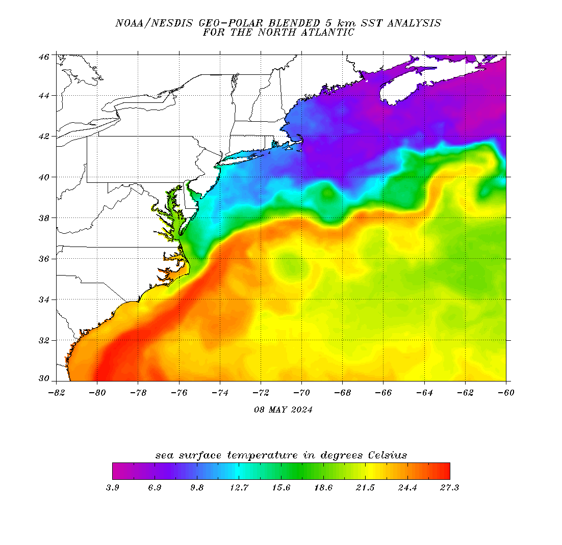
Experimental Beach Forecast Page
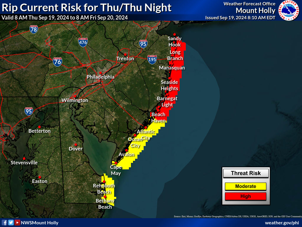
|
||||||||


New Jersey Coastal Waters Model Run
These models forecasts are produced by WFO Mount Holly, NJ, using the NWPS wave models and the Real Time Ocean Forecast System.
NWPS accounts for the following physics:
In here you will see 3-hourly forecast outputs for significant wave height, peak wave direction, peak wave period, and significant swell height (heights in feet and periods in seconds). Our local version of NWPS also uses input from WAVEWATCH III for boundary conditions. NOTE: Significant Swell Height output from NWPS is the average height of the highest 1/3 of the group of waves with periods of 10 secs or longer. |
|
|


 Coastal Flood
 Marine Forecasts
 Text Products
 Climate Information
 Skywarn
 Submit Storm Report
 Weather Event Archives
 Forecast Discussion
 Emergency Managers
 Briefing Page