
Scattered to numerous thunderstorms are likely across the region Tuesday, July 28th through Wednesday, July 29th which will bring a risk of flash flooding and severe thunderstorms across the entire region. View this briefing for the details regarding these hazards. Read More >
 |
 |
NWS Mt Holly Weather Briefing Page"Working Toward a Weather-Ready Nation"Suggestions for improvement are welcome. |
 |
|
NWS Mt Holly Tropical Cyclone Impact Graphics
Available Only When a Storm Threatens the Mid Atlantic Region Within 2-3 Days |
|||
 Wind Impact |
 Storm Surge Impact |
 Inland Flooding Impact |
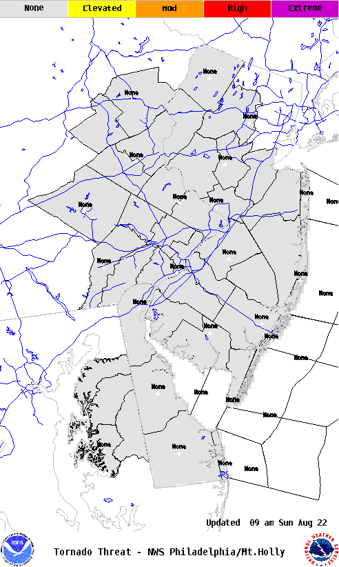 Tornado Impact |
|
NOAA Tropical Satellite Imagery
|
|
Visible Imagery
|
||
|
Infrared Imagery
|
||
Extra-Tropical Storm Surge Guidance
.png) |
 |
 |
 |
 |
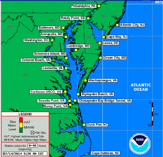
Click here for tide predictions from MD to NJ
|
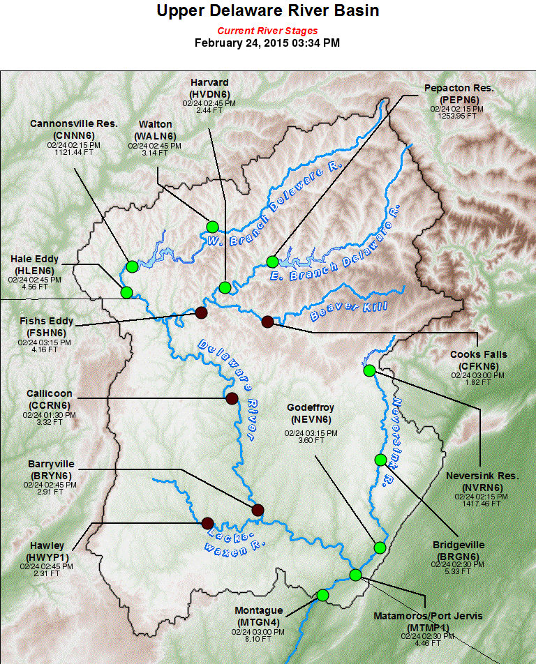
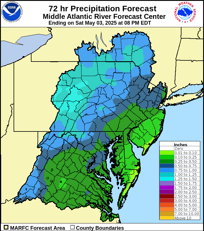
Daily river forecast and statements for the WFO PHI hydrologic service area Mid-Atlantic River Forecast Center (MARFC) Weather Prediction Center Rainfall Forecasts
|
||||||||||||
|
||||||||||||
|
|
|
|
|
|
DAYS 4-5 FORECAST PRECIPITATION |
DAYS 6-7 FORECAST PRECIPITATION |
 |
 |
|
DAYS 6-10 |
|
|
TEMPERATURE |
PRECIPITATION |
 |
 |
|
DAYS 8-14 |
|
|
TEMPERATURE |
PRECIPITATION |
 |
 |
|
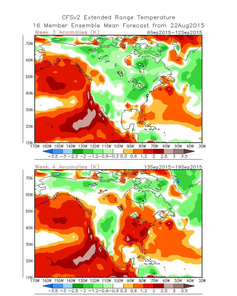
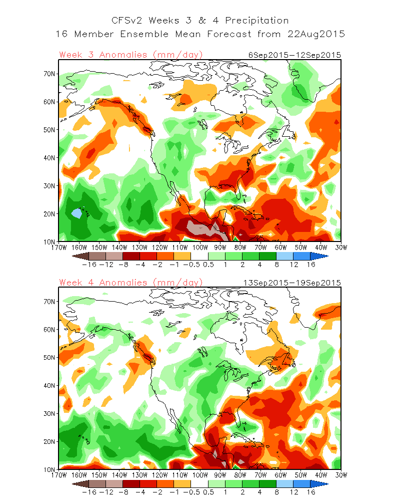
WEEK 3-4 |
|
| What's this? | |
|
TEMPERATURE |
PRECIPITATION |
 |
 |
Updated May 26, 2017


 Coastal Flood
 Marine Forecasts
 Text Products
 Climate Information
 Skywarn
 Submit Storm Report
 Weather Event Archives
 Forecast Discussion
 Briefing Page