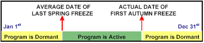
Issuance Policy
Freeze Warning/Watches and Frost Advisories will be issued during the beginning and the ending of the growing season.
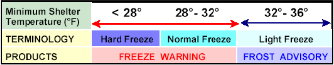
Frost Advisory
A Frost Advisory is issued when temperatures are forecast to be in the 33°F to 36°F range with good radiation conditions. Typically, frost can occur when the temperature falls below 36°F, especially in rural areas. It is a localized phenomenon and can be quite variable across a small area.
Freeze Warning/Watch
A Freeze Warning is issued when minimum temperatures are forecast to be 32°F or less. Frost becomes more widespread when the temperature falls below 32°F with some freeze possible. A Freeze Watch may be issued a few days ahead of time if the potential exists for temperatures to fall into these thresholds.
Hard Freeze Warning/Watch
A Hard Freeze Warning is issued when temperatures are expected to be 28°F or less. A Hard Freeze Watch may be issued a few days ahead of time if the potential exists for temperatures to fall into these thresholds.
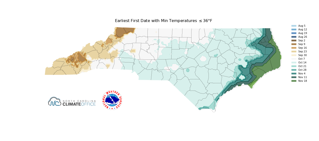
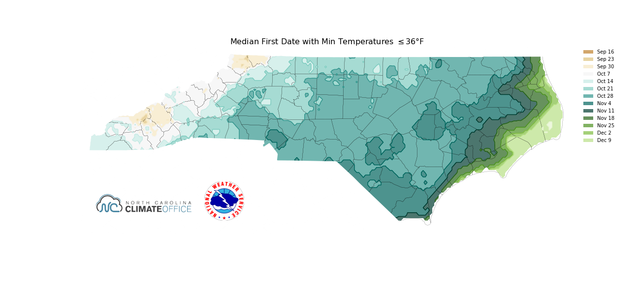
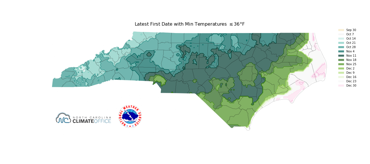
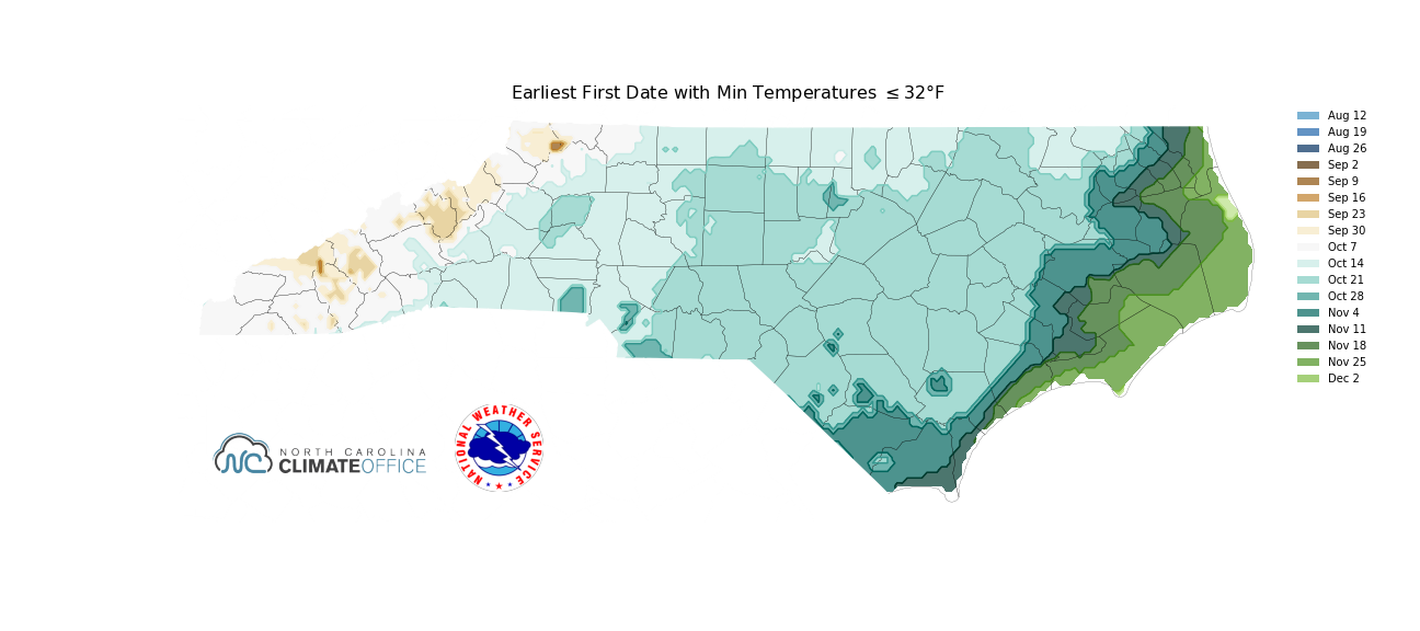
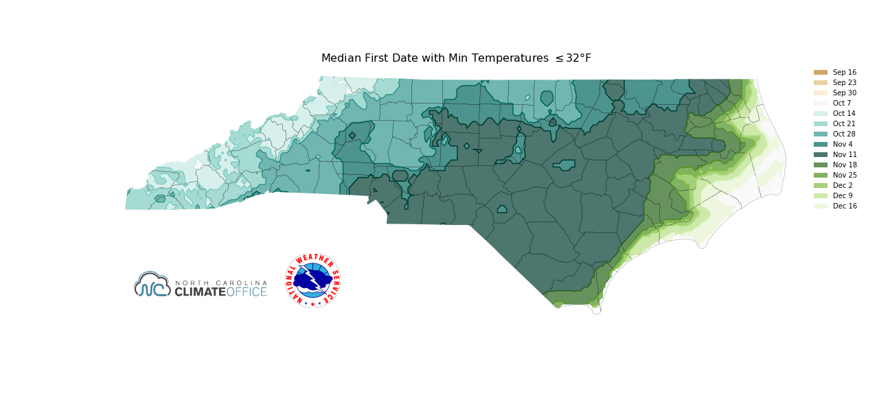
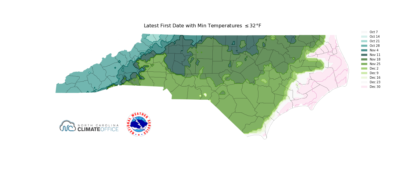
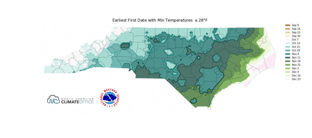
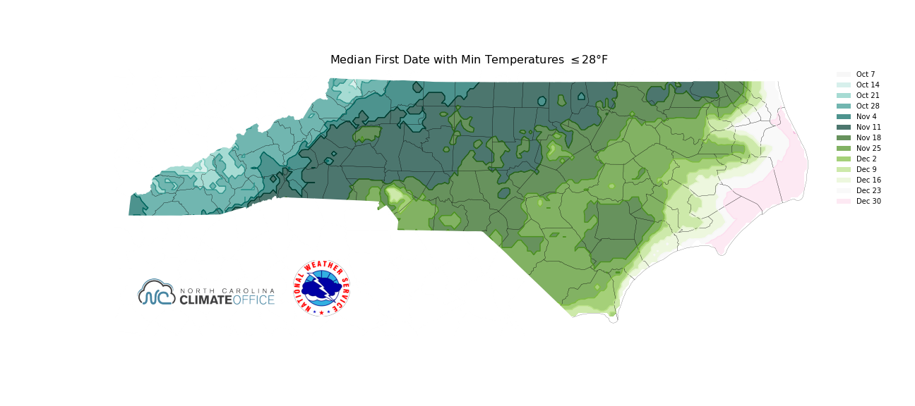
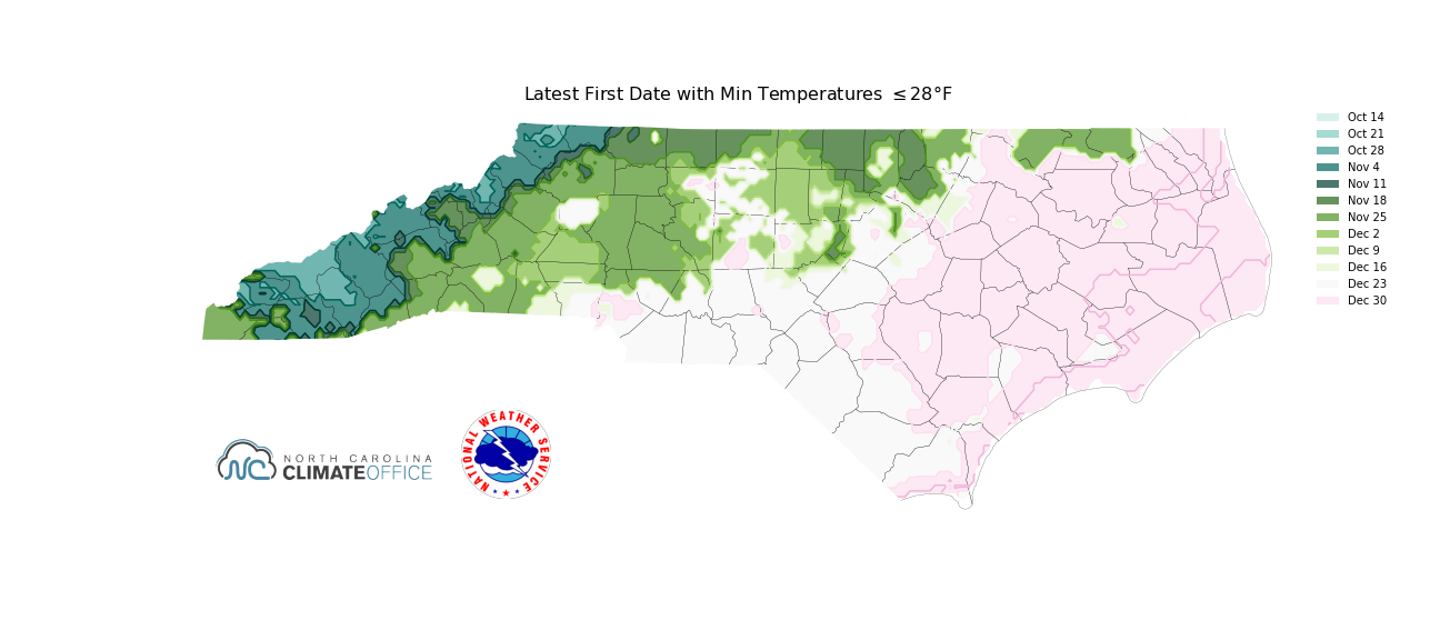
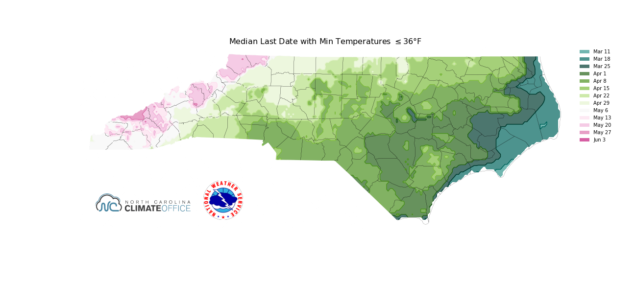
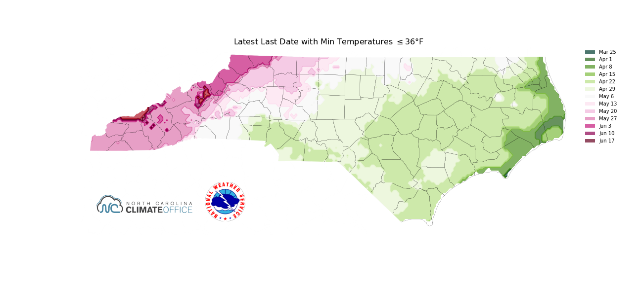
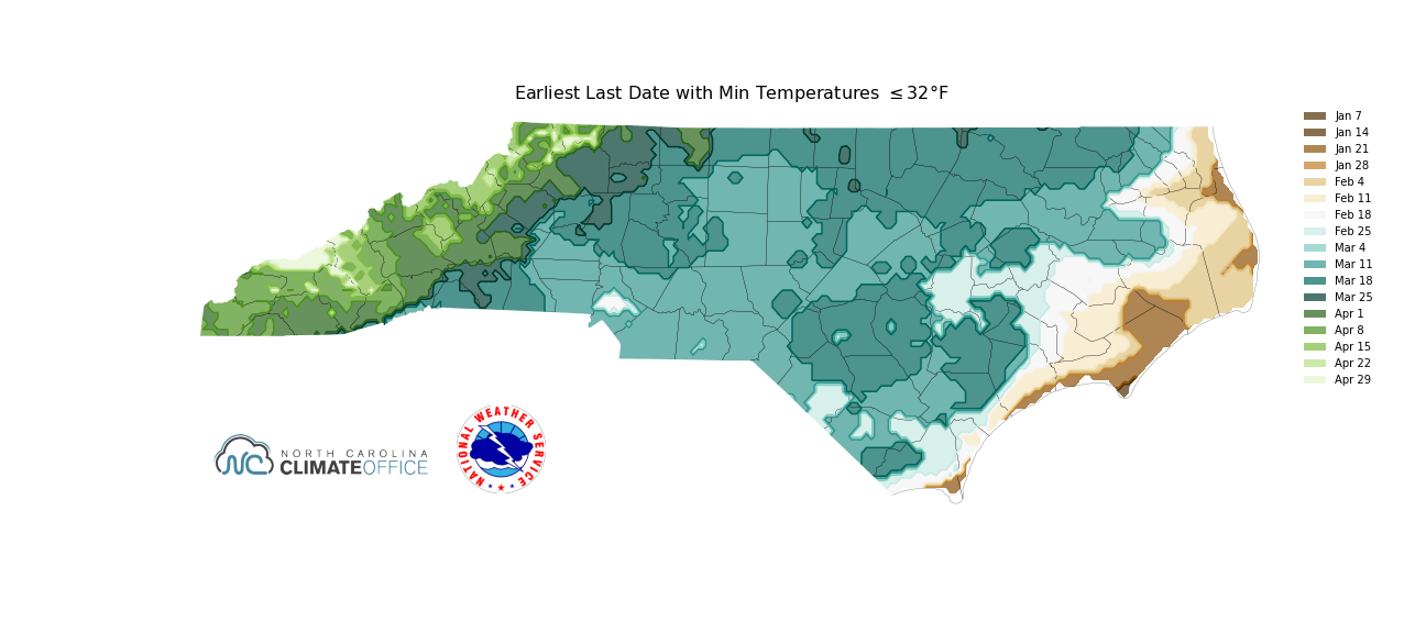
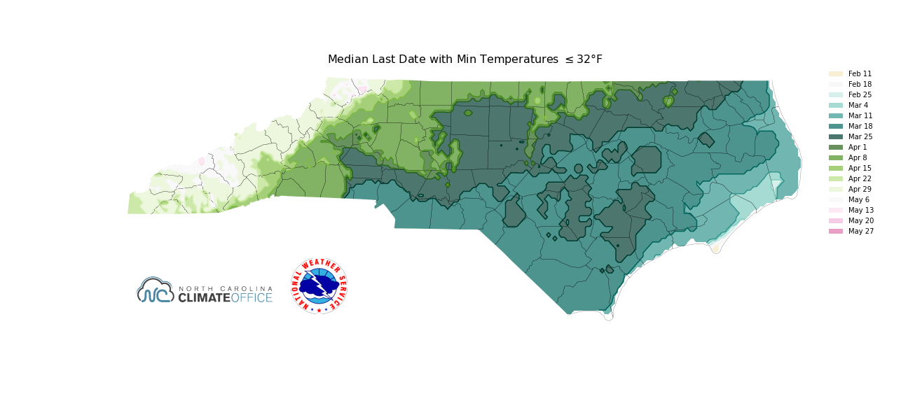
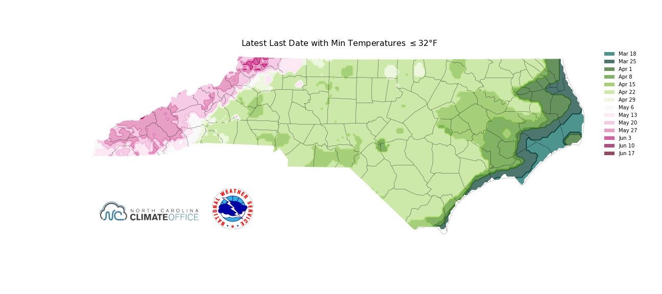
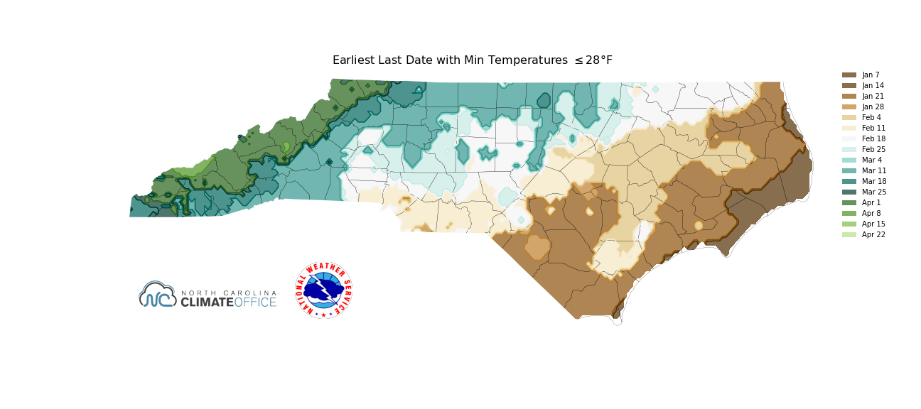
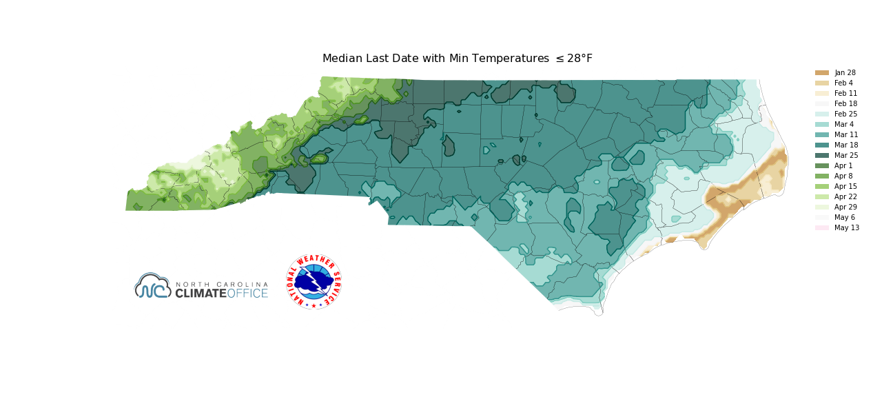
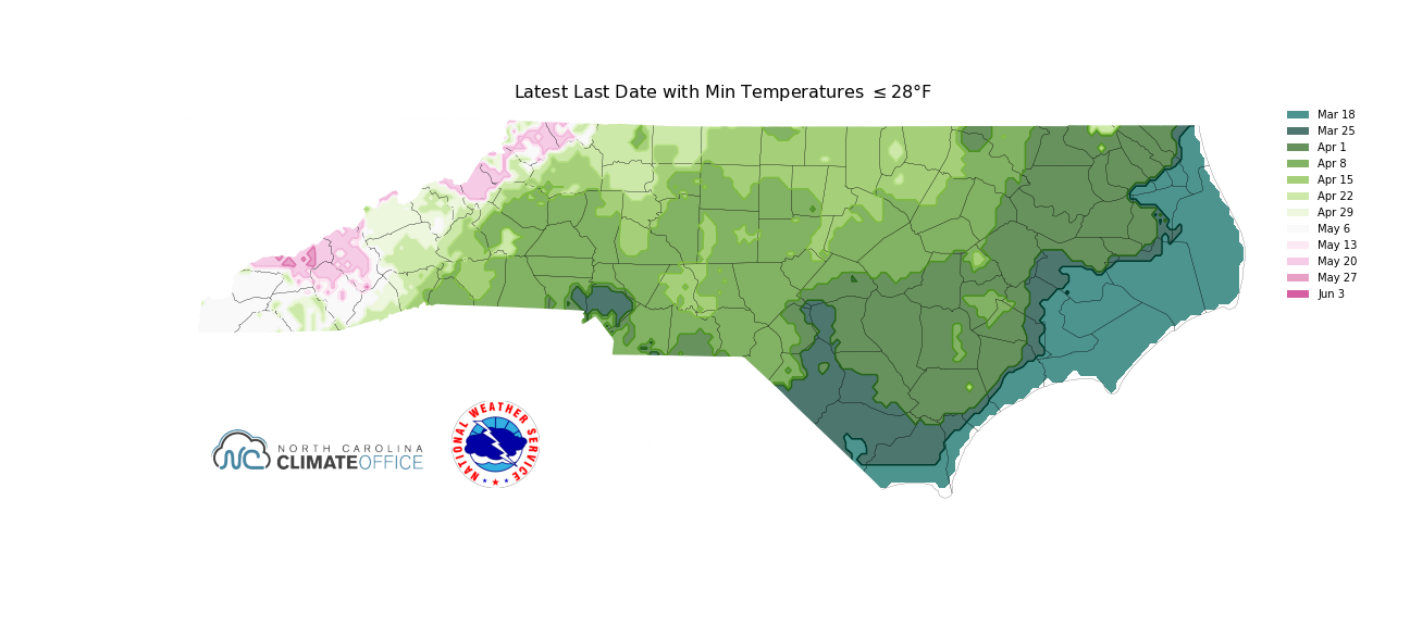
When do we normally see our First(Fall) and Last(Spring) 36°F Frost, 32°F, and 28ºF freezes? Check out these maps from the North Carolina State Climate Office (NCSCO) for freeze information on your location.
Below are images depicting the earliest, median, and the latest dates for the first 36°F Frost, 32°F, and 28°F freezes across our region. Data is derived from the years 1991 to 2020.
Earliest and Latest Dates for the First/Fall 32ºF and 28ºF Freeze for NWS Raleigh Climate Sites
| Earliest | Latest | |||
| 32ºF | 28ºF | 32ºF | 28ºF | |
| Greensboro Area | 10/2/1947 | 10/12/1906 | 12/1/2009 | 12/10/1978 |
| Raleigh Area | 10/2/1947 | 10/20/1972 | 12/3/1931 | 12/27/1918 |
| Fayetteville Area | 10/8/1935 | 10/15/1934 | 12/3/1985 | 12/19/2011 |
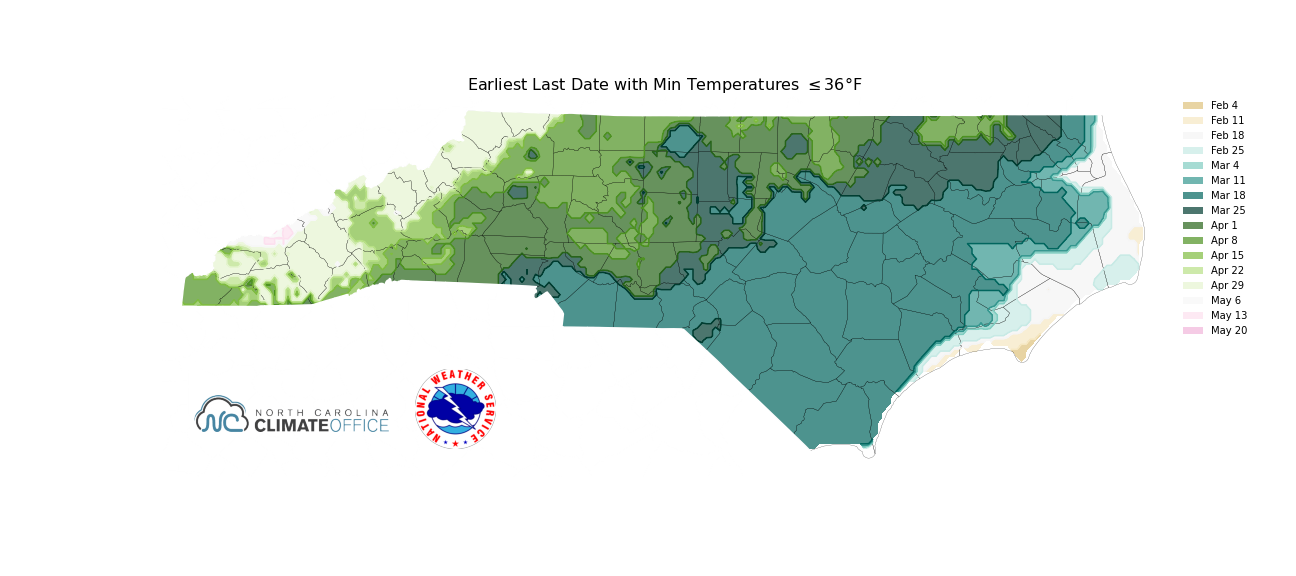
Below are images depicting the earliest, median, and the latest dates for the last 36°F Frost, 32°F, and 28°F freezes across our region. Data is derived from the years 1980 to 2010.
Earliest and Latest Dates for the Last/Spring 32ºF and 28ºF Freeze for NWS Raleigh Climate Sites
| Earliest | Latest | |||
| 32ºF | 28ºF | 32ºF | 28ºF | |
| Greensboro Area | 3/7/2010 | 2/24/1997 | 5/8/1989 | 4/24/1986 |
| Raleigh Area | 3/1/1935 | 2/2/1909 | 5/10/1977 | 4/21/1983 |
| Fayetteville Area | 3/2/1938 | 2/6/2000 | 4/26/1919 | 4/16/1943 |


 Heat Safety
 Statewide Maps
 Forecaster Discussion