The threat of severe weather will return this evening and overnight, with the greatest risk along and north of the I-30 corridor. Large hail and damaging winds will be possible with any severe storms that develop.
A Marginal threat for severe weather will be present across southern zones of the ArkLaTex on Saturday. Large hail and damaging winds will be possible with any severe storms that develop during this timeframe.
A Slight Risk for severe thunderstorms exists Mother's Day Sunday across much of the Four State Region. Large hail, damaging winds and a tornado or two will be the main threats.
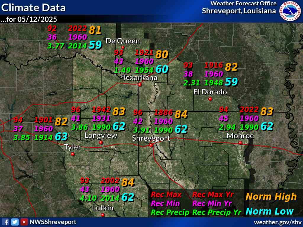
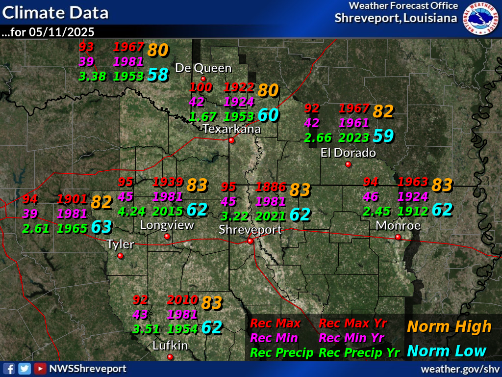
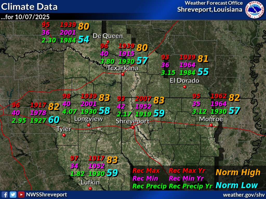
This graphic displays record high and low temperatures as well as the normal high and low temperatures for today. Record precipitation for today is also displayed.


 Regional Radar
 Shreveport Radar
 Weather Map