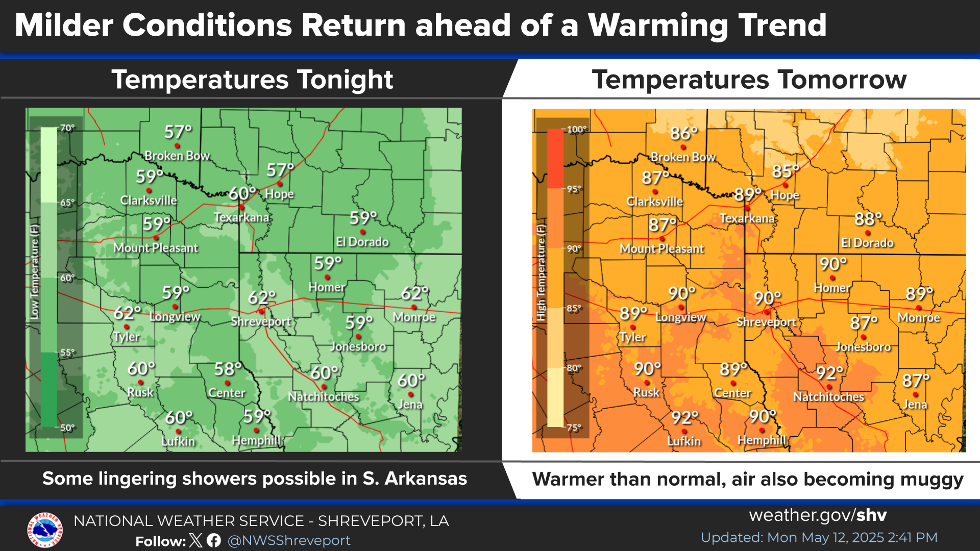
A cold front will push through the Four State Region this Evening into the Overnight hours brining with it a slight cooler weekend. The cool down will be brief with maximum temperatures in the 70s to near 80 forecast for much of next week.
A cool front will shift the winds back to N/NE for the weekend. This boundary will also bring back the clouds overnight, but no rain. Expect the gray skies early to keep temps around 50 degrees early with highs for most of us ranging in the 60s on Saturday.
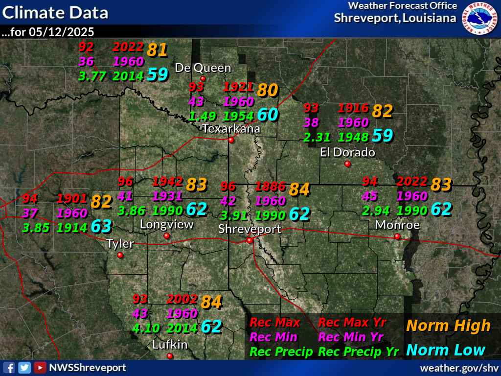
Several of our major climate locations across the Four-State Region saw 2025 rank among the top ten for all-time warmest years on record, and a few even ranked in the top five.


 Regional Radar
 Shreveport Radar
 Weather Map