Scattered damaging winds, isolated severe hail, and a brief tornado or two are possible from the Upper Ohio to Tennessee Valleys during the late afternoon and evening. Across the Southwest, monsoonal moisture will continue to bring heavy rain and a threat for isolated to scattered flash flooding through Saturday. Read More >
 |
|||||||||||||||
|
|||||||||||||||
| Severe Thunderstorms, Damaging Winds, & Hail | |||||||||||||||
| Damaging Winds and Hail | |||||||||||||||
| Louisiana, Texas, Arkansas, and Oklahoma are affected by thousands of thunderstorms every year. The strongest and most dangerous of these thunderstorms are defined as severe thunderstorms. Severe thunderstorms are thunderstorms which produce damaging winds of at least 58 mph, large hail at least 1 inch in diameter, or a tornado. Severe thunderstorms can occur during any time of the year in our Four State Region, but are most common during the spring and autumn months. | |||||||||||||||
|
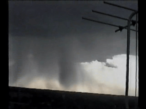
Thunderstorms are capable of producing very strong winds, but it is important to remember that not all damaging thunderstorm winds are caused by a tornado. Straight-line winds refer to winds that are not associated with the rotating winds in a tornado. Rather, they move forward along the ground in unidirectional fashion. One form of straight-line winds, the downburst, is a strong downdraft of air that accelerates toward the ground in a thunderstorm. Once near the ground, the downdraft can no long descend and therefore radiates outward in all directions, producing a sudden rush of damaging winds at the surface. Two types of downbursts exist: the microburst and the macroburst. The microburst is a short-lived event and of great concern to the aviation community. Microbursts produce strong winds in an area less than 2.5 miles in diameter. In contrast, macrobursts are longer-lived and capable of producing extensive wind damage across areas several miles in diameter. Straight-line thunderstorm winds occasionally reach speeds in excess of 100 mph. These winds may be intense enough to uproot trees and produce substantial damage, if not complete destruction, to buildings. If these winds occur in conjunction with large hail, the damage will likely be even more extensive. |
|
||||||||||||||
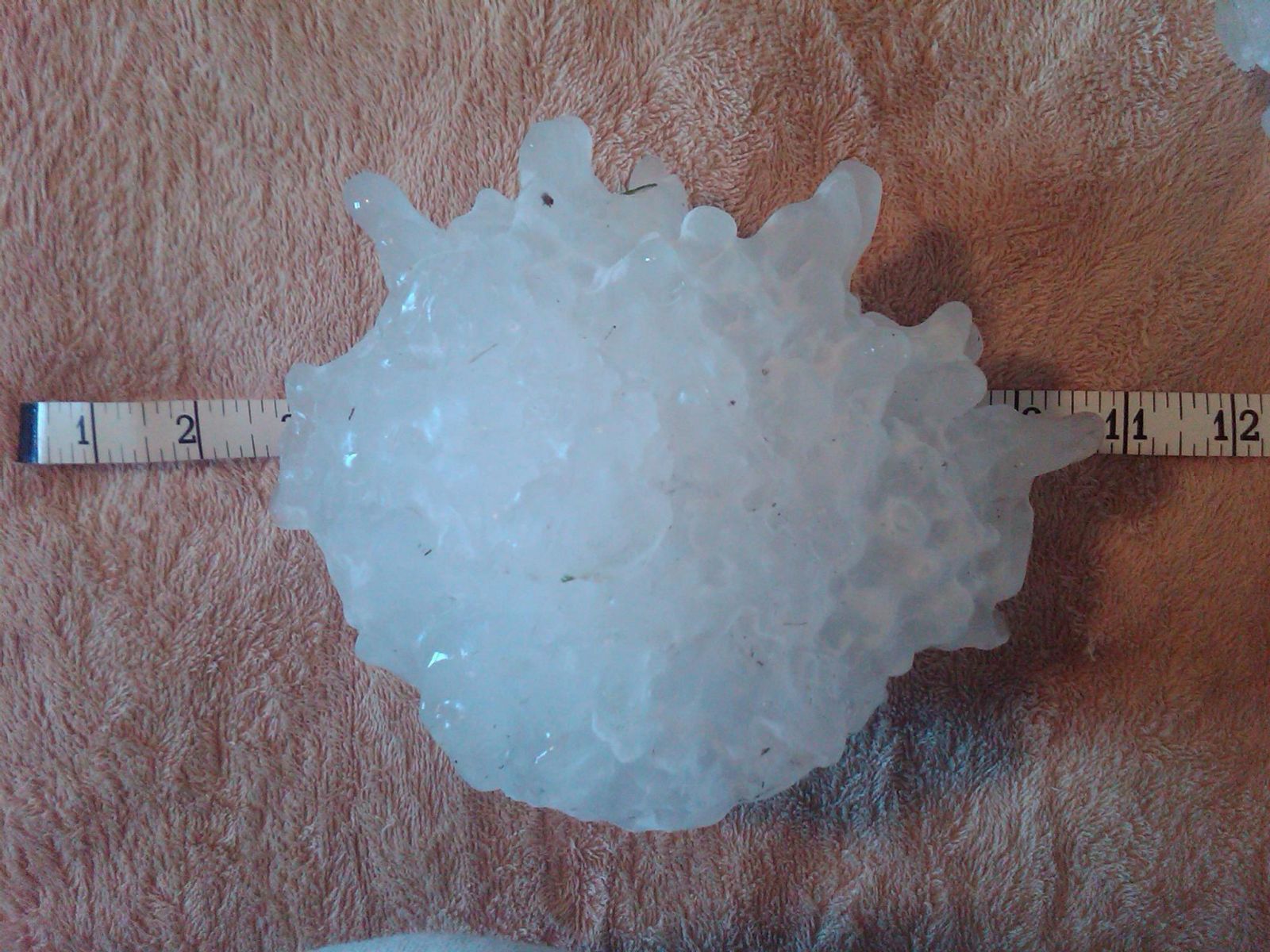
| Treat straight-line wind events the same as you would an approaching tornado. Seek shelter in a reinforced building, preferably on the lowest floor, in an interior room or closet and away from any windows. Always cover your head to protect against the impact of flying debris. Hail that is 1 inch in diameter (as big around as a quarter) or larger is considered severe. Hail is defined as precipitation in the form of lumps or chunks of ice that develop inside strong thunderstorms. Hailstones are usually oval-shaped or round, but can also be spike in appearance. Hail can range in size from pea size (one-quarter of an inch) to greater than softball size (4.5 inches). |
|||||||||||||||
|
|
||||||||||||||
|
If you encounter hail while driving, turn around. You may be driving into the core of a thunderstorm, which is where tornadoes form. Report hail or wind damage to law enforcement as soon as it is safe to do so and seek an alternate route. To protect yourself and your property from damaging winds and hail associated with a thunderstorm, it is important to stay abreast of the latest weather conditions. Staying updated through NOAA Weather Radio from the National Weather Service, as well as monitoring television, radio and the internet, will help you be better prepared for the dangers associated with any severe thunderstorms in your area. |
|||||||||||||||
| Back to Top | |||||||||||||||