Tampa Bay Area, FL
Weather Forecast Office
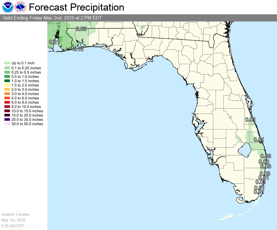
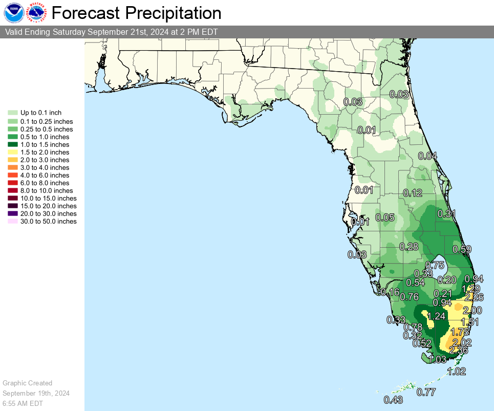
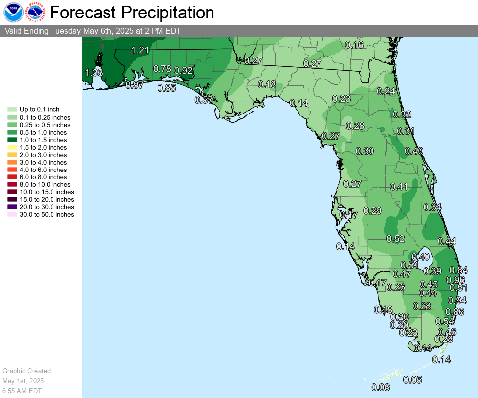
| QPF Day 1 | QPF Day 1-2 | QPF Day 1-5 |
 |
 |
 |
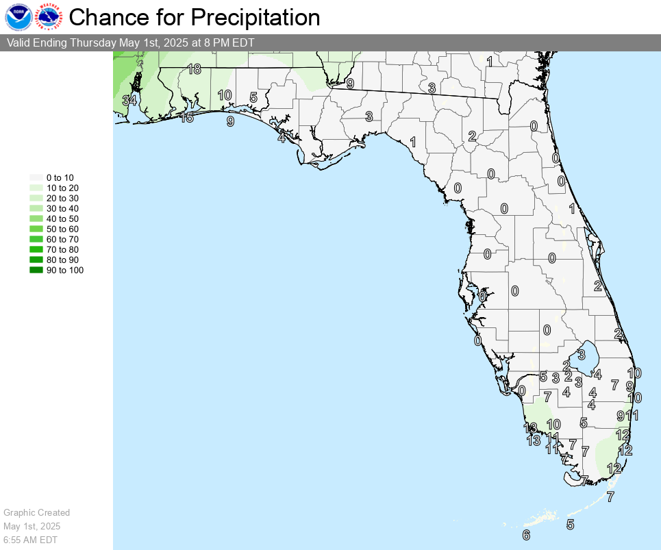
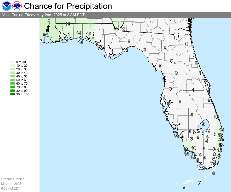
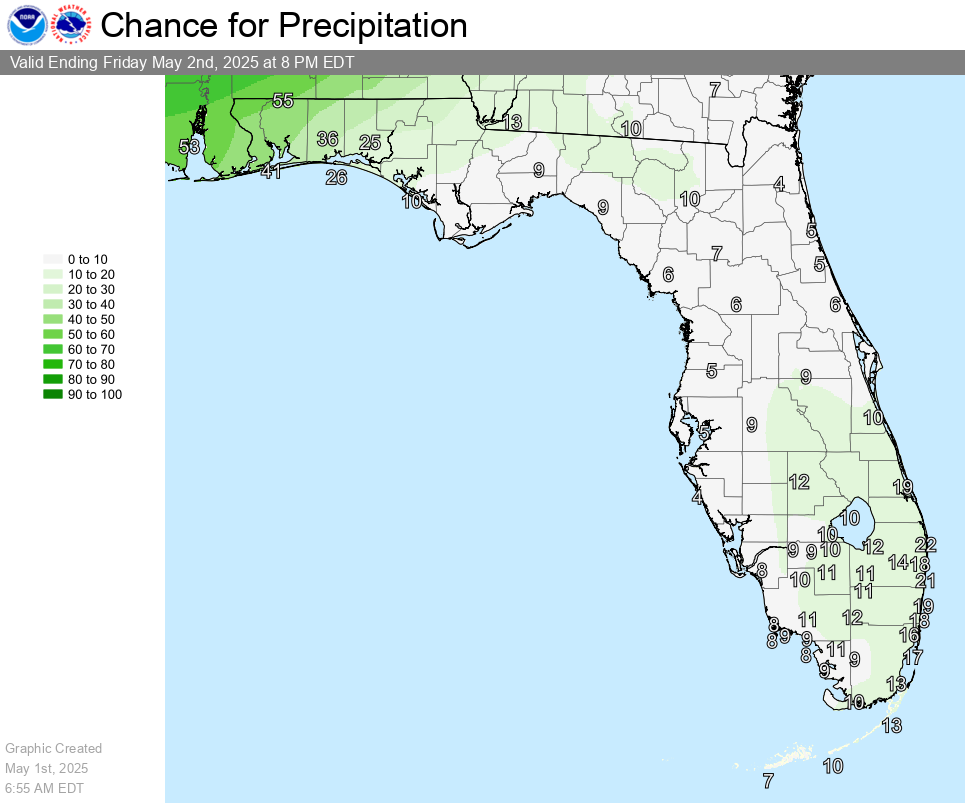
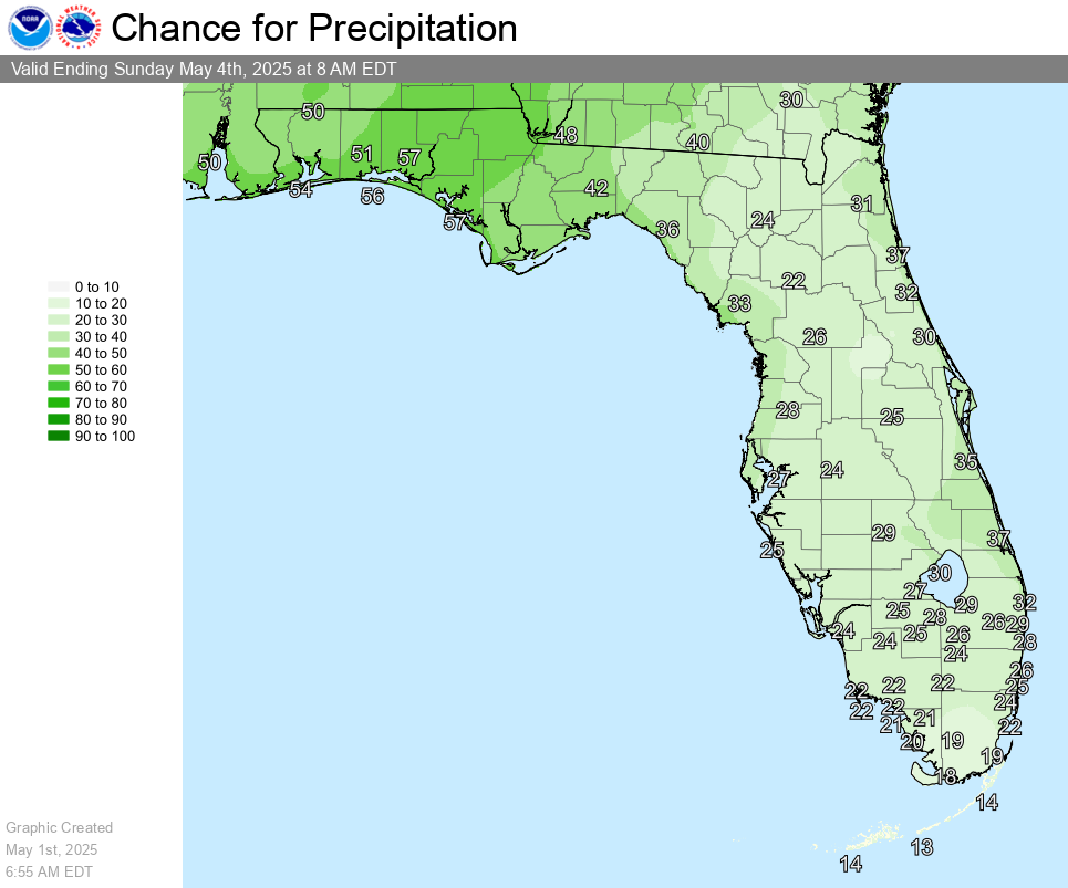
| POP 0-12 Hour | POP 12-24 Hour | POP 24-36 Hour |
 |
 |
 |
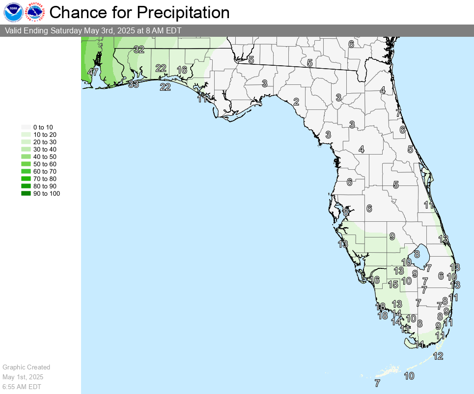
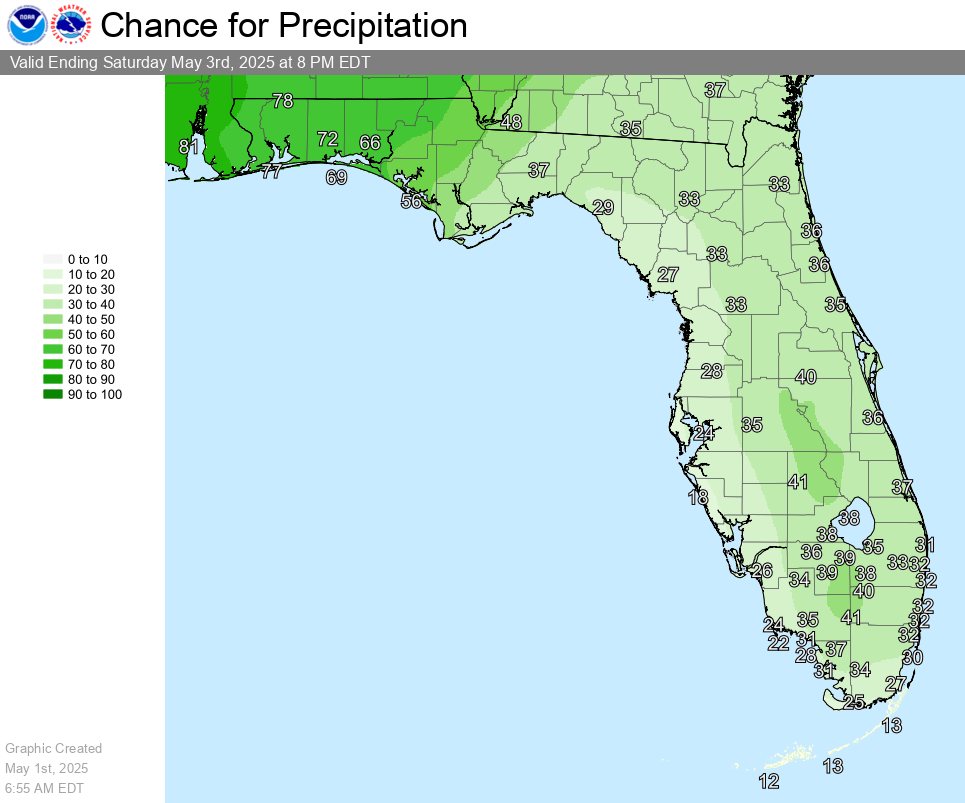
| POP 36-48 Hour | POP 48-60 Hour | POP 60-72 Hour |
 |
 |
 |
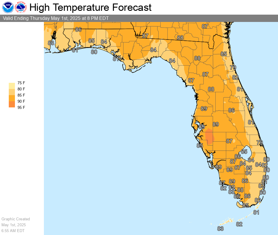
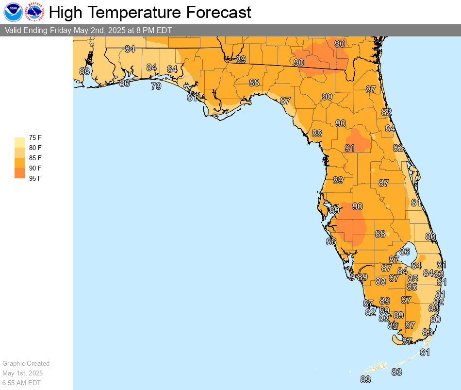
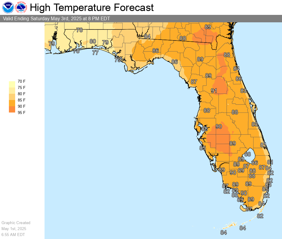
| Max Temp Day 1 | Max Temp Day 2 | Max Temp Day 3 |
 |
 |
 |
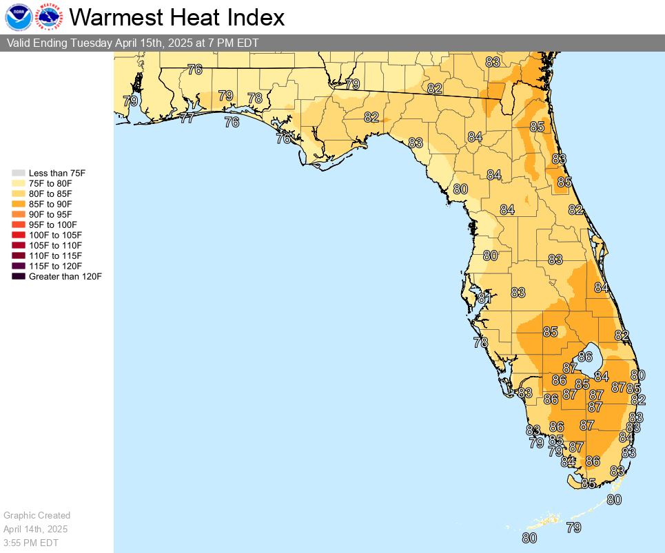
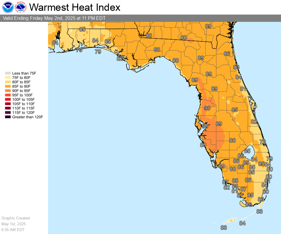
| Max Heat Index Day 1 | Max Heat Index Day 2 | Max Heat Index Day 3 |
 |
 |
 |
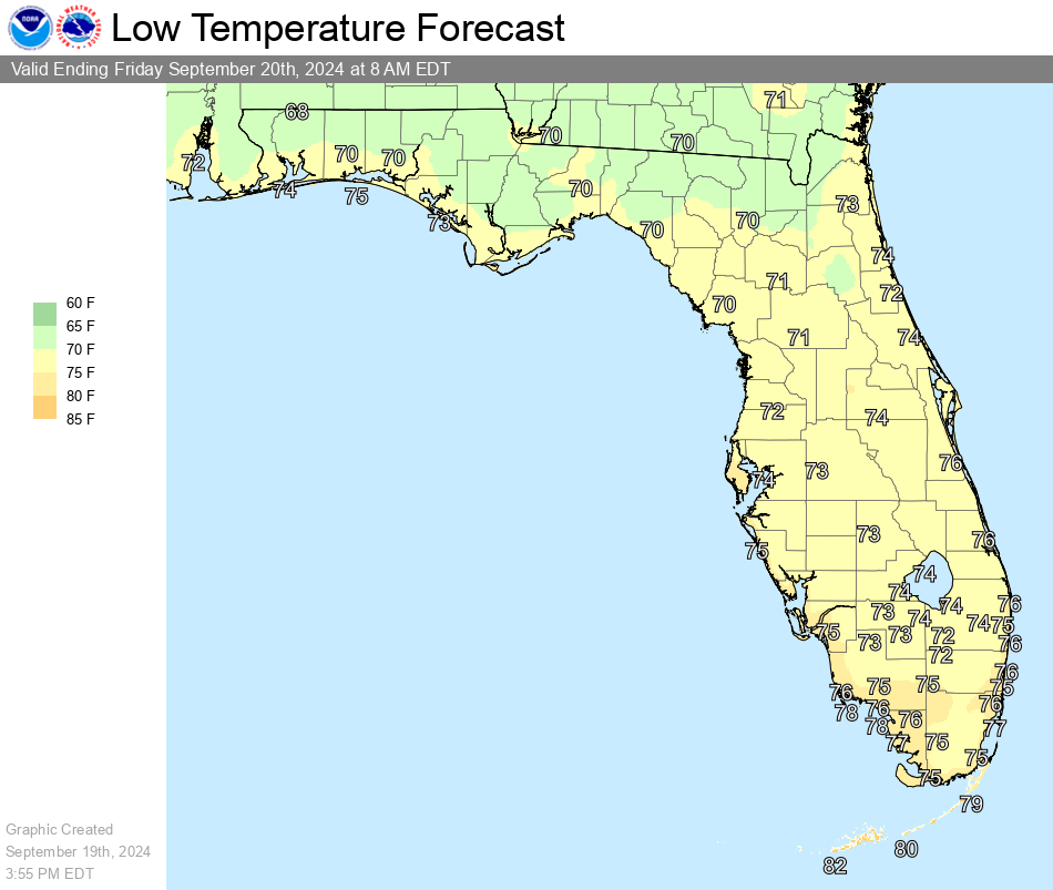
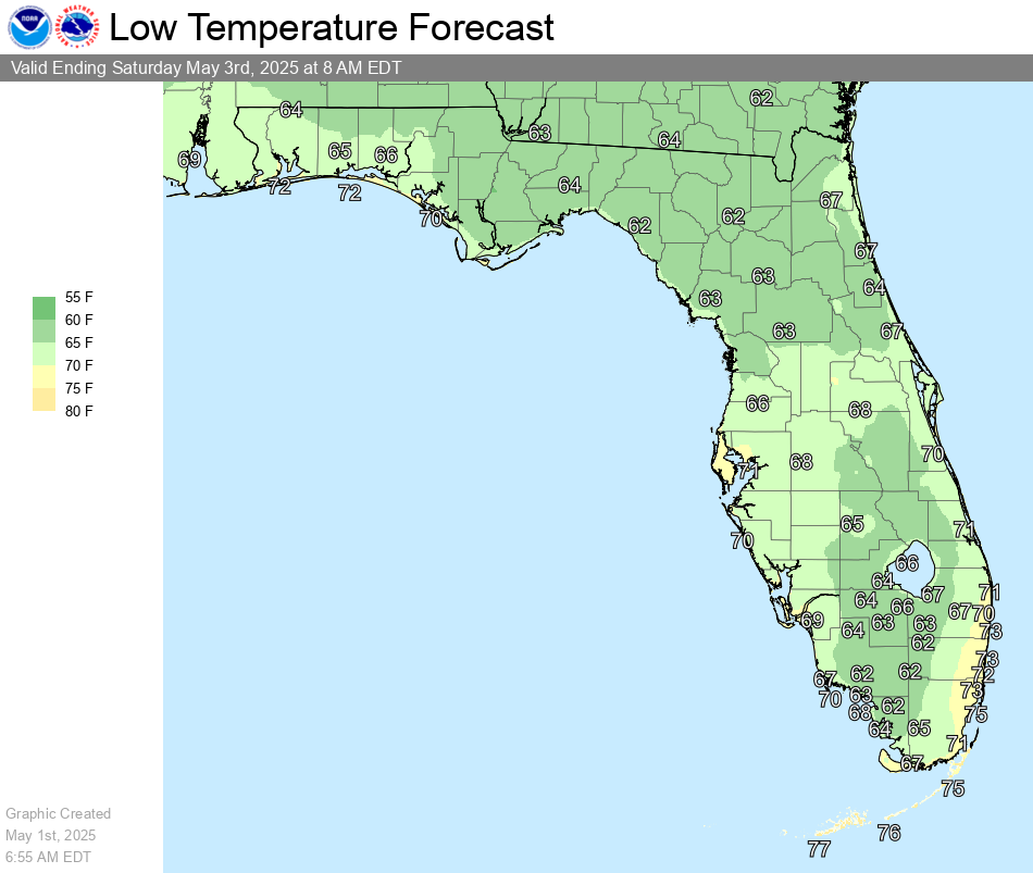
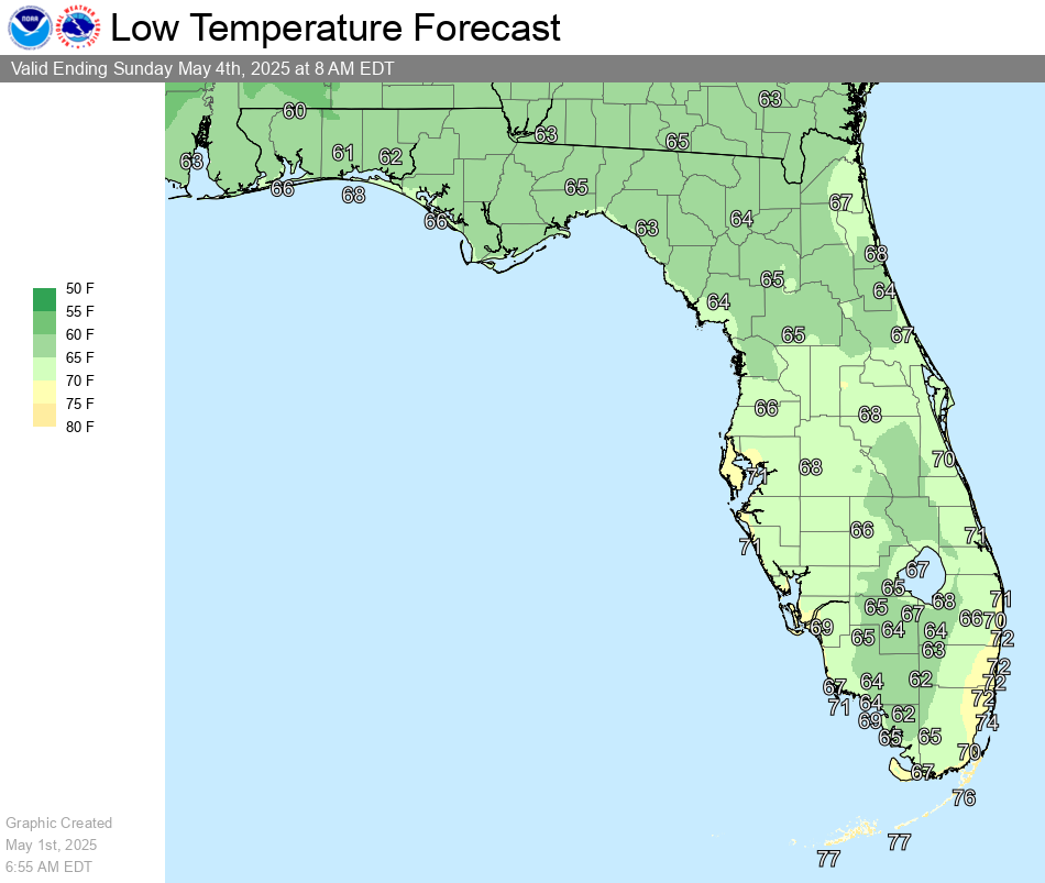
| MinTemp Day 1 | MinTemp Day 2 | MinTemp Day 3 |
 |
 |
 |
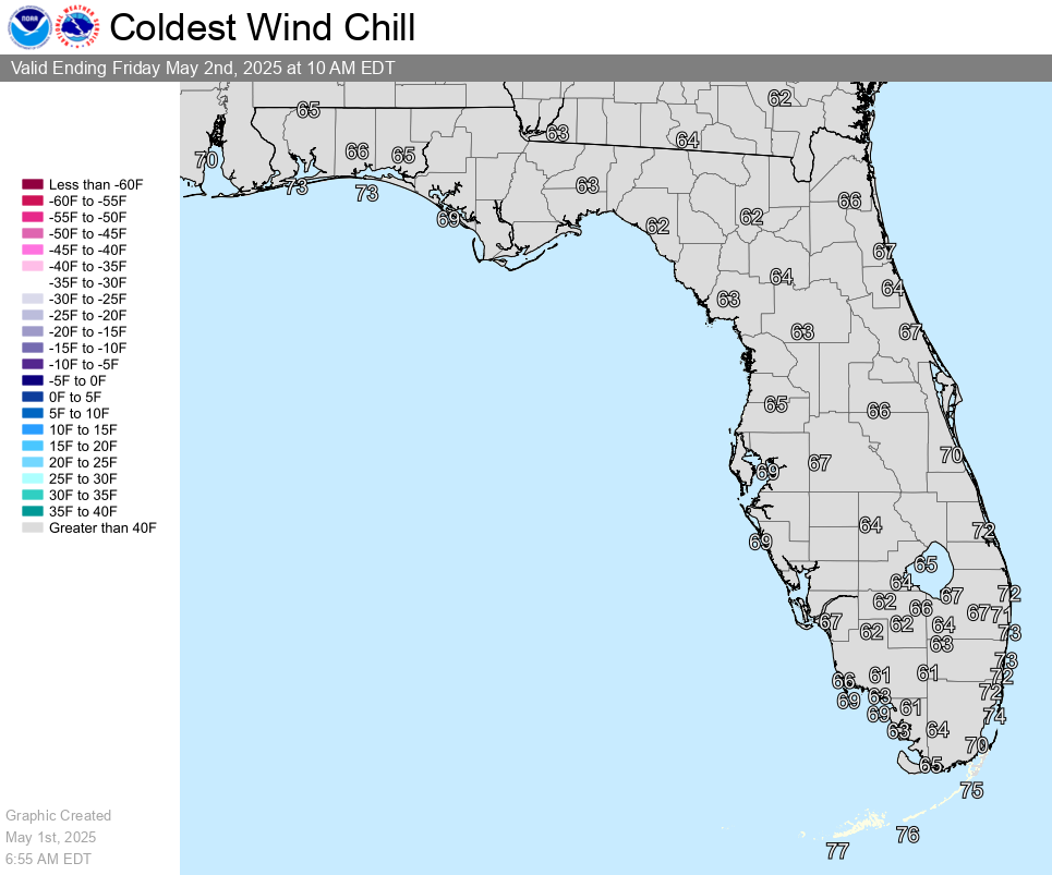
| Wind Chill Day 1 | Wind Chill Day 2 | Wind Chill Day 3 |
 |
 |
 |
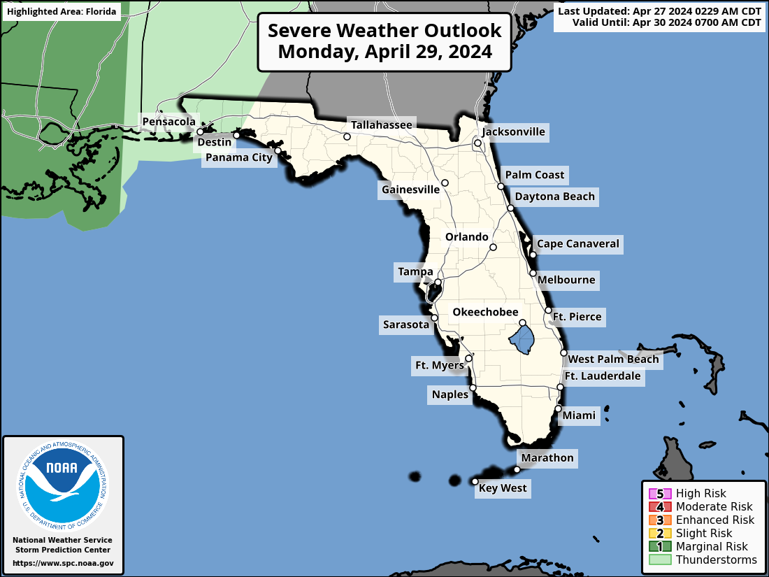
| Severe Wx Outlook Day 1 | Severe Wx Outlook Day 2 | Severe Wx Outlook Day 3 |
 |
 |
 |
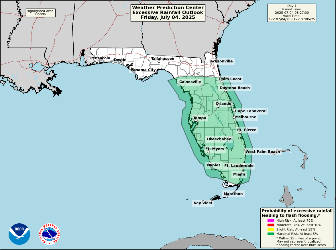
| Excessive Rain Outlook Day 1 | Excessive Rain Outlook Day 2 | Excessive Rain Outlook Day 3 |
 |
 |
 |
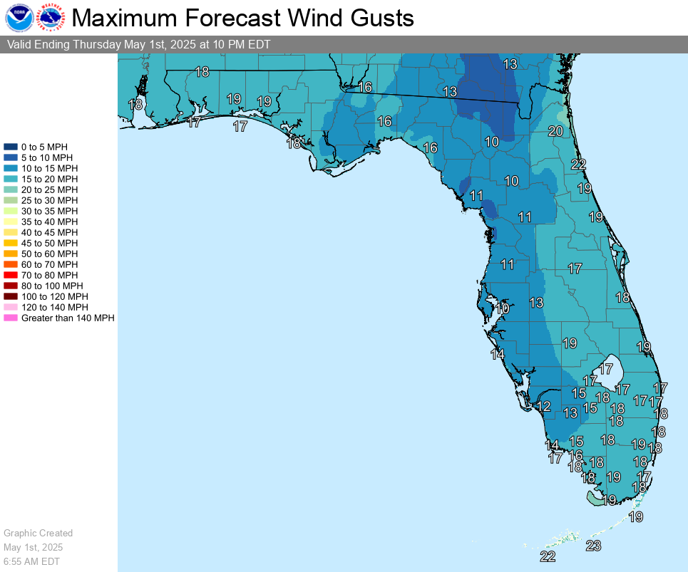
| Max Wind Gust Day 1 | GeoColor Satellite | Surface Map |
 |
 |
 |
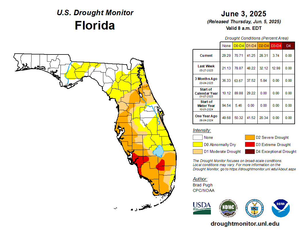
| 24 Hour Precipitation | CoCoRahs Rain Reports | Drought Monitor |
 |
 |
| Links |
| SPC Outlooks for Florida SPC Outlooks for TBW CWA Satellite centered on TBW Probabilistic Forecasts for TBW |
Current Hazards
Outlooks
Graphical Hazards
Submit a Storm Report
Local Storm Report Map
Radar Imagery
Local KTBW Radar
Regional Radar
KTBW Radar Status
Current Conditions
Surface Observation Map
Satellite
Observed Precipitation
Local Beaches
Local Observations
Past Weather
Tropical Cyclone Reports
Weather Events
Weather History
Forecasts
Activity Planner
Aviation
Beach
Fire
Forecaster's Discussion
Graphical
Hydrology
Marine
Tropical
Probabilistic DSS
Climate
National
Local
Records and Normals
1991-2020 Climate Normals
Local Drought/Rainfall
Thunderstorm Climatology
El Niño Southern Oscillation
Arctic Oscillation
Climate Summaries
US Dept of Commerce
National Oceanic and Atmospheric Administration
National Weather Service
Tampa Bay Area, FL
2525 14th Ave. SE
Ruskin, FL 33570
(813) 645-2323
Comments? Questions? Please Contact Us.

