Overview
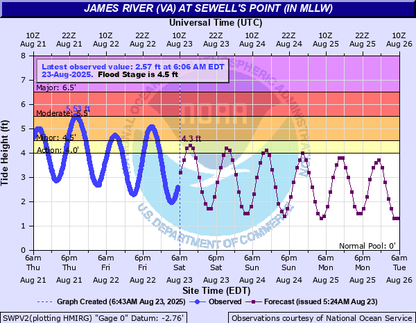
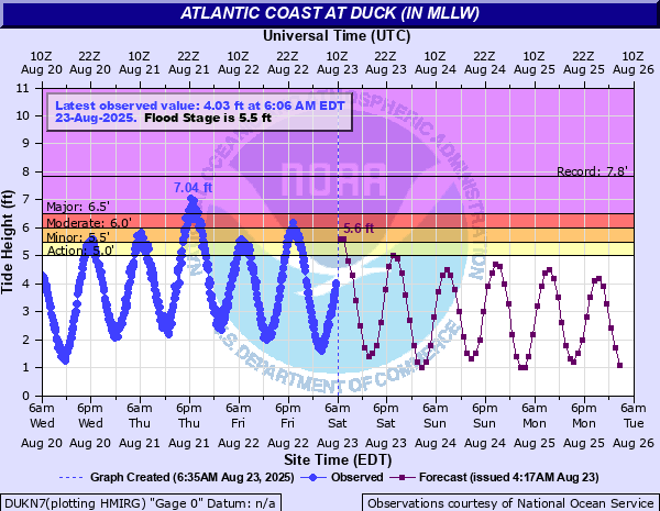
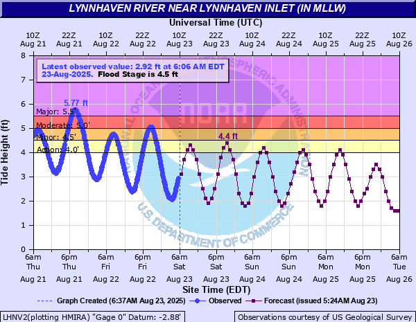
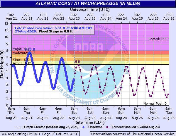
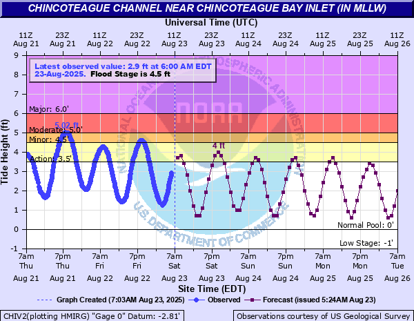
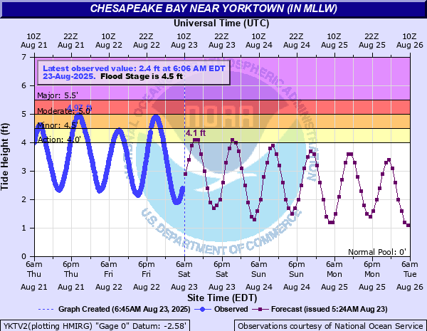
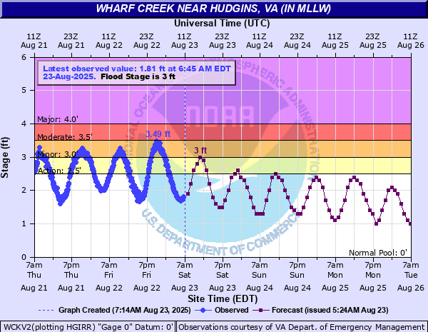
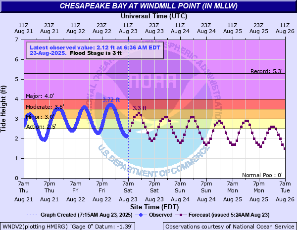
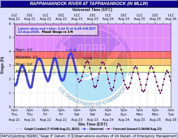
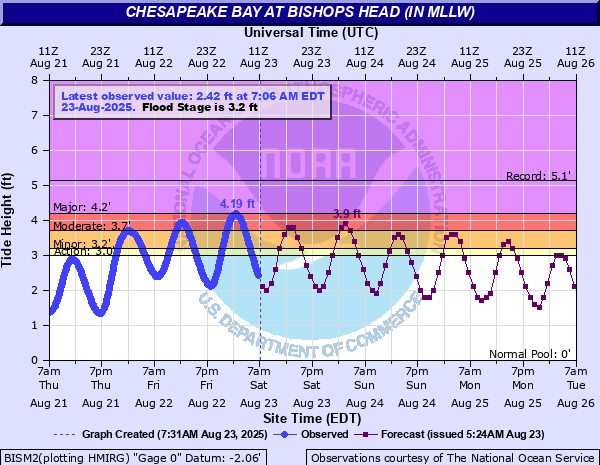
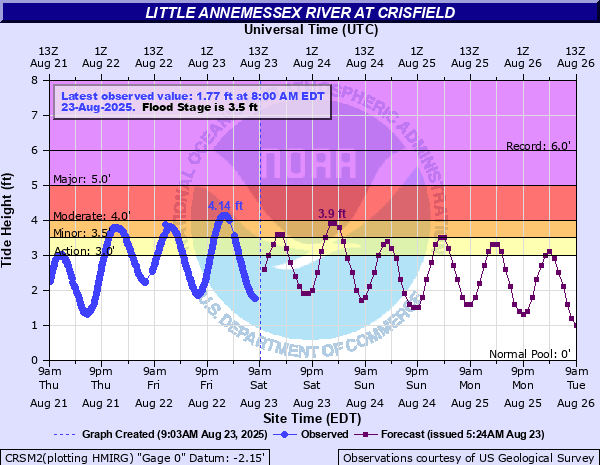
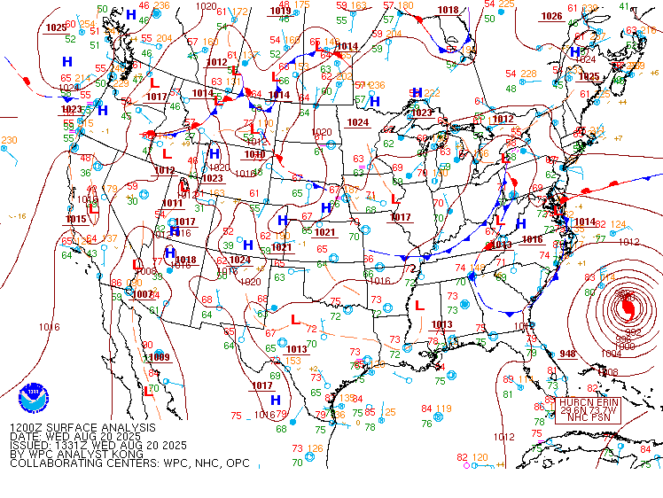
Hurricane Erin tracked from a few hundred miles off the Florida coast to well offshore of the VA/NC coast from 8/20 to 8/22. Perhaps the most notable thing about Erin was its size, as tropical storm force winds extended 500+ miles from the center of the storm. So even though Erin was well offshore, the gradient between Erin to our E/SE and ~1025mb high pressure to the north resulted in a 6-12 hour period of 25-30 knot sustained winds with gusts of 30-40 knots over the water and near the coast. Winds were initially out of the NE during the night of the 20th into the early morning on the 21st. Then, winds became due north during the day on the 21st. In addition to the wind, tremendous swell on the order of 12-18 feet was observed near the VA/NC/MD coast. This not only resulted in beach/dune erosion, but also helped to elevate water levels/tides in the bay/ocean higher than they normally would with a typical N-NE gale event. Tidal anomalies of ~2.5 feet above normal were common across the lower bay and ocean during the day on the 21st, with water levels peaking in most sites during the evening/overnight high tide cycle from the 21st-22nd. Most sites saw levels peak in the moderate flood range, though gages exceeded major flood stage at Lynnhaven, Kiptopeke, and Duck (NC). Water levels in the upper bay were initially below flood stage but peaked in the moderate range a day later (during the early morning on the 23rd) as the swell/diminishing winds allowed water to become trapped in the bay (as is typically seen). Other than wind, tidal flooding, and coastal impacts, there were no other impacts from Erin in terms of rain/tornadoes as it tracked well offshore.
Tidal Flooding
Hydrographs
 |
 |
 |
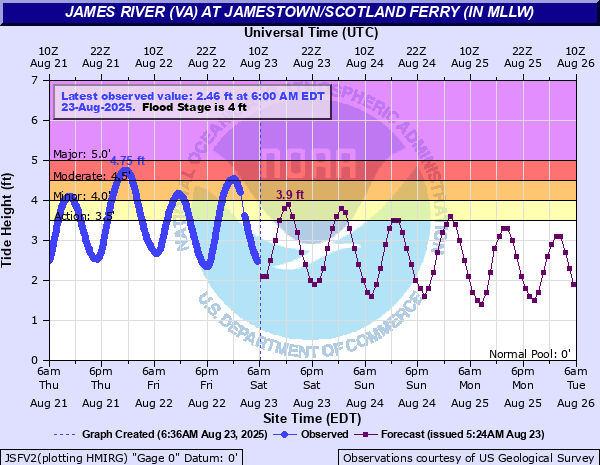 |
| Sewell's Point | Duck, NC | Lynnhaven Inlet, VA | Jamestown, VA |
More Hydrographs
 |
 |
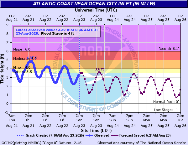 |
| Wachapreague, VA | Chincoteague, VA | Ocean City, MD |
 |
 |
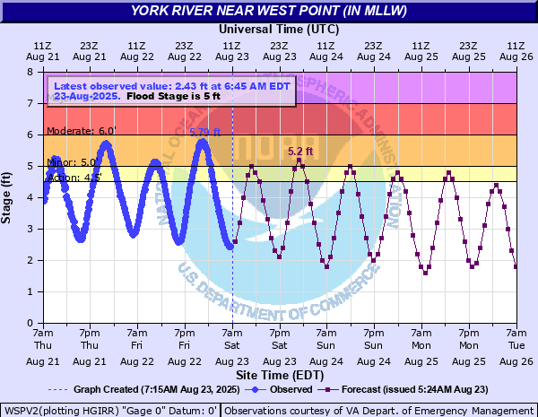 |
| Yorktown, VA | Gwynn's Island, VA | West Point, VA |
 |
 |
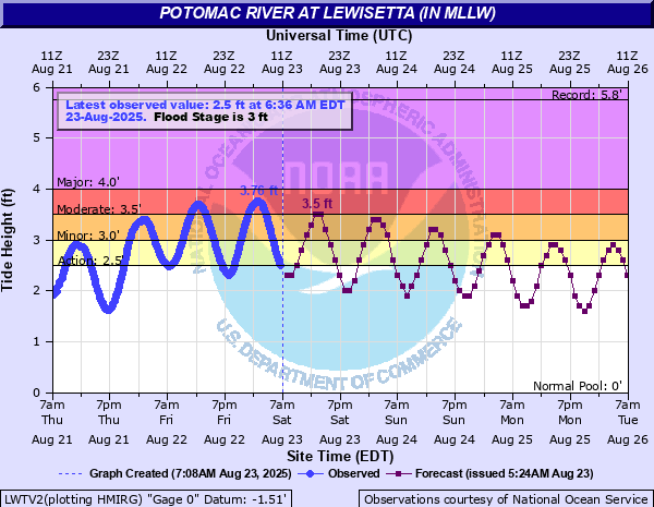 |
| Windmill Point, VA | Tappahannock, VA | Lewisetta, VA |
 |
 |
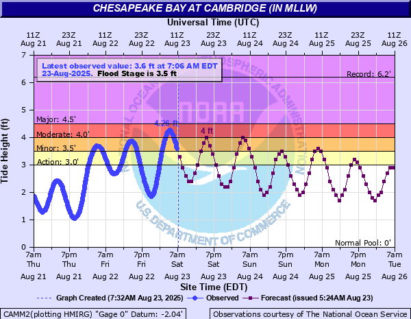 |
| Bishop's Head, MD | Crisfield, VA | Cambridge, MD |
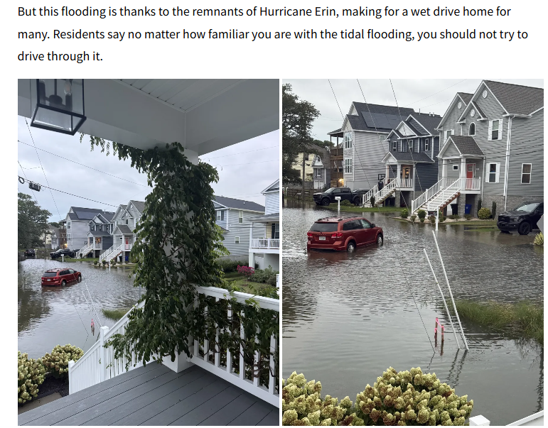
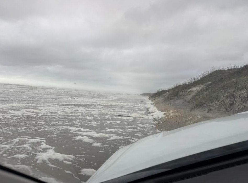
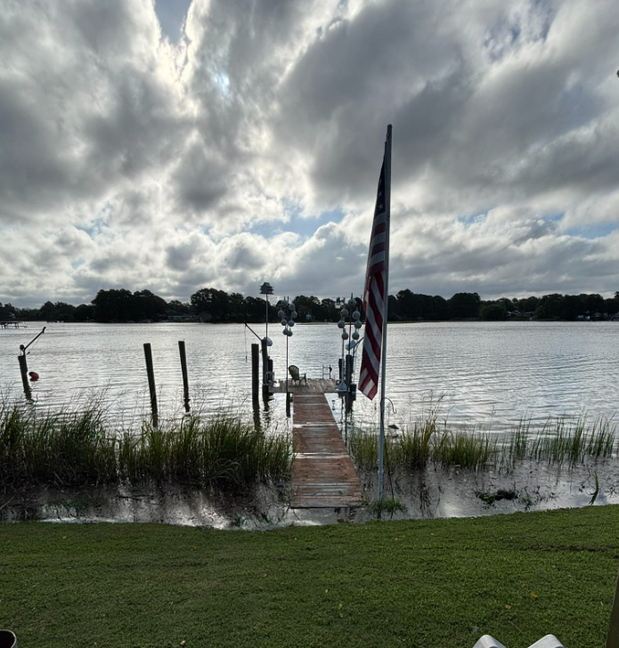
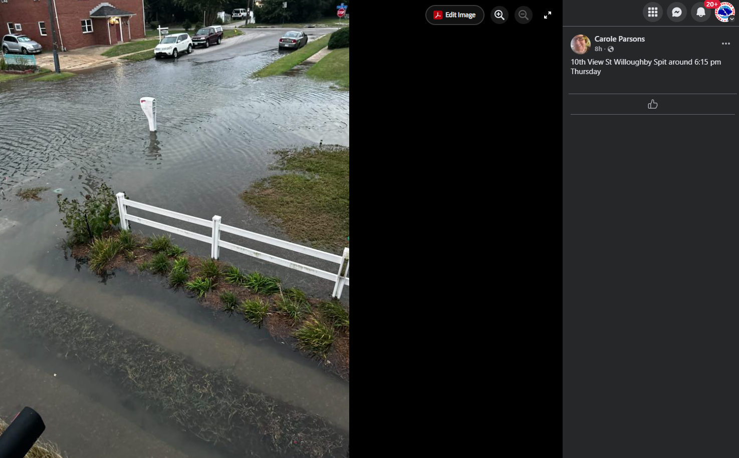
Photos
 |
 |
 |
 |
| Lynnhaven Colony |
Corolla 4WD Area | Chesapeake Bay Rd by Shipyard Dock |
Willoughby Spit Flooding |
Environment/Synoptic Pattern
Synoptic summary.
 |
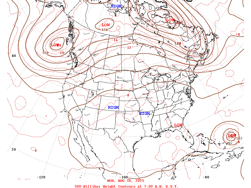 |
| Loop of WPC Surface Analysis from 8/20 to 8/23 in 3 hour increments | Loop of WPC 500mb Analysis from 8/18 to 8/22 in 24 hour increments |
 |
Media use of NWS Web News Stories is encouraged! Please acknowledge the NWS as the source of any news information accessed from this site. |
|


 Coastal Flood
 Heat
Heat