Winter Safety Week for Maryland
December 9th - 15th, 2024
Please join us with Maryland's Department of Emergency Management (MDEM) in promoting winter weather safety during this year's "Winter Safety Week". The National Weather Service asks emergency management, public safety officials, local media and Weather-Ready Nation Ambassadors to help join forces in improving the nation's readiness, responsiveness, and overall resilience against extreme weather during the winter weather season.
Get familiar with, and make it a part of your routine to check out, our winter forecast pages that will help you with your planning and safety this winter.
Each day this week, a different topic will be covered. Click on the tabs below for more winter weather preparedness information. Also check out the Maryland Department of Emergency Management page too.
Monday - Winter Outlook & What is a Watch, Warning, & Advisory?
|
This will provide you with some terms the National Weather Service uses to describe winter weather as well as the definitions of watches, warnings, and advisories issued for winter weather events. The national outlooks for December through February are below. What this means for Maryland:
|


|
Watches mean "keep a watch on things". They for a POTENTIAL threat, and are often issued before a storm has even formed. With a Watch, hazardous winter weather is only a possibility, not a certainty. Think of Watches as the "yellow light" in a traffic light - be aware. The following are the watch headlines issued for winter weather events:
|
|
Warnings are issued when the threat to life and property is imminent or has already begun from severe winter weather. With warnings, we move from the potential, to the EXPECTATION of a hazardous winter event. Think of Warnings as the "red light" in a traffic light - take action. The following are the warning headlines issued for winter weather events:
|
|
Advisories are low-level warnings, issued for the EXPECTATION of less serious weather conditions that will not cause immediate threat to life and property. Advisories will be issued when weather conditions will impact motorists, outdoor activities, or public events. These events could become life-threatening if proper precautions are not taken. Like warnings, they are also a "red light", but for a less serious event. The following are the advisory headlines issued for winter weather events:
|
Tuesday
Winter Storms affecting Maryland
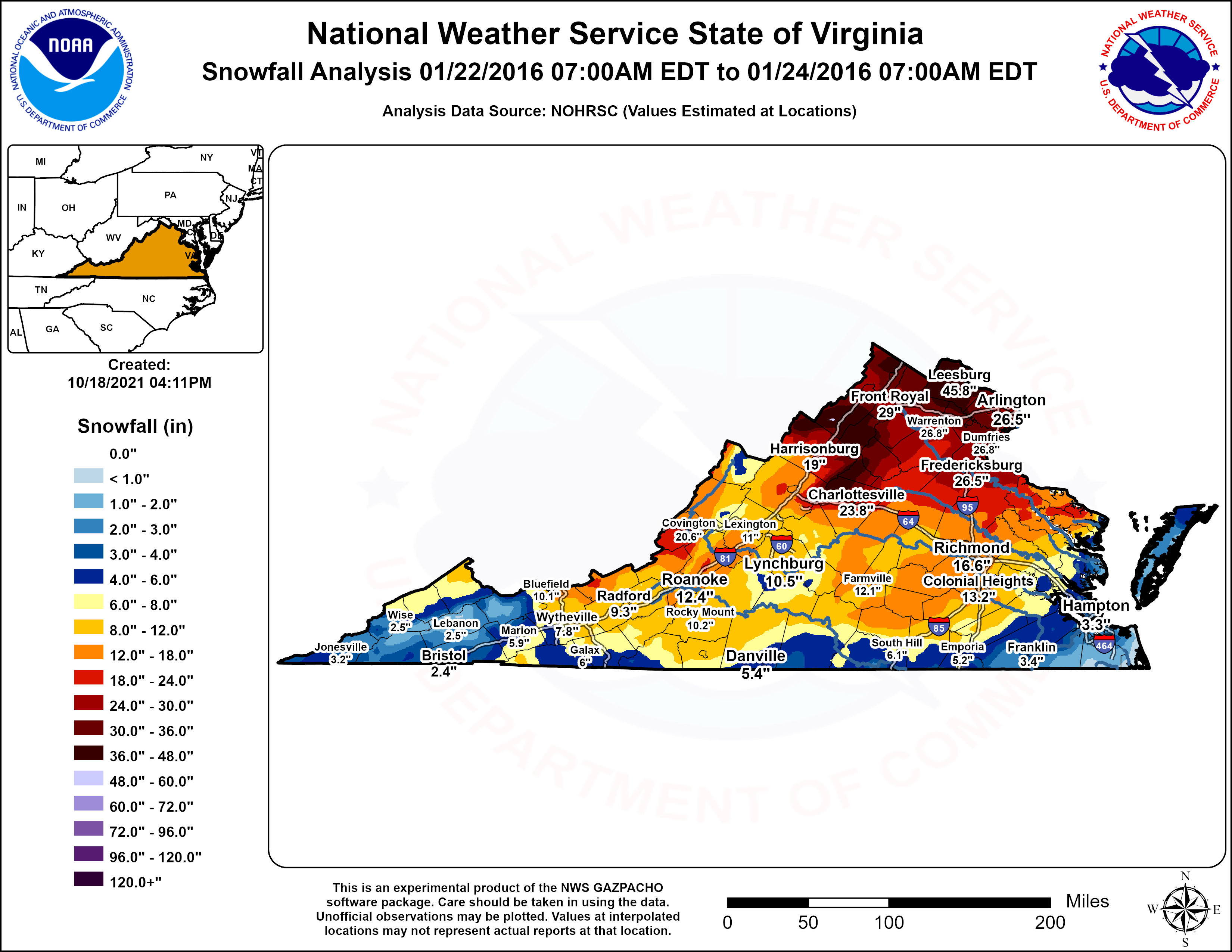
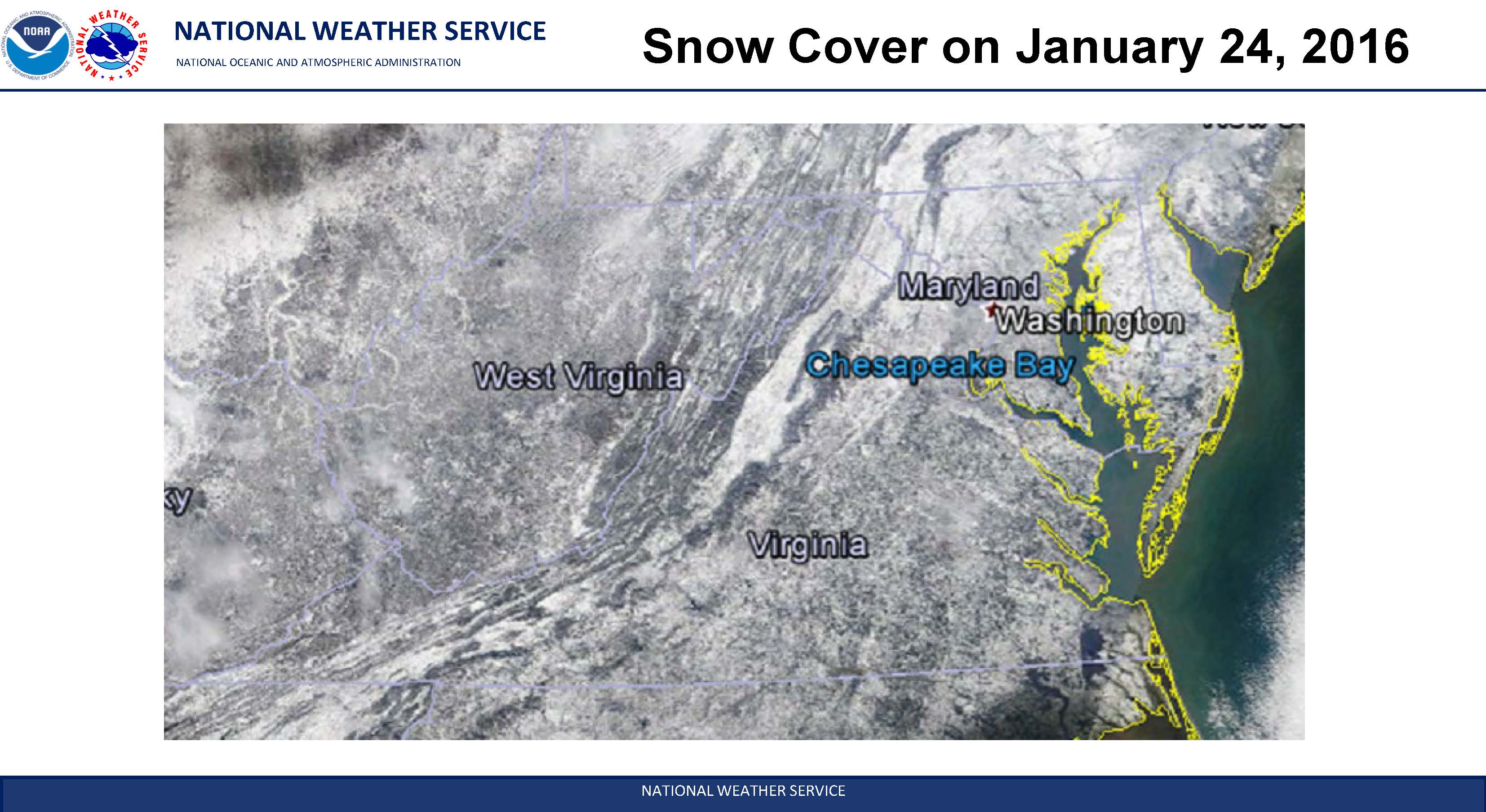
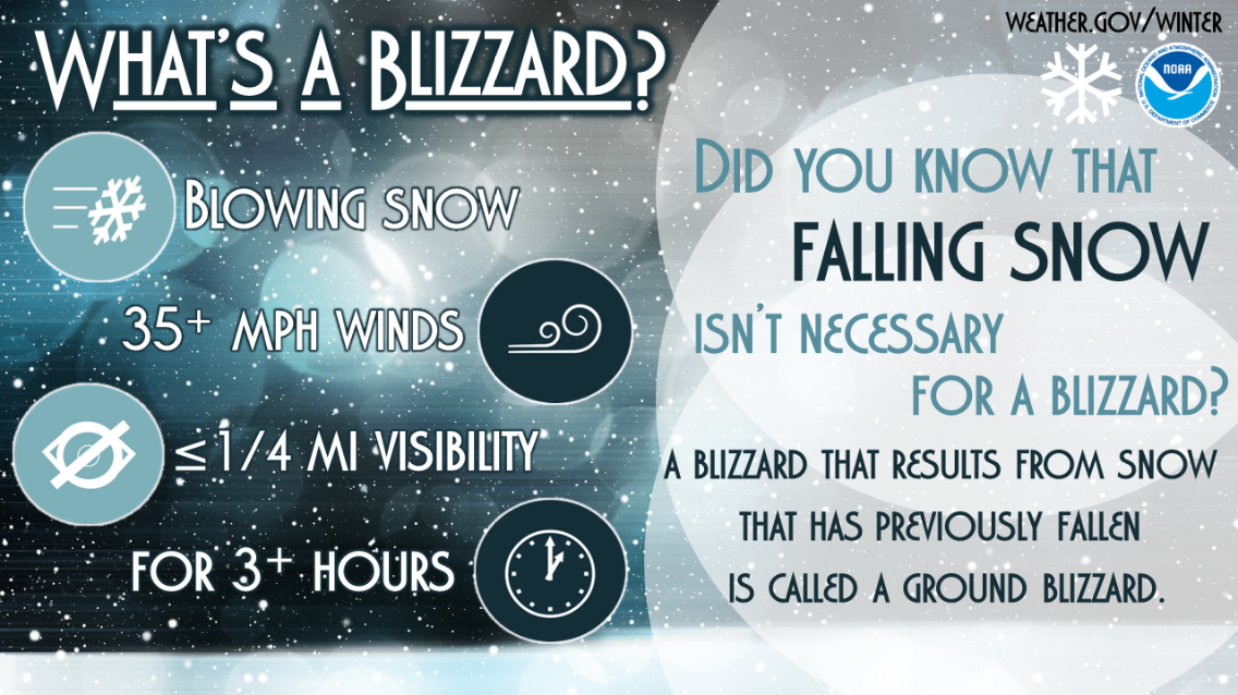
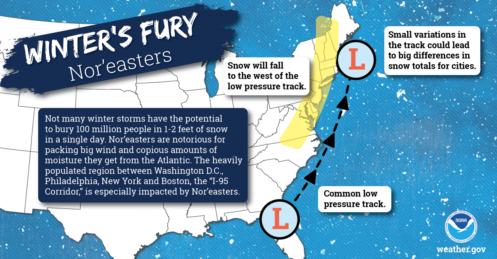
The most dangerous winter weather systems for Maryland, which can produce major amounts of snow and ice, are strong coastal low pressure systems known as nor'easters. These types of storms can impact the region any winter, most notably in 2009-10 when we had an unprecedented 3 in one winter. But on average, they happen once every several years.
Our most recent was 9 winters ago on January 22 - 23, 2016, when Maryland was impacted by a nor'easter with heavy snow. 1-3 feet of snow fell over Maryland, with lesser amounts over the southern Eastern Shore. At the same time, strong winds produced blizzard conditions over part of the state. The maps below show just how much snow fell with this storm. Here are snow reports from that event that include the southern Eastern Shore from NWS Wakefield, as well as an event page from NWS Mt. Holly that includes the northern Eastern Shore, and an event page from NWS Baltimore/Washington.
 |
 |
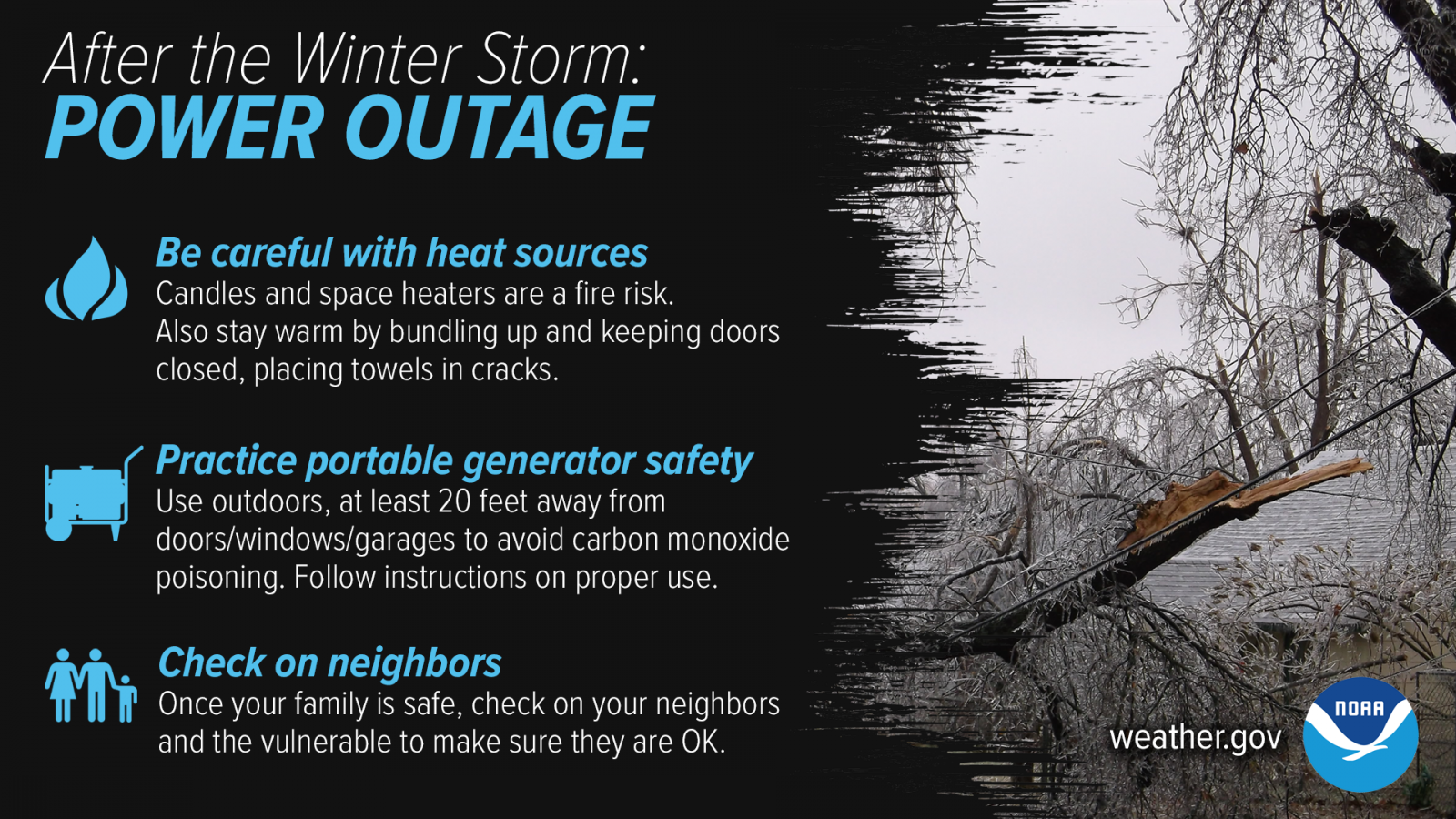
Winter storms can make driving and walking extremely dangerous. The aftermath of a major winter storm can have a devastating impact for days or even weeks. Winter storms can be deceptive killers because most deaths are indirectly related to the storm. People die in traffic accidents on icy roads, have heart attacks while shoveling snow, or succumb to fires or carbon monoxide while trying to heat their home improperly. With proper planning and preparation, you can limit or even mitigate the impacts from winter storms.
Lastly for today, The National Weather Service needs accurate snowfall measurements during winter storms. Those accurate snowfall measurements help us to adjust continually update the forecast and warnings during the event. Are you willing to be a snow observer to help the NWS? If so, become a NWS spotter with us!. Register for one of our SKYWARN weather spotter classes (as they become available through the winter) for: the southern Eastern Shore (AKQ), northern Eastern Shore (PHI), or for the rest of Maryland (LWX).

Winter infographics
 |
 |
 |
 |
 |
 |
Wednesday
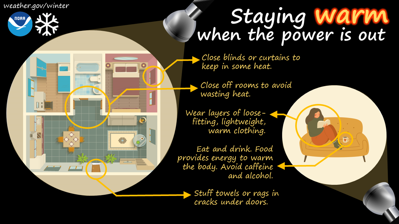
Excessive Cold and Preparing your home for winter
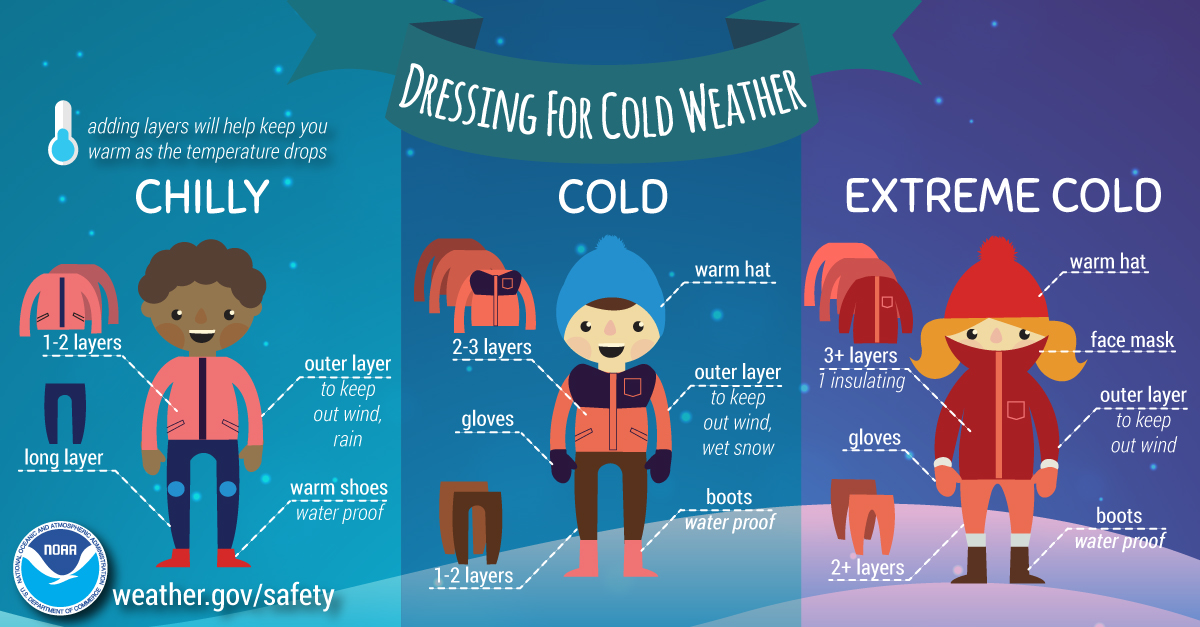
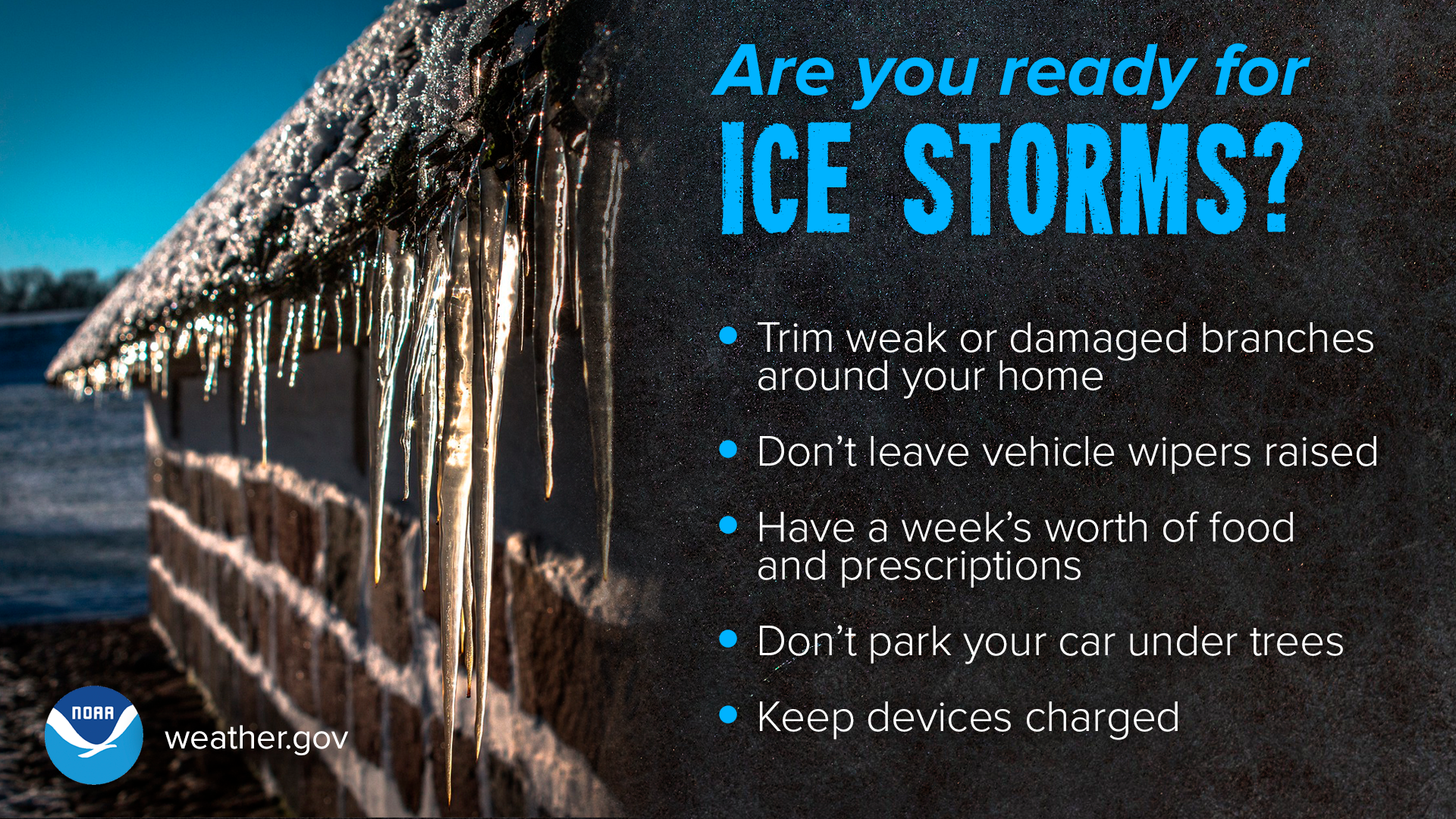
Cold weather is a fact of winter. With the cold temperatures comes an increase in the number of house fires. House fires resulting from heating material within the home ranks second for the most deaths and property loss. Chimney fires are the number one cause of home heating fires and typically the result of a poorly maintained chimney where creosote is allowed to build up. Space heaters are typically involved in 25 perfect of home heating fires and account for 74 percent of the deaths. Be sure to test smoke and carbon monoxide detectors and replace any broken detectors and dead batteries.

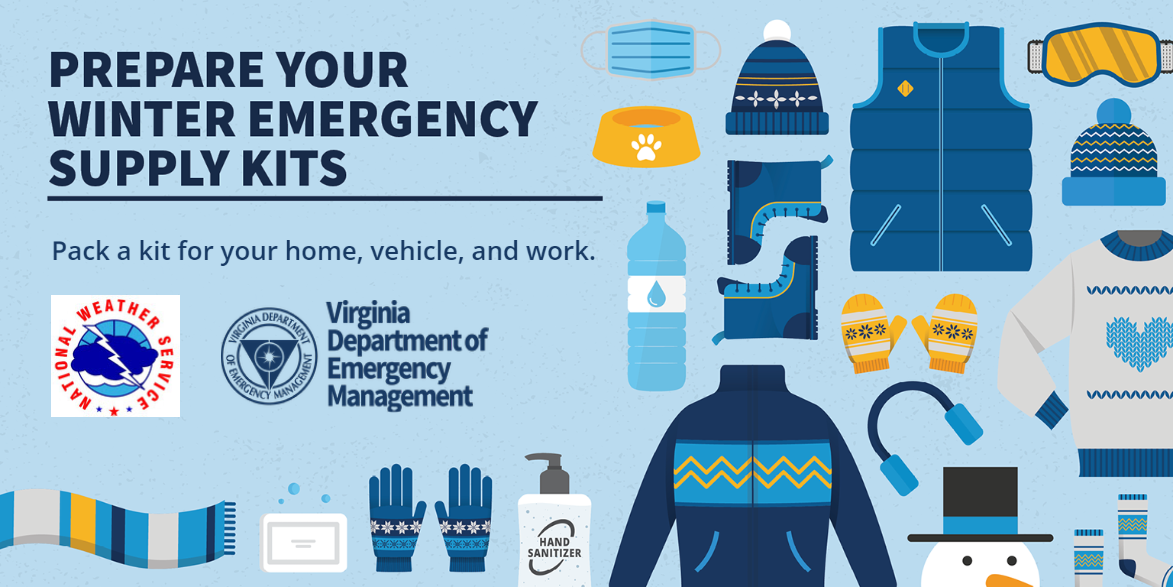
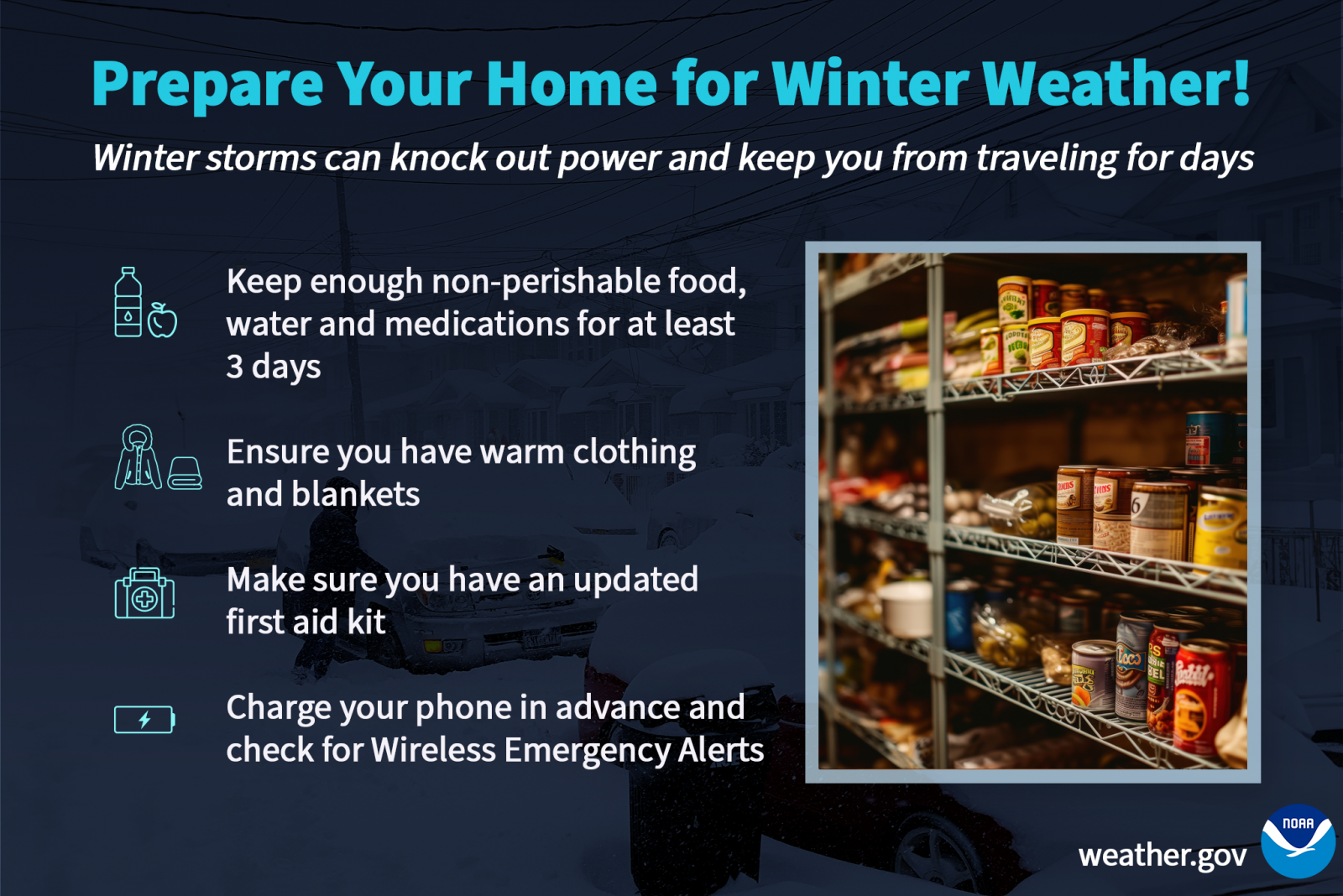
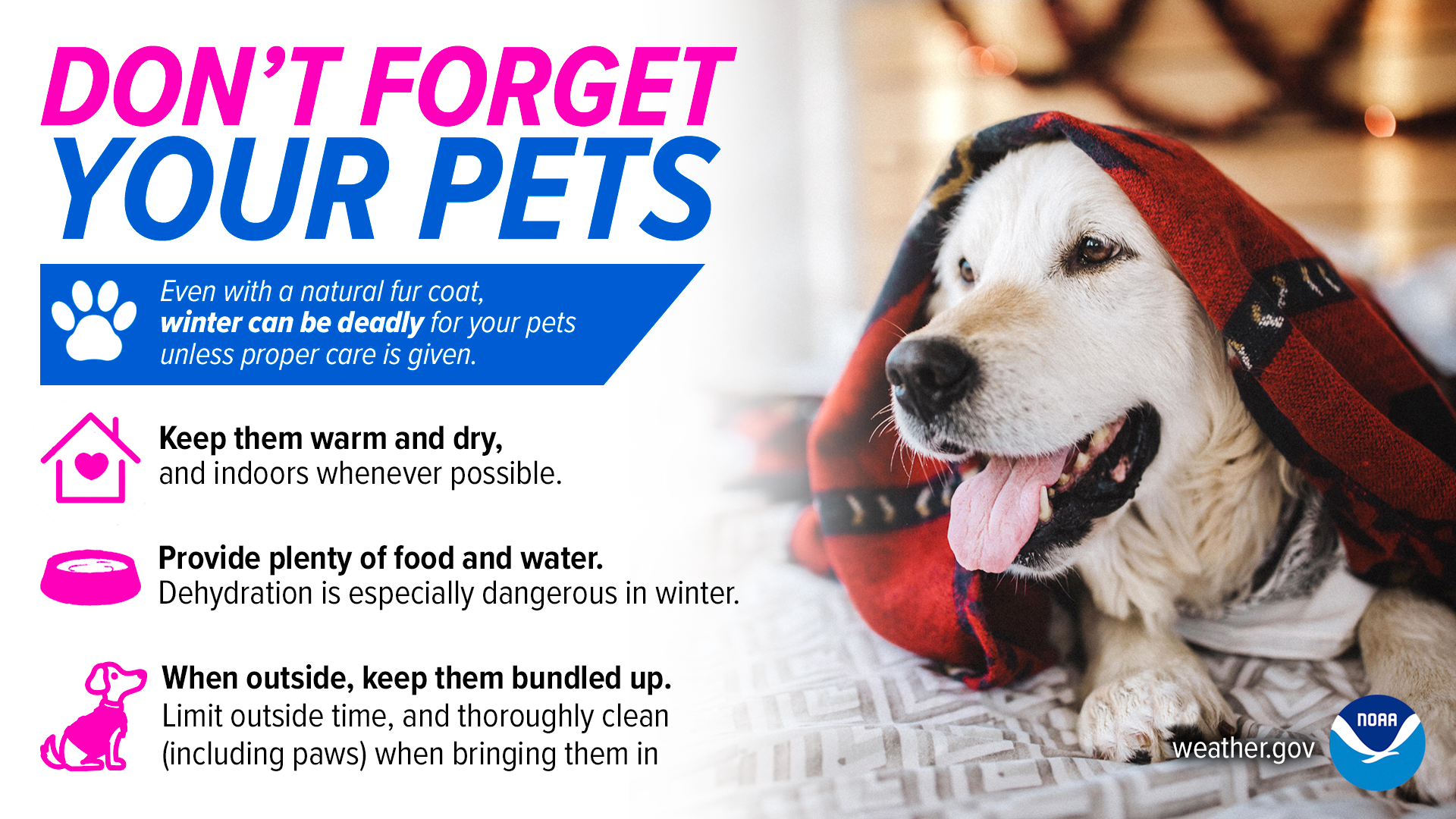
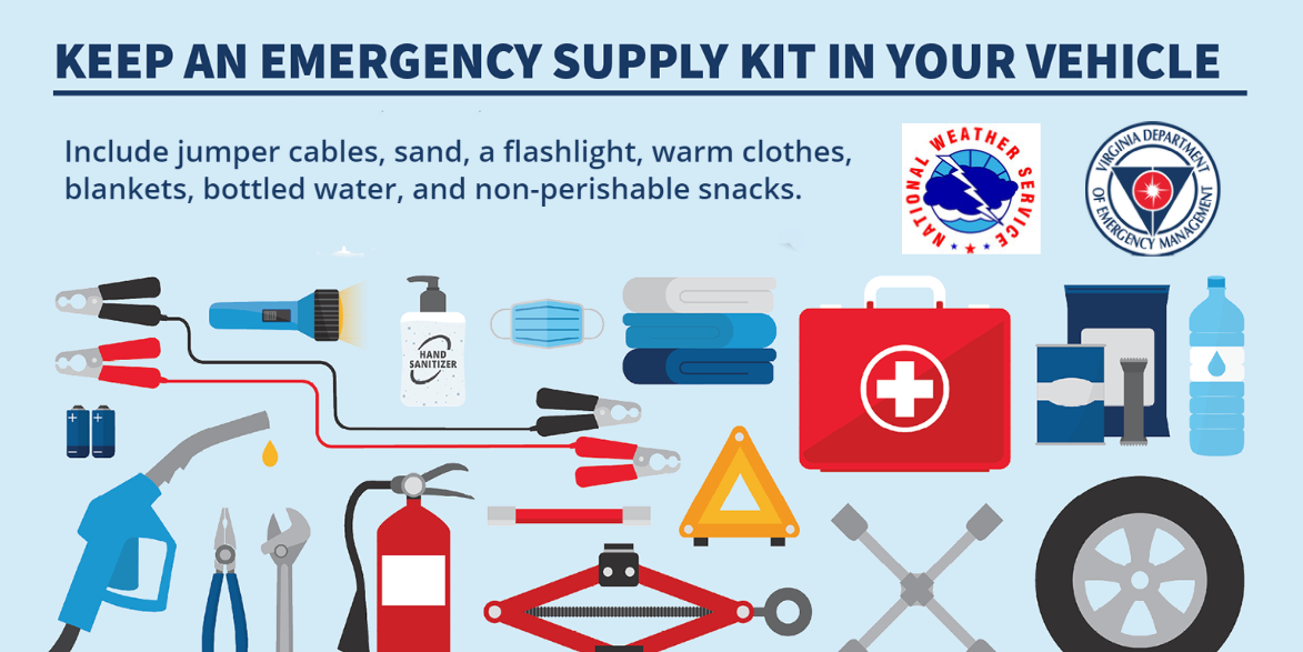
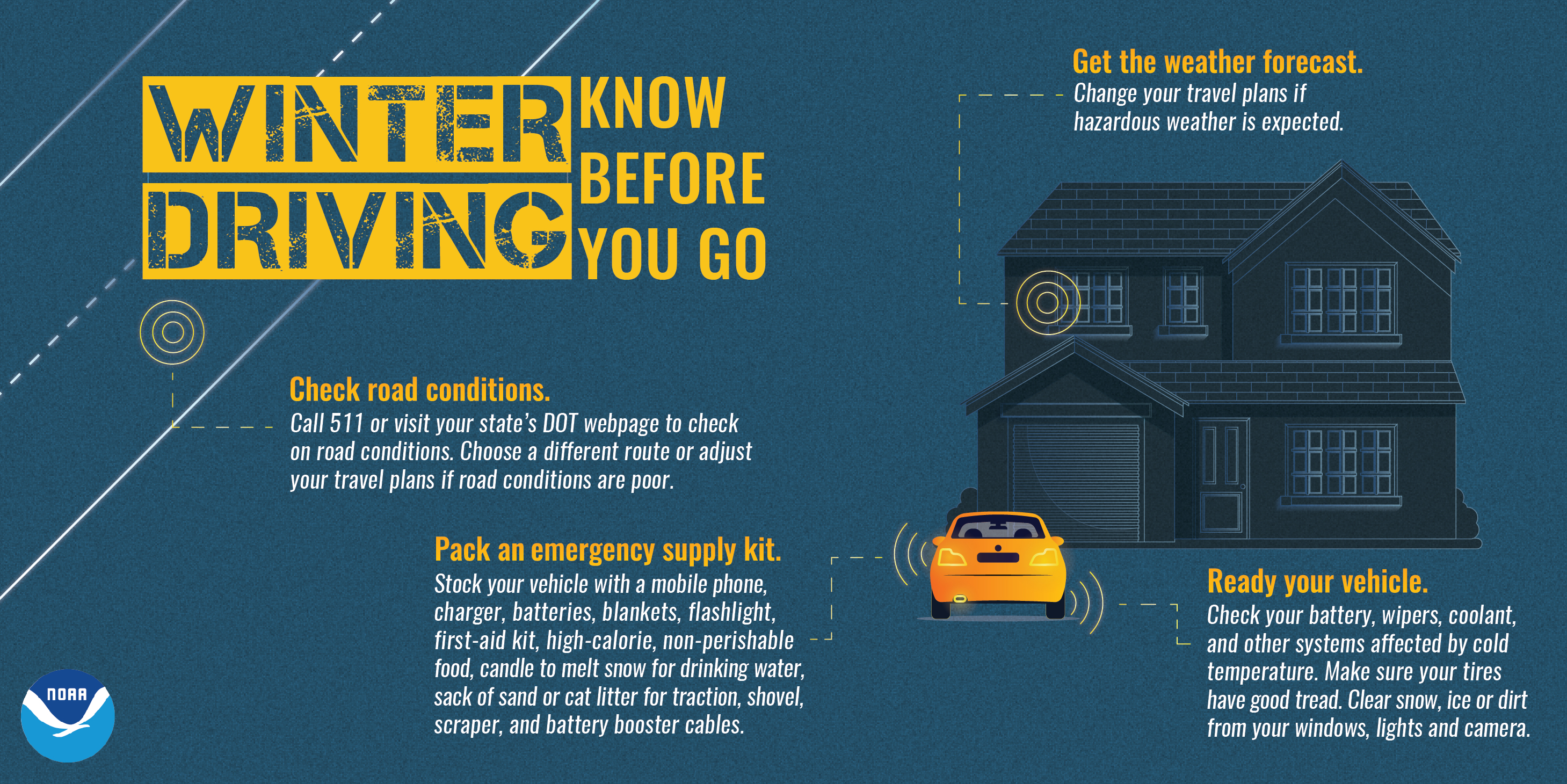
Severe winter storms can produce conditions which can isolate you in your home for several days. Prolonged loss of power can severely limit your ability to heat your home. Also obtaining supplies, food and other necessities can be hampered or prevented by poor road conditions. Make sure to stock an emergency supply of food and water prior to the onset of a winter storm. Include food items which require no cooking such as canned meats, peanut butter and other non-perishables. Also do not forget to have necessary medicines and baby items on hand. A three to five day supply of food and medicine is generally sufficient. A lot of these items may already be in your home from your hurricane kit.
Example home emergency supply kit
Winter infographics
 |
 |
 |
 |
Thursday
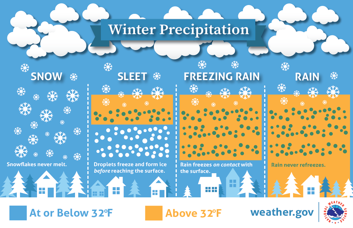
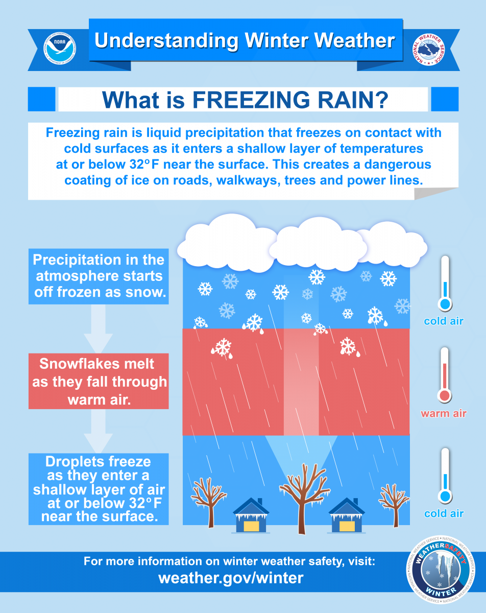
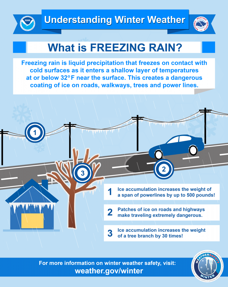
Dangers associated with freezing rain and sleet
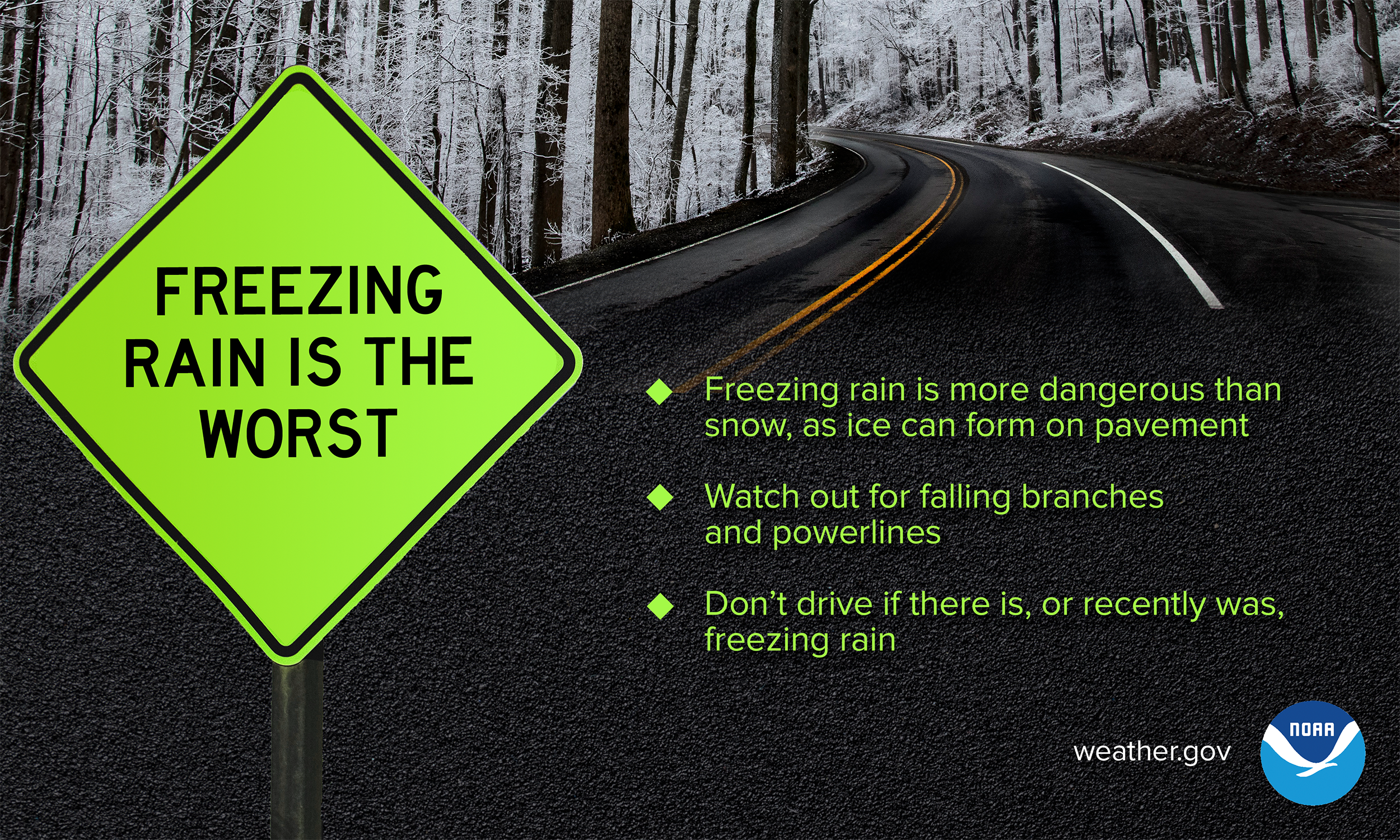
Ice falling in the form of freezing rain is particularly dangerous and poses a variety of problems. The ability of freezing rain to accumulate on nearly every surface, including trees, power lines, and bridges, makes it one of the most dangerous forms of winter weather. Just the smallest accumulation of ice glaze from freezing rain can cause vehicle accidents or a slip and fall from your front porch when you first venture out. As little as a quarter of an inch of freezing rain can create widespread power outages.
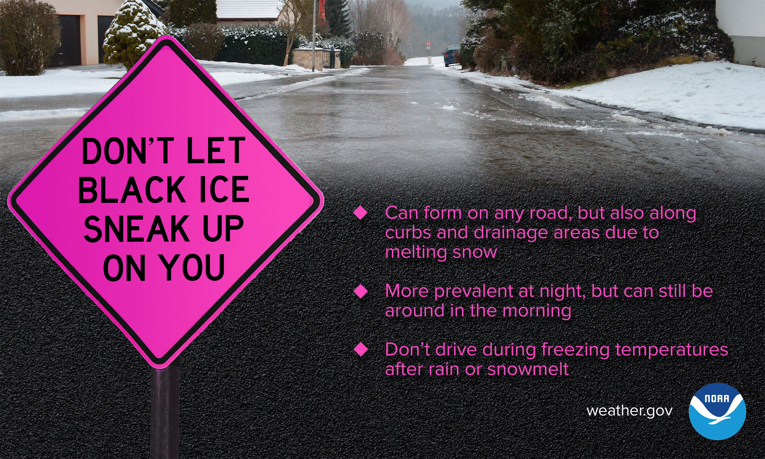
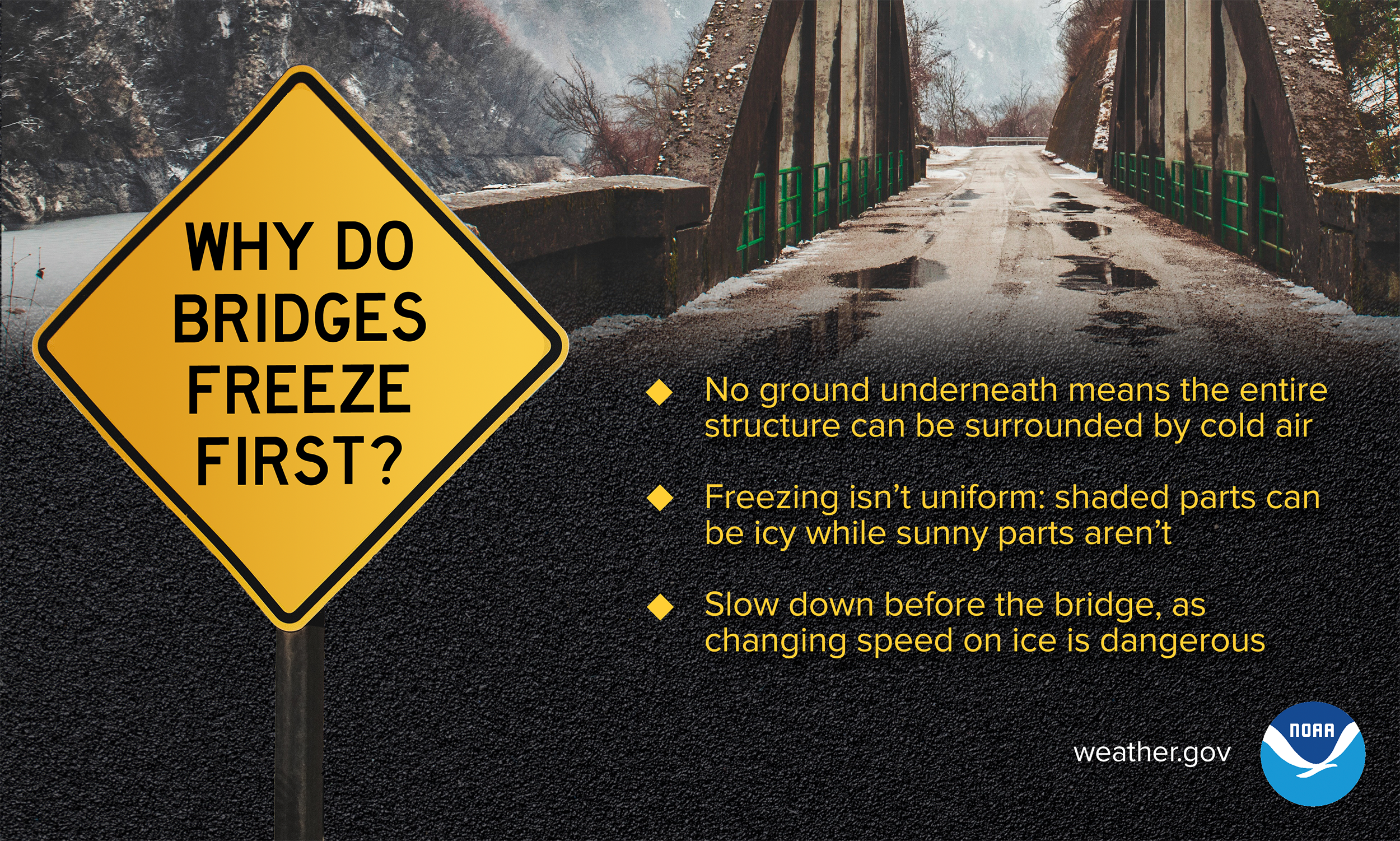
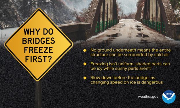
When driving, ice can be very difficult to recognize. The roadway may appear to be wet when in reality when appears to be water may actually be ice. If the temperature outside is below freezing, ice can form on the roads, especially on bridges and overpasses. When encountering ice, do not panic and do not stomp on your brakes. It is safer to slowly decelerate to a stop.
Because of the warm waters of the Gulf Stream just off our eastern coast, it is common for the line between rain and snow to reside over or near the I-95 corridor and Baltimore and Washington metros. When a storm strikes, a common setup is for areas to the southeast of I-95 to see rain, or a mixture of snow & ice turning to rain . Meanwhile areas to the northwest receive more snow, often mixing with ice (sleet and freezing rain) at times. A total ice storm with heavy ice accumulations, is less common. However, February 1994 provided one within a winter that featured several freezing rain events.
During the winter of 1993-1994, repeated storms from January into early March produced between 19 and 23 days of icy precipitation over greater metropolitan area. The worst storm struck on February 10-11, 1994 just from Fredericksburg VA through southern and central Maryland. Freezing rain in those areas caused a thick glaze of ice across trees, power and phone lines and roads. Travel was extremely hazardous. Trees and utility lines fell under the weight of the ice. Some people were left without power and heat for up to two weeks due to the extent of the damage. This storm warranted a Presidential Disaster declaration for a swath of devastation from ice that stretched from Tennessee to Delaware. Damage to Maryland was estimated at over $20 million.
Winter infographics
 |
 |
 |
 |
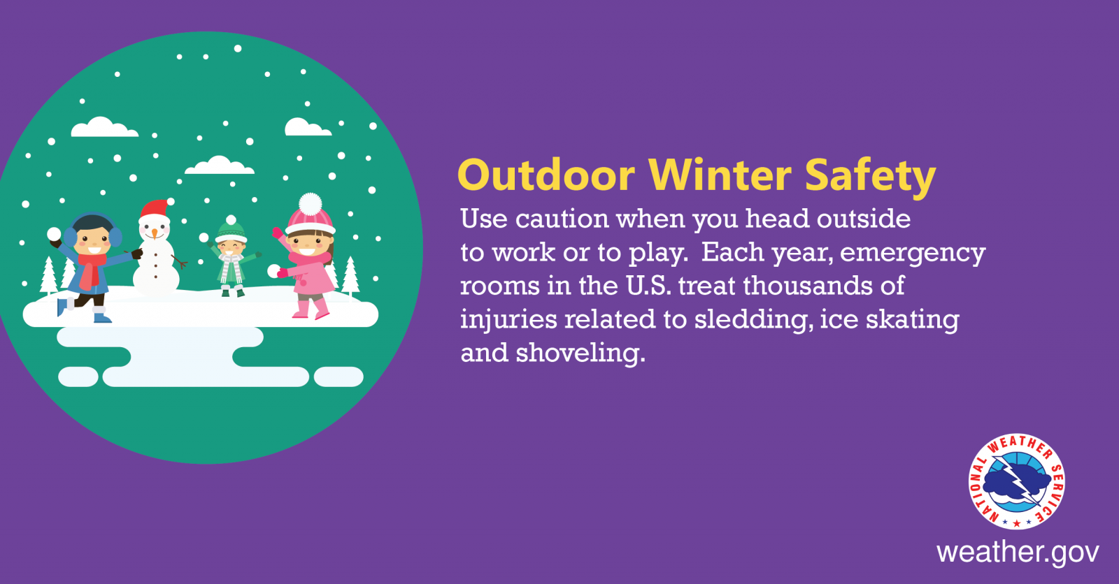
Friday
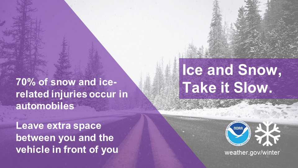
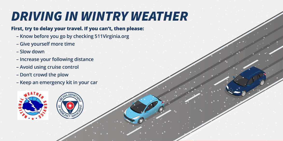
Driving in winter weather
Seventy-five percent of all winter weather related deaths occur on the road, either in accidents or by people becoming stranded. When the weather is bad and driving conditions are poor, the best bet is to stay at home
Here are some additional tips from our partners at Maryland's Department of Transportation.
Winter infographics
 |
 |
 |
 |
 |
 |
Frequently Asked Questions
What items should be included in a vehicle Winter Storm Kit?
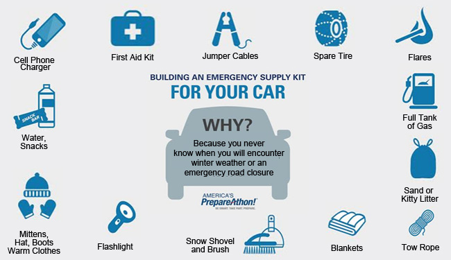
Get more information at build your winter storm kit and prepare for cold weather.
What is the polar vortex?
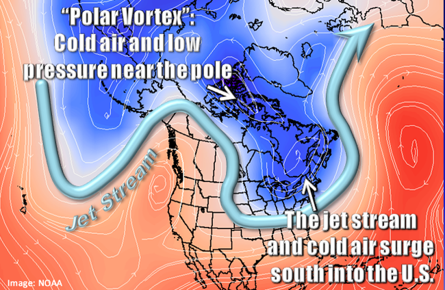
The polar vortex is a large area of low pressure and cold air surrounding both of the Earth’s poles. It ALWAYS exists near the poles, but weakens in summer and strengthens in winter. The term "vortex" refers to the counter-clockwise flow of air that helps keep the colder air near the Poles. Many times during winter in the northern hemisphere, the polar vortex will expand, sending cold air southward with the jet stream (see graphic above). This occurs fairly regularly during wintertime and is often associated with large outbreaks of Arctic air in the United States.
Get more information at: Polar Vortex FAQ.
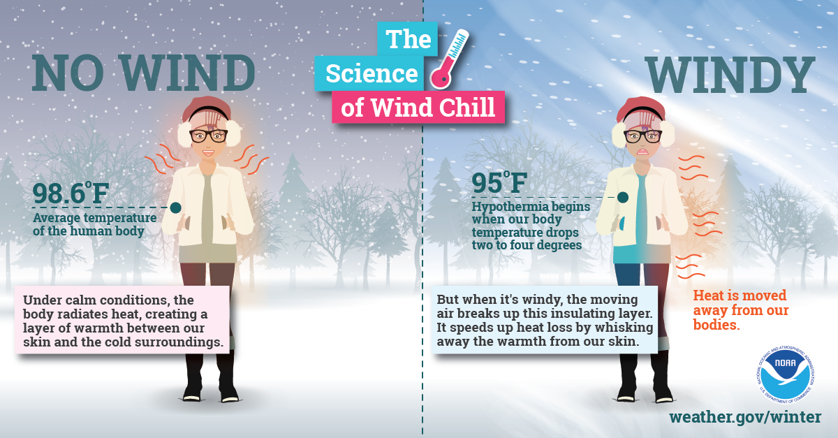
What is Wind Chill, and how is it calculated?
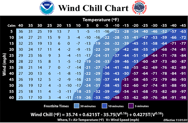
Wind Chill is how cold people or animals feel when outside. Wind chill is based on the rate of heat loss from exposed skin caused by wind and cold. As the wind increases, it draws heat from the body, driving down skin temperature and eventually the internal body temperature. Therefore, the wind makes it FEEL much colder. If the temperature is 0°F and the wind is blowing at 15 mph, the wind chill is -19°F. At this wind chill temperature, exposed skin can freeze in 30 minutes. The wind chill temperature is calculated using the following formula:
Wind chill (ºF) = 35.74 + 0.6215T - 35.75(V^0.16) + 0.4275T(V^0.16)
Where: T = Air Temperature (F)
V = Wind Speed (mph)
^ = raised to a power (exponential)
Wind chill Temperature is only defined for temperatures at or below 50°F and wind speeds above 3 mph. Bright sunshine may increase the wind chill temperature by 10°F to 18°F.
More information on Wind Chill is included at Wind Chill FAQs.
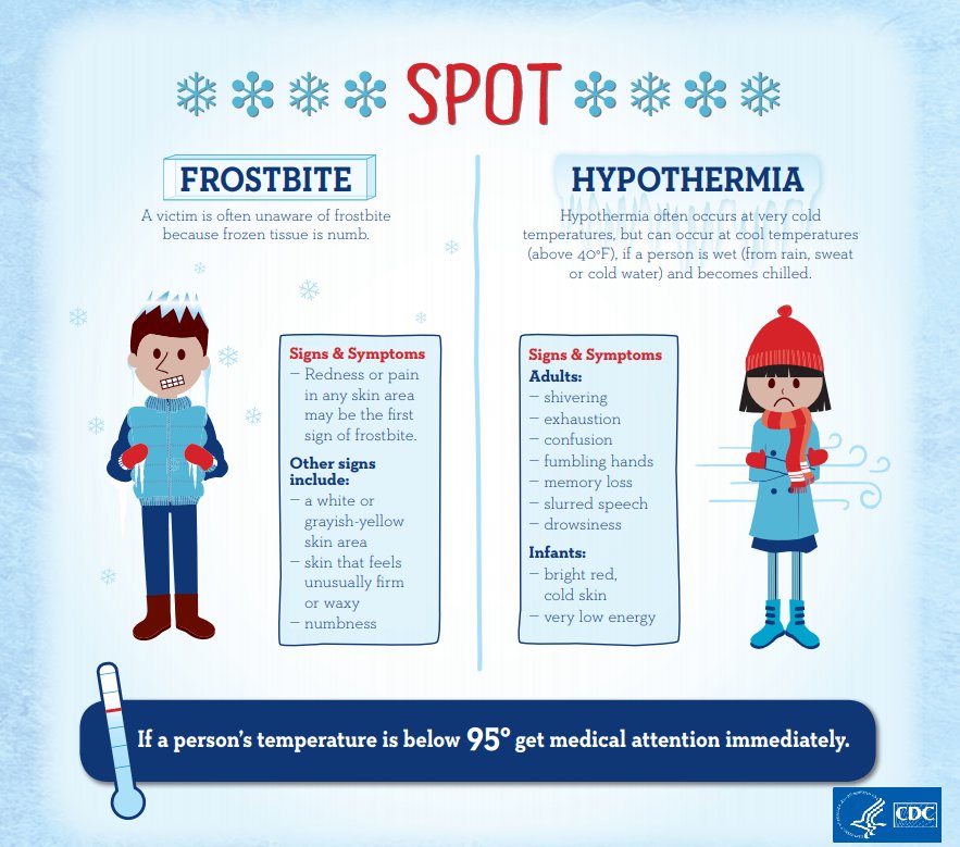
What is the difference between frostbite and hypothermia?
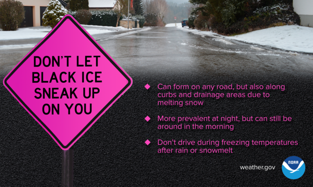
What is meant by black ice?
Why do bridges and overpasses freeze before other surfaces?
What is a snow squall, and what is the difference between a snow squall and a snow storm?
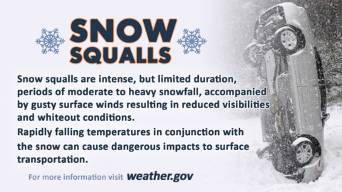
More information is available at Snow Squall FAQ.
Find us on social media:
You can also contact:
Eric Seymour (Eric.Seymour@noaa.gov) for additional information about Maryland's 2024 Winter Weather Preparedness Week.


 Youtube
 Coastal Flood
 Heat
Heat