| Space Weather for: |
Aviation Community |
Radio Communications |
Power Companies |
Emergency Management |
Space Weather Enthusiasts |
|
 |
|
Space Weather Impact Charts (Click chart below corresponding to NOAA Scale above)
|
|
Click to enlarge
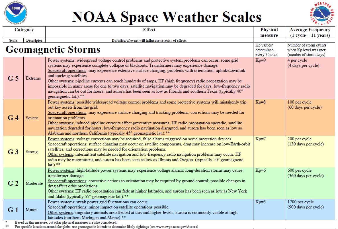 Geomagnetic Storm Impacts Geomagnetic Storm Impacts |
Click to enlarge
 Solar Radiation Storm Impacts Solar Radiation Storm Impacts |
Click to enlarge
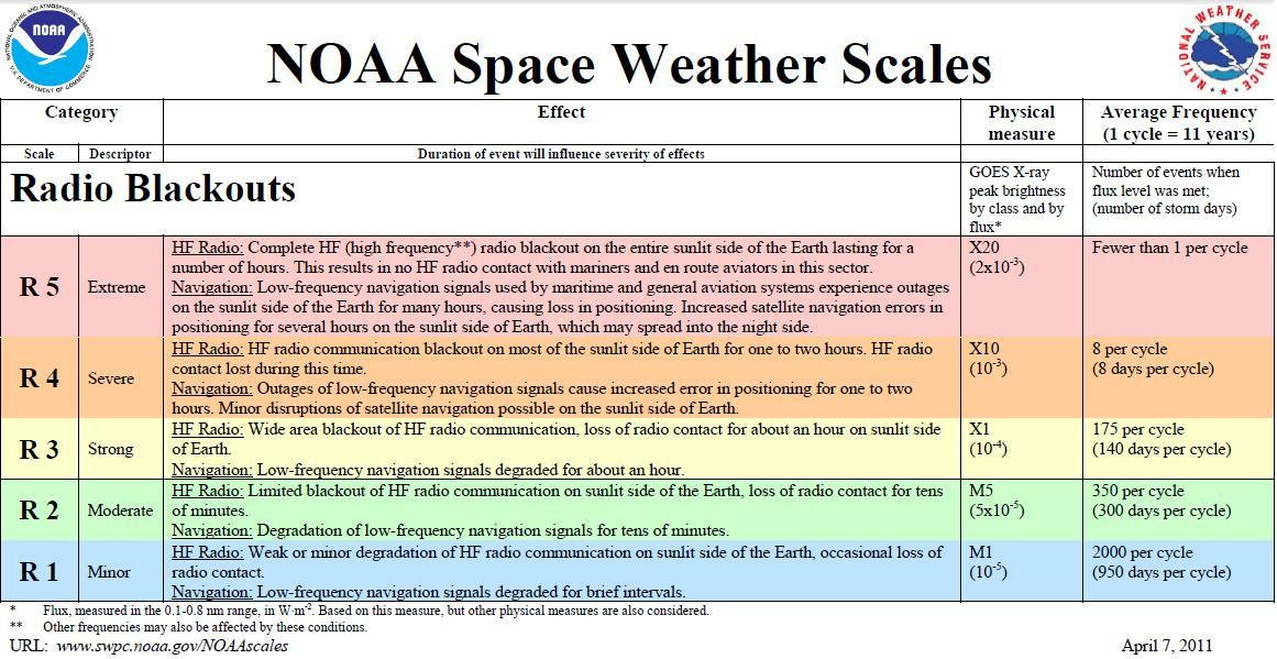 Radio Blackouts Impact Scale Radio Blackouts Impact Scale |


 Coastal Flood
 Heat
Heat