National Weather Service United States Department of Commerce

Latest Aviation Discussion:

.AVIATION /07Z THURSDAY THROUGH MONDAY/...
As of 135 AM EDT Thursday... 

VFR conditions prevail through this evening before deteriorating
tonight. Today will be dry despite a weak cold front crossing
the area during the morning-midday. Expect clear skies outside
of FEW-SCT cumulus during the late morning-aftn. Winds will
become NW at 5-10 kt by late morning-midday. Then, a backdoor 
cold front crosses the terminals from NE to SW between 21-03z. 
Winds become NE at ~10 kt (could see a brief period of 20 kt
gusts near the coast) following the FROPA. In addition, MVFR- 
IFR stratus likely overspreads the entire area tonight/early 
Fri AM as the front moves well SW of the terminals. MVFR to IFR
CIGs are likely at all of the terminals after 06z Fri.

Outlook: Conditions slowly improve Friday (although restrictions
may persist at SBY through much of the day) as the backdoor
front retreats to the NE. A stronger cold front arrives from the
NW and crosses the area late Friday/Friday night with scattered
showers. Rain chances generally end after Sat morning, but 
return later Sunday into early Monday as low pressure passes 
through the Carolinas.

&&


This discussion and more can be found in the Area Forecast Discussion.


Aviation Forecasts

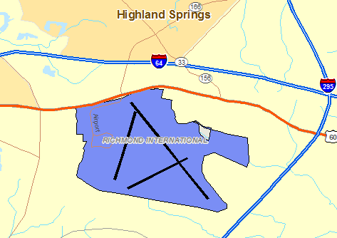
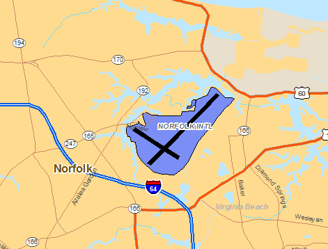
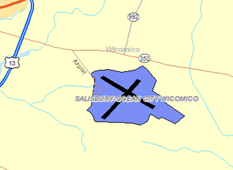
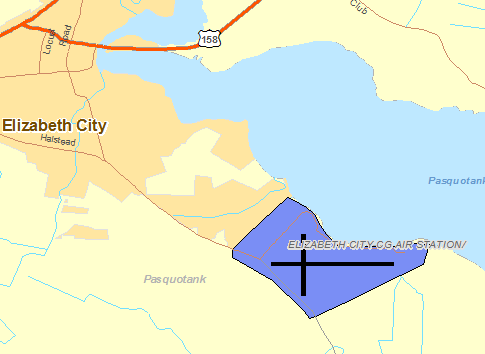
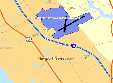
The National Weather Service Office in Wakefield, VA has responsibility for five Terminal Aerodrome Forecasts or TAFs in Virginia, Maryland and Northeast North Carolina.   Click on the RUNWAY on the map below to view the latest TAF.

RICHMOND

  TERMINAL FORECAST (TAF)

  24 HRS OF OBSERVATIONS

  FAA DETAILS

  TABULAR FORECAST

  RIC TAF BOARDRichmond TAF & Current Observation


NORFOLK

  TERMINAL FORECAST (TAF)

  24 HRS OF OBSERVATIONS

  FAA DETAILS

  TABULAR FORECAST

  ORF TAF BOARDClick for Latest Norfolk TAF & Observation


SALISBURY

  TERMINAL FORECAST (TAF)

  24 HRS OF OBSERVATIONS

  FAA DETAILS

  TABULAR FORECAST

  SBY TAF BOARDClick for Latest Salisbury TAF & Observation


ELIZABETH CITY

  TERMINAL FORECAST (TAF)

  24 HRS OF OBSERVATIONS

  FAA DETAILS

  TABULAR FORECAST

  ECG TAF BOARD

Click for Latest Elizabeth City TAF & Observation


NEWPORT NEWS/WILLIAMBURG

  TERMINAL FORECAST (TAF)

  24 HRS OF OBSERVATIONS

  FAA DETAILS

  TABULAR FORECAST

  PHF TAF BOARD


Click for Latest Newport News/Williamburg TAF & Observation


Center Weather Service Unit Products

One Center Weather Service Unit (CWSU) covers the NWS Wakefield, VA County Warning Area. Use the buttons on the map or....CLICK HERE to view either a Meteorological Impact Statement (MIS) or Center Weather Advisory (CWA) issued by the CWSUs.  For complete AVIATION WEATHER CENTER products click here.

Interactive Aviation Map (mouse over & CLICK for Observations)


See Complete MESONET MAP & OBS

Decoded/Raw Text

  • 24 hour decoded observations for Virginia Portion of our CWA...
  • 24 hour decoded observations for Maryland Portion of our CWA...
  • 24 hour decoded observations for North Carolina Portion of our CWA...

Surface Weather Maps

Wind Rose Data

  • RICHMOND WIND ROSE DATA...
  • NORFOLK WIND ROSE DATA...

Miscellaneous