
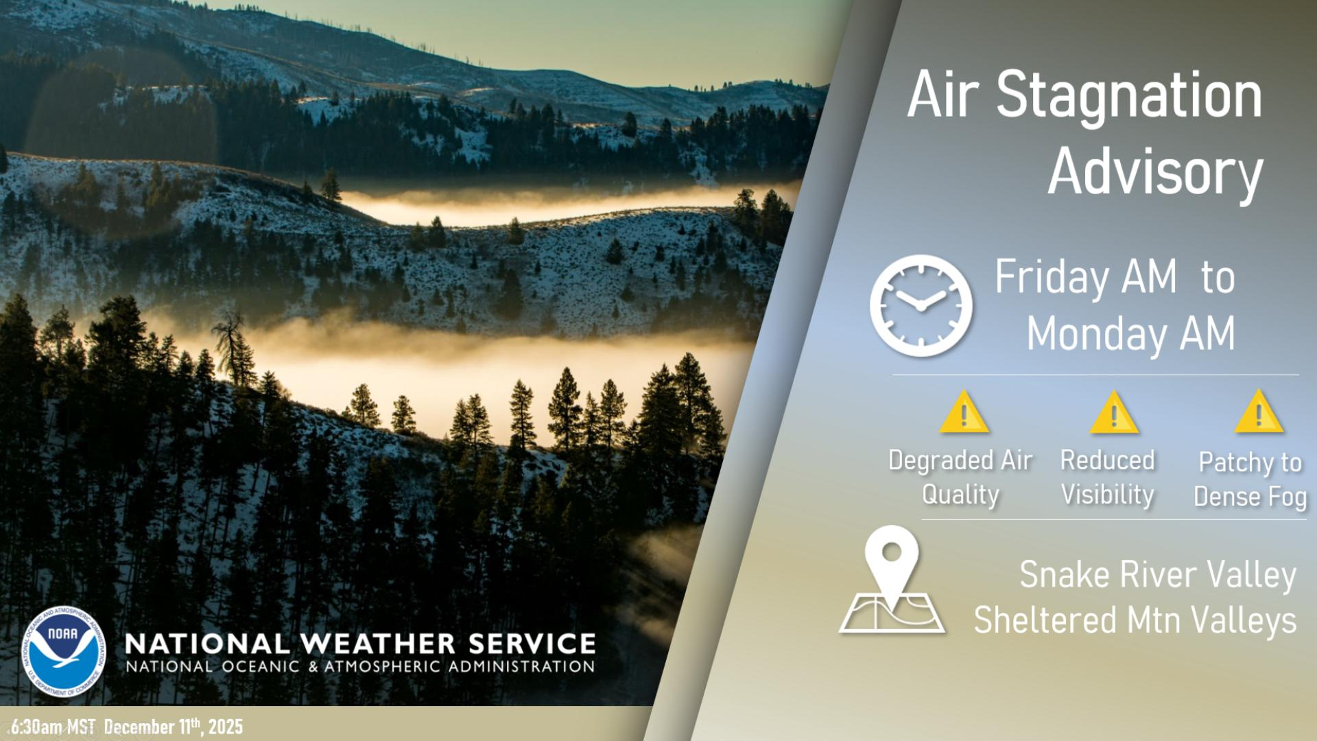
Extreme heat continues today from the central Plains to the lower Mississippi River Valley, over southeast Montana, and from southern California into the Southwest Deserts. Extreme Heat Warnings remain in effect. Severe thunderstorms capable of strong to severe wind gusts and large hail are possible across the Great Lakes into the Ohio Valley today into tonight. Read More >
Last Map Update: Mon, Jul 27, 2026 at 10:04:10 am MDT


 Social Media
 Radar
Radar Satellite
 Surface Weather Maps
 Tabular Forecasts
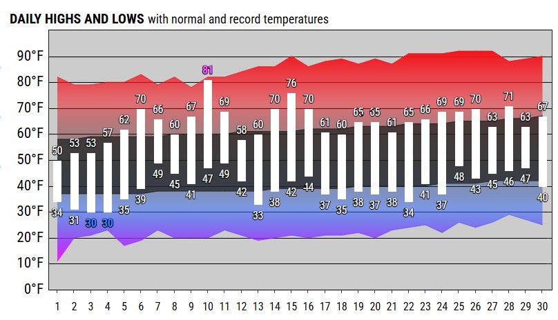 Month Charts
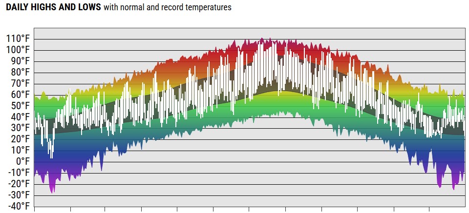 Year Charts
 Web Cameras
 Area Forecast Discussion
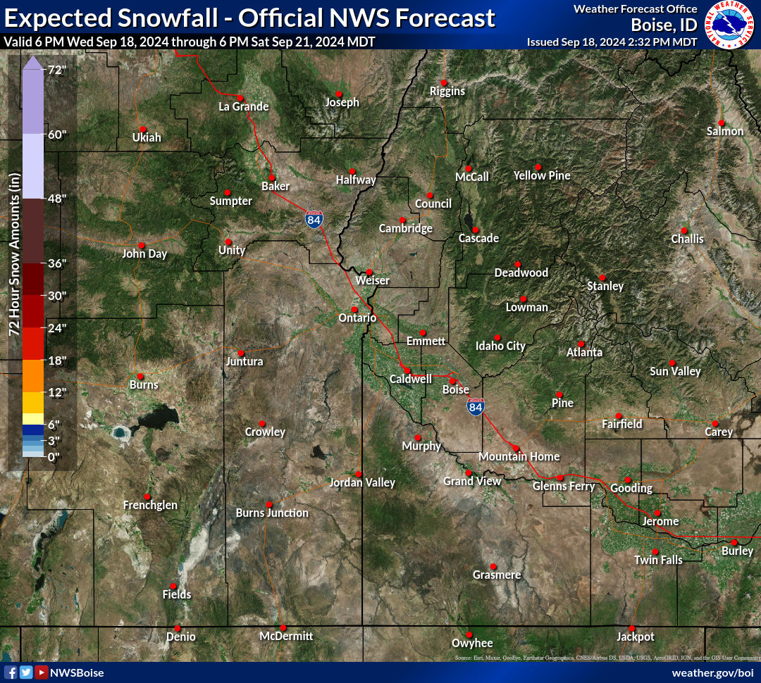 Probabilistic Snow Information
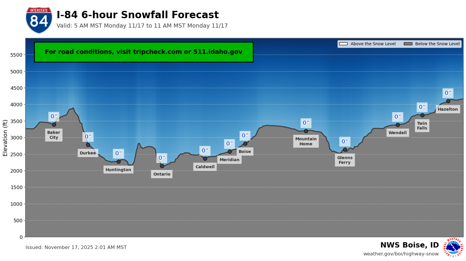 Highway Snow Profiles
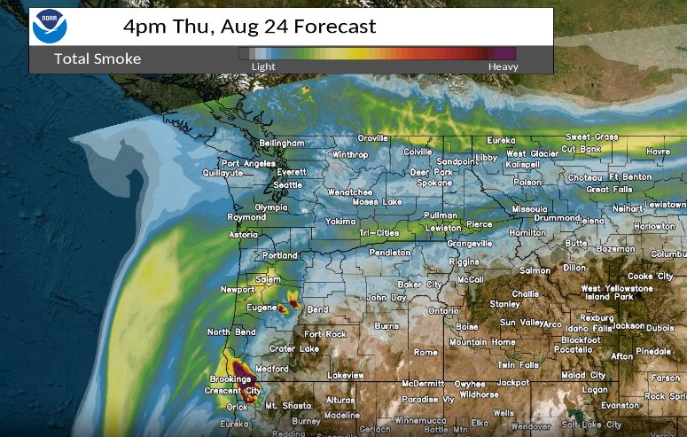 Experimental Smoke Forecast
 Aurora 30min Forecast
 Submit Reports