
Dangerous and extreme heat will remain across portions of the southern U.S. this week. Heavy rainfall may bring significant flash flooding across portions of the Mid-Atlantic and Northeast through the night, and additional flash flooding concerns across New England on Wednesday. Monsoonal thunderstorms will bring a flash flood risk to the Four Corners region, especially in burn scar areas Read More >

For Moderate/High/Extreme hazard risk, more detailed information will be provided via emailed briefings to core partners.
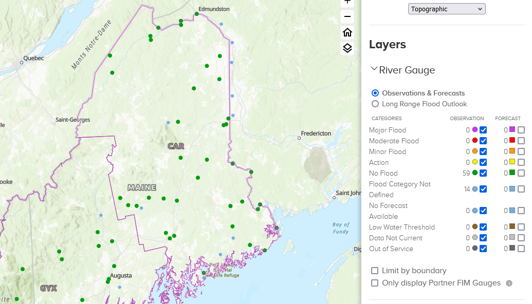 |
River Forecast PointsMap displays river points in Maine and New Hampshire. Just click on the point where you want a forecast. Map is updated every time a new observation or forecast is generated. |
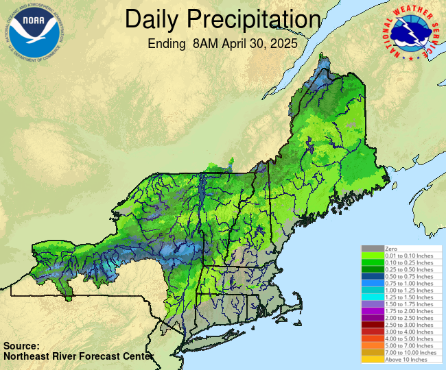 |
Observed PrecipitationNortheast River Forecast Center |
 |
24Hr QPF ForecastMap displays 24hr forecasted precipitation amounts. Map is updated every time the forecaster issues a new forecast. |
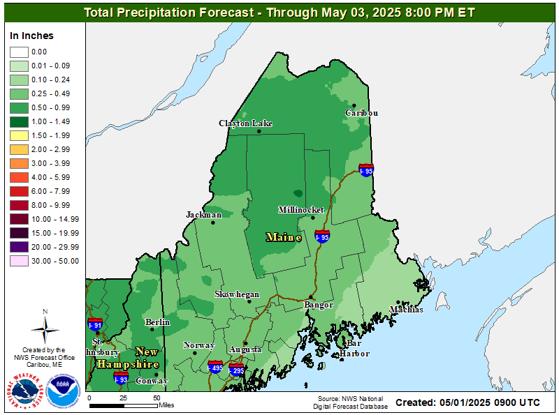 |
2.5 Day QPF ForecastMap displays 2.5 Day forecasted precipitation amounts. Map is updated every time the forecaster issues a new forecast. |
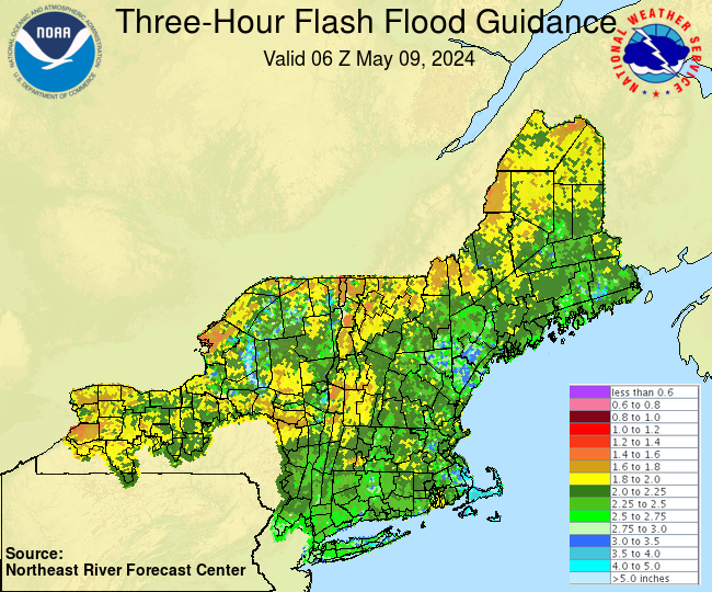 |
Flash Flood GuidanceFlash Flood Guidance is an estimate of the amount of rainfall required over a given area during a given duration to cause small streams to flood issued by Northeast River Forecast Center. |
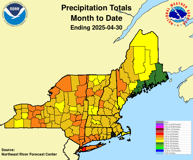 |
Precipitation / DepartureThe precipitation totals used in these graphics and the accompanying text products are from the 6-hourly county mean areal precipitation calculated for use in the NERFC's Community Hydrologic Prediction System. |
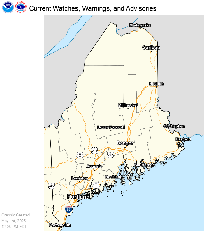 |
Weather HazardsMap displays active watch, warnings, advisories and short term forecasts in the lower 48 states. Map automatically refreshes every five minutes. |
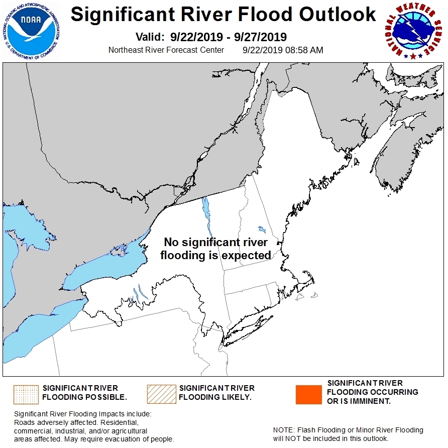 |
Significant River Flood OutlookThis Flood Outlook is intended to provide a general outlook for significant river flooding. It is not intended to depict all areas of minor flooding or small-scale events such as localized flooding and/or flash flooding. |
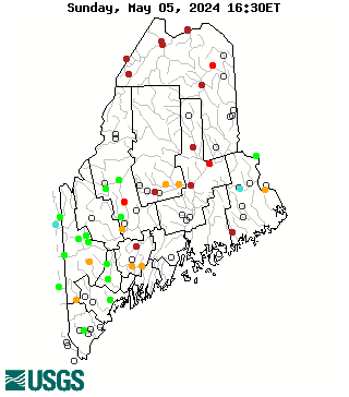 |
Historical StreamflowMap of real-time streamflow compared to historical streamflow for the day of the year. |
 |
National Snow AnalysesIncludes data on snow water equivalent, snow depth and more. The data can be view for a day or animated for a two week period or a seaon. NERFC: Observed Snow Maps |


 Coastal Flood