State College, PA
Weather Forecast Office
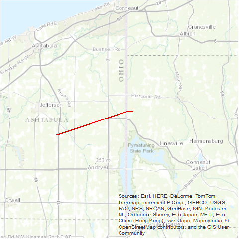
A tornado touched down 5 miles southeast of Jefferson, OH along state Route 193 just north of Dorset. The tornado moved east-northeast, passing just south of Pierpoint and continuing into Pennsylvania. The tornado ended one mile north of Pennline, PA. This storm damaged several homes and farm buildings. It also caused extensive tree damage and widespread utility outages.
Source: NCDC Storm Data: May 1985; Volume 27, Number 5
US Dept of Commerce
National Oceanic and Atmospheric Administration
National Weather Service
State College, PA
328 Innovation Blvd, Suite 330
State College, PA 16803
(814)954-6440
Comments? Questions? Please Contact Us.


 Send Us a Report