
Tropical Depression Two is expected to gradually strengthen and could bring tropical storm conditions to the Florida Panhandle beginning late Monday. Areas of flash flooding will be possible through Thursday along the eastern and central Gulf Coast. Severe thunderstorms will develop and move along a cold front crossing the Upper Midwest Monday, and through the Ohio Valley/Mid-Atlantic on Tuesday. Read More >
| Snow / Ice | Heat | Cold | Wind | Frost / Freeze | Fog | Fire |
Winter Precipitation
Statements for these hazards will be issued under the header "PHLWSWCTP (WWUS41 KCTP)."
|
||||||||||||||||||||||||
Non-Precipitation Phenomena
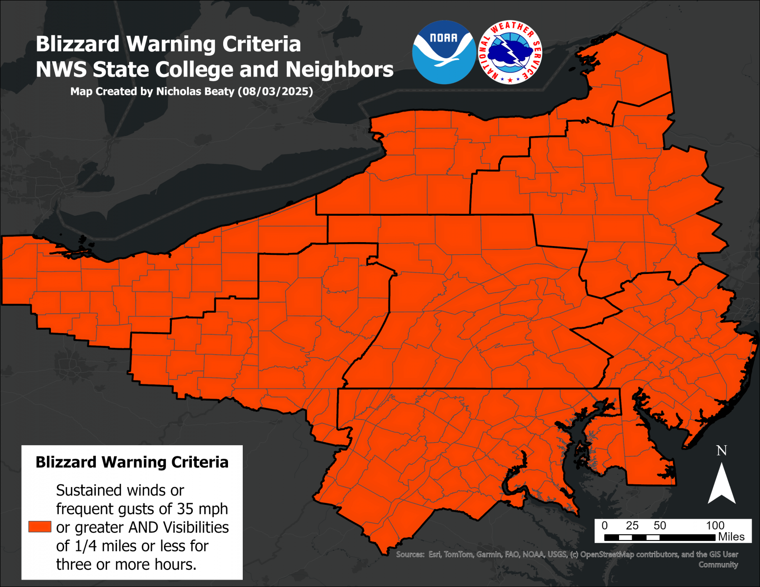
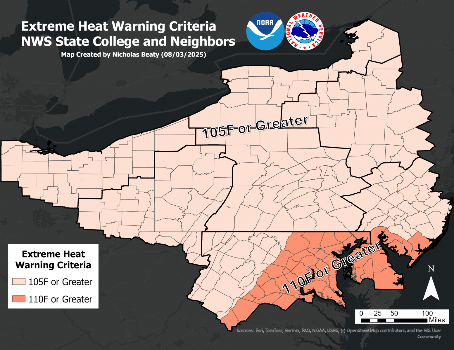
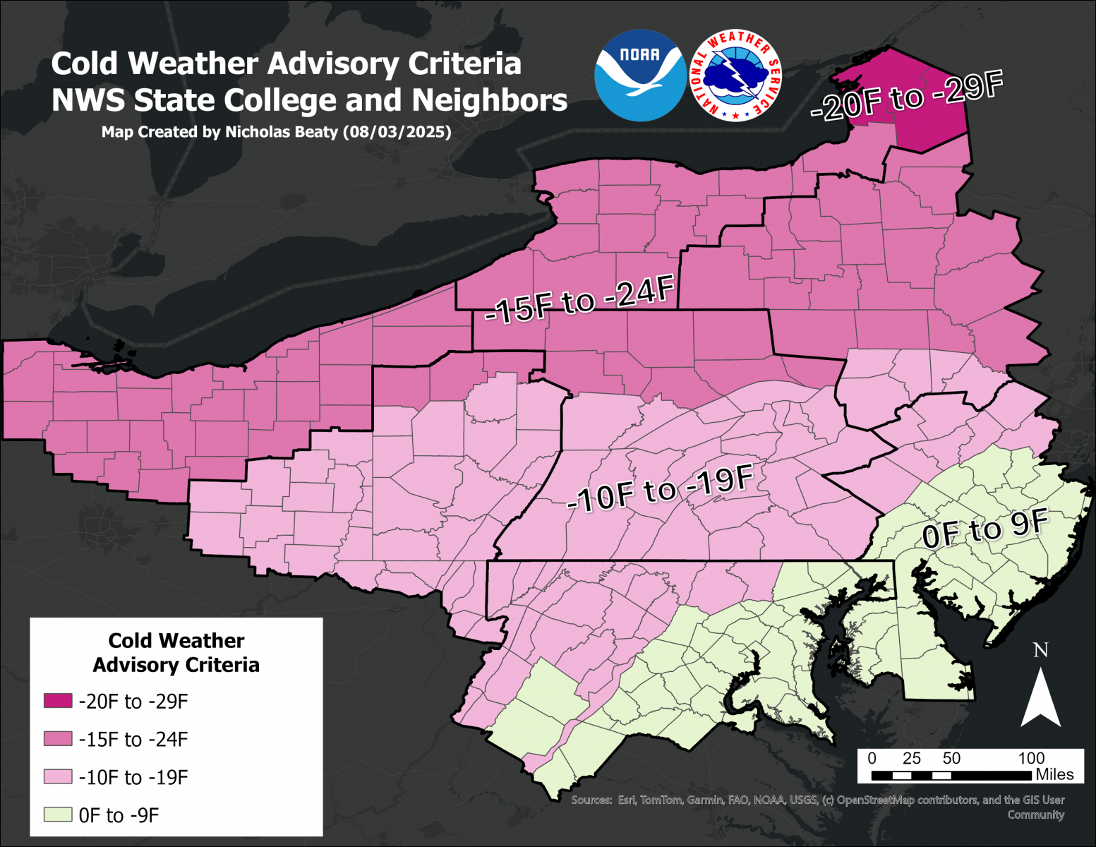
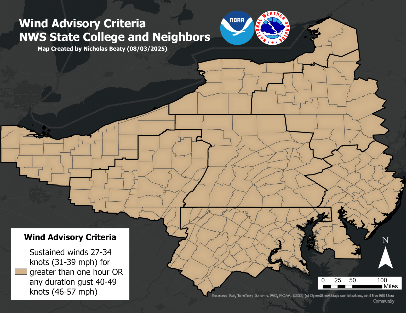
The State College NWS Office will issue Advisories and Warnings under the header "PHLNPWCTP (WWUS71 KCTP)" for these situations:
|
||||||||
Non-Precipitation Phenomena Warning Terminology
The State College NWS Office will issue Advisories and Warnings under the header "PHLNPWCTP (WWUS71 KCTP)" for these situations:
|
||||||||||
Non-Precipitation Phenomena Warning Terminology
The State College NWS Office will issue Advisories and Warnings under the header "PHLNPWCTP (WWUS71 KCTP)" for these situations:
|
||||||||
Non-Precipitation Phenomena Warning Terminology
The State College NWS Office will issue Advisories and Warnings under the header "PHLNPWCTP (WWUS71 KCTP)" for these situations:
|
Non-Precipitation Phenomena Warning Terminology
The State College NWS Office will issue Advisories and Warnings under the header "PHLNPWCTP (WWUS71 KCTP)" for these situations:
|
||||||
Fire Weather Products
The State College NWS Office will issue these two Fire Weather related products under the header "PHLRFWCTP (WWUS81 KCTP)" for situations when the following criteria are met:
|


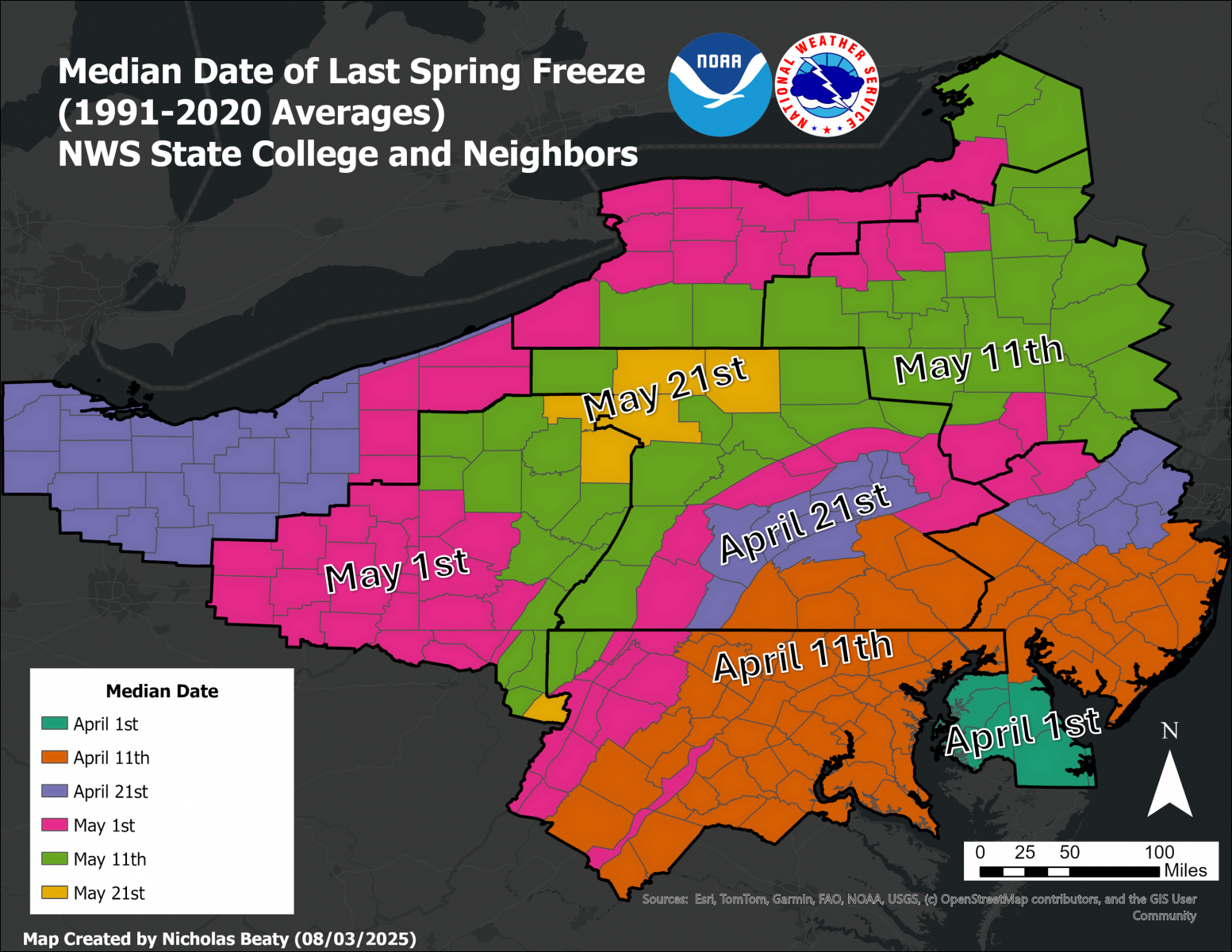 See a map of the Median Date of the Last Freeze in Spring
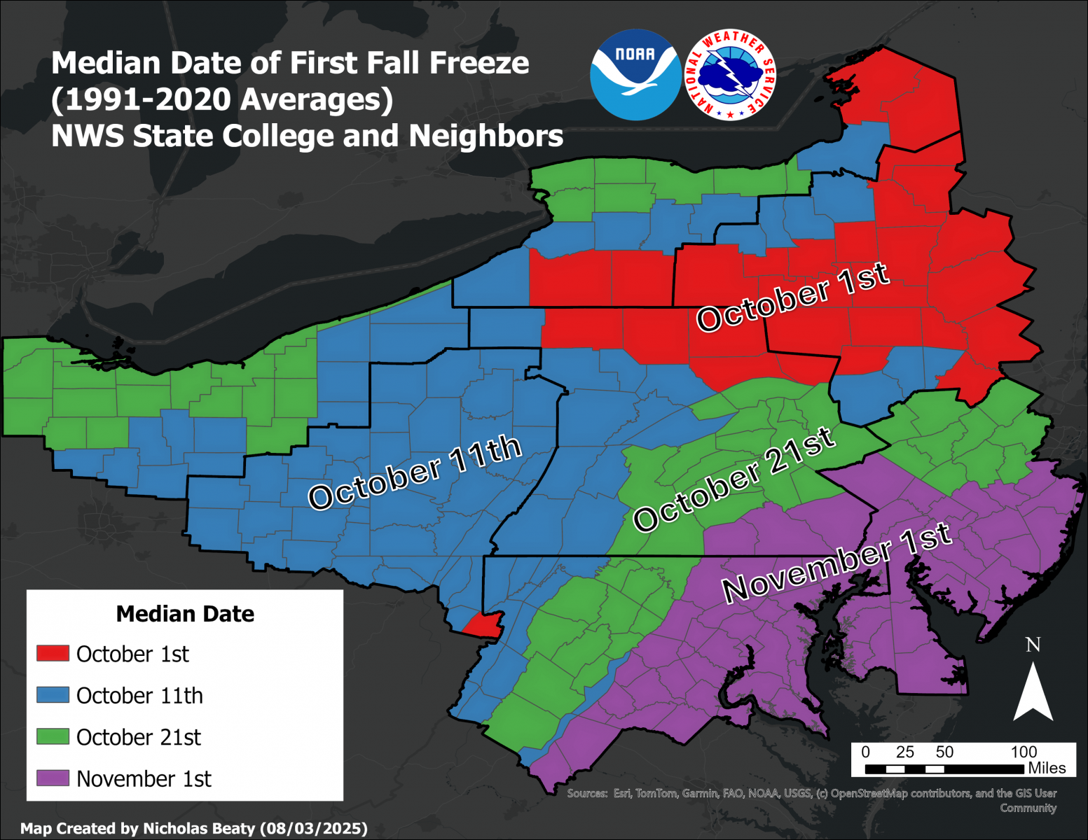 Median Date of the First Autumn Freeze
 Send Us a Report