Southern Clearfield County, PA (near Whiteside and Morann)
OVERVIEW
Public Information Statement
National Weather Service State College PA
448 PM EDT Sun Jul 19 2026

...NWS Damage Survey for 07/18/26 Tornado Event...

.Overview...

A damage survey conducted on Sunday July 19th confirmed an EF-1
tornado occurred in Whiteside, PA south of Houtzdale in Clearfield
County on the evening of Saturday July 18, 2026. The tornado
produced extensive damage along Morann Avenue (PA-153), N
Railroad Street, and Hale Rd. Details of the survey follow.

..Houtzdale Tornado...

Rating:                 EF1
Estimated Peak Wind:    110 mph
Path Length /statute/:  1.00 miles
Path Width /maximum/:   400 yards
Fatalities:             0
Injuries:               0

Start Date:             07/18/2026
Start Time:             08:16 PM EDT
Start Location:         2 S Houtzdale / Clearfield County / PA
Start Lat/Lon:          40.7995 / -78.359

End Date:               07/18/2026
End Time:               08:18 PM EDT
End Location:           2 SSE Houtzdale / Clearfield County / PA
End Lat/Lon:            40.7914 / -78.3434

Survey Summary:
Tree damage began near the northwest terminus of Gum Street and
continued east-southeast toward Morann Avenue (PA-153). Several
pine trees were snapped off halfway up between Gum Street and
Hemlock Street along with minor damage to a few structures. Upon
crossing Morann Avenue, the tornado moved across N Railroad street
and continued to produce extensive damage to trees and power
lines. A single wide mobile home and adjacent vehicle were shifted
slightly northeast as winds surged around the south side of the
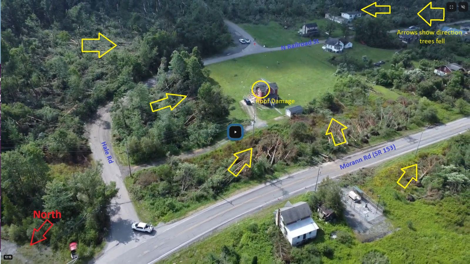
circulation. Farther northeast toward the intersection of N
Railroad St and Hale Rd, a chimney was ripped off the side of a
house and a couple trees fell northwest/upwind. Seeing trees fall
opposite the direction of the tornado`s motion provided the
confidence to lean toward the upper end of damage indicators,
making this a high-end EF-1 at 110mph.

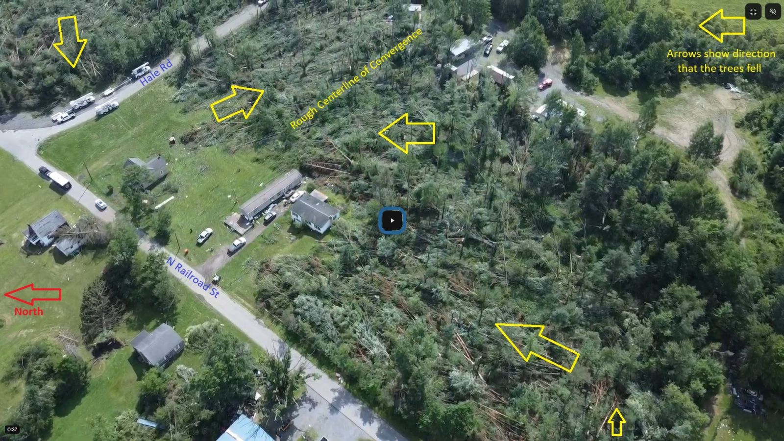
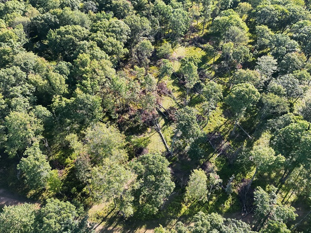
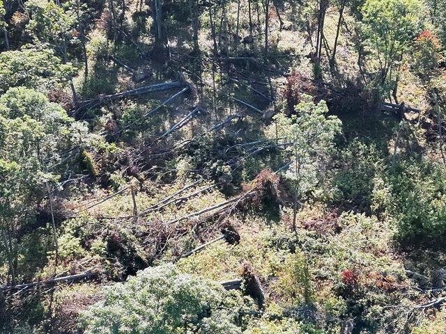
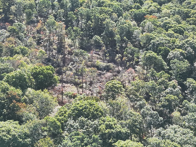
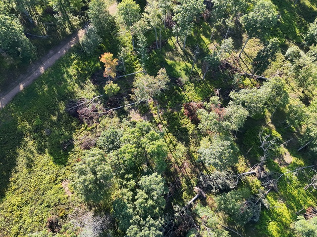
Remarkably, there was only very minor damage to many of the
structures in the path of this tornado, but extensive snapping of
trees. In particular, the forested area southeast of N Railroad
Street and southwest of Hale Rd suffered extensive tree fall.
Dozens to perhaps hundreds of trees were knocked over and/or
snapped off. The camp owner at the top of the hill at the
southeast edge of the forested area remarked that he could not
previously see the mountain to his northwest. His previously
"shaded" camp now had a much improved view, he said. Again, little
to no damage occurred to any of the structures (campers and a
cabin) at the camp, but extensive tree damage occurred. The
tornado then briefly lifted/stopped producing damage to the
southeast of a hilltop as it crossed an open field. Damage resumed
as the tornado moved back into a forested area along Hale Rd
toward Sonia Ln. Extensive tree and powerline damage was observed
along that stretch with a convergent pattern of tree fall. The
damage became much more sporadic as the circulation crossed
Moshannon Creek, marking the end of the tornado path.

NWS State College would like to send a sincere thanks to
Clearfield County Department of Emergency Services and the
Houtzdale Fire Company for their assistance with today`s survey.
Additional surveys may be conducted in the coming days for this
severe weather event and additional Public Information Statements
will be sent as needed.

&&

EF Scale: The Enhanced Fujita Scale classifies tornadoes into the
following categories:

EF0.....65 to 85 mph
EF1.....86 to 110 mph
EF2.....111 to 135 mph
EF3.....136 to 165 mph
EF4.....166 to 200 mph
EF5.....>200 mph

NOTE:
The information in this statement is preliminary and subject to
change pending final review of the event and publication in
NWS Storm Data.
PHOTOS
DRONE PHOTOS (courtesy Clearfield County Dept of Emergency Services)
RADAR IMAGES
Vanscoyoc Hollow EF0 Tornado
Northern Blair County, PA
OVERVIEW
Public Information Statement
National Weather Service State College PA
407 PM EDT Thu Jul 23 2026

...NWS Damage Survey for 07/18/26 Tornado Event...

.Overview...
A damage survey conducted on Thursday July 23rd confirmed an EF-0
tornado occurred northwest of Olivia in Blair County on the
evening of Saturday July 18, 2026. The tornado produced pockets of
tree damage along and just south of Vanscoyoc Hollow Rd in the
vicinity of Camp Anderson. Details of the survey follow.

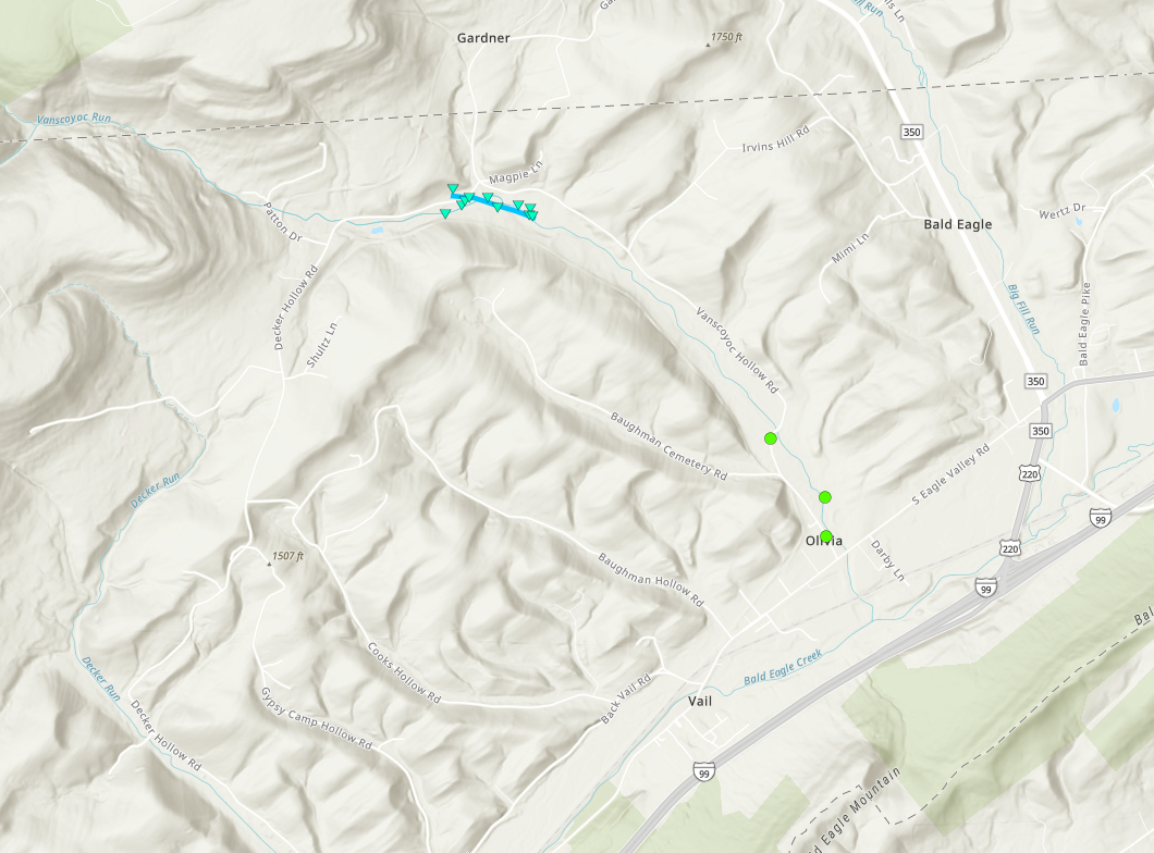
..Vanscoyoc Hollow Rd Tornado...

Rating:                 EF0
Estimated Peak Wind:    85 mph
Path Length /statute/:  0.37 miles
Path Width /maximum/:   150 yards
Fatalities:             0
Injuries:               0

Start Date:             07/18/2026
Start Time:             08:29 PM EDT
Start Location:         3 W Bald Eagle / Blair County / PA
Start Lat/Lon:          40.7342 / -78.2321

End Date:               07/18/2026
End Time:               08:30 PM EDT
End Location:           3 W Bald Eagle / Blair County / PA
End Lat/Lon:            40.7329 / -78.2253

Survey Summary:
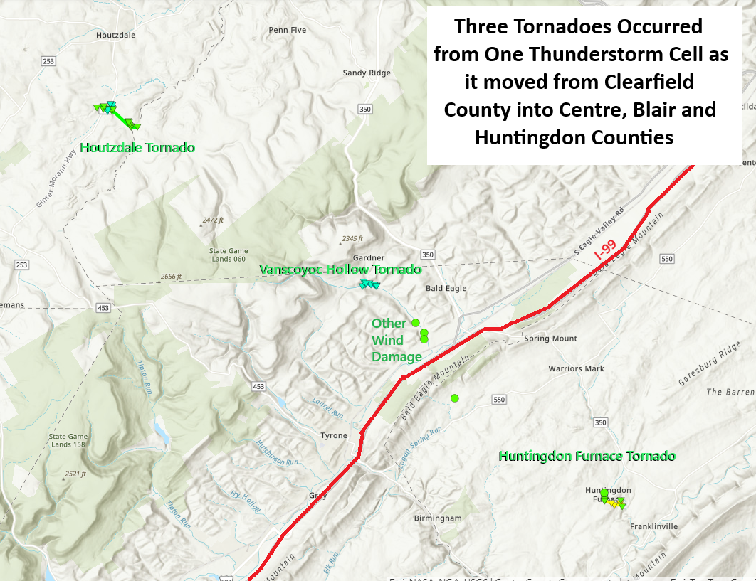
A line of thunderstorms with an embedded supercell moved through
northeast Blair County the evening of Saturday July 18th. The
same storm that produced a tornado about 7 miles to the northwest
near Houtzdale produced another tornado along Vanscoyoc Hollow Rd
in Camp Anderson. The tornado began just north of Decker Hollow
Rd and continued southeastward across Vanscoyoc Run Stream and
Camp Anderson Lake before lifting just past the southeast-most
campsite. A few trees on the north side of the track fell to the
southeast, while several trees on the south side of the track
fell northeast or east-northeast, indicating convergence
associated with a tornado.

Additional sporadic tree damage was observed farther southeast
along Vanscoyoc Hollow Rd, but it was spread out enough to
preclude extension of this tornado path.

We would like to thank the owners of Camp Anderson along with
Blair County Emergency Management Agency for their assistance with
this survey.

&&

EF Scale: The Enhanced Fujita Scale classifies tornadoes into the
following categories:

EF0.....65 to 85 mph
EF1.....86 to 110 mph
EF2.....111 to 135 mph
EF3.....136 to 165 mph
EF4.....166 to 200 mph
EF5.....>200 mph

NOTE:
The information in this statement is preliminary and subject to
change pending final review of the event and publication in
NWS Storm Data.
PICTURES
RADAR IMAGES
Huntingdon Furnace EF2 Tornado
Northern Huntingdon County, PA
OVERVIEW
Public Information Statement
National Weather Service State College PA
400 PM EDT Mon Jul 20 2026

...NWS Damage Survey for 07/18/26 Tornado Event...

.Overview...

A damage survey conducted on Monday July 20th confirmed an EF-2
tornado occurred in Franklin Township, Huntingdon County on the
evening of Saturday July 18, 2026. The tornado damaged a few
structures and produced significant tree damage along and just
south of Old Mill Rd. Details of the survey follow.

..Old Mill Rd Tornado...

Rating: EF2
Estimated Peak Wind: 125 mph
Path Length /statute/: 0.53 miles
Path Width /maximum/: 500 yards
Fatalities: 0
Injuries: 0

Start Date: 07/18/2026
Start Time: 08:43 PM EDT
Start Location: 3 NNE Spruce Creek / Huntingdon County / PA
Start Lat/Lon: 40.6551 / -78.116

End Date: 07/18/2026
End Time: 08:45 PM EDT
End Location: 2 W Franklinville / Huntingdon County / PA
End Lat/Lon: 40.6531 / -78.1063

Survey Summary:
The same storm that produced the tornado in Houtzdale (Clearfield
County) continued southeast into Huntingdon County on Saturday
evening. It started producing minor damage again as it crossed
Huntingdon Furnace Road just northwest of Turnpike Rd as it
knocked down some corn stalks. Strong downdraft winds knocked down
several 200+ year old pine trees in front of a farm house on
Huntingdon Furnace Rd along with a couple smaller trees in the
farm field and then the tornado began moments later.

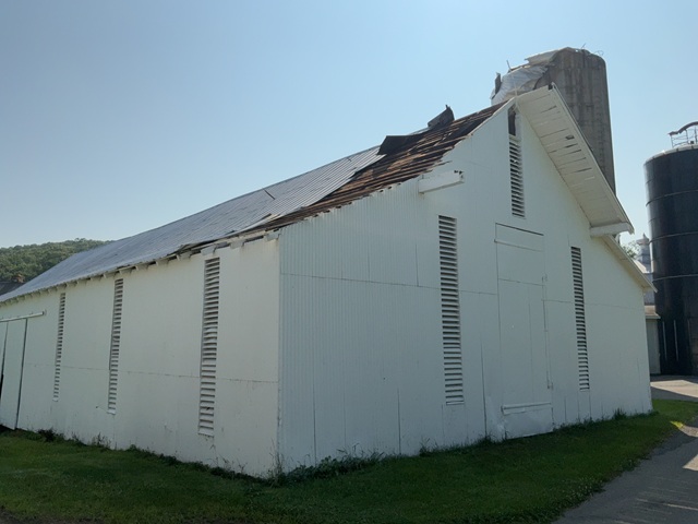
The first structural damage was observed as the roof of the oldest
of 3 large silos was partially blown off toward the northeast,
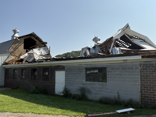
exhibiting a cyclonic wind pattern. The southern half of a large
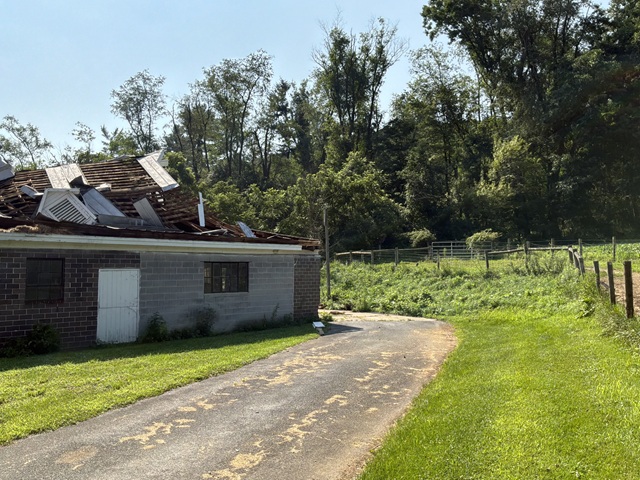
barn roof collapsed and was blown northeast as well. An adjacent
barn had several sheets of its tin roof blown northeast into the
adjacent field as well. The circulation then continued east-
southeast paralleling Warriors Mark Run and Old Mill Rd and
produced an incredible amount of tree damage as it moved up a
small ridge. Hundreds of trees were snapped off 20-30 feet up or
uprooted along the path of the tornado. Notably, trees were thrown
in an easterly direction to the right of the tornado path and
northwesterly to the left of the path. This pattern, along with
the evident path of damage left no doubt that the damage was
caused by a tornado.

There were also several cabins in the densely wooded area through
which the tornado passed. One cabin, which was inhabited by two
individuals in their 80s, had a tree fall on one side of it.
Fortunately, both individuals were safely sheltered on the
opposite side of the house and were able to escape unscathed. The
other cabins suffered no damage, though inhabitants were unable to
enter or exit the camp until significant clearing efforts were
undertaken. The tornado continued east- southeastward toward Camp
Kanesatake and lifted as it moved across Old Mill Rd on the north
edge of the camp. Sporadic tree damage was observed downstream at
Camp K, but none of it was concentrated enough to extend the
tornado path at this time.

We would like to thank Huntingdon County Emergency Management and
Franklin Township for their assistance with today`s survey.

&&

EF Scale: The Enhanced Fujita Scale classifies tornadoes into the
following categories:

EF0.....65 to 85 mph
EF1.....86 to 110 mph
EF2.....111 to 135 mph
EF3.....136 to 165 mph
EF4.....166 to 200 mph
EF5.....>200 mph

NOTE:
The information in this statement is preliminary and subject to
change pending final review of the event and publication in
NWS Storm Data.
PICTURES
RADAR IMAGES
Jenner Township EF2 Tornado
Northern Somerset County
OVERVIEW
Public Information Statement
National Weather Service State College PA
651 PM EDT Mon Aug 3 2026

...NWS Damage Survey for 07/18/26 Tornado Event - Update # 1...

.Update...This corrects the previous PNS. The tornado damage occurred
in Jenner Township.

.Overview...
A damage survey and drone imagery confirmed an EF-2 tornado
occurred in northern Somerset County during the early evening
hours of Saturday, July 18, 2026. This tornado produced pockets
of tree damage, with considerable tree damage west of the
Conemaugh Township Reservoir.

.Jenner Township Tornado...

Rating:                 EF2
Estimated Peak Wind:    125 mph
Path Length /statute/:  0.72 miles
Path Width /maximum/:   100 yards
Fatalities:             0
Injuries:               0

Start Date:             07/18/2026
Start Time:             05:38 PM EDT
Start Location:         5 W Jerome / Somerset County / PA
Start Lat/Lon:          40.2404 / -79.0756

End Date:               07/18/2026
End Time:               05:41 PM EDT
End Location:           4 W Jerome / Somerset County / PA
End Lat/Lon:            40.2344 / -79.0648

Survey Summary:
A supercell moving across Westmoreland County began showing
increasing rotation as the cell moved into northern Somerset
County during the early evening hours of Saturday, July 18, 2026.
A tornado associated with this supercell formed northwest of
Conemaugh Township Reservoir. The damage at tornado onset was
mainly in the form of multiple trees being uprooted in a
convergent pattern before the tornado strengthened and produced a
widespread swath where all trees in the area just west of the
reservoir were completely snapped. This entire swath of hardwood
trees comprised of mostly healthy hardwood trees with virtually
no trees remaining standing in a quarter mile swath.

Tree damage continued onto the south end of the reservoir, with
multiple snapped and uprooted trees being knocked into the south
end of the reservoir before shifting to a more southeasterly path
following Ferndale Road for a brief period of time. Concentrated
convergent tree damage continued to be observed on Ferndale Drive
leading up to the reservoir before the damage became more sporadic
and less convergent north of Ferndale Road near Bens Creek.

NWS State College would like to thank the Conemaugh Township
Municipal Authority for drone imagery of this damage near the
reservoir and Somerset County Emergency Management Agency on their
collaboration on this damage survey.

&&

EF Scale: The Enhanced Fujita Scale classifies tornadoes into the
following categories:

EF0.....65 to 85 mph
EF1.....86 to 110 mph
EF2.....111 to 135 mph
EF3.....136 to 165 mph
EF4.....166 to 200 mph
EF5.....>200 mph

NOTE:
The information in this statement is preliminary and subject to
change pending final review of the event and publication in
NWS Storm Data.


$$
PICTURES
RADAR IMAGES
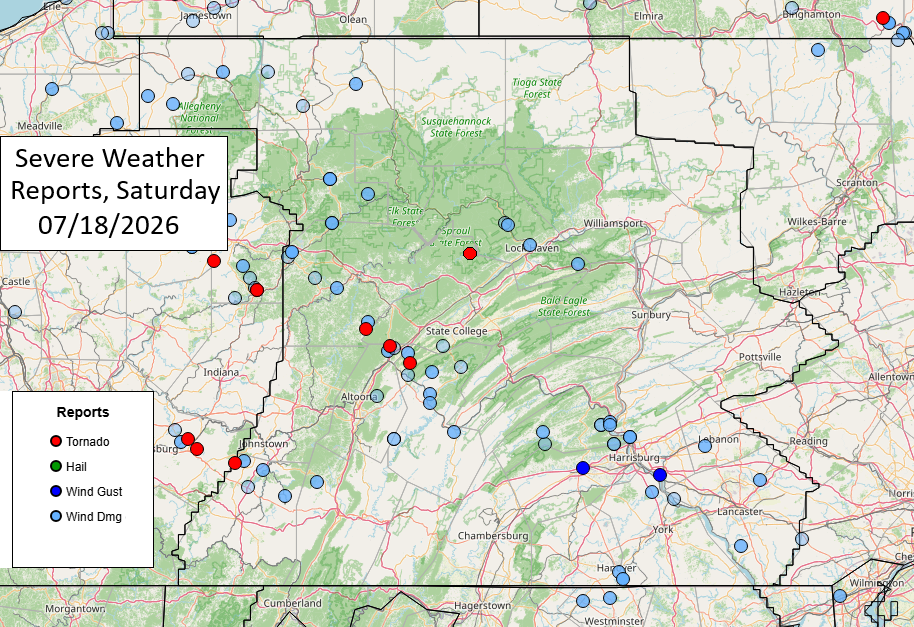
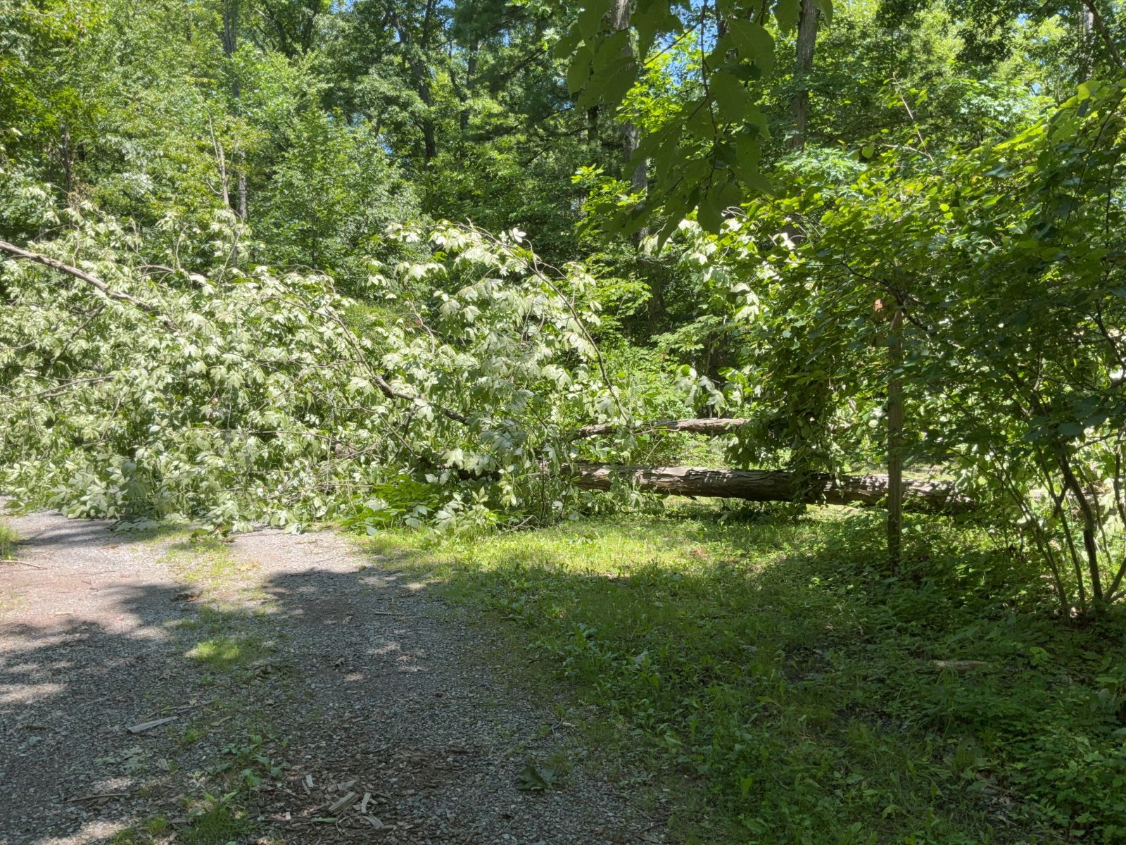
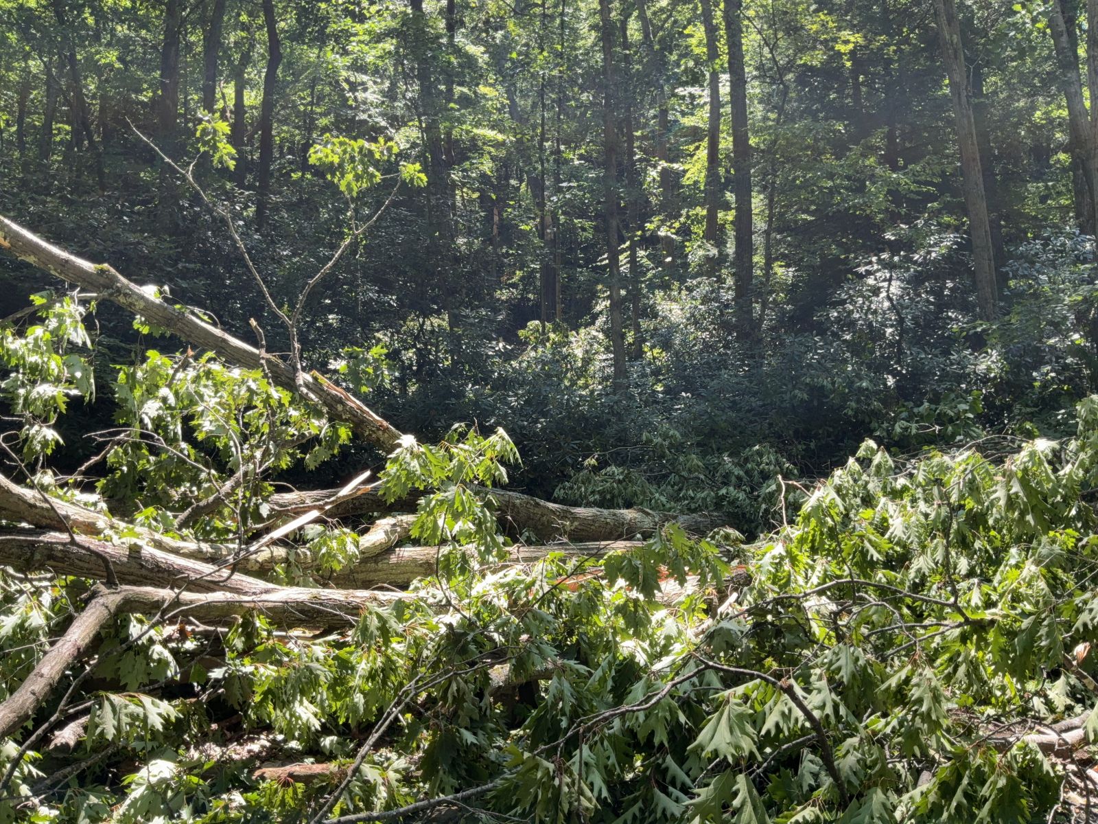
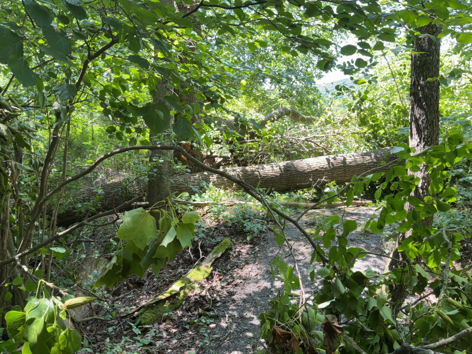
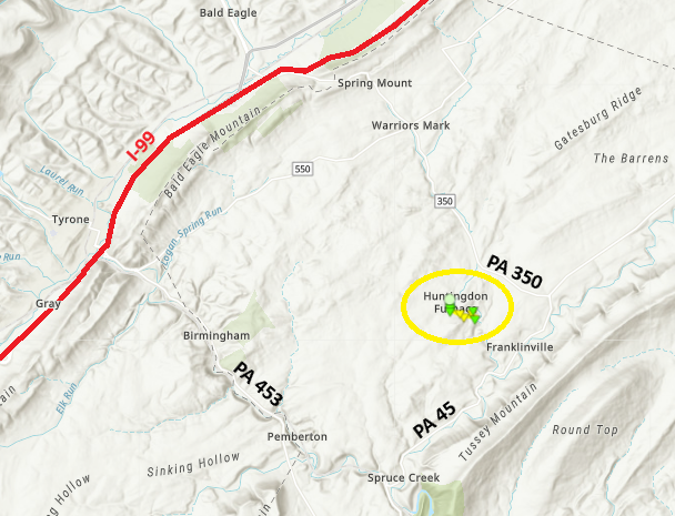
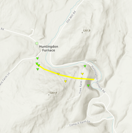
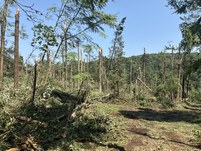
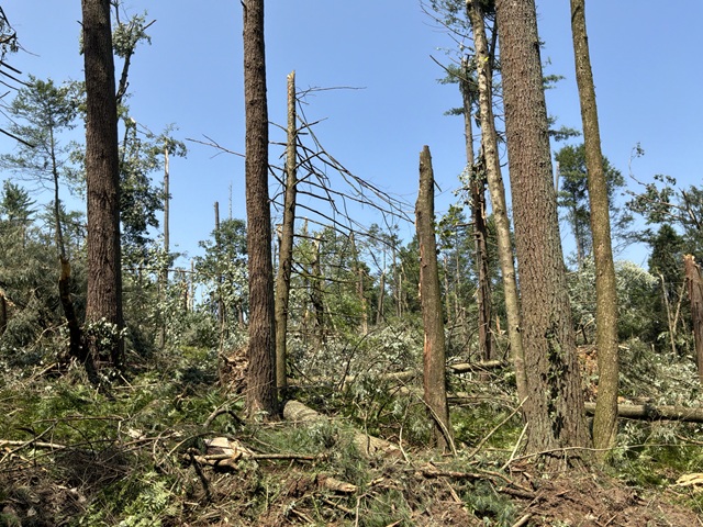
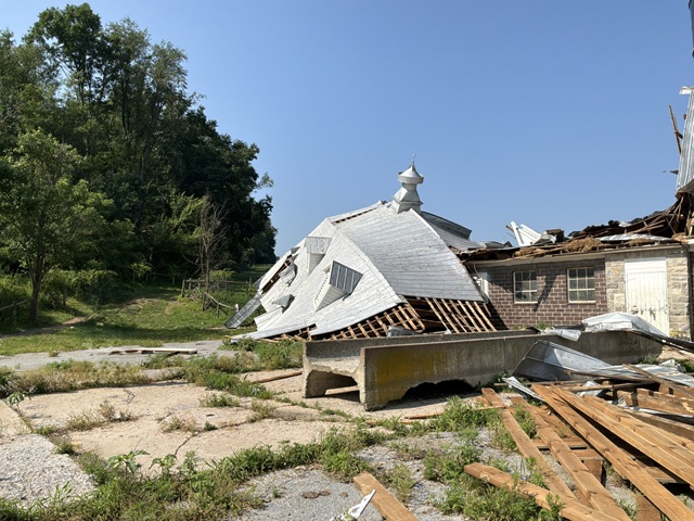
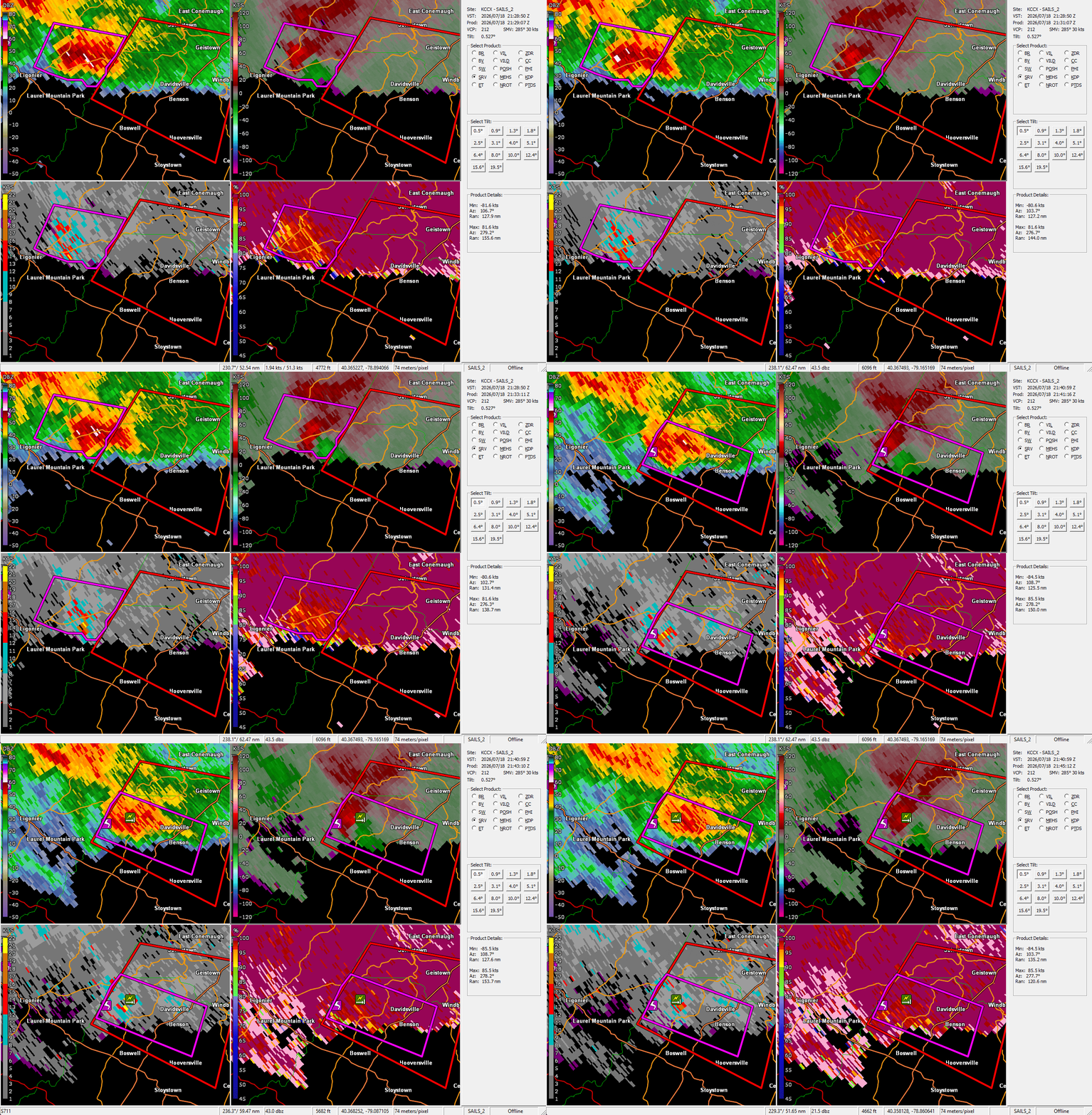
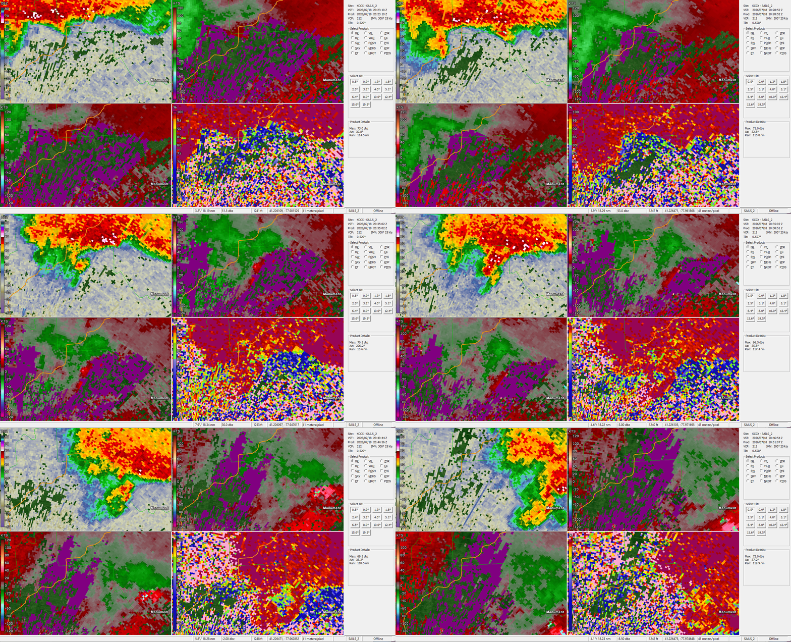
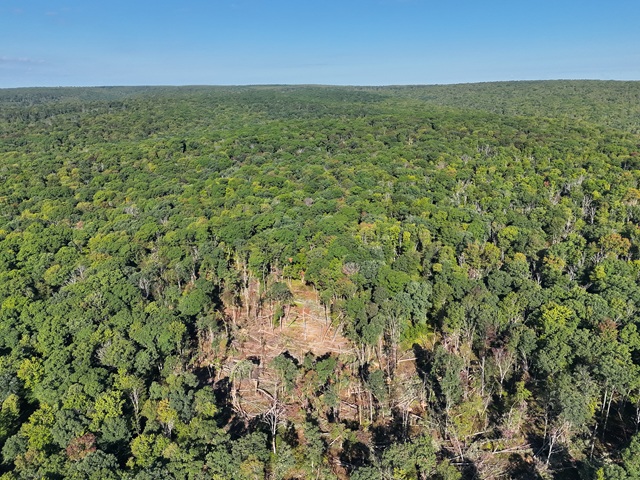
In partnership with PA DCNR/Forestry, we have determined that there was an EF-1 tornado that occurred in and near the Sproul State Forest in northern Centre County.
OVERVIEW
Public Information Statement
National Weather Service State College PA
107 PM EDT Fri Sep 18 2026

...NWS Damage Survey for 07/18/2026 Tornado Event...

..Burnside Township Tornado...

Rating: EF1
Estimated Peak Wind: 110 mph
Path Length /statute/: 1.04 miles
Path Width /maximum/: 250 yards
Fatalities: 0
Injuries: 0

Start Date: 07/18/2026
Start Time: 04:33 PM EDT
Start Location: 8 SSE Keating / Centre County / PA
Start Lat/Lon: 41.1509 / -77.8624

End Date: 07/18/2026
End Time: 04:35 PM EDT
End Location: 8 SE Keating / Centre County / PA
End Lat/Lon: 41.1453 / -77.8446

Survey Summary:
At approximately 4:33 PM EDT on July 18, 2026, a supercell
thunderstorm produced a tornado in northern Centre County just
east of Eddy Ridge Road near State Line Road. The tornado
produced multiple areas of concentrated tree damage over the next
2 minutes as it travelled southeastward for just over a mile in a
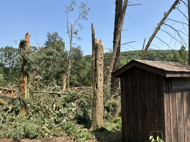
heavily wooded area. Approximately 200 trees were downed or
snapped. We would like to thank the PA Bureau of Forestry for
their help with this survey.

&&

EF Scale: The Enhanced Fujita Scale classifies tornadoes into the
following categories:

EF0.....65 to 85 mph
EF1.....86 to 110 mph
EF2.....111 to 135 mph
EF3.....136 to 165 mph
EF4.....166 to 200 mph
EF5.....>200 mph

NOTE:
The information in this statement is preliminary and subject to
change pending final review of the event and publication in
NWS Storm Data.















 Public Information Statement
National Weather Service State College PA
107 PM EDT Fri Sep 18 2026
...NWS Damage Survey for 07/18/2026 Tornado Event...
..Burnside Township Tornado...
Rating: EF1
Estimated Peak Wind: 110 mph
Path Length /statute/: 1.04 miles
Path Width /maximum/: 250 yards
Fatalities: 0
Injuries: 0
Start Date: 07/18/2026
Start Time: 04:33 PM EDT
Start Location: 8 SSE Keating / Centre County / PA
Start Lat/Lon: 41.1509 / -77.8624
End Date: 07/18/2026
End Time: 04:35 PM EDT
End Location: 8 SE Keating / Centre County / PA
End Lat/Lon: 41.1453 / -77.8446
Survey Summary:
At approximately 4:33 PM EDT on July 18, 2026, a supercell
thunderstorm produced a tornado in northern Centre County just
east of Eddy Ridge Road near State Line Road. The tornado
produced multiple areas of concentrated tree damage over the next
2 minutes as it travelled southeastward for just over a mile in a
heavily wooded area. Approximately 200 trees were downed or
snapped. We would like to thank the PA Bureau of Forestry for
their help with this survey.
&&
EF Scale: The Enhanced Fujita Scale classifies tornadoes into the
following categories:
EF0.....65 to 85 mph
EF1.....86 to 110 mph
EF2.....111 to 135 mph
EF3.....136 to 165 mph
EF4.....166 to 200 mph
EF5.....>200 mph
NOTE:
The information in this statement is preliminary and subject to
change pending final review of the event and publication in
NWS Storm Data.
Public Information Statement
National Weather Service State College PA
107 PM EDT Fri Sep 18 2026
...NWS Damage Survey for 07/18/2026 Tornado Event...
..Burnside Township Tornado...
Rating: EF1
Estimated Peak Wind: 110 mph
Path Length /statute/: 1.04 miles
Path Width /maximum/: 250 yards
Fatalities: 0
Injuries: 0
Start Date: 07/18/2026
Start Time: 04:33 PM EDT
Start Location: 8 SSE Keating / Centre County / PA
Start Lat/Lon: 41.1509 / -77.8624
End Date: 07/18/2026
End Time: 04:35 PM EDT
End Location: 8 SE Keating / Centre County / PA
End Lat/Lon: 41.1453 / -77.8446
Survey Summary:
At approximately 4:33 PM EDT on July 18, 2026, a supercell
thunderstorm produced a tornado in northern Centre County just
east of Eddy Ridge Road near State Line Road. The tornado
produced multiple areas of concentrated tree damage over the next
2 minutes as it travelled southeastward for just over a mile in a
heavily wooded area. Approximately 200 trees were downed or
snapped. We would like to thank the PA Bureau of Forestry for
their help with this survey.
&&
EF Scale: The Enhanced Fujita Scale classifies tornadoes into the
following categories:
EF0.....65 to 85 mph
EF1.....86 to 110 mph
EF2.....111 to 135 mph
EF3.....136 to 165 mph
EF4.....166 to 200 mph
EF5.....>200 mph
NOTE:
The information in this statement is preliminary and subject to
change pending final review of the event and publication in
NWS Storm Data.
 Radar
Radar Current Weather
 Rivers & Lakes
 Satellite
 Forecast Maps
 Hour by Hour Forecast
 Tropical Weather
 Graphical Hazards
 Weather Hazards Briefing
 Fire Weather
 Text Forecasts and Statements
 Forecaster's Discussion
 Send Us a Report
 KCCX Local Radar (Hi-Res)
 Drought
 Winter
 Follow us on X
 Follow us on Facebook
 CTP RSS Feed