| Average Annual Daytime Cloud Coverage |
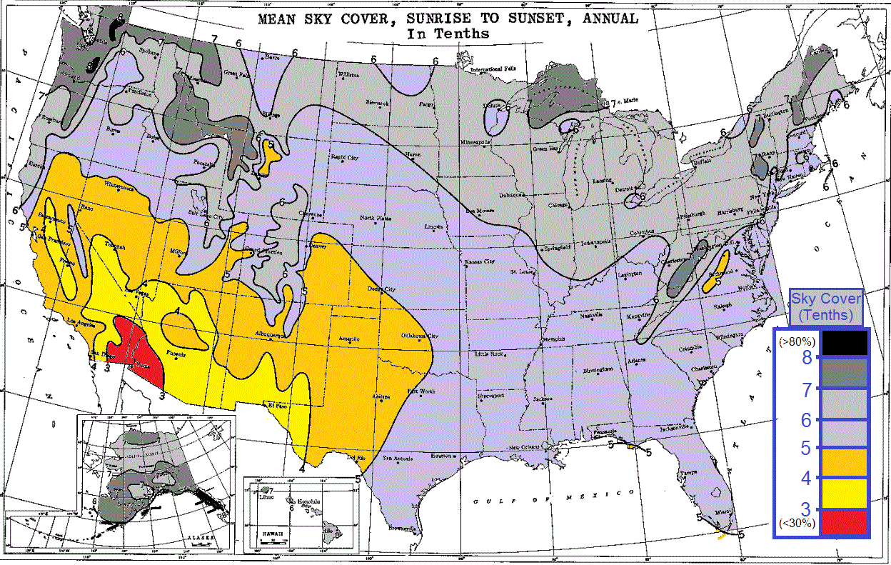
| We have been asked a few times just how cloudy Central PA is versus the rest of the country. "Are we the cloudiest place in the U.S.?" In searching for the answer, I found this dusty old NOAA/NCEI/NCDC chart, most likely produced more than three decades ago, for I could only find a paper copy, and no digital images like it. I scanned it into a digital format and colorized it by hand. I think the coloring makes it a bit easier to see the values and gradients. The chart is labelled "Mean Sky Cover, Sunrise to Sunset, Annual." It should give you the rough idea of where the cloudiest places are. The chart was most likely made using data from sunshine sensors which had been routinely deployed at many oberservation sites. It may also be deduced from a detailed analysis of the sky cover observations at all the observation sites. But, this seems like a tedious and time-consuming operation to do in a time when computers were most likely in their infancy. To summarize - It looks like Pacific Northwest (and the areas ringing the Gulf of Alaska) are cloudier (during the daylight hours, at least) than Central PA. There is a maximum which you can infer along the spine of the Appalachian Mountains, and the Upper Great Lakes where lake-effect clouds no doubt play a large part in keeping us cloudy during the winter months. |
|
Average Annual Sky Cover during Daylight Hours
|


 Send Us a Report