State College, PA
Weather Forecast Office
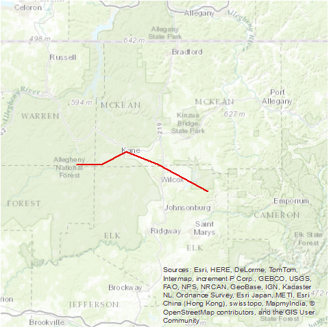
A tornado moved from five miles south of Sheffield, through Kane and into Elk State Park. There were 45 buildings damaged or destroyed. Forest devastation was so complete near the path’s center that every tree was either uprooted or snapped off at the base. Many ended up defoliated and/or debarked.
Source: NCDC Storm Data: May 1985; Volume 27, Number 5
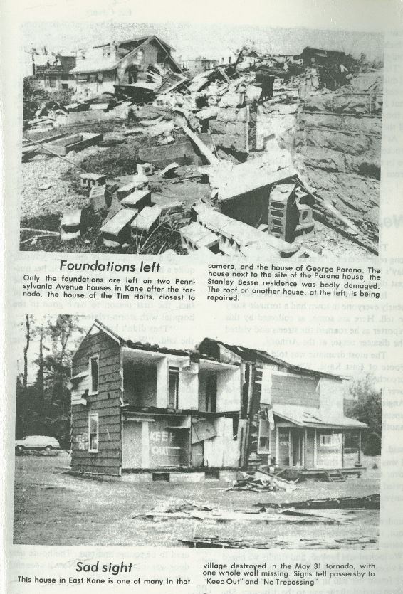
Source: Killer Tornados - Published by The Area Shopper, Photo Credit: The Kane Republican
US Dept of Commerce
National Oceanic and Atmospheric Administration
National Weather Service
State College, PA
328 Innovation Blvd, Suite 330
State College, PA 16803
(814)954-6440
Comments? Questions? Please Contact Us.


 Send Us a Report