State College, PA
Weather Forecast Office
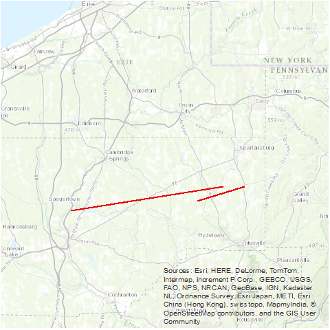
A tornado moved from two miles south of Saegertown to four miles east-northeast of Centreville. Two people died in Centreville. (Note: Although the two tornadoes are listed as one event in NCDC StormData, post-event surveys found that there were two separate tornado tracks)
Source: NCDC Storm Data: May 1985; Volume 27, Number 5
US Dept of Commerce
National Oceanic and Atmospheric Administration
National Weather Service
State College, PA
328 Innovation Blvd, Suite 330
State College, PA 16803
(814)954-6440
Comments? Questions? Please Contact Us.


 Send Us a Report