State College, PA
Weather Forecast Office
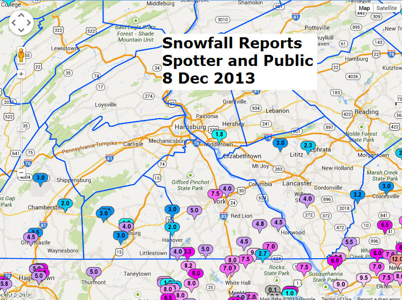
Here's a snowfall map of reports we received at the NWS for the storm of the 8th of Dec, 2013.
See this map on: https://www.erh.noaa.gov/ctp/pnsmaps/snow/archive/snowfall_12082013.php
The tight gradient along the Mason-Dixon Line was due to a very intense west-to-east band of snow which set up during the morning and early afternoon, producing 1-2" per hour rates. Those rates are quite unusual. As a note, the 7.5 inch report in West York is highly suspect, though, as a meteorologist from West York also sent a report of less than 5 inches.
US Dept of Commerce
National Oceanic and Atmospheric Administration
National Weather Service
State College, PA
328 Innovation Blvd, Suite 330
State College, PA 16803
(814)954-6440
Comments? Questions? Please Contact Us.


 Send Us a Report