State College, PA
Weather Forecast Office
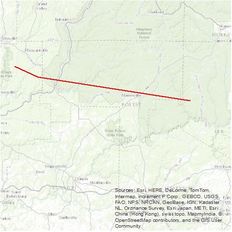
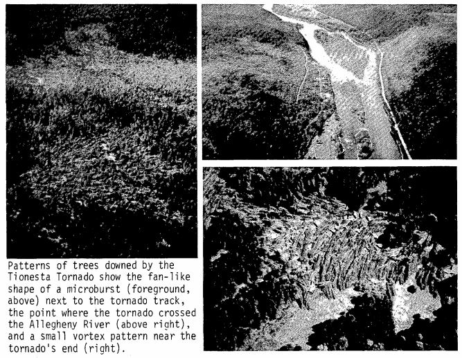
A tornado moved from near Tionesta to north of Marienville, crossing the Allegheny River. Seven people were injured and over 700 structures were damaged or destroyed. Patterns of trees downed by the tornado showed the fan-like shape of a microburst next to the tornado track.
Source: NCDC Storm Data: May 1985; Volume 27, Number 5
Source: NCDC Storm Data: May 1985; Volume 27, Number 5
US Dept of Commerce
National Oceanic and Atmospheric Administration
National Weather Service
State College, PA
328 Innovation Blvd, Suite 330
State College, PA 16803
(814)954-6440
Comments? Questions? Please Contact Us.


 Send Us a Report