|
An EF-1 Tornado occurred in Mahanoy City (Schuylkill County) on May 27th, 2024. |
|
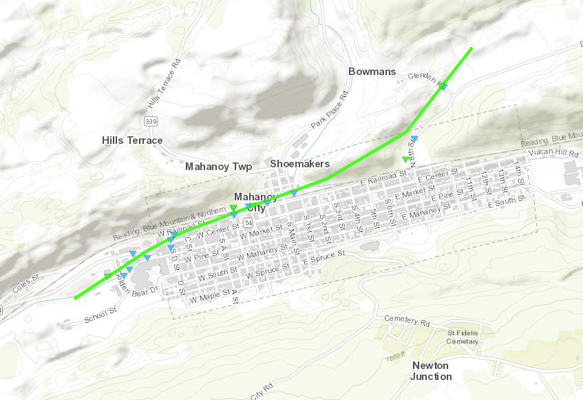
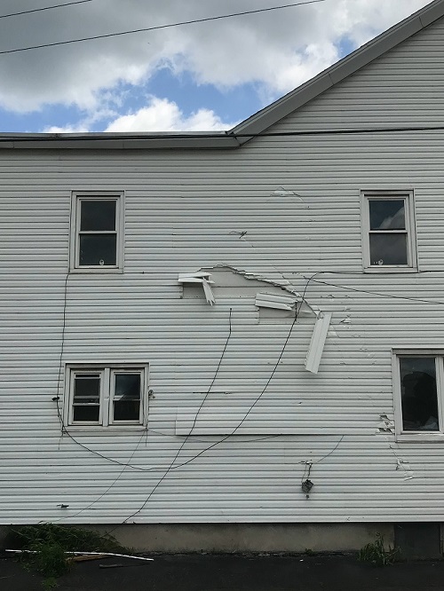
Description: A National Weather Service Survey has confirmed that an EF1 tornado with maximum estimated wind speeds of 90 mph occurred in Mahanoy City during the evening of Monday, May 27, 2024. The tornado formed just west of Mahanoy City at 7:38 PM EDT and traveled NE. The tornado uprooted several trees along its path as it moved into Mahanoy City and crossed E Railroad Street. Roof shingles and pieces of wooden debris had been lofted into the air. Several impalements of wood into roofs were observed from falling debris and the siding from several houses had been damaged. Several windows on the local elementary school had been damaged. The tornado eventually crossed train tracks just N of Mahanoy City uprooting additional trees before lifting after it crossed Glendon Road at 7:44 PM EDT. |
|
Map of damage path:
|
|
The details: Rating: EF-1 (see rating descriptions below) |
|
EF Scale: The Enhanced Fujita Scale classifies tornadoes into the following categories: |
| NOTE: The information in this statement is preliminary and subject to change pending final review of the event and publication in NWS Storm Data. |
|
Some pictures of the damage:
|


 Send Us a Report