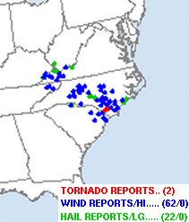
View Text of All Tornado, Wind and Hail Reports
...Storm Survey Discovered Tornado Damage at Whiteville, NC...
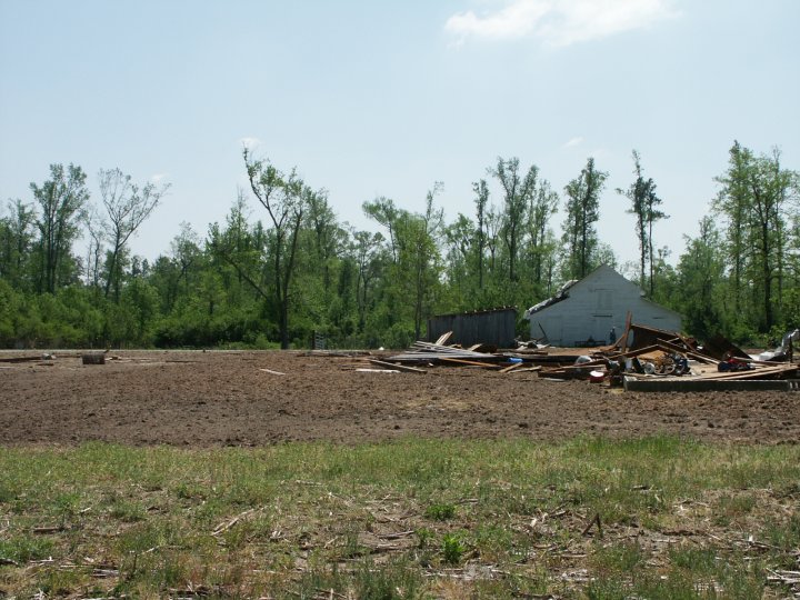
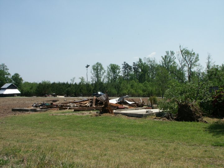
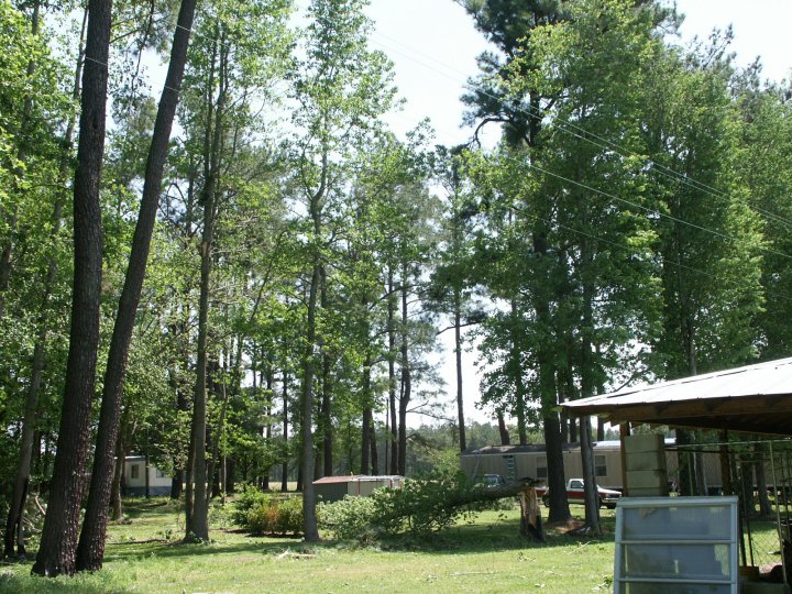
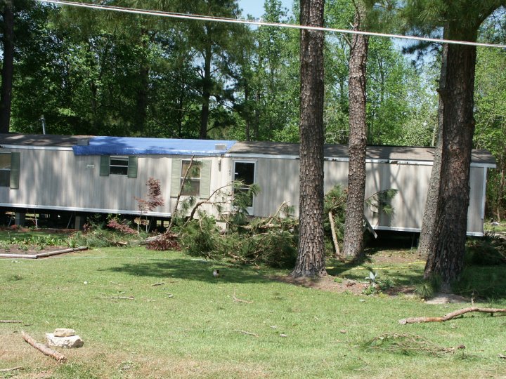
On Monday, April 17, 2006, a line of powerful thunderstorms associated with a Canadian cold front moved through the Carolinas. The following day a National Weather Service storm survey team determined that a gustnado, the result of turbulence along the leading edge of the line of storms, developed at about 505 pm (according to sightings and radar) and caused F1 (73-112 mph wind) damage on the fujita scale, with spotty damage along a roughly 1 mile by 15 yard wide path that occurred in about 2 minutes. Most of the damage to structures and power lines was the result of uprooted and snapped pine trees.
A tornado warning had been issued for Central Columbus County at 504 pm, and NOAA Weather Radio All Hazards in the area automatically alarmed to alert people just as the tornado occurred.
Also associated with the Canadian cold front were powerful straight line wind gusts powerful enough to cause spotty damage to trees and structures in Columbus County and other counties in Southeast North Carolina and Northeast South Carolina (view text of all tornado, wind and hail reports).
Across the area, there were no reports of injuries.
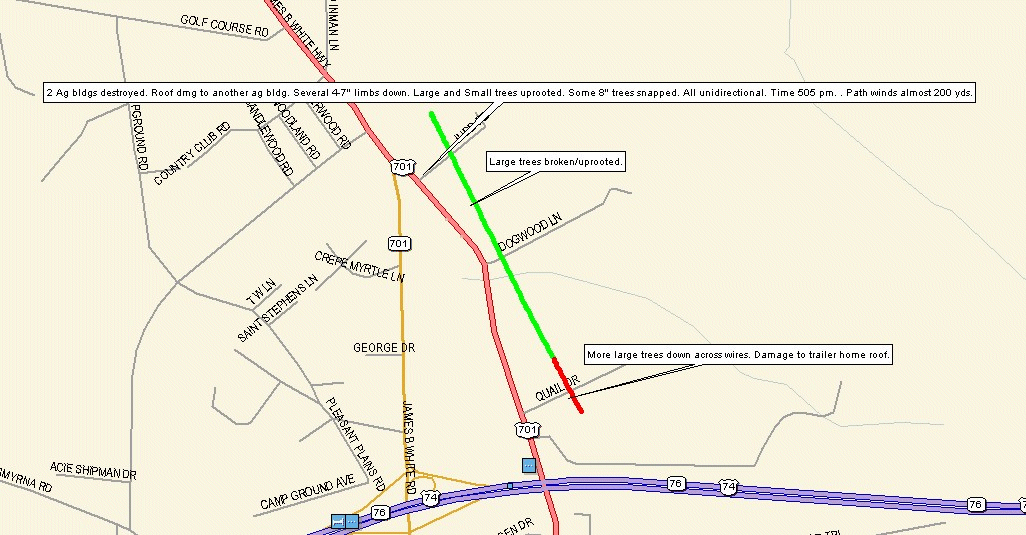
Track of F1 Tornado in Columbus County, NC. Severe straight line winds in green, tornado path in red.
Satellite and Radar Images
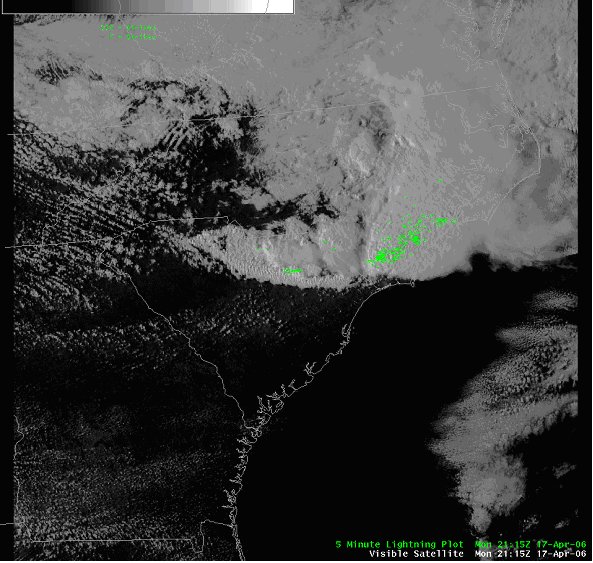 |
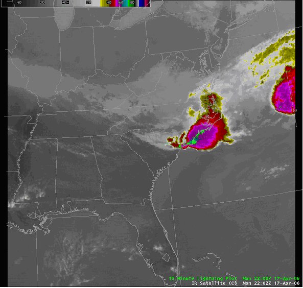 |
| Visible Satellite Image (515 pm) | IR Satellite Image (600 pm) |
 |
 |
|
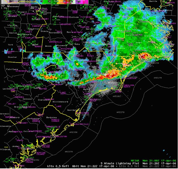
Base Relfectivity at 500 pm showing tight gradient along leading edge/outflow boundary. |
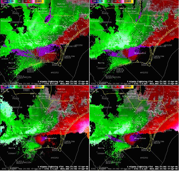
KLTX base velocity at 518 pm. Strong gust front upper left. Mini supercell in central Pender County which a tornado warning was issued for. |
 |
|
|
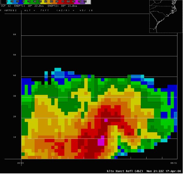
KLTX Refelctivity cross-section of northern Brunswick County storm at 522 pm showing elevated core, west to east tilt and impressive BWER. All storms were somewhat low-topped. |
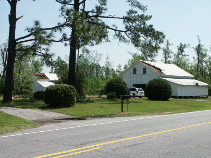
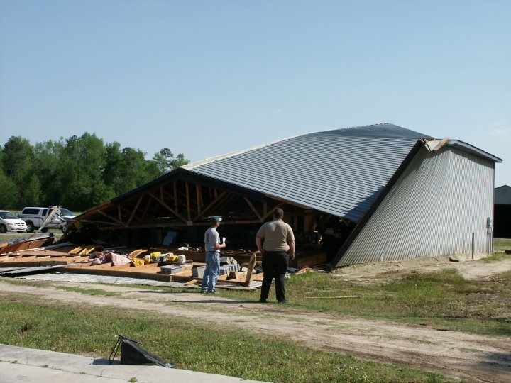
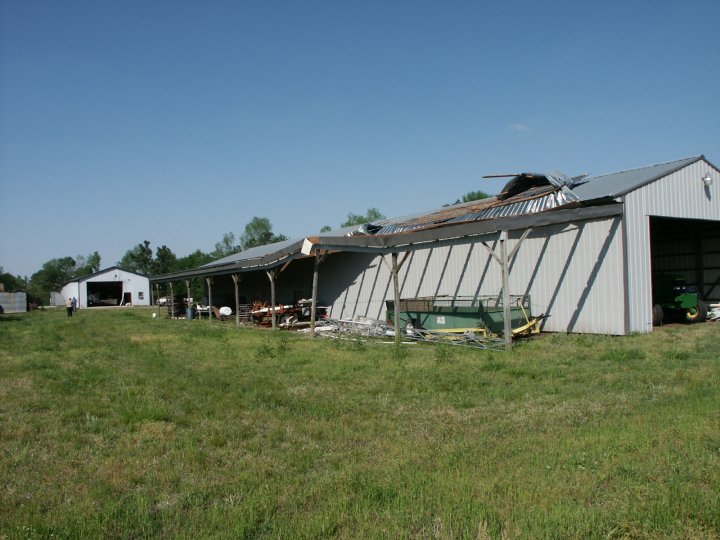
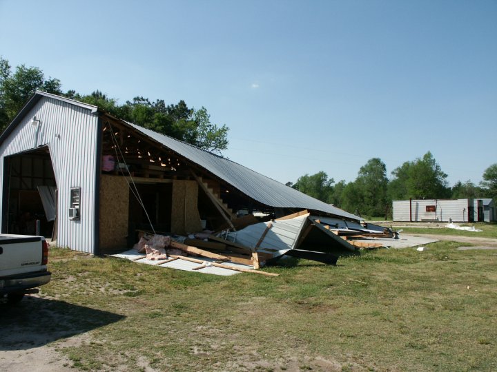
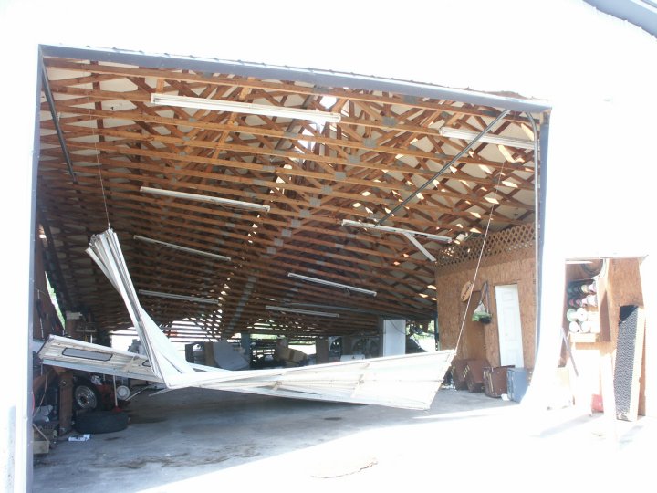
| Damage Pictures | ||
 |
 |
 |
 |
 |
 |
 |
 |
 |


 Coastal Flood