NWS Wilmington, NC
Weather Forecast Office
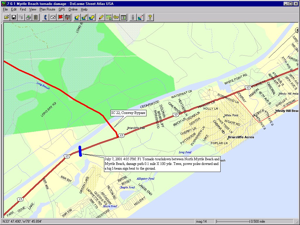
This map shows the small damage track found in North Myrtle Beach. The damage path crossed US Highway 17. The tornado was estimated at F1 strength here and the damage path dimensions were only 0.1 miles long x 100 yards wide.
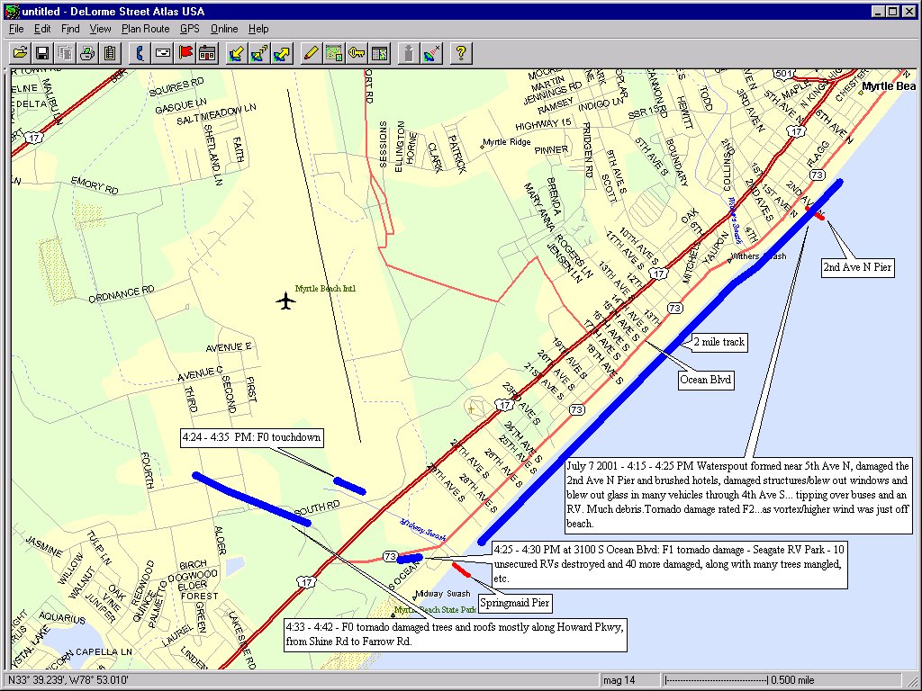
Damage was much more extensive near Myrtle Beach, as shown by this map. Evidence of four separate damage paths were found, although the primary, and possibly the parent tornado, took a path down the beachfront. The tornado was estimated at F2 strength here based on damage patterns observed. The three smaller touchdowns at the southern end of Myrtle Beach displayed F0 and F1 damage. Springmaid Pier, although not officially hit by one of the tornadoes or waterspouts, recorded a wind gust to 66 mph.
Page created July 14, 2001 Tim Armstrong
Last modified Aug 8, 2015
Forecasts
Discussion/Key Messages
Products
Enhanced Graphics
Graph/Table/Text
Graphical
Weather Activity Planner
Aviation
Marine
Hydrology
Rivers/Tides
Tidal Flooding
Beach
Surf
Tropical
Fire
Heat
Winter
Mobile
Weather Models
Hazards
One-stop Briefing
Graphical Hazard Outlook
Latest Briefing
Social Media Feeds
County EM Briefing
Submit Storm Report
Current Conditions
Observations Map
Observations Listing
Marine Observations
Regional Weather Roundup
Satellite
US Dept of Commerce
National Oceanic and Atmospheric Administration
National Weather Service
NWS Wilmington, NC
2015 Gardner Drive
Wilmington, NC 28405
(910) 762-4289
Comments? Questions? Please Contact Us.


 Coastal Flood