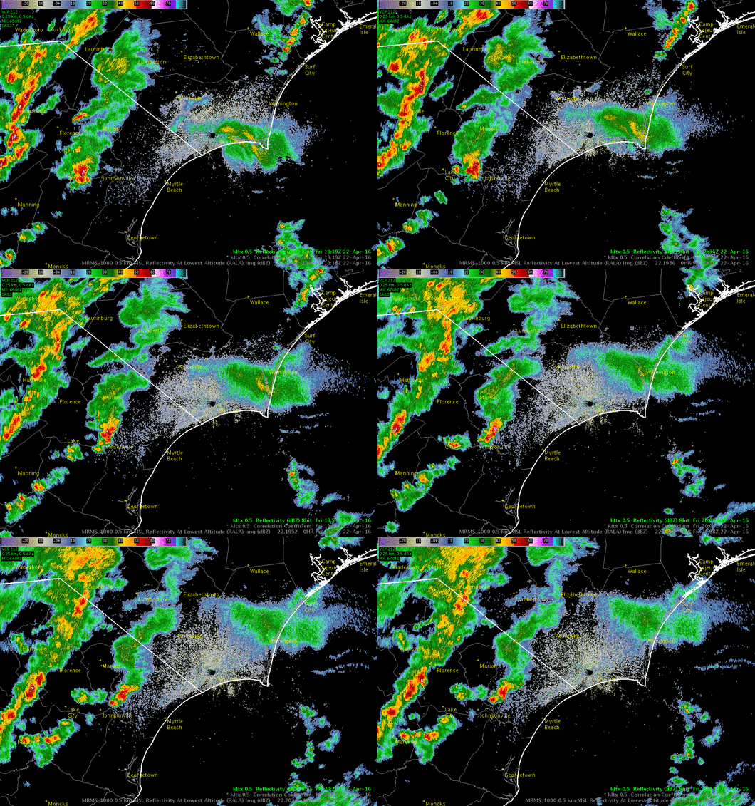
 NWS Wilmington meteorologists had their hands full during the afternoon of April 22, 2016, as several waves of showers and thunderstorms moved across eastern North and South Carolina. The strongest thunderstorm of the day dropped hail up to 3/4 inch in diameter near Florence, SC, along with over three inches of rain.
Another interesting aspect of this event was what at first appeared to be an area of rain near Southport, NC, which later moved north across Wilmington. At least one person called our office while checking the radar on his phone, asking us how much rain we expected to fall in Wilmington over the next hour. Typically dark green to yellow colors on radar mean moderate rainfall rates of 0.10 to 0.30 inches per hour, so our answer was quite surprising to him: "No rain at all!"
How did we figure this out? First a brief word on radar:
Weather radar works by transmitting special radio waves from of a large dish antenna, then "listening" to see where the waves bounce back from. Besides rain, hail, and snow, lots of other things can bounce these radio waves back too -- like birds, insects, shifts in wind, even the sides of mountains!

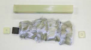
Another item that can reflect radar waves is chaff. Chaff is the name given to tiny glass fibers covered in aluminum metal. Developed by the British and Germans independently during World War II, its purpose is to confuse enemy radar to make it more difficult to detect aircraft during wartime. It is dropped by airplanes and spreads widely with the wind as it falls. Chaff is often used offshore during local military training exercises, and NWS meteorologists note its appearance on radar several dozen times a year just off Cape Fear.
More details about chaff are available at http://web.archive.org/web/20130313150907/https://www.ellsworth.af.mil/shared/media/document/AFD-121022-061.pdf
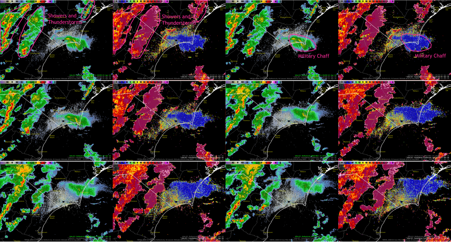
Although chaff may look similar to rain in radar reflectivity, it appears very different in some of the new radar products added during the dual-polarization radar upgrade several years ago. The difference is most apparent in correlation coefficient, a product that shows how similar in shape the items being sampled by the radar beam are. Falling raindrops are all generally the same shape (nearly spherical) so their correlation coefficient is very high: 0.97 to 0.99. Hail usually has a lower correlation coefficient (0.8 to 0.9) since hailstones are irregularly shaped. Since individual pieces of chaff tumble as they fall and present a variety of cross sections to the radar, they register a low correlation coefficient below 0.60. Note in the following image how the chaff appears blue in correlation coefficient while rain is generally purple.

![]()
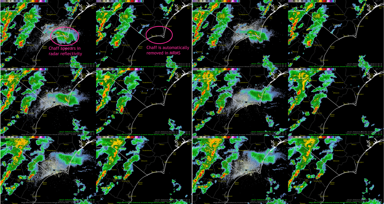
Another recent introduction to our suite of radar products is Multi-radar Multi-sensor (MRMS) imagery. The MRMS system combines data from multiple radars, models, and observations to create a more complete weather picture. In this case, MRMS used dual-polarization data from the radar and automatically removed the chaff since it's not meteorological in origin. This results in better weather radar data and also leads to improvements in precipitation estimates.


Page Author: Tim Armstrong
Page Created: May 25, 2016
Last Updated: May 25, 2016