There is a high risk of rip currents today for the northeast Florida beaches and southeast Georgia beaches. Rip currents can sweep strong swimmers away from the shore. Heed the advice of lifeguards, beach patrol flags, and signs. When in doubt, don't go out!


 Jacksonville Radar
 Weather Map
 Regional Satellite
  DAY 1 Convective Outlook
 DAY 2 Convective Outlook
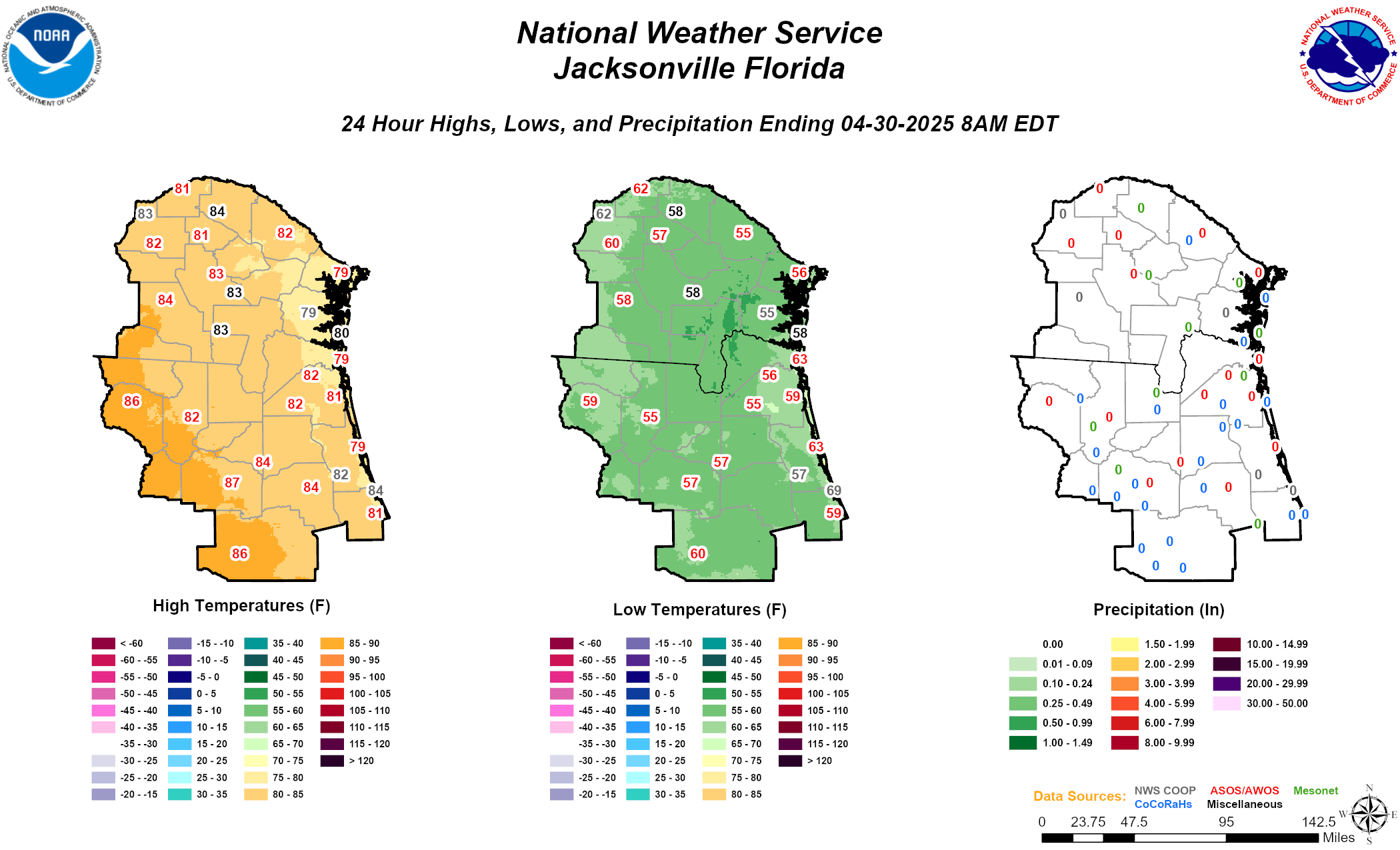 Daily Graphics
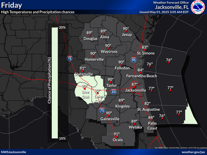