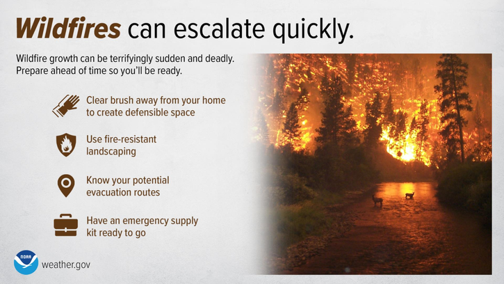
⚠️A Red Flag Warning 🔥 has been issued for the St. Johns River Valley region of northeast FL Thursday.
Breezy southwesterly winds, low daytime relative humidity, and ongoing drought conditions could contribute to extreme fire 🔥 behavior.
Fire Weather 🔥conditions will remain elevated outside of the warning area.
Make sure to avoid open flames 🔥 or sparks, properly discard cigarettes🚬 , keep vehicles off of dry grass & clear dead vegetation around your home & gutters.


 Jacksonville Radar
 Weather Map
 Regional Satellite
  DAY 1 Convective Outlook
 DAY 2 Convective Outlook
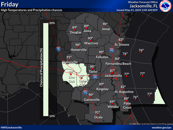
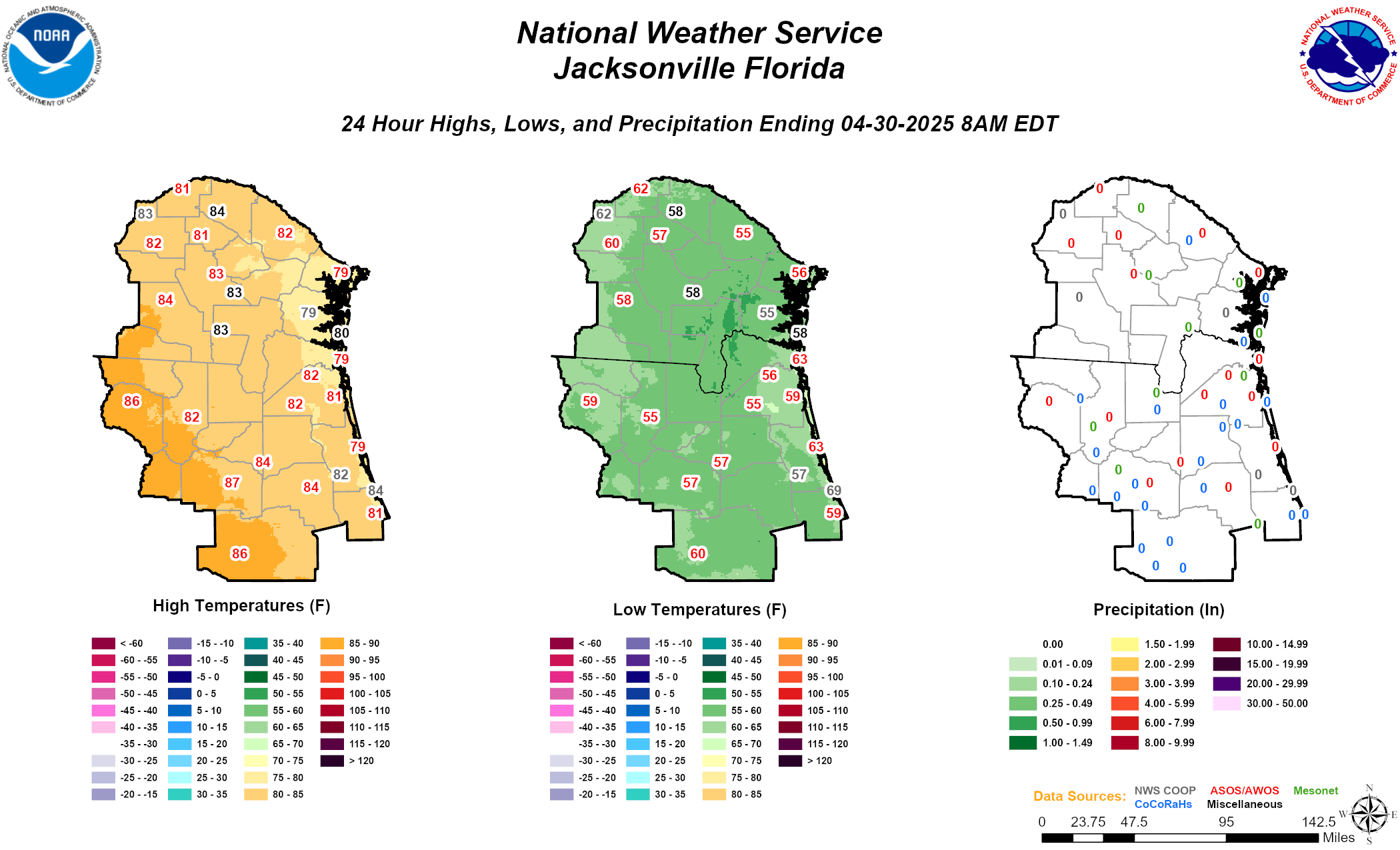 Daily Graphics