Increasing winds and building surf through the weekend will lead to a HIGH risk of rip currents at all local beaches from St Simons Island south through Flagler Beach. Be cautious when heading to the beach and make sure to heed "Red Flags" and if you're unsure about the surf conditions, talk to the lifeguard for that stretch of beach. Always swim near lifeguards!


 Jacksonville Radar
 Weather Map
 Regional Satellite
  DAY 1 Convective Outlook
 DAY 2 Convective Outlook
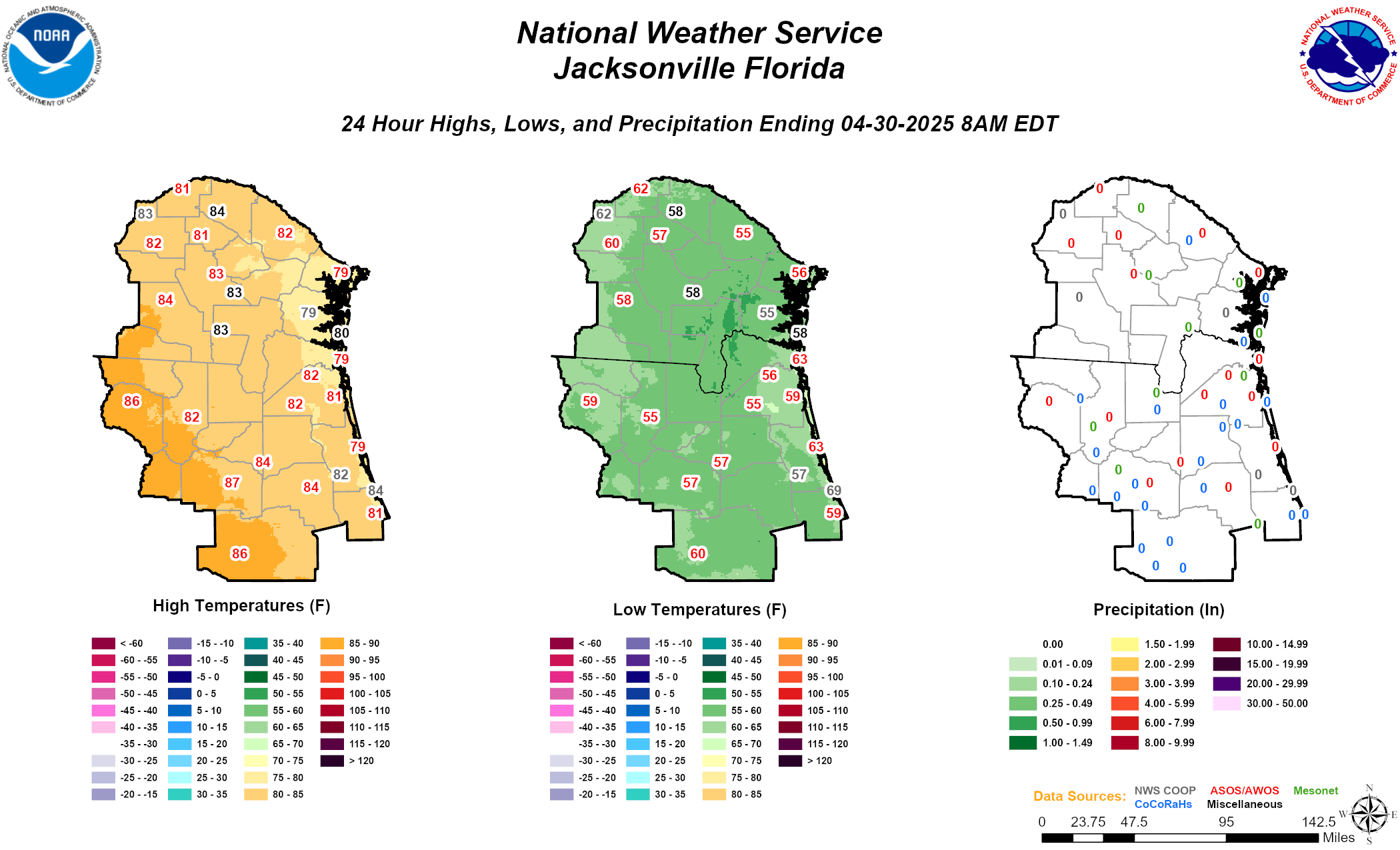 Daily Graphics
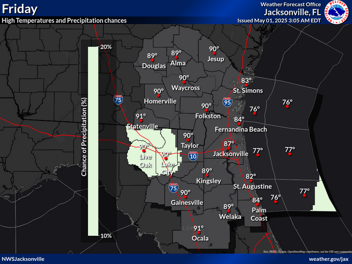