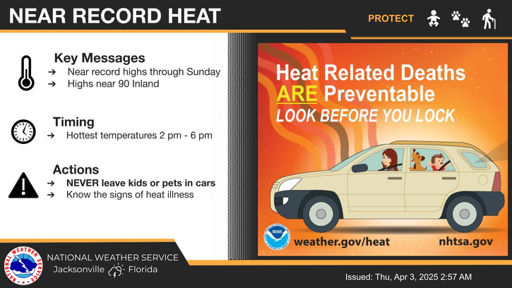
National Weather Service United States Department of Commerce
Click a location below for detailed forecast.

Last Map Update: Sat, Aug 2, 2025 at 11:22:20 am EDT

Several waves of thunderstorms will develop along a slowing front as it reaches southern GA and moves near the Florida-Georgia state line. An abundance of moisture and energy will lead to heavy rain and potentially 3-5" of rain with locally higher amounts. This may lead to flooding, especially in flood prone urban areas such as Waycross, Brunswick, and Jacksonville. Ensure you have multiple ways to receive weather alerts!
⛈️Strong to borderline severe thunderstorms will be possible this afternoon into evening mainly for areas along and north of the I-10 corridor. The main threat will be localized flash flooding and heavy downpours especially in flood prone urban areas such as Waycross, Brunswick, and Jacksonville.
Low temperatures and rain chances for Tonight.
High temperatures and rain chances for Tomorrow.
Climate statistics.

Text Product Selector (Selected product opens in a new window) 
 
Briefing Info
Decision Support
Radar
Fire Weather
Aviation
Rivers-Flooding
Briefing Info
Decision Support
Radar
Fire Weather
Aviation
Rivers-Flooding
Marine
Beach
Satellite
Hourly Forecasts
Climate
Social Media
Marine
Beach
Satellite
Hourly Forecasts
Climate
Social Media
Tropical
Observations
NOAA Weather Radio
Report Weather
Storm Spotters
Air Quality
Tropical
Observations
Weather Radio
Report Weather
Storm Spotters
Air Quality