


- Relative
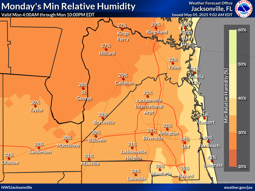
Humidity - Min RH
Probability - Wind
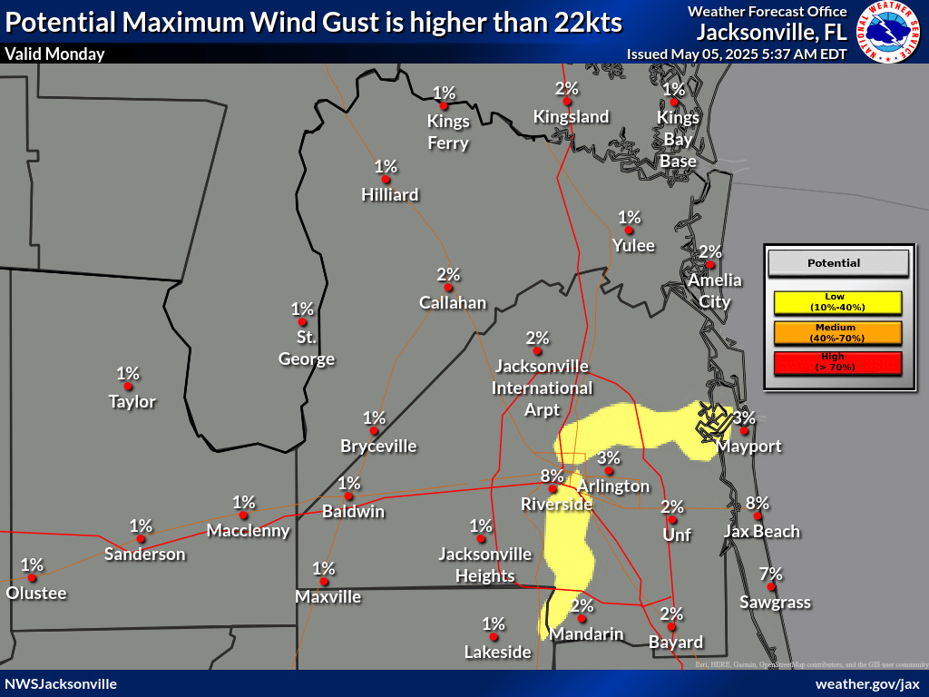
Gusts - Probability Wind Gust
≥25 mph - Chance
of Rain - Heat
Index - High/Low
Temperatures - Mixing
Height - Transport
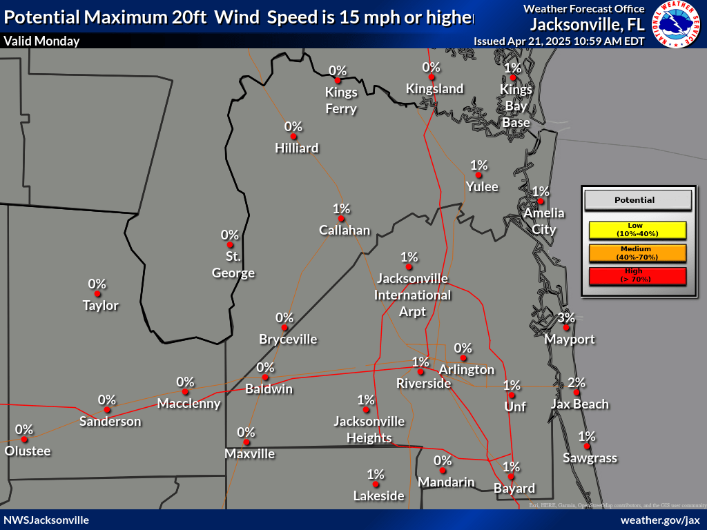
Wind - Probability 20 ft Wind
≥15 mph - Wind 20ft
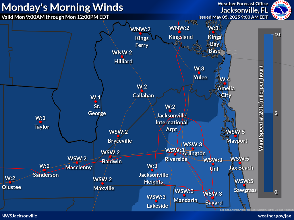
Morning - Wind 20ft
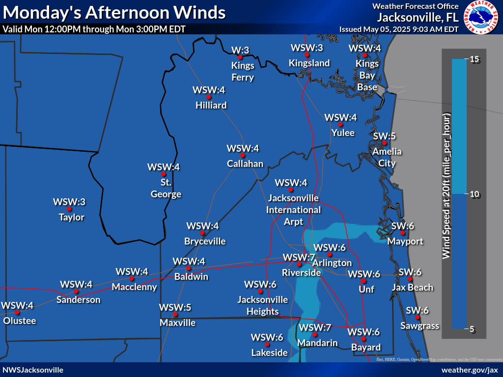
Early Aftn - Wind 20ft
Late Aftn - Min/Max
Dispersion - Fog
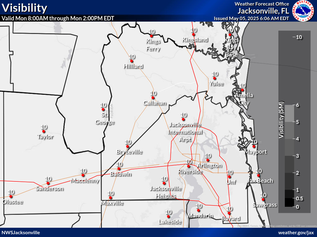
Forecast - Max Low Vis
Occurrence Risk Index - Fire Temperature
RGB to Highlight Fires
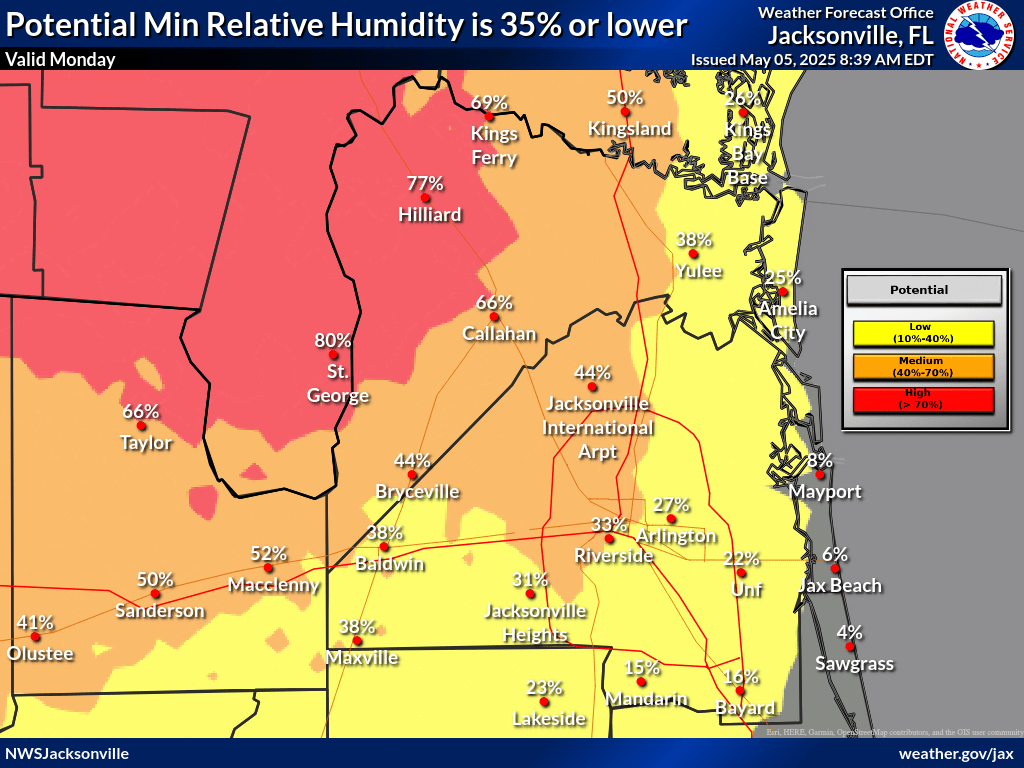
Relative Humidity (%)
|
|
|
Visibility (Fog) Forecast (miles)
|
|
 |
Probability 20 ft Wind Speed ≥15 mph
|
|
|
Probability Maximum Wind Gust ≥25 mph
|
|
|
Minimum Relative Humidity Probabilities (%)
|
|
|
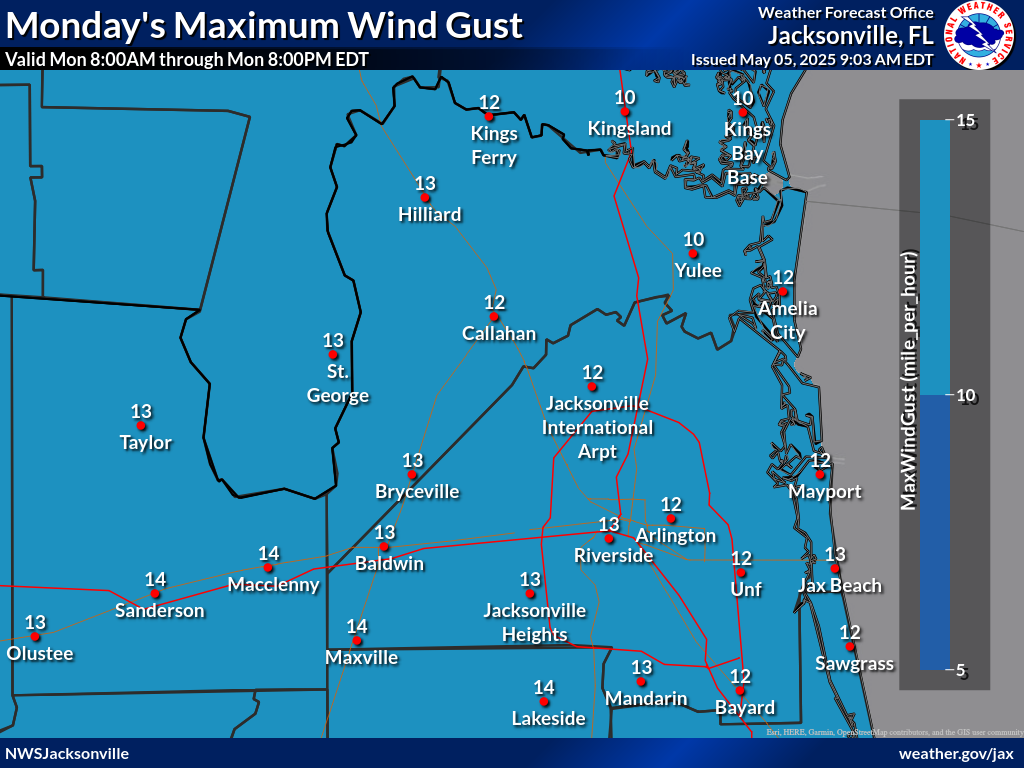
Wind Gusts (mph)
|
|
|
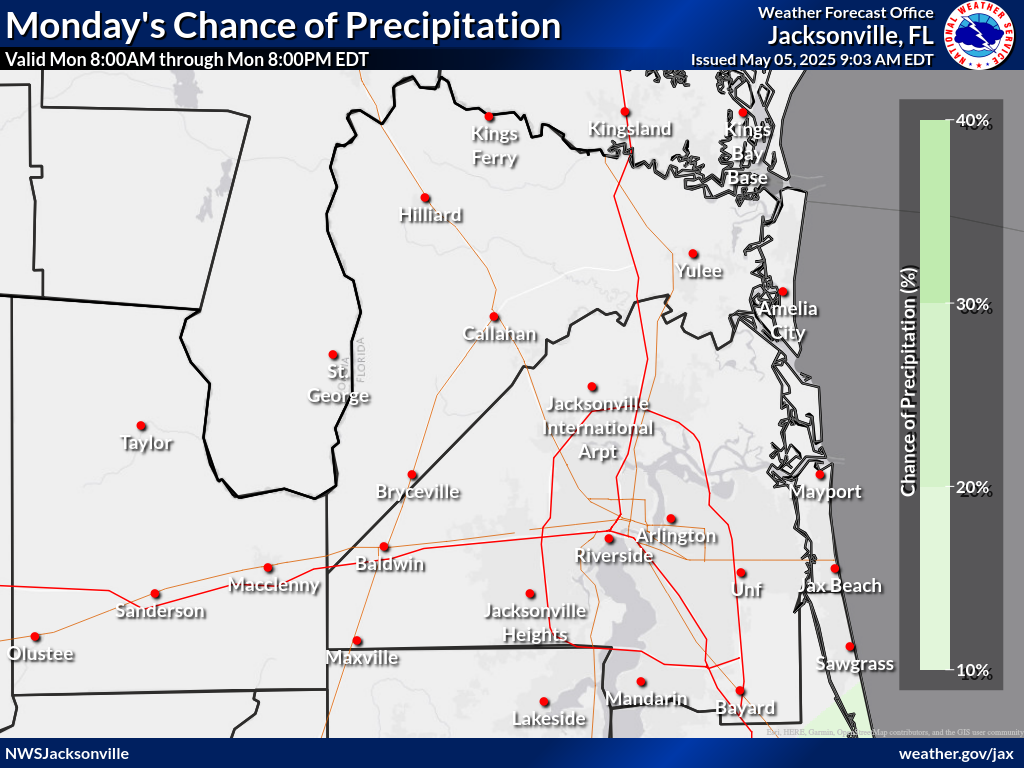
Chance of Rain (%)
|
|
|
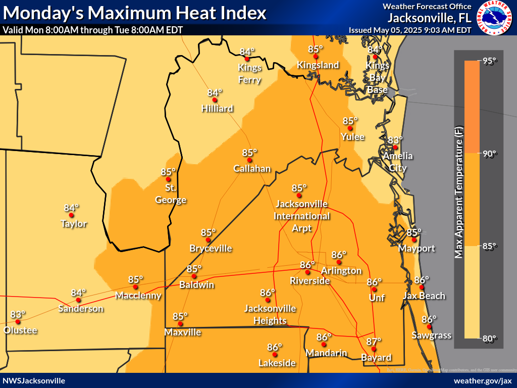
Maximum Heat Indexes (°F)
|
|
|
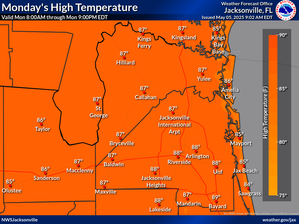
Temperatures (°F)
|
|
|
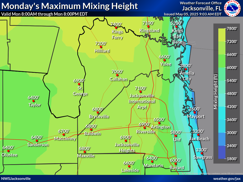
Mixing Height (agl)
|
|
|
Transport Wind (mph)
|
|
|
Wind 20ft Late Afternoon 9 am to Noon (mph)
|
|
|
Wind 20ft Early Afternoon Noon to 3 pm (mph)
|
|
|
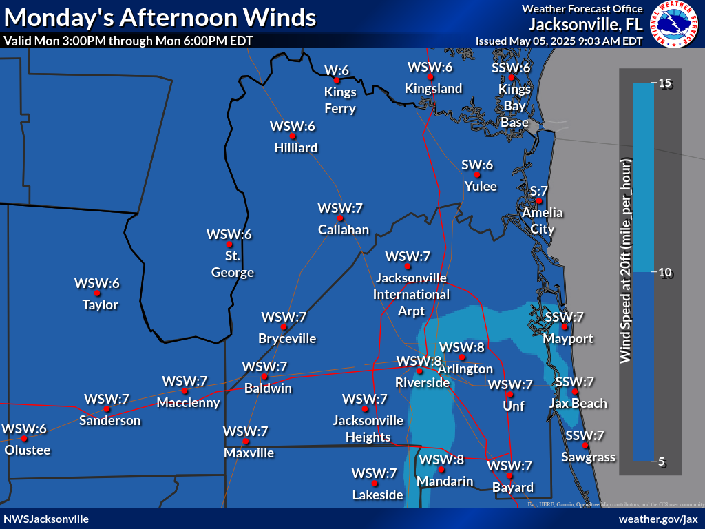
Wind 20ft Late Afternoon 3 pm to 6 pm (mph)
|
|
|
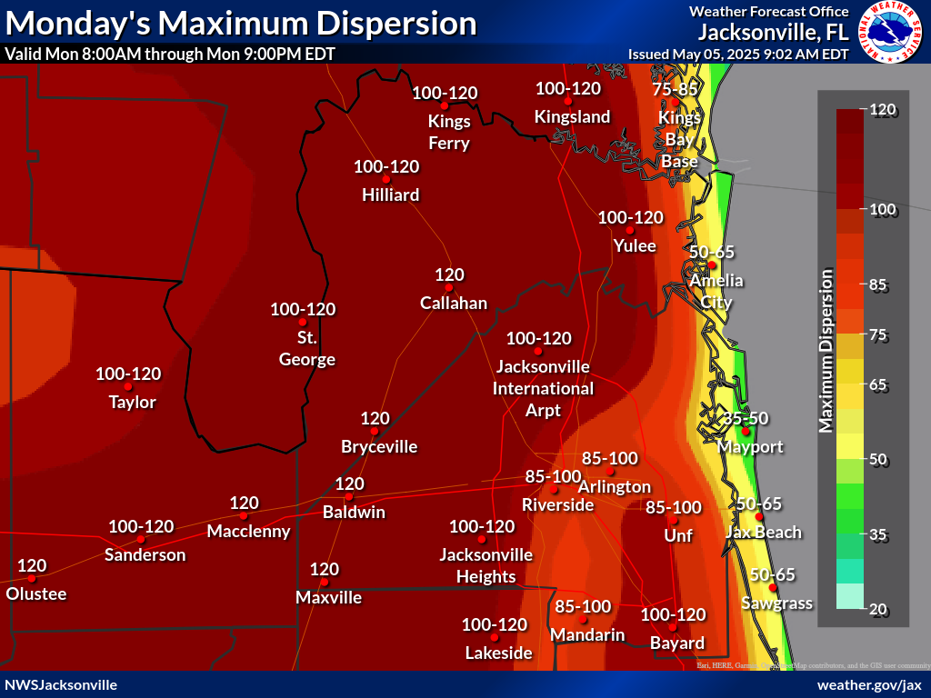
Max Daytime and Min Nighttime Dispersion
|
|
|
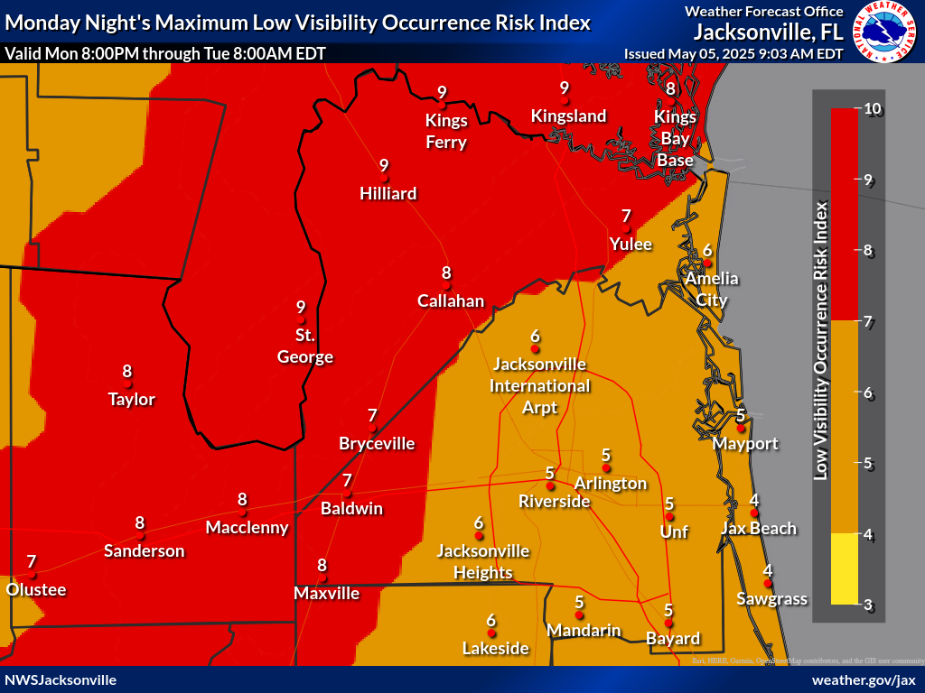
Maximum Low Visibility Occurrence Risk Index
|
|
|
Fire Temperature RGB Used to Highlight Fires
|
|
|


