


- Daily Weather
Impact - Watches/Warnings/
Advisories - Local/Regional
Radars - SPC
Reports - Regional
Satellite - Convective
Outlooks - Wind
Gusts - Probability Wind
Advisory (Wind ≥26 mph) - Probability Wind
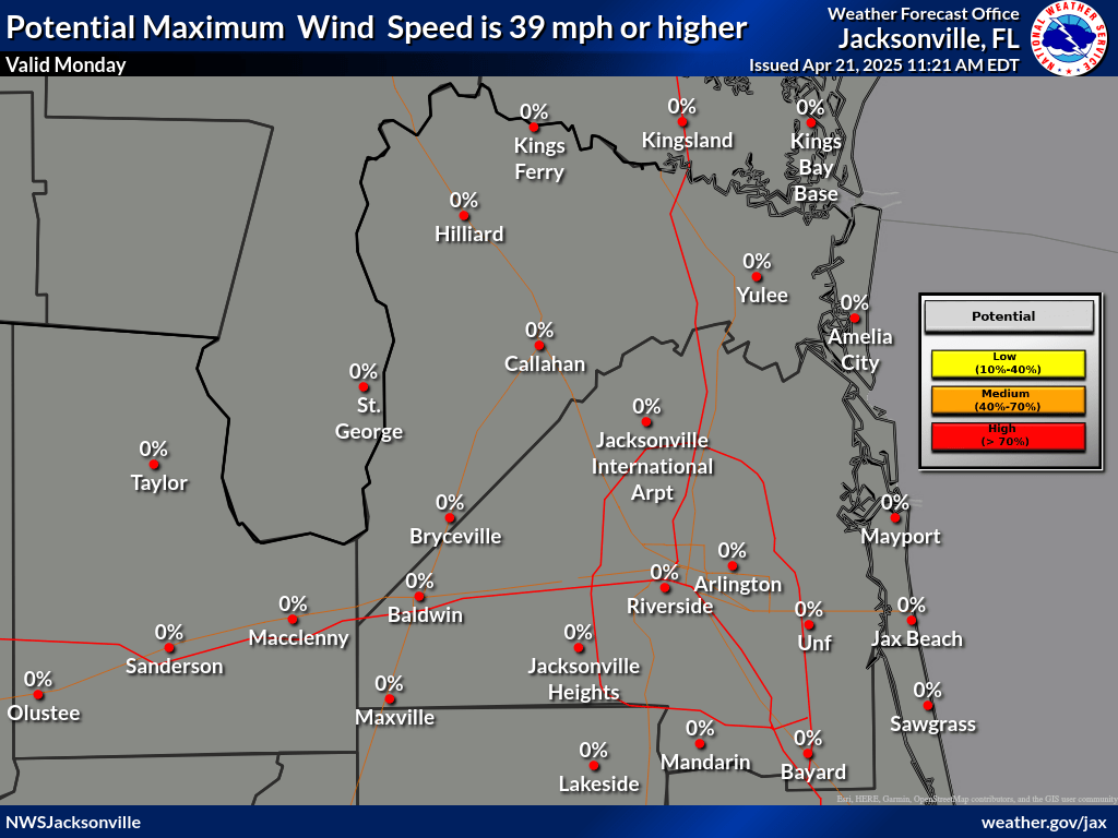
Advisory (Gusts ≥39 mph) - Probability High Wind
Warning (Wind ≥39 mph) - Probability High Wind
Warning (Gusts ≥58 mph) - Precipitation
Chances - Visibility (Fog)
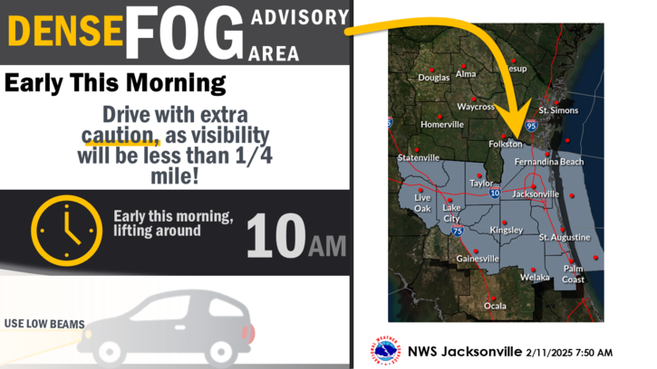
Forecast - Probability Dense
Fog Advisory ≤¼ mile
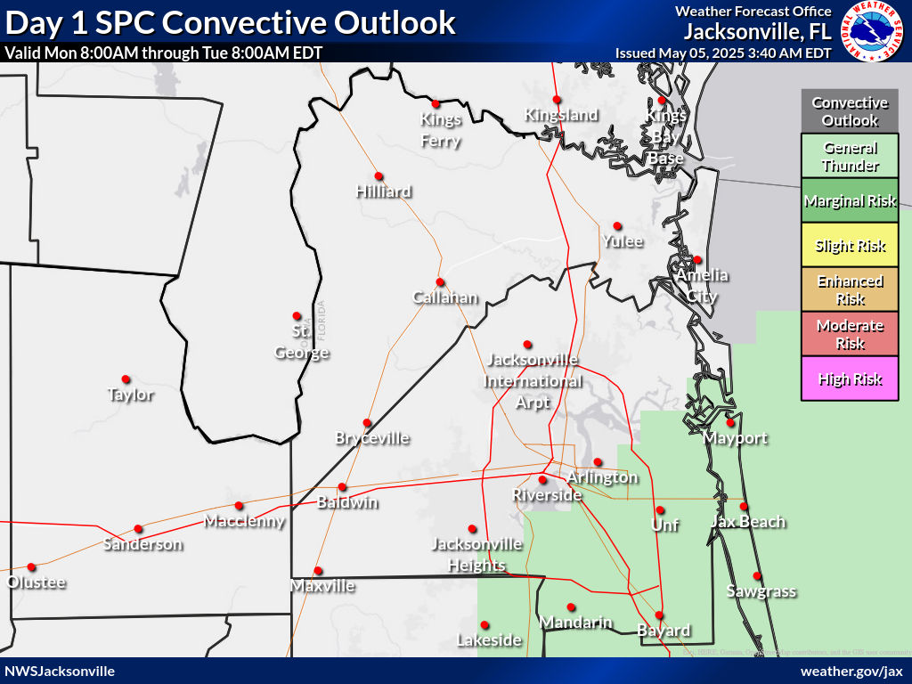
Thunderstorm Outlook Graphics
|
|
 |
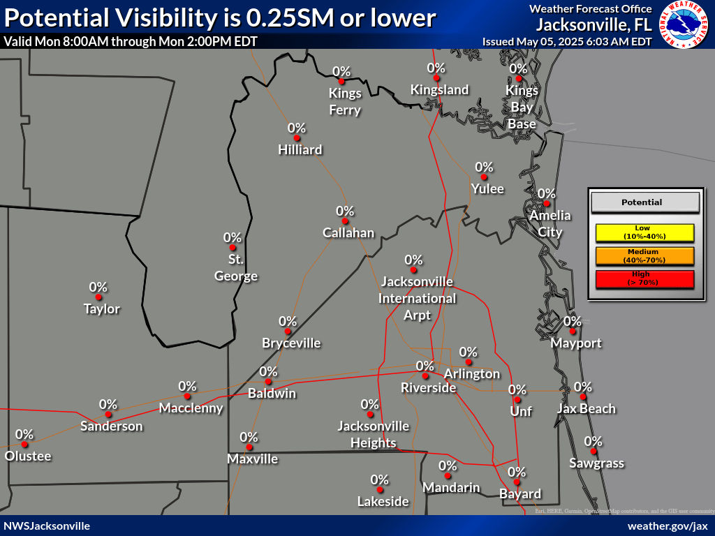
Probability Dense Fog Advisory One Quarter Mile or less
|
|
 |
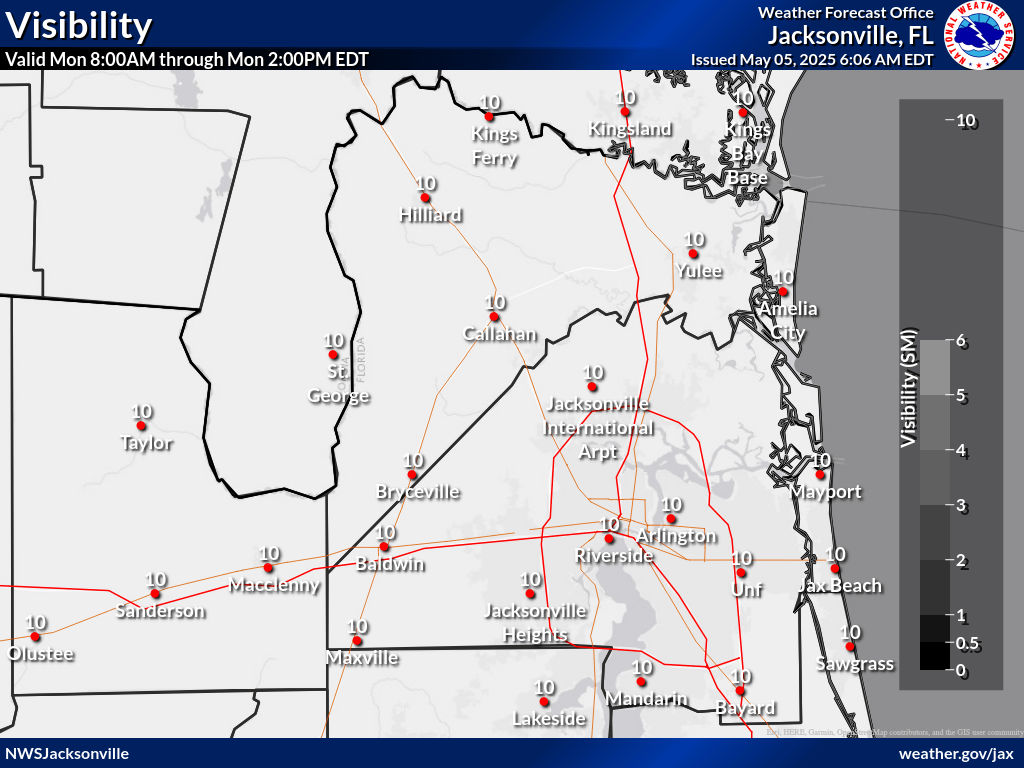
Visibility (Fog) Forecast (miles)
|
|
 |
Probability Wind Advisory Sustained Winds ≥26 mph
|
|
 |
Probability High Wind Warning Sustained Winds ≥39 mph
|
|
 |
Probability Wind Advisory Wind Gusts ≥39 mph
|
|
 |
Probability High Wind Warning Wind Gusts ≥58 mph
|
|
 |
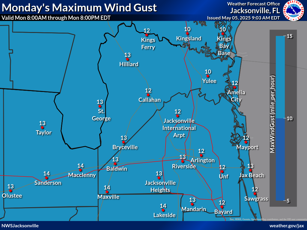
Forecast Maximum Wind Gusts (MPH)
|
|
 |
Watches/Warnings/Advisories (WWA)
|
|
 |
Daily Weather Impact Graphic
|
|
 |
Local and Regional Radars
|
|
 |
SPC Reports
|
|
 |
Regional Satellite
|
|
 |
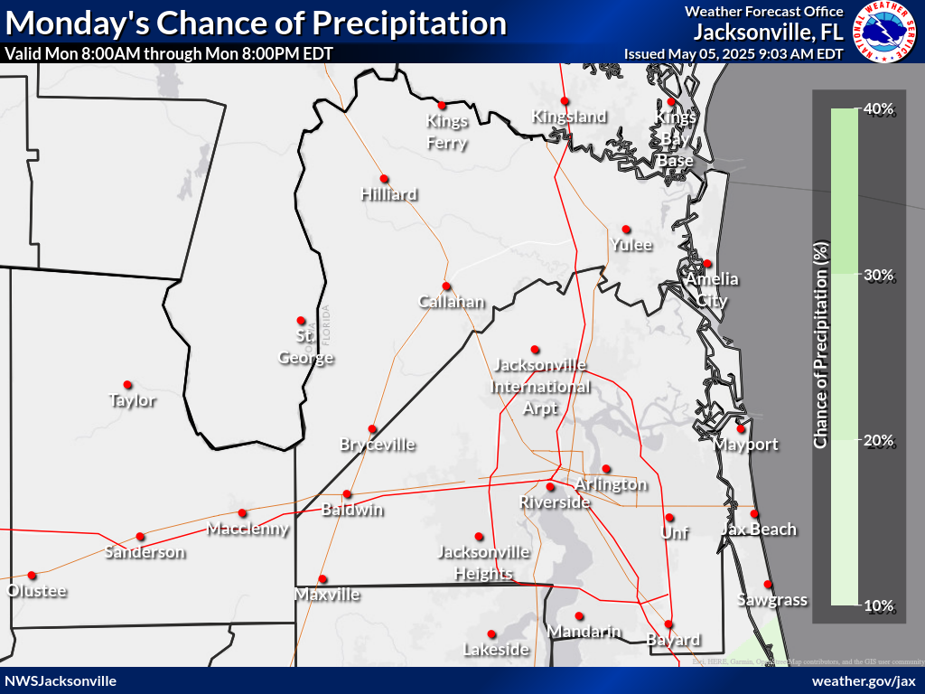
Probability of Precipitation
|
|
 |


