


- Max/Min
Temps - Probability
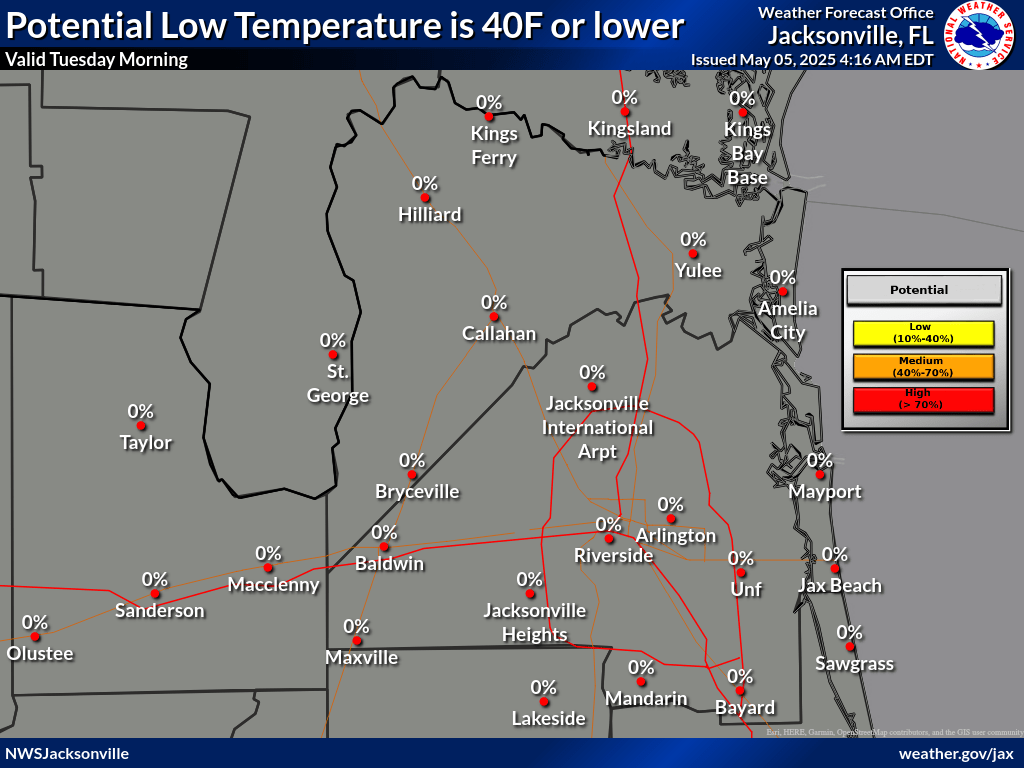
MinT ≤40 - Probability
Freeze ≤32 - Probability
Hard Freeze ≤27 - Wind
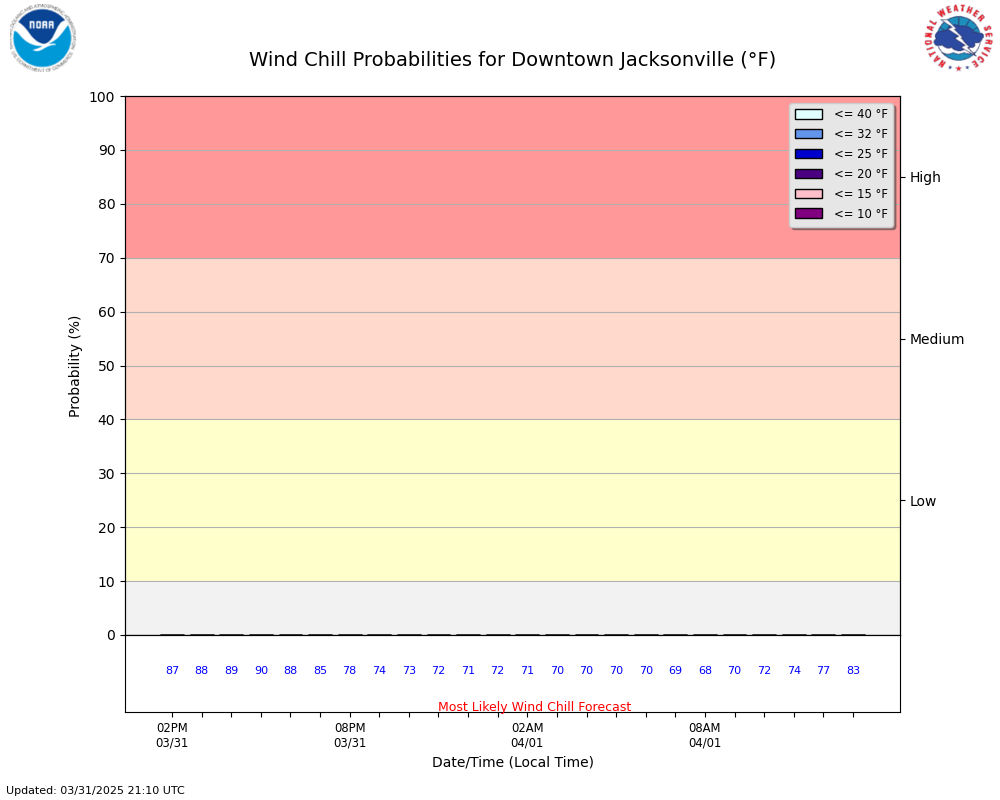
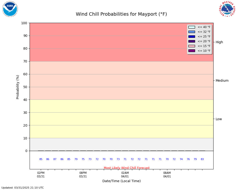
Chill - Probability
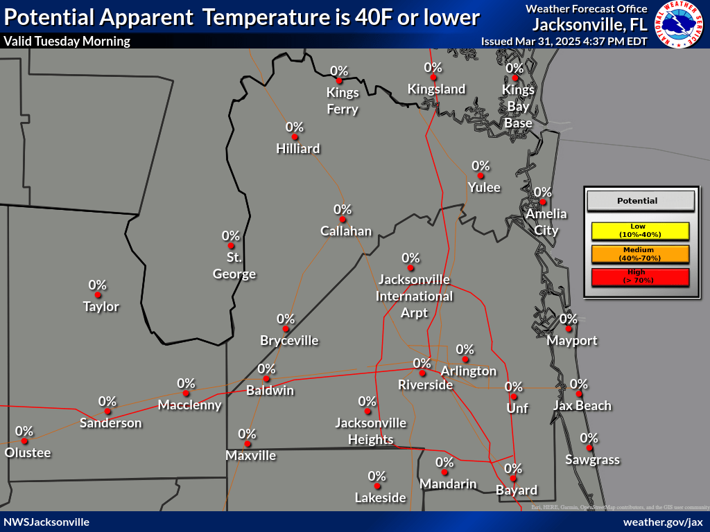
Wind Chill ≤40 - Probability
Wind Chill ≤30 - Probability Cold
Weather Adv. ≤25 - Probability Extreme
Cold Warn ≤15 - Wind
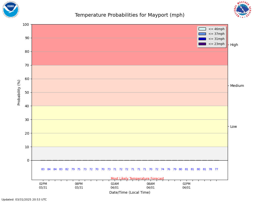
(mph) - Wind
Gust - Hourly
Probabilities
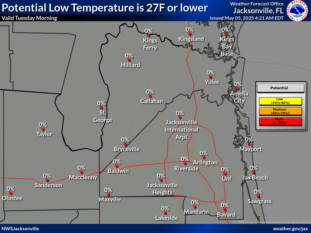
Probability of Hard Freeze ≤27
|
|
 |
Cold Weather Forecast
|
|
 |
Wind Forecast (mph)
|
|
 |
Maximum Wind Gust Forecast (mph)
|
|
 |
Probability Wind Chill ≤40
|
|
 |
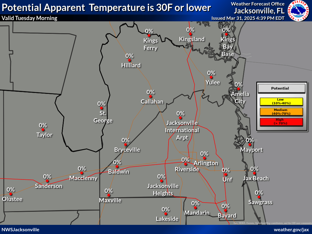
Probability Wind Chill ≤30
|
|
 |
Probability Cold Weather Advisory ≤25
|
|
 |
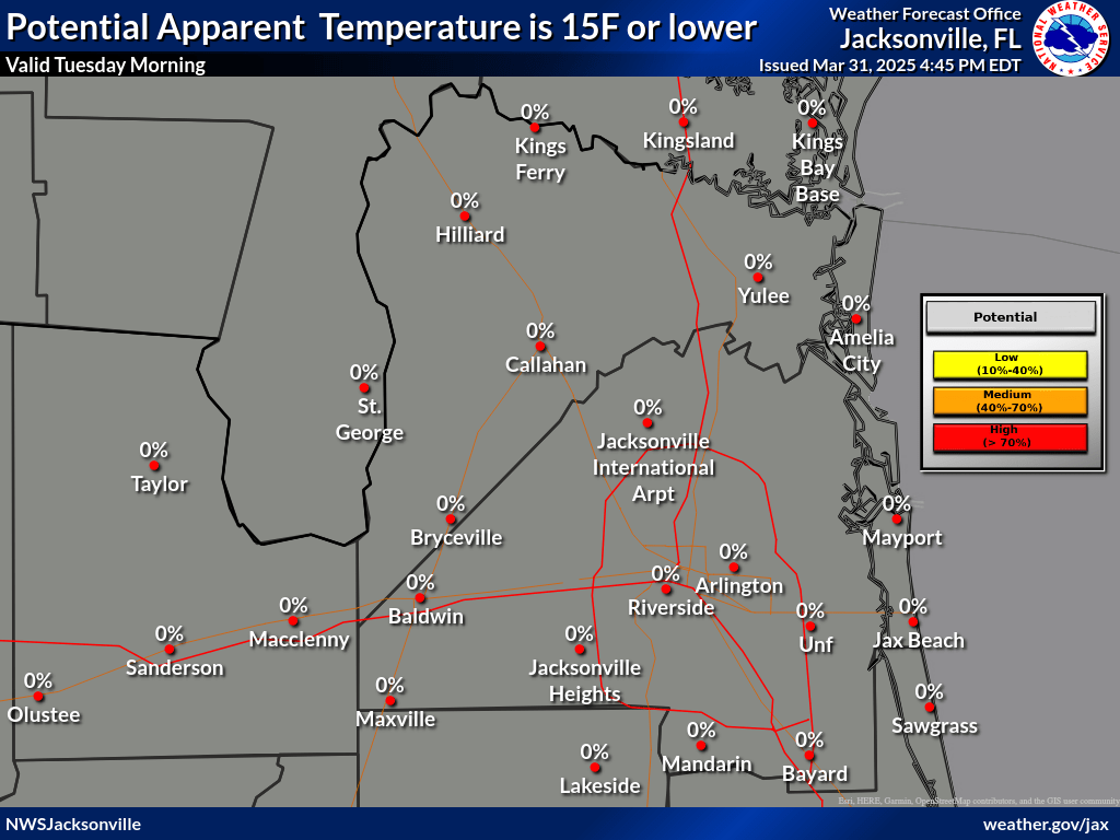
Probability Extreme Cold Warning ≤15
|
|
 |
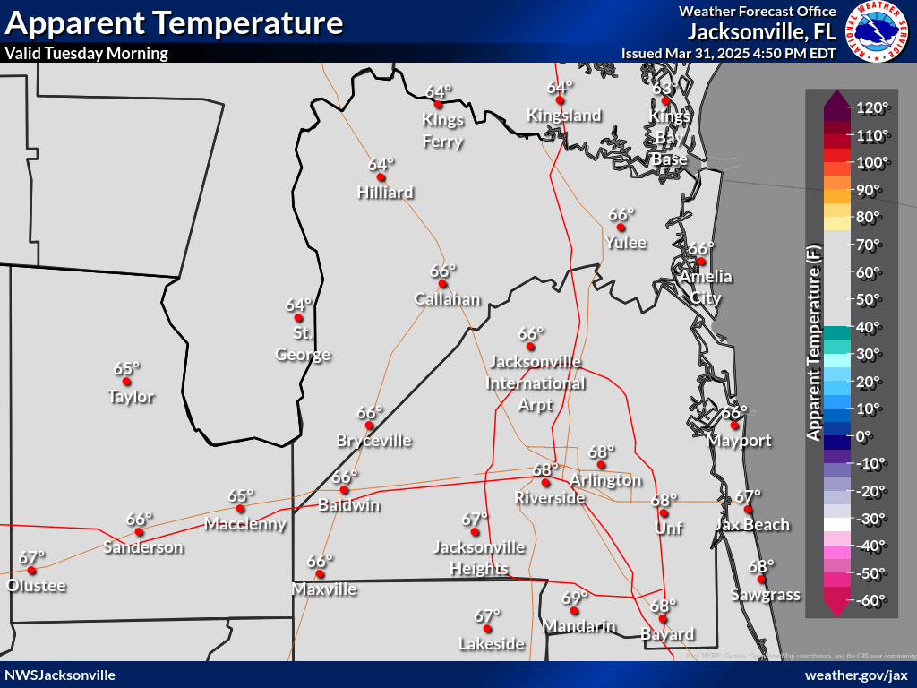
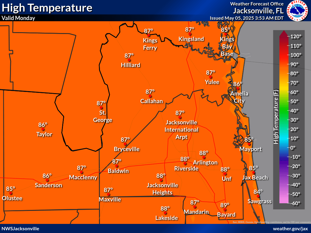
Temperatures
|
|
 |
Probability Freeze ≤32
|
|
 |
|
|||||||
|
|||||||
|


Probability Minimum Temperature <=40
|
|
 |


