
Heavy rainfall this morning has already produced 1 to 3 inches of rain across portions of western and southwestern Marion County.
Looking ahead, a Flood Watch is in effect Today through Monday evening for Gilchrist, southwestern Columbia, Suwannee, western Alachua, and western Marion Counties. Persistent southwesterly flow will continue to transport deep tropical moisture into the region, supporting multiple rounds of showers and thunderstorms through Monday. While widespread rainfall totals of 1 to 3 inches are expected, localized amounts of 4 to 6 inches are possible where storms repeatedly develop or move over the same locations.
The greatest concern is flooding of low-lying areas, poor drainage locations, small creeks and streams, and other flood-prone areas. If soils become increasingly saturated, additional rounds of heavy rainfall will elevate the potential for more significant flooding, particularly west of I-75.
Please continue to monitor the latest forecasts and be prepared for the possible issuance of Flood Warnings if conditions warrant. We will continue to provide updates as the situation evolves.


 Jacksonville Radar
 Weather Map
 Regional Satellite
  DAY 1 Convective Outlook
 Tropical Weather Outlook
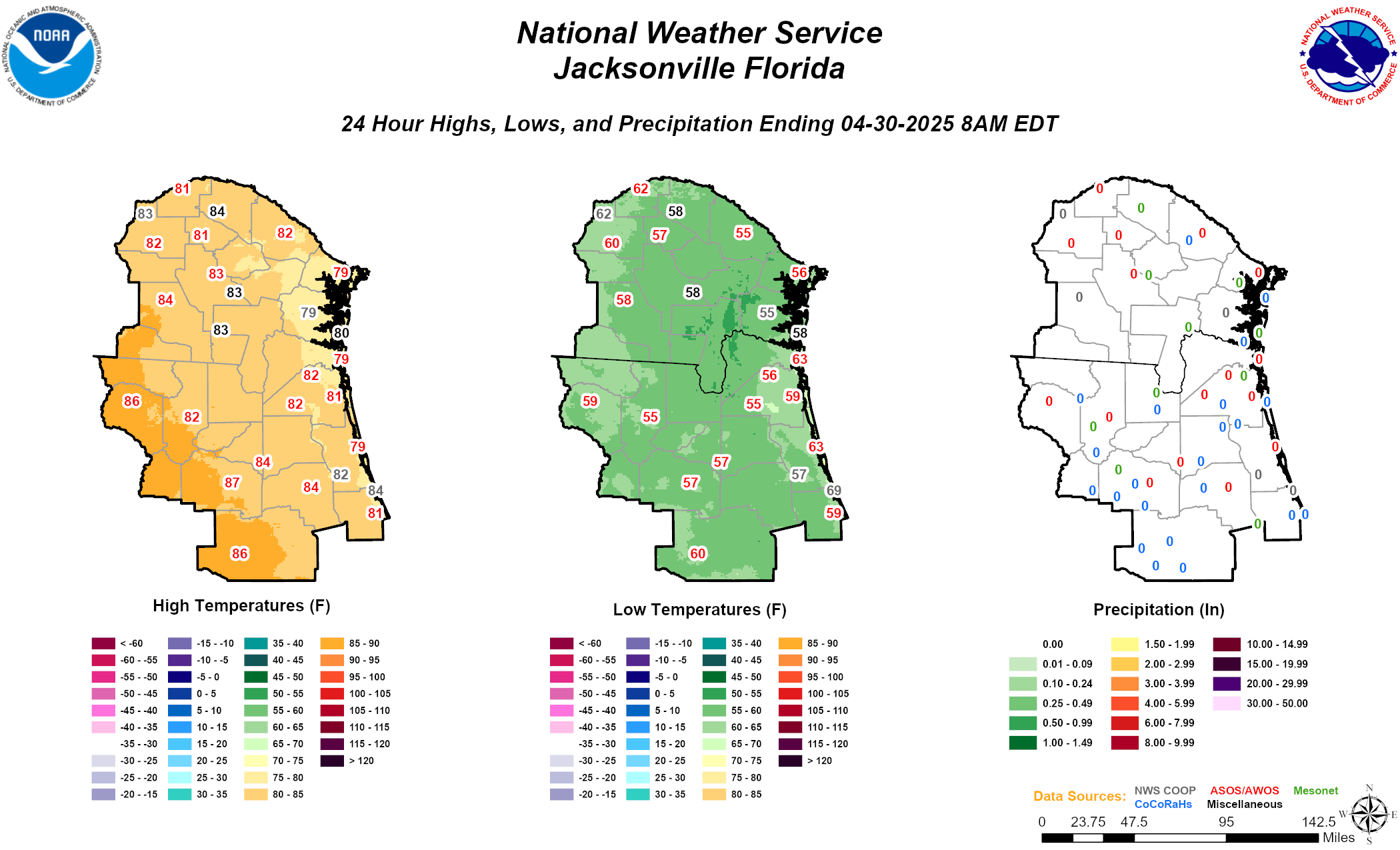 Daily Graphics