Overview
|
|
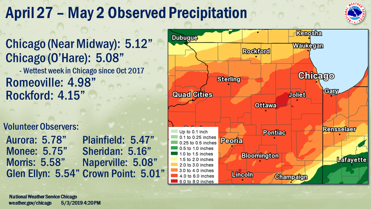
Rainfall
PUBLIC INFORMATION STATEMENT
NATIONAL WEATHER SERVICE CHICAGO IL
200 PM CDT FRI MAY 3 2019 /300 PM EDT FRI MAY 3 2019/

...PRECIPITATION AMOUNTS FROM APRIL 27 THROUGH MAY 3...

LOCATION                               AMOUNT
----------------------------------------------
IL CHICAGO MIDWAY 3SW COOP              5.12
IL CHICAGO OHARE AIRPORT ASOS           5.08
IL ROMEOVILLE WFO COOP                  4.98
IL ROCKFORD AIRPORT ASOS                4.15

VOLUNTEER OBSERVERS THAT HAD 4.50"+:

LOCATION                               AMOUNT
----------------------------------------------

IN GARY 4.8 ENE COCORAHS                6.63
IL AURORA COOP                          5.78
IL MONEE RESERVOIR COOP                 5.75
IL MORRIS 1 NW COOP                     5.58
IL GLEN ELLYN 4S COOP                   5.54
IL PLAINFIELD 3 NE COOP                 5.47
IL DARIEN 0.4 SSE COCORAHS              5.43
IL LANSING COOP                         5.38
IN HOBART 1.6 E COCORAHS                5.30
IL GLEN ELLYN 1.1 WSW COCORAHS          5.29
IL WHEATON 2.0 NNE COCORAHS             5.26
IL NAPERVILLE 2.4 SE COCORAHS           5.26
IL SHERIDAN 3.4 SSE COCORAHS            5.16
IL PLAINFIELD 4.8 SW COCORAHS           5.15
IL ROSELLE 1.2 ESE COCORAHS             5.12
IL CHICAGO MIDWAY AP 3SW COOP           5.12
IL COUNTRYSIDE 0.8 ENE COCORAHS         5.12
IL STREATOR 3 SE COOP                   5.11
IL PLAINFIELD 2.4 SSE COCORAHS          5.09
IL MINOOKA 0.3 NE COCORAHS              5.09
IL NAPERVILLE 1.1 NW COCORAHS           5.08
IL PARK FOREST COOP                     5.06
IL CHICAGO BOTANIC GARDEN COOP          5.06
IL PALOS PARK 1.3 SW COCORAHS           5.02
IL OAK FOREST 0.6 N COCORAHS            5.01
IN CROWN POINT 1N COOP                  5.01
IL DIXON 1W COOP                        5.00
IL ROMEOVILLE WFO COOP                  5.00
IL HOMEWOOD 0.1 ESE COCORAHS            5.00
IL HOMER GLEN 0.7 NNE COCORAHS          4.99
IL PLAINFIELD 3.0 ESE COCORAHS          4.99
IL MENDOTA 2 SE COOP                    4.98
IL AURORA 3.8 SE COCORAHS               4.98
IL MORRIS 4.8 NNW COCORAHS              4.98
IL MANHATTAN 5 NE COOP                  4.98
IL CHICAGO 5.5 ESE COCORAHS             4.98
IN CROWN POINT 2.0 WSW COCORAHS         4.97
IL DOWNERS GROVE 0.4 NNE COCORAHS       4.95
IL OAK PARK 1.3 NNE COCORAHS            4.95
IL NAPERVILLE 4.0 SSW COCORAHS          4.93
IL ELBURN COOP                          4.92
IL NORTH AURORA 1.5 NE COCORAHS         4.89
IL NAPERVILLE 2.8 SSW COCORAHS          4.88
IL OAK PARK 1.5 S COCORAHS              4.88
IL EARLVILLE 3S COOP                    4.87
IL MONEE 4.9 W COCORAHS                 4.86
IL PEOTONE COOP                         4.85
IL PALOS PARK 3.6 WNW COCORAHS          4.84
IL BURR RIDGE 1.9 SW COCORAHS           4.83
IL PLAINFIELD 2.4 SSE COCORAHS          4.83
IL OTTAWA 1.3 NW COCORAHS               4.82
IL OTTAWA 1.6 N COCORAHS                4.82
IL DWIGHT COOP                          4.82
IL VILLA PARK 1.0 NWCOCORAHS            4.81
IL MONTGOMERY 0.8 SSECOCORAHS           4.81
IL OTTAWA 0.4 N COCORAHS                4.81
IL KANKAKEE WASTEWATER COOP             4.80
IL DOWNERS GROVE 0.9 S COCORAHS         4.79
IL JOLIET 2.9 WNW COCORAHS              4.78
IN VALPARAISO 1.7 N COCORAHS            4.78
IL CRETE 2.6 E COCORAHS                 4.78
IL OAK LAWN 1.6 WNW COCORAHS            4.77
IL ELMHURST 2.0 SE COCORAHS             4.76
IL JOLIET BRANDON RD COOP               4.76
IL LISLE 1.3 SE COCORAHS                4.75
IN GRIFFITH 1.2 N COCORAHS              4.75
IL MORRIS 5.9 ESE COCORAHS              4.73
IN PORTAGE 2.8 E COCORAHS               4.72
IL MENDOTA 0.4 ENE COCORAHS             4.71
IL ELMHURST 0.4 SW COCORAHS             4.69
IL LITTLE RED SCHOOL HOUSE COOP         4.69
IN SCHERERVILLE 1.1 E COCORAHS          4.68
IL LA GRANGE PARK 0.7 SSW COCORAHS      4.68
IL MANHATTAN 1.9 SE COCORAHS            4.67
IL WEST CHICAGO DUPAGE AP ASOS          4.67
IL MORTON ARBORETUM COOP                4.67
IL LA SALLE 0.1 W COCORAHS              4.65
IL OAK LAWN 1.9 SE COCORAHS             4.65
IN HAMMOND 0.6 SSW COCORAHS             4.64
IL PLAINFIELD 2.9 NNW COCORAHS          4.63
IL ELK GROVE VLG 0.6 ESE COCORAHS       4.62
IL MIDLOTHIAN 0.1 SSE COCORAHS          4.61
IL CHANNAHON 0.8 NNE COCORAHS           4.60
IL NEW LENOX 2.9 ENE COCORAHS           4.59
IL LOCKPORT 1.3 SE COCORAHS             4.58
IN WINFIELD 1.2 NE COCORAHS             4.55
IL HOMER GLEN 1.6 NW COCORAHS           4.55
IL MANHATTAN 0.8 ESE COCORAHS           4.54
IL OAK LAWN 0.5 SSW COCORAHS            4.54
IN VALPARAISO 5.7 WSW COCORAHS          4.53
IL OAK PARK 1.0 SW COCORAHS             4.52
IL HARWOOD HEIGHTS 0.4 NNE COCORAHS     4.51
IL BATAVIA 1.3 WNW COCORAHS             4.51
IL CHATSWORTH COOP                      4.50
IL CHANNAHON 2.5 SSE COCORAHS           4.50
IL CHICAGO RIDGE 0.2 WSW COCORAHS       4.50
​
Rivers
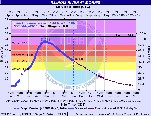
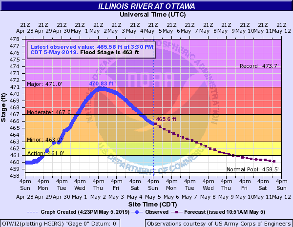
NOTE: These are static images of the crests. For the latest river stages and forecasts, please see our AHPS Page.
| Observed Stages (in blue) on the Illinois River | ||
 |
 |
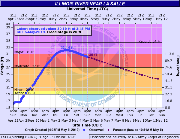 |
| Morris Hydrograph | Ottawa Hydrograph | LaSalle Hydrograph |
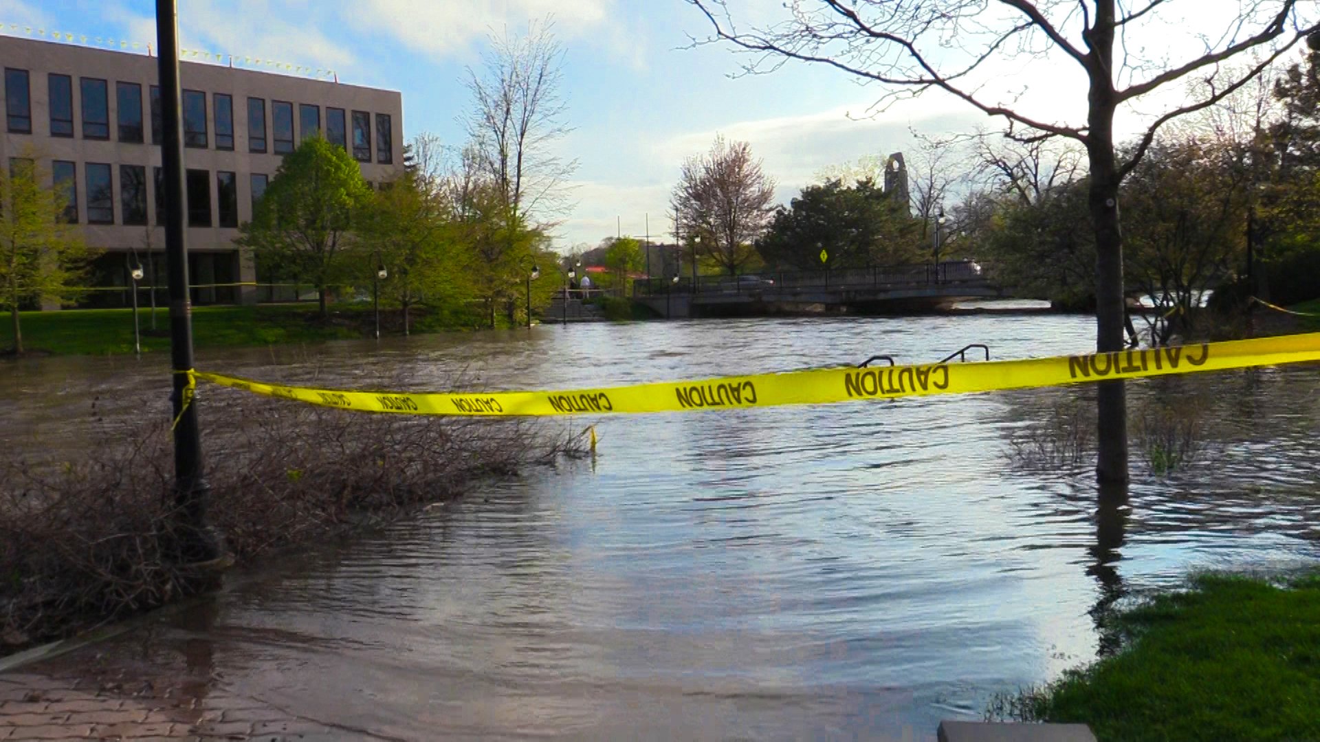
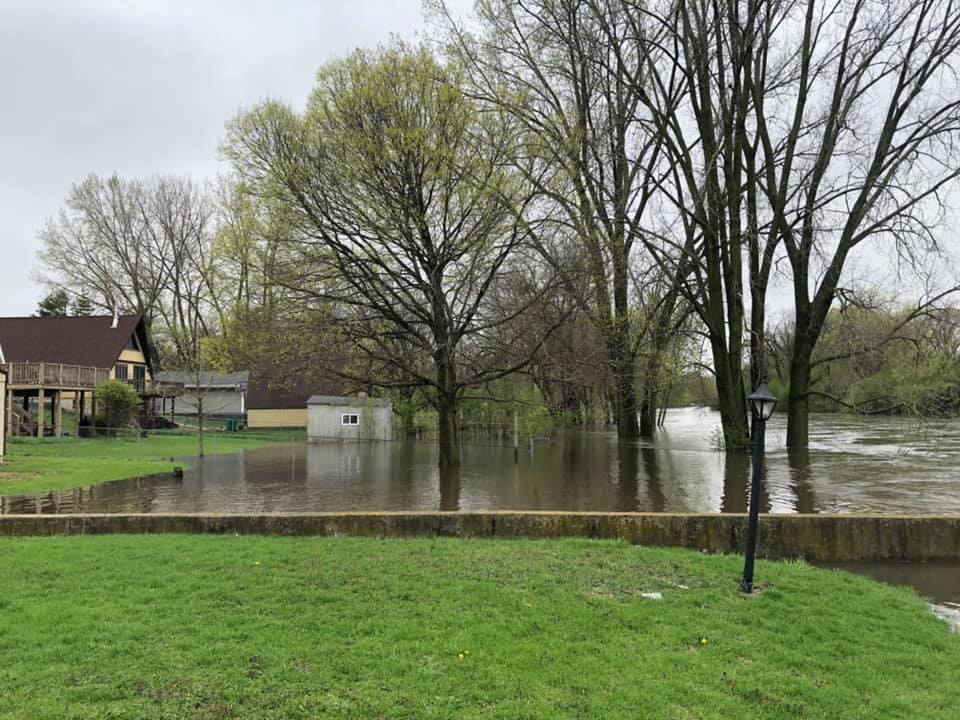
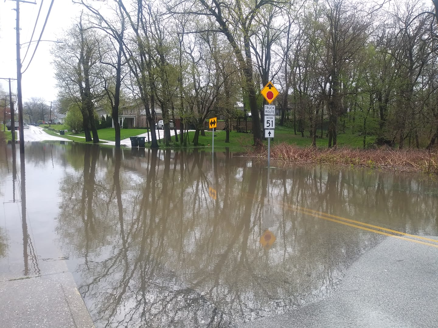
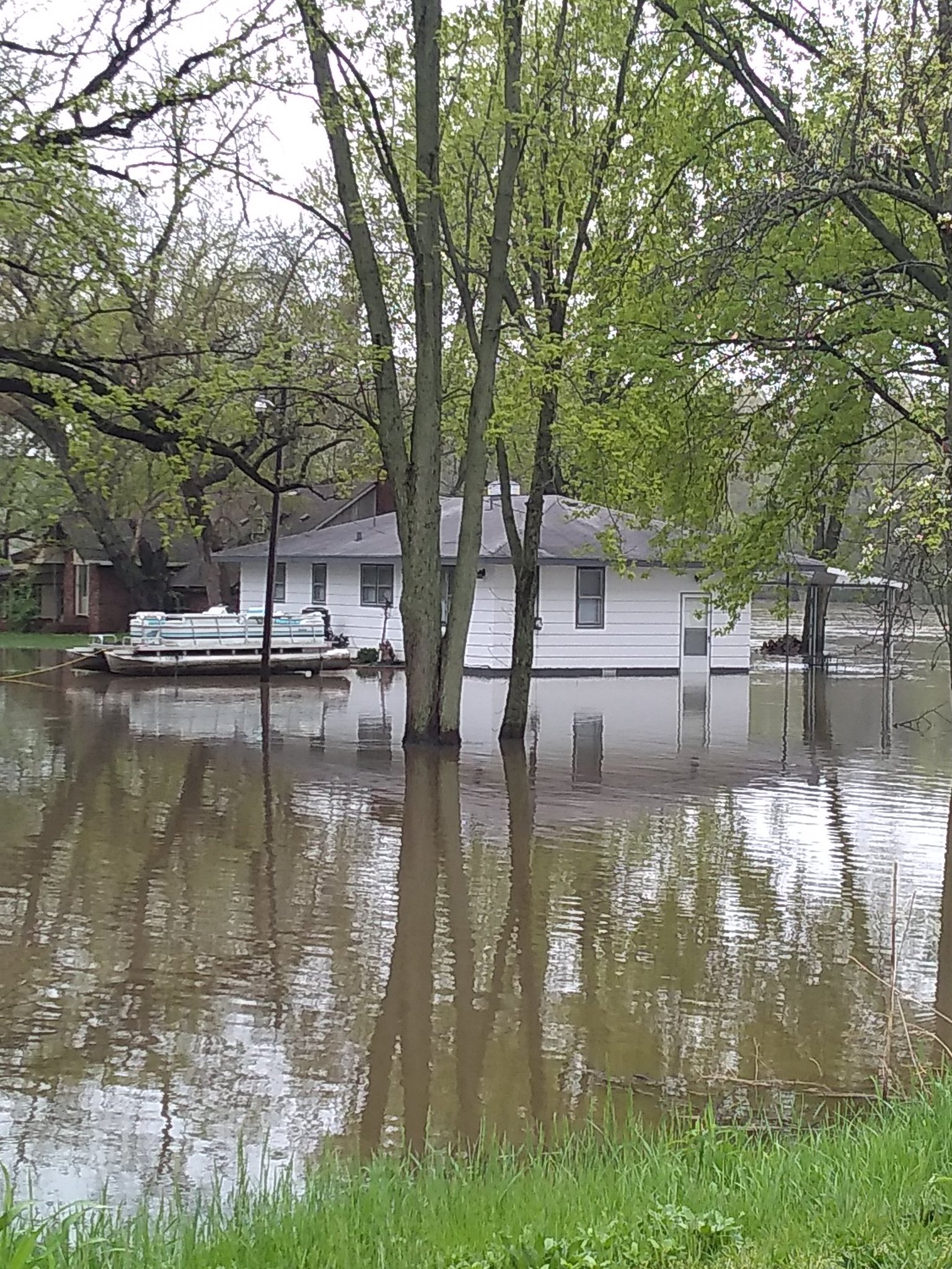
Photos
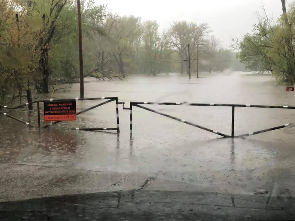 |
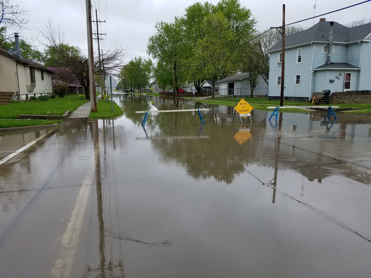 |
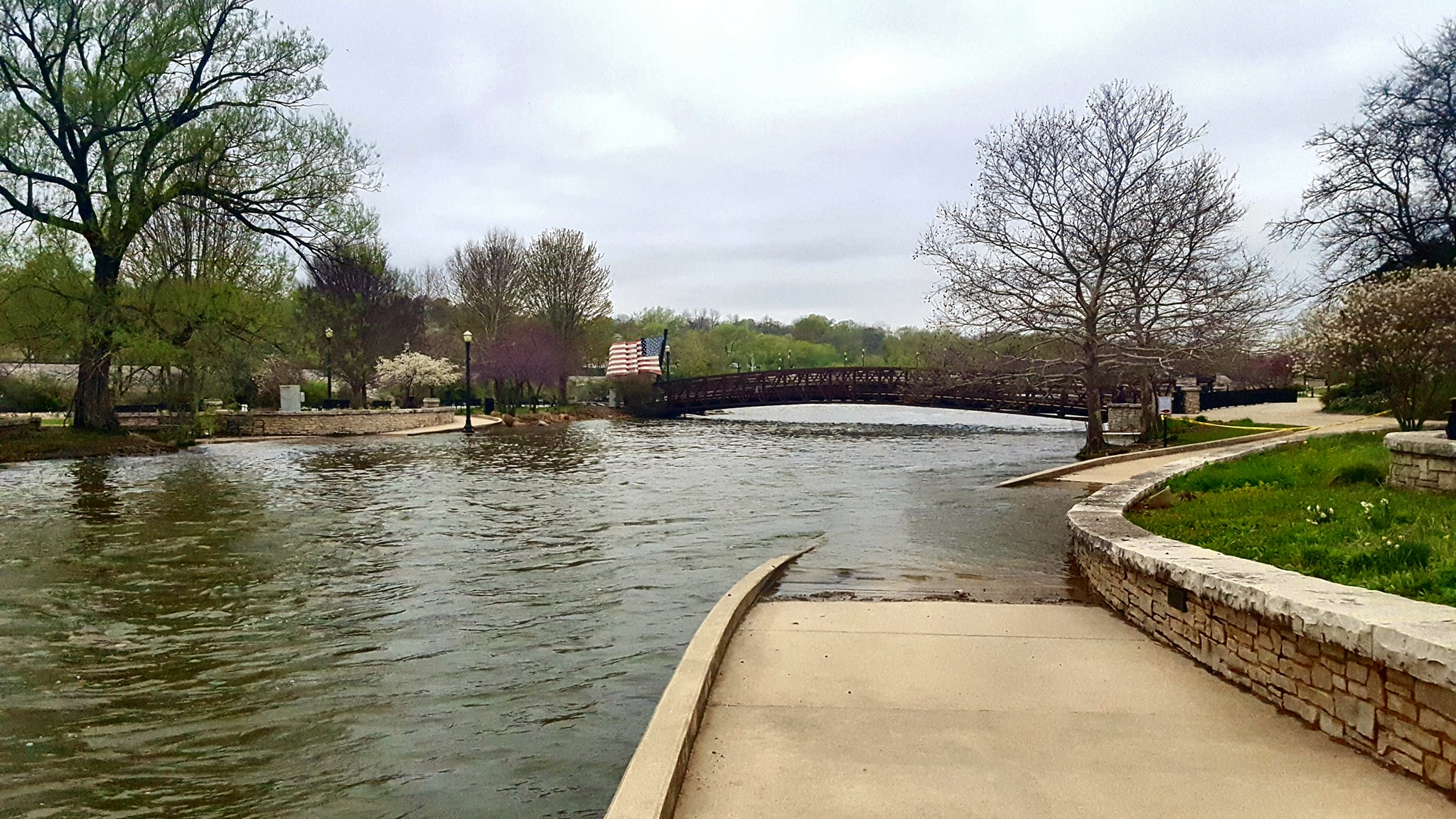 |
| Illinois River at the Starved Rock boat ramp, courtesy of Lisa Sons | Vermillion River- near Pontiac at Livingston Street, courtesy of Alex Eggenberger | Fox River in downtown Elgin, courtesy of GT Gio |
 |
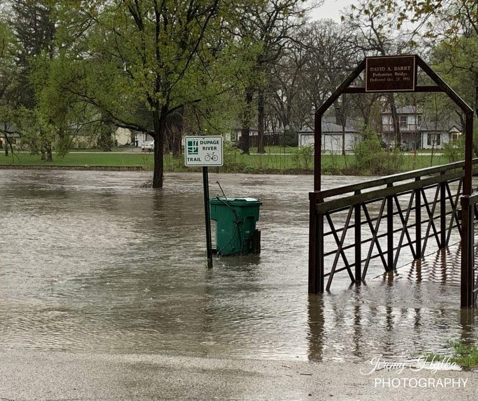 |
| DuPage River in Downtown Naperville, courtesy of Shane Gustafson | DuPage River Near Illinois Hwy 59, South of U.S. 52 in Shorewood, courtesy of Jeremy Hylka |
 |
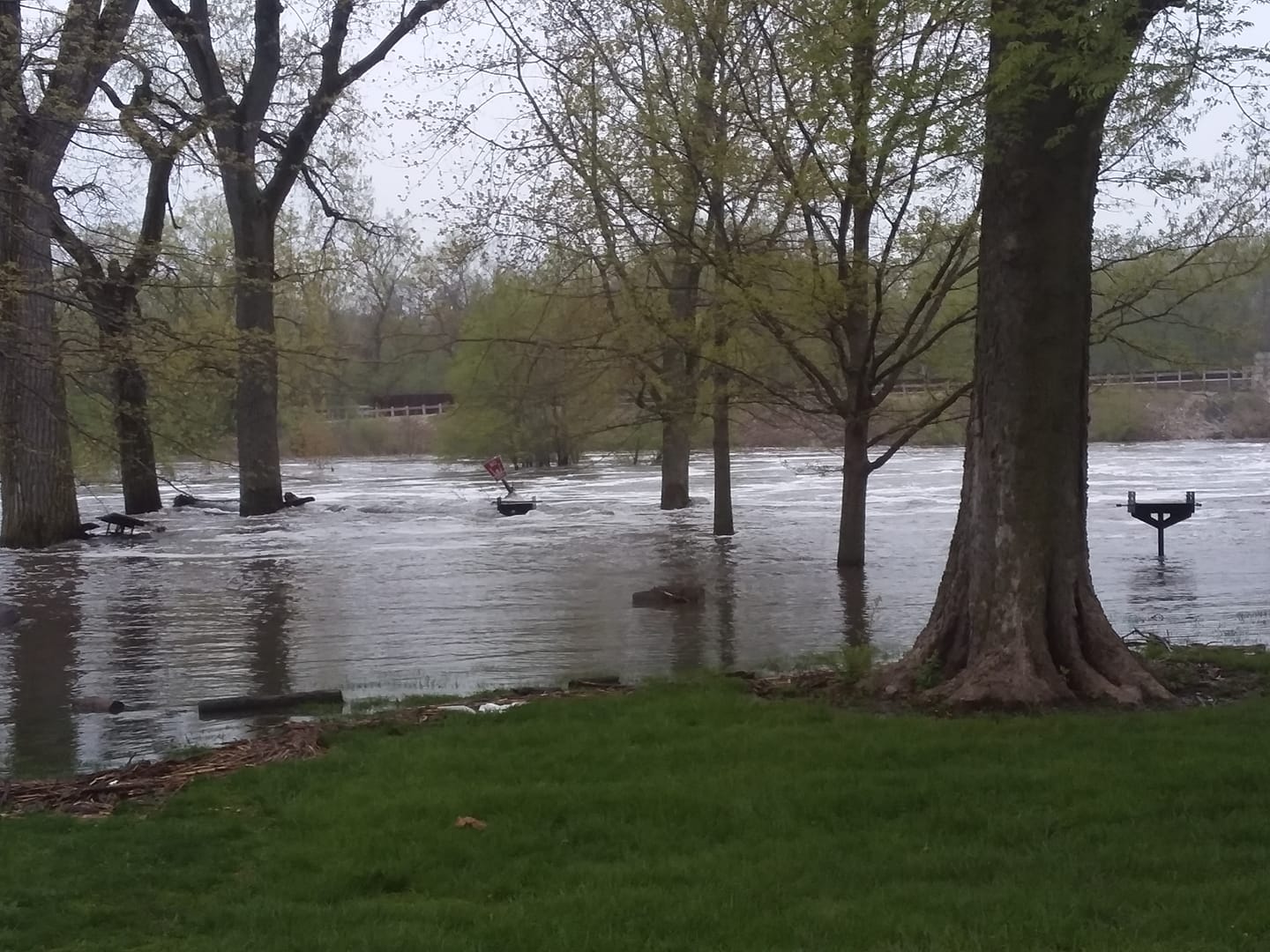 |
| DuPage River Near Plainfield, courtesy of Liz Willow Soul | DuPage River in Channahon State Park, courtesy of Lisa Wunder |
 |
 |
| Deep River in Hobart, courtesy of Tami Bateman | Kankakee River near Route 17E in AromaPark, courtesy of Andrea Mirabella |
Additional
 |
Media use of NWS Web News Stories is encouraged! Please acknowledge the NWS as the source of any news information accessed from this site. Additional recaps can be found on the NWS Chicago Past Events Page |
|