
Flash flooding threatens areas from the Tennessee Valley to the Carolinas as storms repeat along a stalled front. Monsoonal storms may trigger flooding in the Southwest. Dangerous heat expands across the Desert Southwest, Plains, mid-Mississippi Valley and Southern Tier. Critical fire weather for interior Pacific Northwest. Cooler, drier air brings brief relief to the Great Lakes and Northeast. Read More >
Storms Produce Hail, Wind and 1 Brief Tornado
8 June 2008
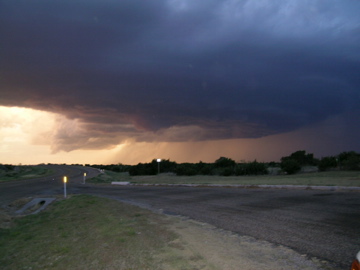
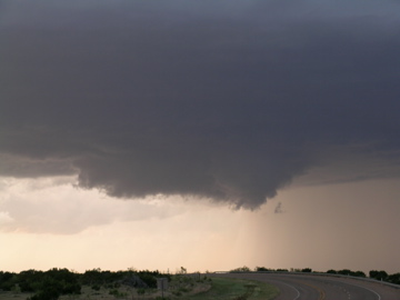
Image of a severe thunderstorm that tracked across northern Briscoe and Hall Counties on 8 June 2008. This image was taken from Highway 86, about 5 miles northwest of Quiteque, looking north around 8:53 pm. Picture courtesy of David Purkiss.
Sunday, June 8th, brought scattered thunderstorms to portions of the South Plains and Texas Panhandle. Early in the day, a cold front sank south into the central and southern Texas Panhandle before stalling out by early afternoon and retreating northward slightly late in the day. Along and south of the front, temperatures climbed well into the 90s under strong early June sun, and with decent moisture in place, moderate amounts of instability developed. By late in the afternoon, scattered thunderstorms developed along the front. Additionally, more isolated activity developed southward along a dryline that extended across the western Texas Panhandle into southeast New Mexico. The moderate instability, coupled with adequate amounts of wind shear, were sufficient to allow some of the storms to become severe.
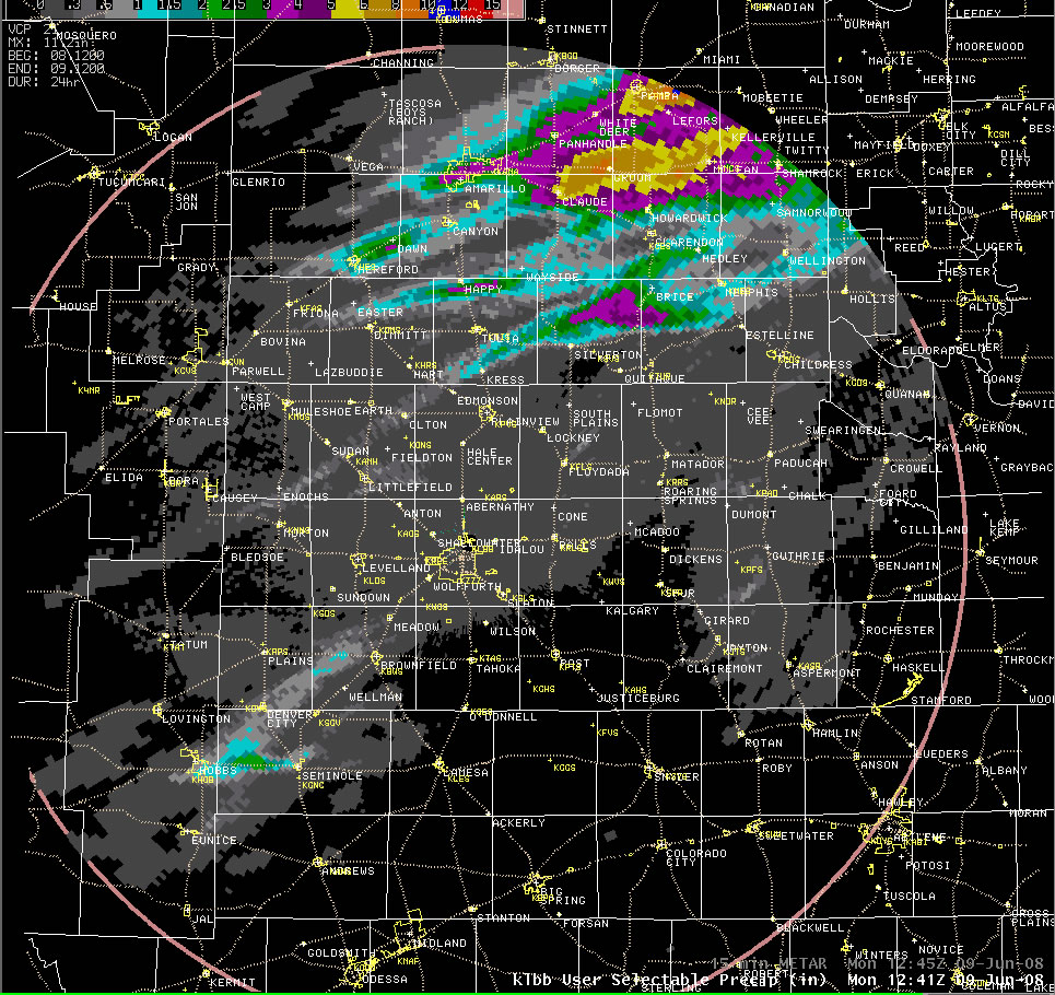
Above is a map of the radar estimated precipitation throughout the duration of the severe thunderstorm event. A number of tracks can be seen, most which were associated with severe thunderstorms. The initial activity produced golf ball sized hail east of Kress. This storm eventually became the most severe of the storms, slowing considerably, rotating strongly aloft, generating up to baseball sized hail, and even producing a brief tornado about 8 miles north-northwest of Turkey. Other severe thunderstorms also developed, one that brought penny sized hail to Amherst, and another farther to the south, that threw out half dollar sized hail west of Brownfield before quickly diminishing. More severe storms developed late in the evening across the north, with Happy being hit with half dollar sized hail and strong winds. Scattered non-severe showers and thunderstorms continued over parts of the Rolling Plains through the night, though rainfall amounts were generally light. A more significant complex of thunderstorms formed over the eastern Texas Panhandle and moved into western Oklahoma, bringing very heavy rain which resulted in some flooding.
For a complete listing of the preliminary Local Storm Reports (LSRs) CLICK HERE.
 |
 |
 |
 |

