National Weather Service United States Department of Commerce

Scattered thunderstorms are expected tonight mainly in the far southeastern Texas Panhandle and northern Rolling Plains. Large hail and damaging winds are possible.
With gusty northeasterly winds and mostly cloudy skies today, temperatures will only warm into the 60s to lower 70s. Storm chances will continue through late morning with the greatest chances being off the Caprock.
Mostly cloudy skies should clear and the gusty winds should weaken by later this evening. Temperatures will be cooler in the upper 30s to 40s.
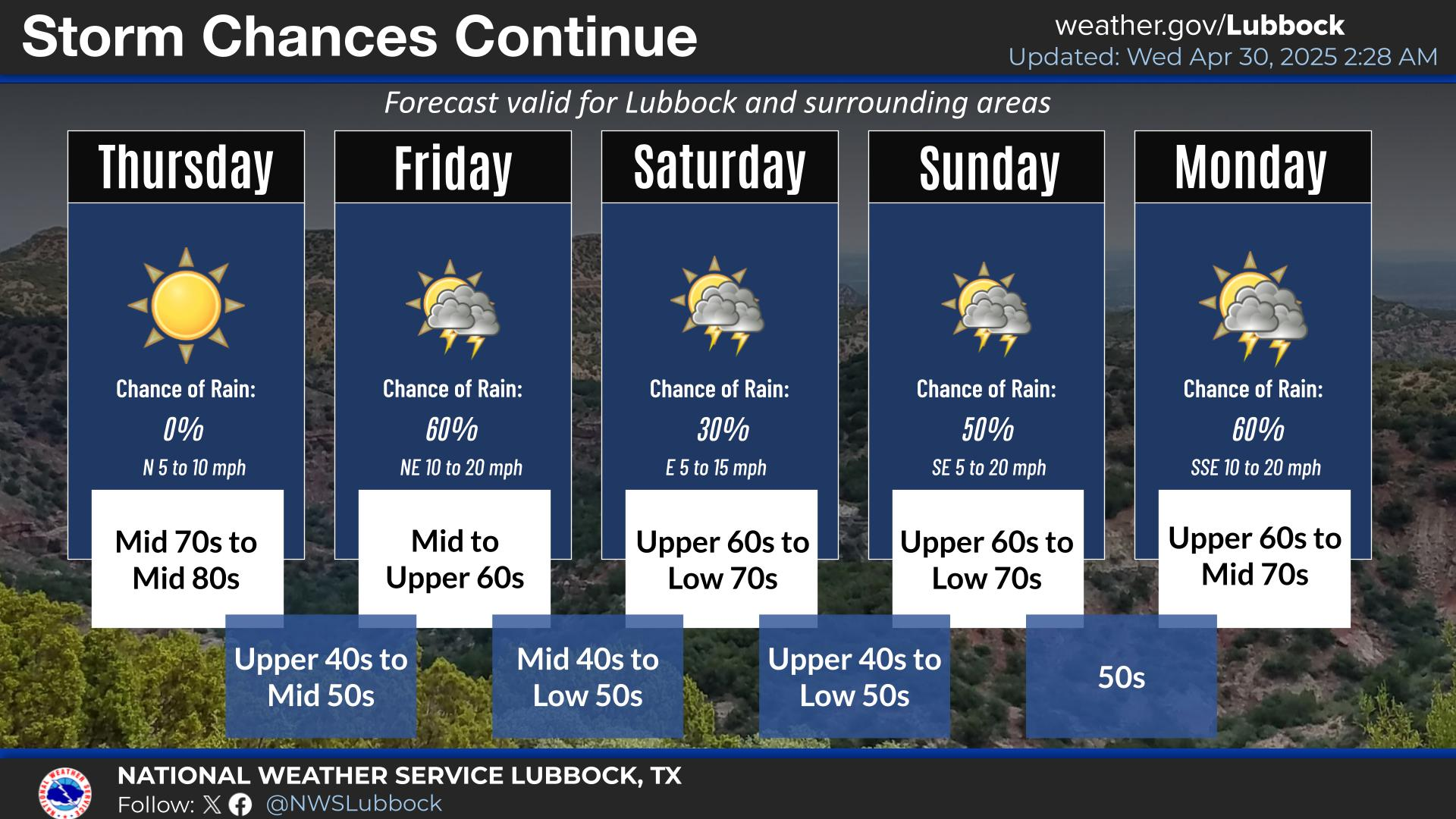
Chances are increasing in the potential for a flooding event early next week across the Caprock and Rolling Plains. Widespread rainfall is forecast Monday night into Tuesday. Heavy rainfall will accompany thunderstorms.
Storm chances Friday morning will give way to fair weather Saturday, with additional storm chances returning Sunday and into early next week. Chances are increasing in the potential for a flooding event early next week across the region.


Local Weather History For May 2nd...
1978: Multiple rounds of severe thunderstorms rumbled across the southern South Plains from early this morning through
early afternoon. Starting at 1:25 AM, a hailstorm struck Slaton dropping hailstones as large as golf balls. By 6:42 AM,
Lubbock County experienced another intense storm; this time in the form of a tornado near Acuff as spotted by the public.
The tornado moved easterly for three miles before dissipating. No damage was reported from the tornado, but winds near 70
mph along with 1/2 inch hail caused a swath of mostly roof and crop damage west and east of Acuff. At 7:40 AM, wind gusts
to 62 mph damaged a piece of roofing in Lubbock that landed on a glider inside a hangar causing minor damage. A final bout
of storms developed early in the evening and once again took aim on Acuff. The town received winds as high as 70 mph which
mildly damaged a barn four miles to the west.